I have been self employed for just over 30 years. During that time I have often been amused by remarks to whit: “Man, I’d like to have my own business so I could take off whenever I feel like it…”. The thing is, anyone who has been in business for themselves for any length of time knows this desire is much more a dream than a reality. In my first 20 years, the only time I had off was when I didn’t have any work. This was generally an unpleasant time because besides being “time off” it also portended the possibility of no money coming in. Time off was a bad thing. In the last year, though, life at Casa FitzGerald has changed. Both of our children were married last year and have thus left our home. So, I do seem to have a little bit more “free time” these days (even more when business is slow – like right now…).
I say all this because I actually took off on a Monday afternoon to go flying. I still feel obligated to justify playing “hooky” from work. In my mind it was a big deal but I think most people wouldn’t think twice about it. It did, though, turn out to be an excellent decision.
In the 2011 flying season, I made a determined effort to visit some new airports within 70 miles of my home base Selby Airpark. I took a lot of pictures on these flights in order to make mini travelogs to post here on Sky Surfing – The Flight Blog. I consider them Mini-Adventures. Sure, they’re not quite on the scale of climbing Mount Kilimanjaro, but they are a break from the norm combined with a (baby step) leap into the unknown. Even though I do research the airports and know if they have gas and the condition of the runways and all that, I have never visited any of them prior to landing at them. Consider this… Unlike going to a destination by car, when you travel by Ultralight, asking directions is difficult (although I have done it on occasion). I don’t have a radio and reading a map out in the 40-50 mph wind is a challenge particularly since I need reading glasses now… I do have a GPS that works pretty good most of the time…
For the 2012 Fun Flying Season, I had been thinking about some new airports. For about a week prior to the day of “The Epic Flight”, we had been having wind storms across Kansas. It had not been propitious for “low and slow, light flight”. On top of that, business-wise, I had 3 short movies to edit and had a deadline to finish them before “playing hooky”. Finally things began to “Look Up“. The last “big blast” came through on Saturday and the wind direction changed 180 degrees. Because of this I knew from experience that Monday would most likely be calm. Along with Church, work and everything else I was doing, I started gearing my mind up for a flight to a new destination. When morning came around I checked the weather report and was pleased to see my prediction had come true. The wind had settled down to about 3 mph out of the North East and the ambient temperature would be 70 – 80 degrees. I was able to finish the video editing project that morning. I examined my file of “New Airports For Fun Flights” – I have been assembling it this spring. Because it was the shortest distance and that it would start heading into the wind, I settled on the Elk County Airport just outside of Moline, Kansas. It is almost directly East of my home field. I knew it would be a Fun Flight but as it was it turned out to be far more than that taking on a dimension heretofore not experienced by yours truly. Thus, in my mind it became The Epic Journey of Colossal Beauty as I floated above the Majesty that is called The Flint Hills of Kansas. In addition to the wondrous beauty arrayed beneath my plane, the trip provided about 3 hours and 40 minutes of delightful airtime making it my longest round trip in an Ultralight to date.
A HOLLYWOOD TRIVIA NOTE TO CONSIDER WHILE READING THIS TRAVELOG:
In the movie “The Wizard of Oz”, the scenes that are in Technicolor™ actually represent Kansas – not the black and white part. Kansas IS OZ. The black and white open to the movie was put there as a trick to confuse people.
While the weather guys were saying the visibility was 20 miles, I would say it was more like 50 or as we say CAVU – Ceiling and Visibility Unlimited. I took to the air and headed East.
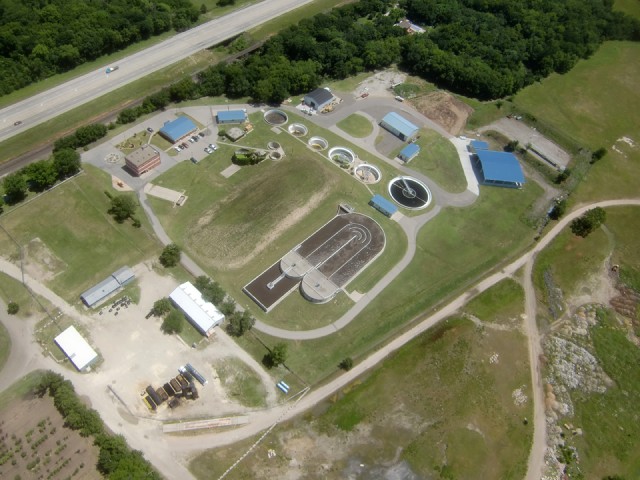
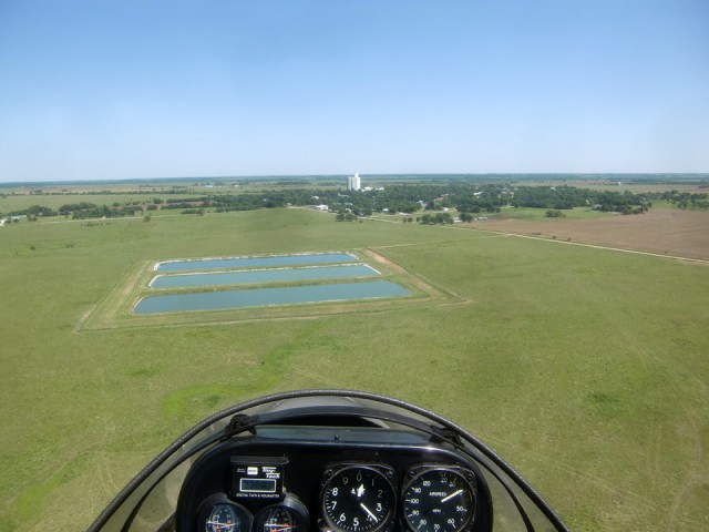
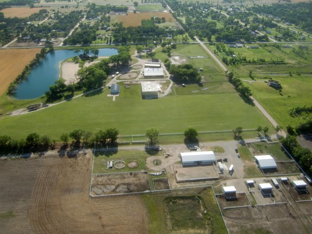
I took this shot so none of you could ever say again “I have never looked down on a sewage plant from above”. Also, as I was passing over this technological wonder, I thought about places I have been overseas where sewage actually runs down the gutters next to the street. People in America have no idea how degraded life is in most of the world due to the lack of “simple” sewage treatment. For instance, in India they dump raw sewage and dead animals in the Ganges River – while bathing in and drinking water out of the same river. Consider the implications of that. Yikes!
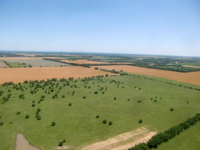
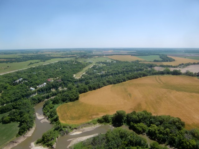
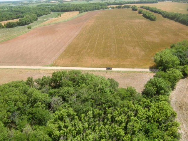
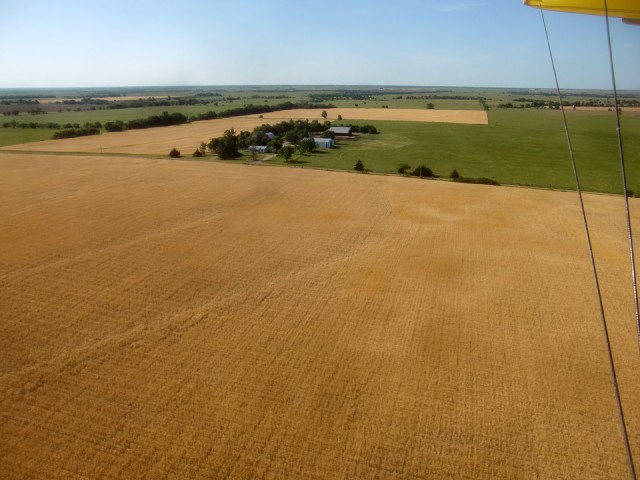
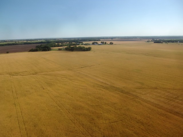
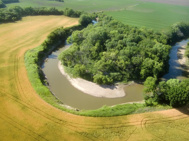
Although I am not a farmer, I couldn’t help learning a few things about farming after living in Kansas for 30+ years. One thing still amazes me and that is how fast the wheat changes from green to brown. Just a week earlier I was over this area and the wheat was green. Now it is light brown and within another week it will be dark and ready to be harvested. The word is that this year will be a great yield.
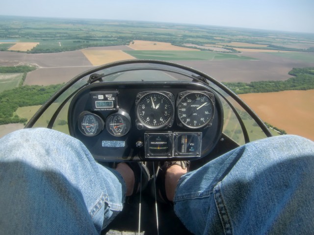
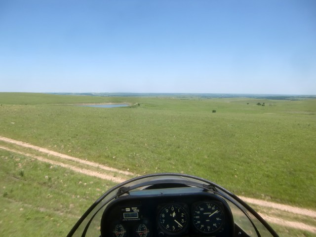
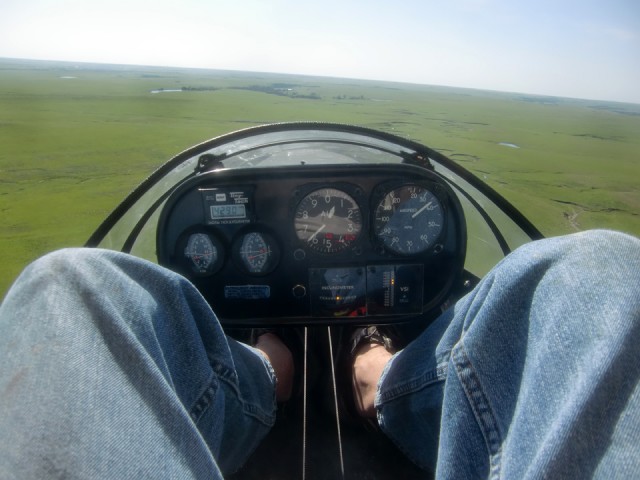
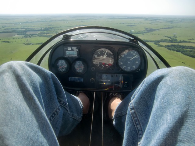
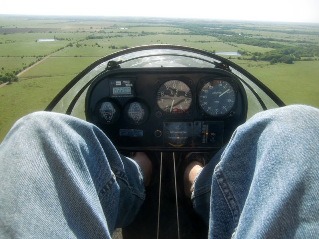
I am going to show some of these instrument pod shots to share my grateful good fortune with you. If you are not a pilot, all you need to understand is that fuel efficiency and interaction with the wind velocity and direction is far more important in aviation than it is regarding cars on the highways. Typically, this plane will not fly under about 4400 RPM engine speed. I was getting so much convection lift all day, I was able to “dial back” the throttle more than I ever have been able to before. I like to fly at about 600 feet AGL but as you can see above I just received almost 400 feet of what I call “Free Air” (altitude) just by the rising air currents (convection). Since I was going for distance today that advantage was turned into less worry about running low on gas for the trip.
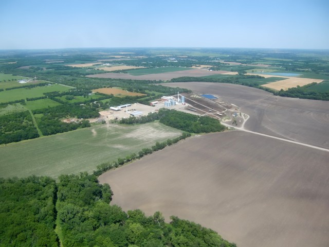
As I headed East on a bearing of about 100 degrees I passed South of Douglass, Kansas and this feed lot. Douglass, Kansas is the home of Aviator Lawrence Alley and his famous Alley Field. The shot above was from about 1300 feet AGL Southwest of Douglass. Even as I throttled back some more I was continuously gaining altitude. This wouldn’t have been that big a deal but even though it was a pleasant 78 degrees on the ground, at 1500′ AGL it was getting “brisk”. “Brisk” is the temperature level right before “Chilly”.
Pilot Pointe, shown above is due South of Douglass. Back in the 80’s we had a memorable Ultralight Fly-In there. You can see the airfield in the middle of the wooded area. An interesting feature of this airfield is that the North End of it goes right over a cliff with a railroad track at the bottom. I featured some shots of it in my first movie called “A Beginner’s Guide to Ultralight Flying“. My wife Debra brought our two children Bevin and Jack out to watch the action. I have a memorable shot in the movie of the three of them sitting in the shade of my Quicksilver MX wing. That was back when everything was still delivered on VHS tape…
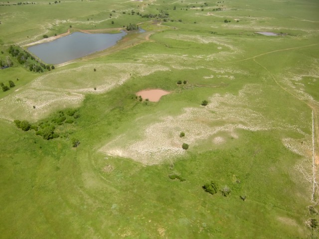
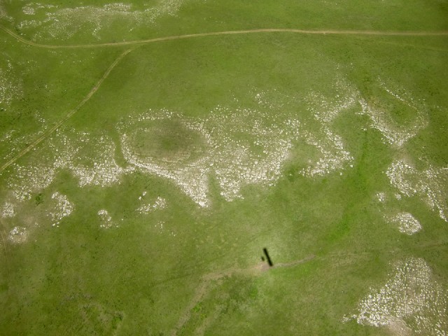
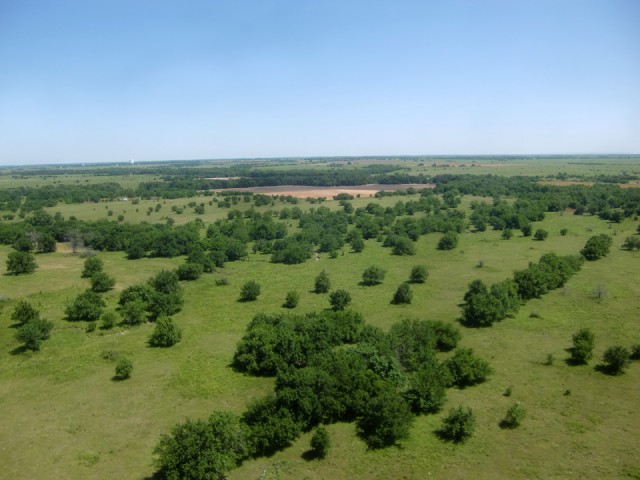
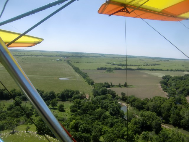
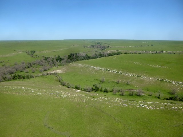
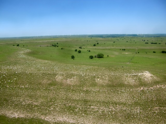
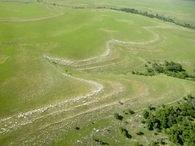
Scenes like you see above start appearing just East of Douglass, Kansas so this must be the beginning of The Flint Hills. The formation in the photo above is a little bit too far off but what you are seeing is the exposed chert appearing around the edges of the mounds and hilltops due to erosion. Chert that is darker in color is called flint and can be chipped to form very sharp-edged implements like spear and arrow heads.
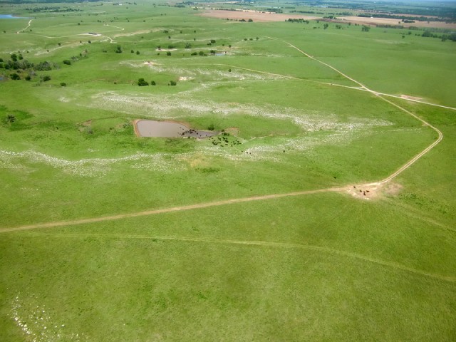
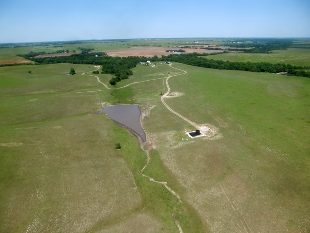
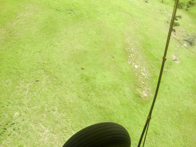
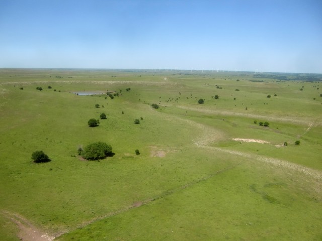
The Flint Hills alternate between land suitable for farming and land best for raising cattle. Above you can see some cattle congregating around a feeder (lower right) and near the center a group of them are cooling off in a Cattle Pond.
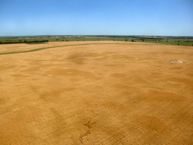
A Stretch of Land Obviously Suitable for Growing Wheat – shot from about 300′ AGL looking East Southeast
We have some good friends at Church (Central Christian Church) who farm Southwest of Hutchinson, Kansas near the town of Abbyville named The Fosters. I always laugh when I think of Brother Gary’s observation that the acquaintances he knows who seem to be the best at farming all feature those rocking arms called Pumpjacks sprinkled across their property. Above you can see a nice cluster of them hooked up to a tank farm. It’s a good thing because that ground doesn’t seem likely to produce much wheat any time soon.
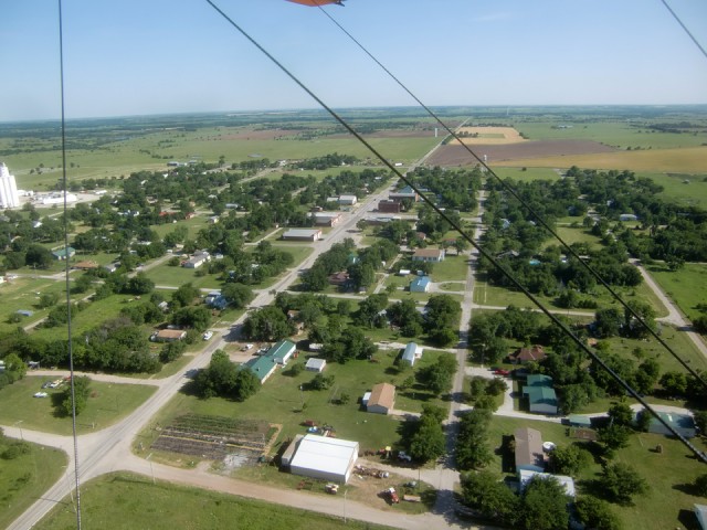
I am ashamed to admit I did not study my map well enough to know which towns would be on the way. That’s one of the problems of depending on a GPS for navigation – you can get lazy. I decided to swing right (to the South) and check out their grain elevator or water tower for the town’s name which is always posted on either or both.
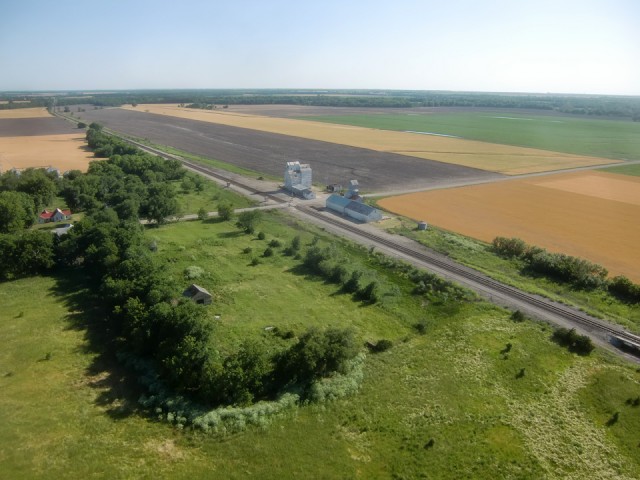
As soon as I saw the name on the grain elevator I recognized it. Joe O’neal has a plane at our airfield and I’m pretty sure his son Ashley lives in Atlanta so that’s why I was familiar with it. Also, every time I fly to Douglass and look East I can see the bright white grain elevator in the distance. Now I know what town it is. One of these days I’ll call up Ashley to give me an idea where to land and I’ll shoot up there and look around.
My Dad, who was an Air Force Fighter Pilot would have called this a “Gotcha“. I didn’t think to take the picture until far too late but here’s what I did. If you look carefully down the tree line near the center of the shot, to the left you will see a speck. Actually that is a tractor cutting hay. As I was approaching his position from behind his direction of travel I noticed my shadow was a bit in front of me and creeping up from behind him. I thought it would be cool to make the shadow go right over him and then wave. I did this and it sure enough got a reaction. I’m sure he couldn’t figure what bird was big enough to make a shadow that big. He came to an abrupt halt and started looking all over the place until I passed to his right about 200 yards. We waved and I continued. About 30 seconds later I remembered to take the shot.
It is not the best shot but as I came over a ridge with a tree line these three deer came busting out. I grabbed my camera and shot wild in the general area of the deer because I didn’t have time to look through the monitor. Because this is a wide angle lens it seems like I am much farther away but I am only about 150 feet over them.
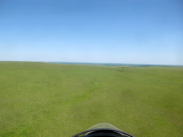
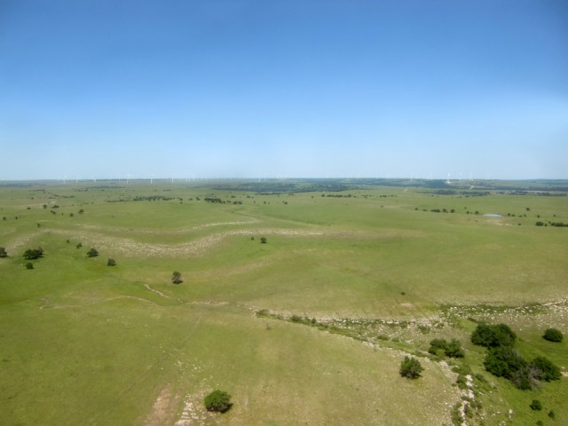
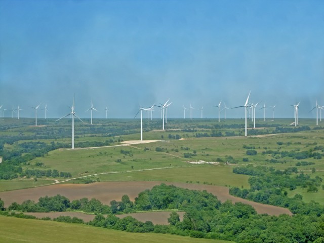
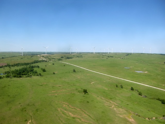
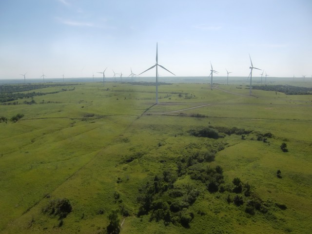
Next is a sequence I only wish could be more apparent than these pictures convey. This set of photos really needed one of those panoramic cameras but this is what I had to work with at the time. Anyway, I was down low over some really smooth pasture land. There were small herds of cattle on the left and right of the scene below. As I climbed to match the rising terrain and continued forward a completely different part of the Flint Hills unfolded. If you look carefully to the left part of the horizon you will see the Wind Generator Farm that seems to extend to Moline from Beaumont, Kansas.
My little pocket cam is suffering from microscopic dust on the imager that cannot be removed because it is inside the body. This causes dust spots in the pictures. The effect becomes dramatically more pronounced when you zoom in. That is why the sky is “blotchy”. I left the shot in, though because it serves to give you some idea of the expanse of this windmill field.
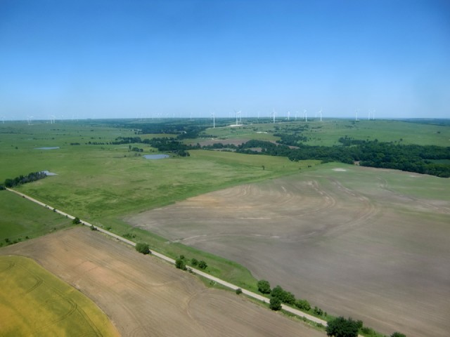
The Howard/Moline wind farm is as big as the one near Beaumont, Kansas. Until visiting Moline, I had no idea it was even here although I am very familiar with the one in Beaumont. If you are not familiar with this wind farm stuff, a lot of it seems to be shrouded in secrecy or at least media “under-coverage”. You have to do some digging to learn about it.
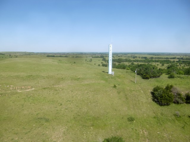
Since Moline was still a little farther East I kept on track but swung out a little to get close to this water tower
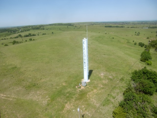
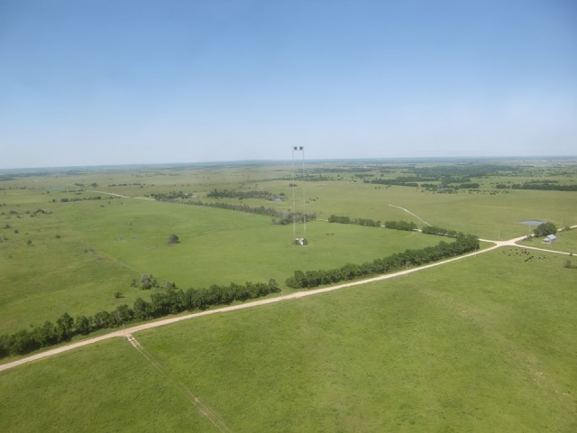
Out in the middle of this great expanse I saw the strange sight above. I knew immediately what it was although I had never seen one configured that way. Usually you see them on tall buildings. Once again, I am actually a lot closer than it appears but there were guy cables around it and I figure you would get the idea from this distance.
After about 1 hour and 50 minutes from leaving Selby Aerodrome I arrive in the Moline, Kansas airspace. Elk County Airport is 3 miles Northeast of town. I could have made a more direct route to the airport but I like to make a grand swing around a town before landing at their airport.
I wanted to show the Main Street of town but would also point out that the truck seen straddling the railroad tracks on Main Street heading toward the camera made a full stop when I came into view. He sat their the whole time I crossed his vision. I waved but could not see if he responded due to the reflection on his windshield. I continued around the Southeast side of town.
Because I was conserving fuel I did not do what I would have normally done and flown closer to the Quarry shown above. It is about 3 miles East of town. I looked it up and it is owned by Cornejo.
As I turned North after crossing the Southeast part of Moline I took the shot above just to get another angle on the town. Only when I got home did I notice the F-80 sitting outside in the park at the lower right of the photo. I did a search on the web but could not find any data about the jet except that it is in Griffin Park. I love their enthusiasm for the airplane but it is definitely NOT a good idea to display an aircraft out under the sun because it will disintegrate much faster that way. I hope they put a cover over it or put it in a display building. I was counting off the miles from city center when I looked East and saw the airport right next to Highway 160.
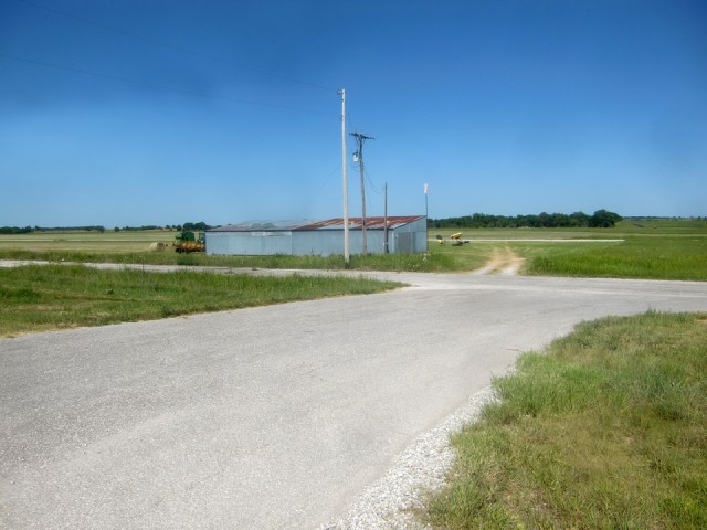
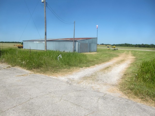
I was just entering downwind when I noticed a huge nameplate of the airport on top of the hangar. I snapped this to see if it would be evident in the photo. It is not.
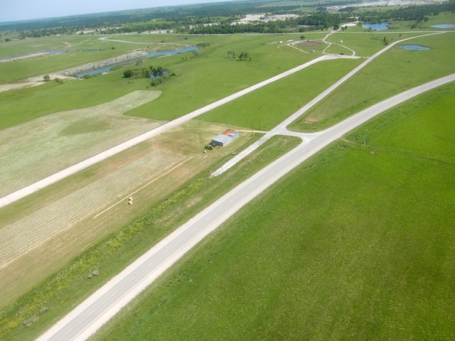
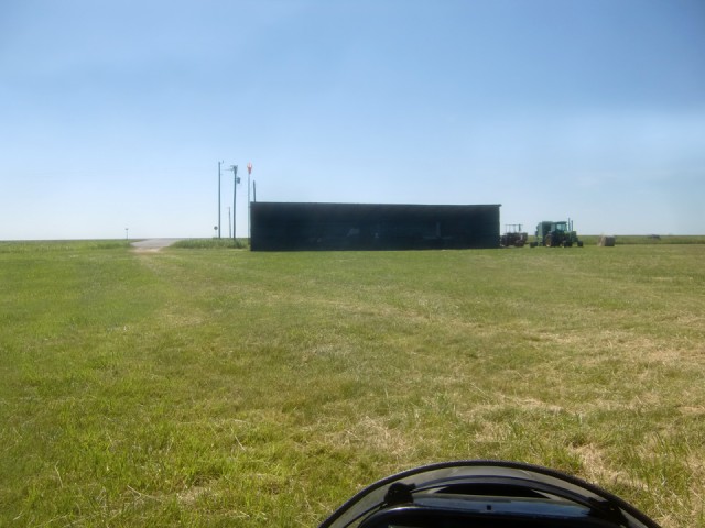
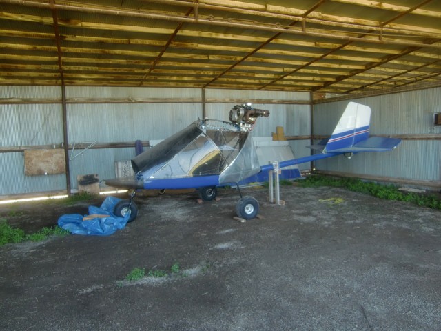
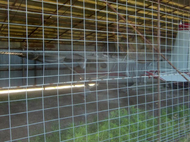
The airport’s hangar is just off the highway. There are only two airplanes hangared there and neither of them gave evidence of recent use.
I called up my wife to let her know I was in Moline. She said “That’s nice. When will you be home for dinner?”. Then I called up my buddy Captain Doug Moler. He was impressed that I flew out farther than Beaumont. A couple of years ago Moler, Bryson Voth and I flew out to Beaumont – I in my MXL. Doug in his Airbike. Bryson in his Titan Tornado. At about 1,000′ AGL we had a 60 mph tailwind out to Beaumont. That was the fun part. Unfortunately the wind did not abate while we ate breakfast. As a headwind on our return West it was enough an impediment to cause us to divert to the Augusta, Kansas Airport to find more fuel. As it turned out, Ed Hooper – a fellow member of Central Christian Church was at the field and drove Doug to get some 2 cycle oil to mix with our gas. We then continued to our respective destinations – Doug and Bryson to High Point and Brian to Selby Aerodrome. That was the last time Doug has attempted a cross country in his Airbike. I keep working on him, though.
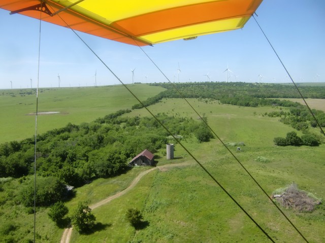
After leaving the Elk County Airport I headed back West in order to make the return journey to Selby Aerodrome. I thought this farmstead above looked good.
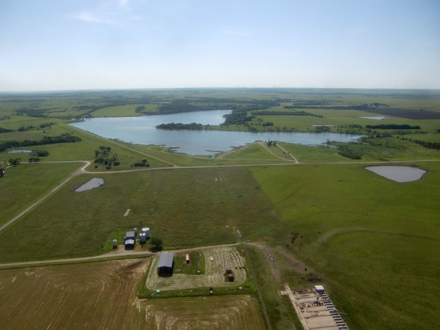
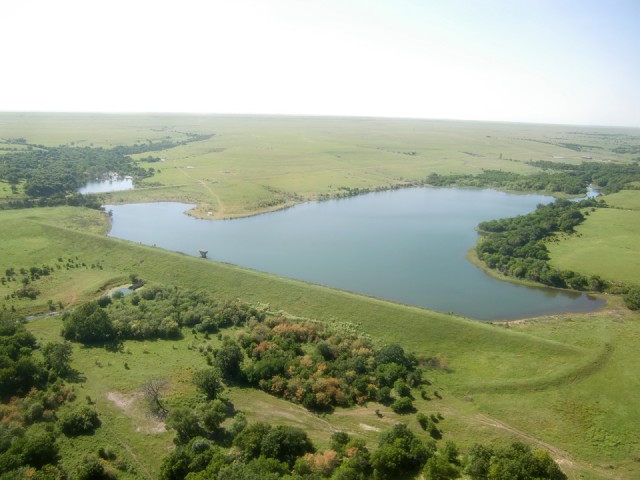
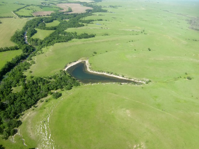
I checked on Google Earth and Mapquest and neither one could give me a name of the body of water shown above. I shall christen it Lake Moline.
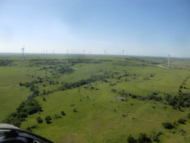 Since I wanted to make sure I had plenty of fuel for the trip I made no detours on the way to Moline. Upon landing I confirmed an excellent fuel burn and had plenty remaining for the trip home. This would allow for some slight deviations from course – all the excuse I needed for an excursion through the wind farm.
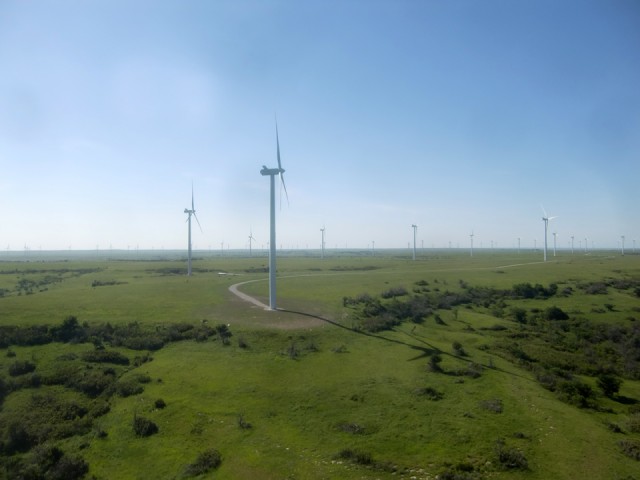
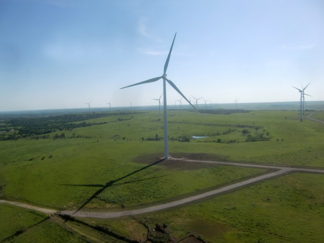
Here is another highlight of the trip that was Providential. On the way in to Moline the wind was from the East Northeast and was practically nil with gusts to about 1 mph. The wind generators were all still. Now as I headed back to Selby Aerodrome the wind had picked up to about 7 mph providing me a nice boost of free ground speed for the trip home. Next is a short series through the wind field. By this time, due to the slight tailwind I was given, a few of the windmills were barely turning but only on occasion. They are mesmerizing to watch.
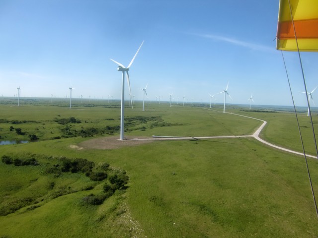
If you look closely you will see a spare windmill blade lying near the foundation of the closest windmill
I had flown for almost 2 hours to my destination with a negligible headwind and now on my return I was getting a tailwind that increased my ground speed 18%! All Free! On top of that I was getting so much convection lift I was able to throttle back to an unheard of 4220 RPM. I held this setting right up to Rock, Kansas which I will be showing you in a little while.
A day like this is why I coined the term “Sky Surfing”. This day I was Riding The Wave just like the guys at Waimea Bay!
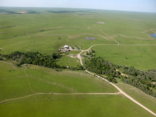
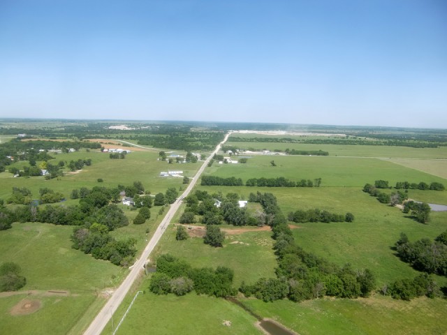
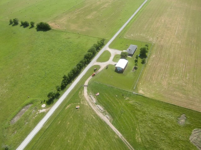
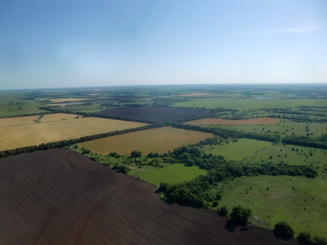
I was really impressed with this homestead which is the most remote I have seen out here. There was no one around them for miles.
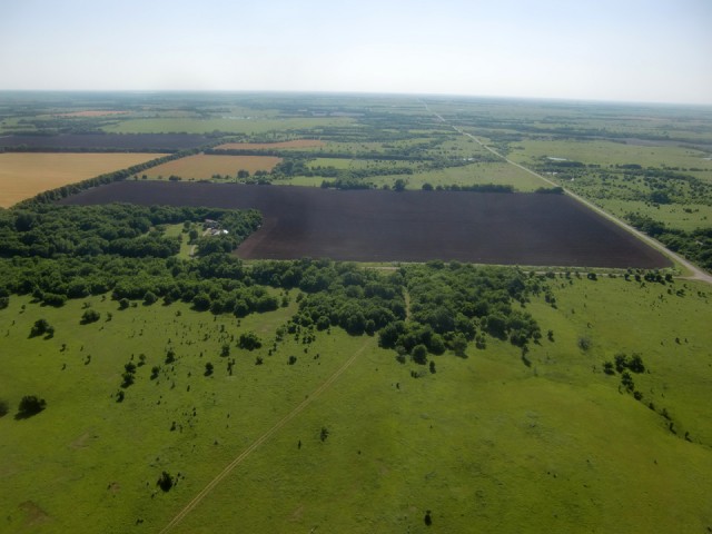
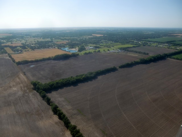
Again, I am not the agronomist but I do understand that earth this dark is greatly desired in the farming community. Since flying the area over 25 years, I have never seen any this dark. It had recently been plowed and is apparently ready for seeding.
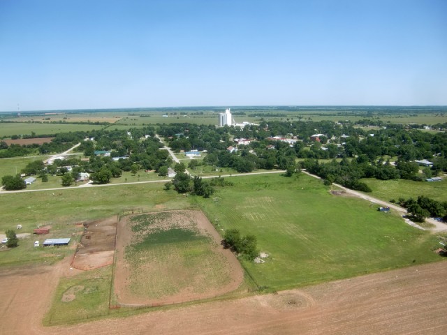
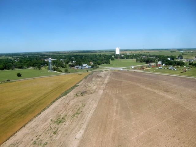
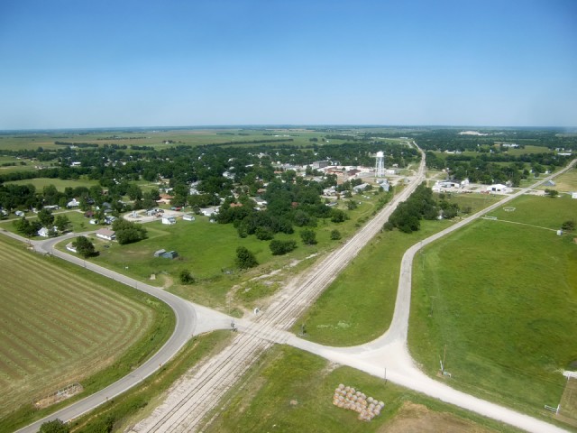
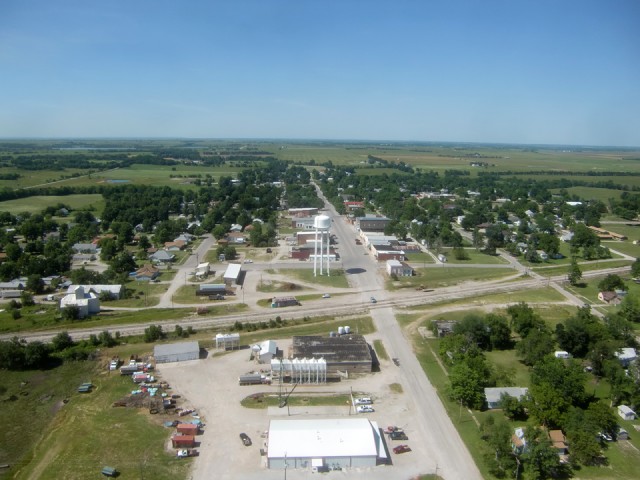
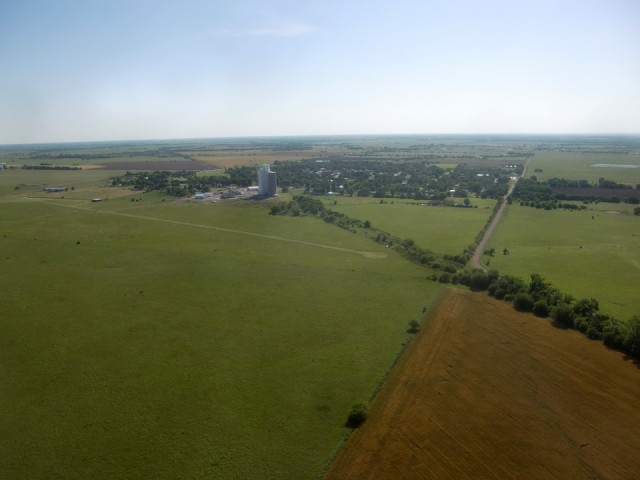
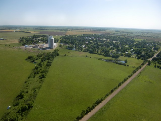
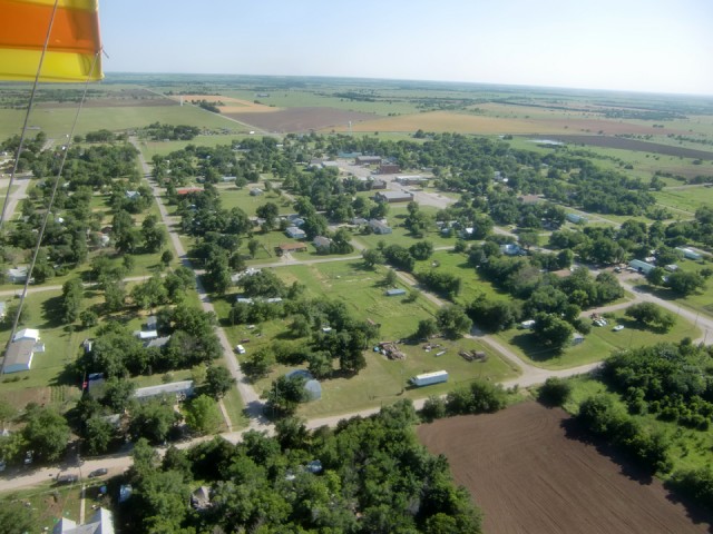
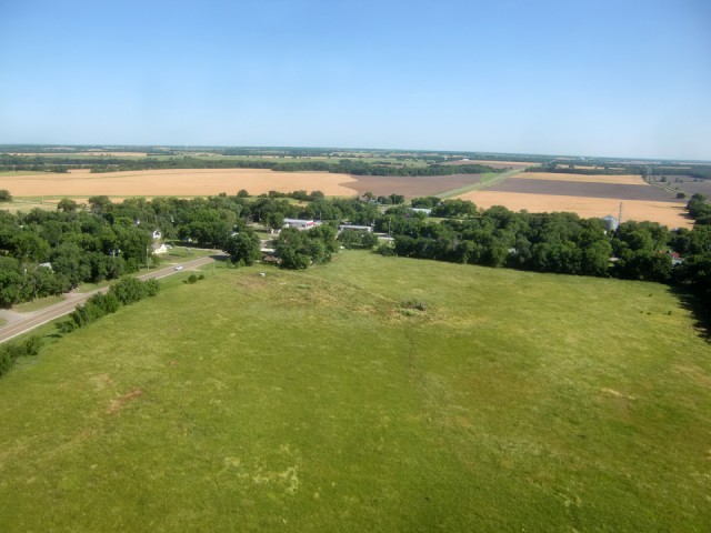
Next I feature a series of shots approaching Atlanta, Kansas again but this time from the East and swinging North around the town.
The whole time I was in proximity to Atlanta, Kansas I couldn’t get the song “Hot ‘lanta” by the Allman Brothers out of my mind. I saw the Allman Brothers in the late 60’s at Memorial Auditorium in Sacramento, California probably on their first tour. They are among my 5 top LIVE bands ever. Whoever penned the article about them in Wikipedia says, “The band achieved its artistic and commercial breakthrough in 1971 with the release of At Fillmore East, featuring extended renderings of their songs “In Memory of Elizabeth Reed” and “Whipping Post” and often considered one of the best live albums ever made.”
I HEARTILY AGREE. I can’t tell you how many times I listened to those two recordings. I wore out at least 2 copies of their album “Live at Filmore East”. Dicky Betts is one of my favorite guitar players.
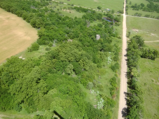
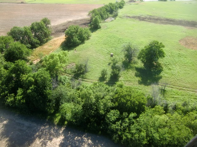
One thing I notice A LOT out in the country is all the deer blinds. This guy above has a regular grocery store set up with the feeder on the tree line just about 40 yards from his hold. I imagine he knows exactly when to show up and wait for the deer. Take one shot, climb down, back up the pickup and put it in the bed. Excellent.
Suddenly I came up over a tree row and there was Rock, Kansas. The following 2 pix are showing Rock from about 200′ AGL from the North.
Back in the 80’s I worked as a news cameraman for the NBC affiliate KARD (later KSNW). About two years before I came on board there had been an accident at at Titan missile silo positioned not far from Rock, Kansas that resulted in the death of an Airman named SSGT. ROBERT J. THOMAS. This was during the tail end of The Cold War. We would go up there on occasion to do retrospective stories about the unfortunate incident. I had forgotten about this until I started writing this commentary. (I have just decided I need to fly up to the area soon and see if I can find any remnant of the old silo. If I do I will add it to this report.)
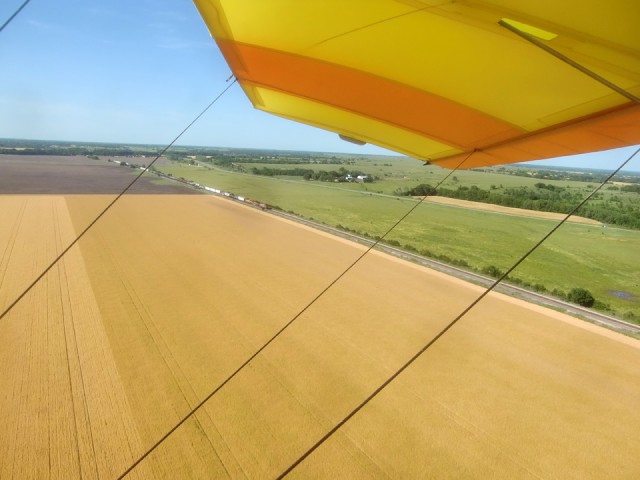
Above, as I was leaving the Rock, Kansas area, I realized I had passed over a railroad track. I whipped my head around to “bag” this train approaching from the North. “Bagging Trains” is one of my favorite “Fun Flight” activities. This flight just continued to amaze me. It had everything going for it.
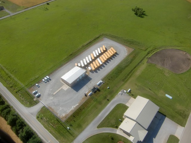
Hey! On the outskirts of Mulvane, Kansas I found where they hide all the school buses during the day!
After about 1 hour and 50 minutes my home field Selby Aerodrome comes into sight. It is the left-most part of the green band you see toward the middle of the shot. I still had about a gallon of gas left in the tank. Usually I will make 5 or 6 passes around the field using different approach methods for fun but today I just came in from the South and taxied up to the hangar. I had just been given the best flight of my Fun Flying days but it was time for it to come to a close.
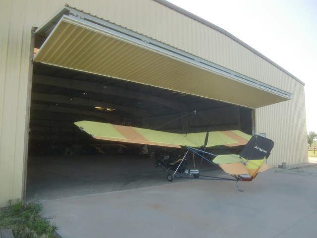
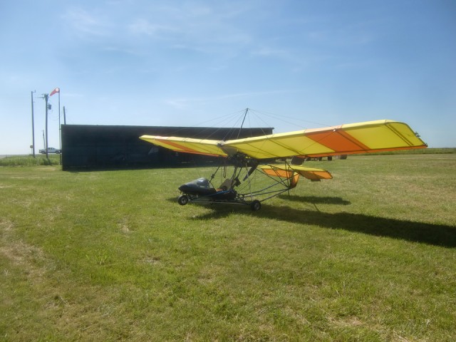
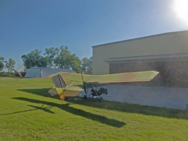
The MXL ready for a propeller rub down and general “once over” before being put away until “the next time”
A Close and a Sermonette
As I was making this “Epic Flight”, there was one adjective beating all others in my mind to describe the trip. It is a word that I normally avoid like the plague because it has become overused in our culture to the point of being leeched of all its meaning and hackneyed to use. Nonetheless, I cannot avoid expressing it as most appropriate to the day. The word is Awesome. Used properly is describes a human’s response to incomprehensible majesty. It describes the wonder and humility we should have when contemplating the works and mind of Almighty God. Having had an opportunity like this given to me, being treated to the Beauty of Creation, it was impressed upon me to do my part to help anyone out there who is seeking the answer to The Big Question of Life.
I decided this report, “The Epic Flight”, besides being a travelog might have a secondary use to people who are not Christians. Specifically this message is directed to those who have been thrown off track by a particular stumbling block in their path to God.
The misunderstanding given some people goes like this:
“Christianity teaches that you must profess that Jesus is Lord and believe in your heart that He is God and your Savior and you will be saved. This means you to go to heaven when you die. If that is true, why would you worship a God who would knowingly sentence people to hell just because they have never had a chance to hear the Gospel and thereby make a decision to follow Jesus.”
It continues that people deep in the jungle or the desert or anywhere in the world who have never had a chance to learn about Jesus should not be penalized with an eternity in hell without even being given a chance. God could not be that unfair and therefore they will have none of this “religion”. They take the stance that if every person on the globe is not given the opportunity to have someone explain about Jesus than the whole business is a fraud.
It is not an unreasonable position to take. Unfortunately, though, it has been formed in the absence of a key piece of information.
Please understand, people far more astute than I have written volumes on this subject but here is my short form answer:
First, as the absolute sovereign Creator of the Universe – The First of First Things – God has full authority to do exactly what He wants to do. The Good News is that He has chosen to be “fair”. He has commissioned The Church to go out and make disciples of all nations, tongues and creeds. That is the Primary Purpose of The Church of Jesus Christ. Since God IS “fair”, though, and knows that with the best of efforts not everyone can get “face time” with a missionary, He has provided a parallel and equally powerful testimony: His Creation.
When you look at a puppy or gaze at a sunset, behold a beautiful flower, witness an incredible athletic feat or marvel at your children playing in the park – whenever you are “Awed” by His Creation – God is talking to you. You are being given a chance to acknowledge that He exists, that He Loves You and wants you to join His Kingdom. You are being given a chance to make Jesus your Savior. The Bible explains this in many places but Romans 1:18-23 makes it perfectly clear.
I just ask you to keep that in mind the next time you are truly awestruck by Creation. If you are not already a Christian, use this “Calling from God” to ask Him to reveal Himself to you. If you do that with humility and truth in your heart He will respond.
King David wrote in one of his songs that we call Psalm 14: The fool has said in his heart, “There is no God.”
So don’t be a fool! It takes far, far, far more faith to believe in evolution than it does to believe Christ has risen from the dead. Believe and you will receive.
That is the sermon for today!
Blue Skies & Tailwinds™
Brian FitzGerald
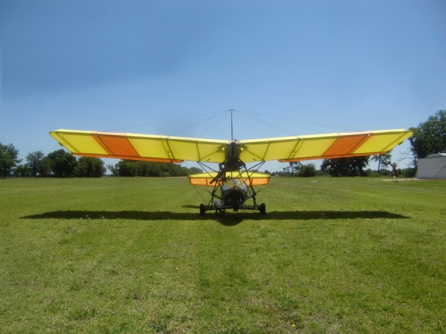
Brian, loved the photos and the information given. See you Sunday.
Glenn
Brian,
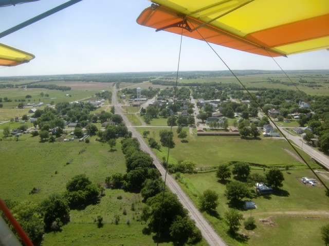
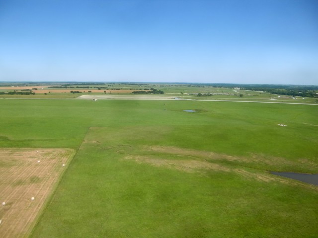
Great shots and narrative of the Kansas landscape. You mentioned calling Ashley about where to land in Atlanta. In your photo’s of Atlanta on the return trip you can see their grass strip just on the east edge of town.
I enjoy reading your stories.
Terry Alley