Picking a Fun Flight Destination
I moved to Kansas in 1980. Except for living in Hutchinson for about a year I have lived in Wichita since moving here from California. During the time I have lived here I have had the opportunity to visit all 4 corners of the state. Some of the trips were for business while other times were family “day trips” we took when our children were young. My wife Debra would pick a place we could reach in no more than 3 hours and we would go there. During the 30+ years I have lived here, one place I had heard a lot about but had never been to before was Medicine Lodge, Kansas. So, on June 30 the time had come!
Medicine Lodge has a rich history and is nestled in some very picturesque and interesting terrain. Every other year the town stages a world-renowned pageant to replicate Peace Treaties that were signed with the Five Plains Indian Tribes back in 1867. It involves hundreds of people, horses and wagons with the participants all dressed in the garb of the era.
Longest Distance
Prior to traveling to Medicine Lodge, the longest trip I have ever taken in my Ultralight was to Moline, Kansas about a month earlier (the post describing that trip is here). Medicine Lodge would be another ten miles further yet. From the trip to Moline I determined that I could have gone a little farther judging from the fuel left in my tank when I landed. That estimation proved to be correct on the trip to the Medicine Lodge Airport which is just South of their Golf Course, a couple miles Southeast of town.
From the discussion above, you see that of my two longest Ultralight Flights to date, one was to the East and one was to the West. My method here takes into account that the prevailing wind in South Central Kansas is from the South. By making my “adventure” trips Cross Wind I have the potential to achieve my maximum distance per fuel on board. This method has worked fine. After dropping down to about 300′ AGL and because the wind was South Southwest that day, I suffered only a 6mph ground speed deficit on the leg TO Medicine Lodge (it is West South West from Selby Aerodrome). On the way back I gained roughly that much in tailwind even though it had increased in speed down to the surface quite a bit. This was because the wind had come around more directly from the South by that time. That meant I did not gain as much benefit as if it would have remained from the SSW and been a more direct rather than quartering tail wind.
Every time I head to the hangar to go flying I stop at a gas station to fill up a 5 gallon container for my plane. The aircraft fuel tank is 5 gallons so it works out perfectly. A rare occasion is when I hit “5 Even” mark on my “Quick Stop” game. OK. The “Quick Stop” game is when I “let go” of the gas pump trigger to see if I can hit 5 gallons “right on the nose” rather than creeping slowly up on it. To hit it to the 1/thousandth digit is a “Perfect Score” (Question: Does anybody believe we are really measuring gas to that tolerance???). Anyway, I took it as a good omen for the trip. Now before you start thinking I read tea leaves and bird entrails before deciding to fly – relieve yourself of that notion… Bad omens are not allowed in my worldview regarding flying or anything else. So, everything is a good omen to go flying… Especially the blue sky and fluffy cumulus clouds adorning the sky south of Wichita that morning.
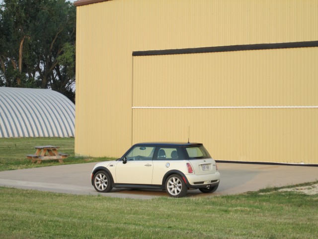
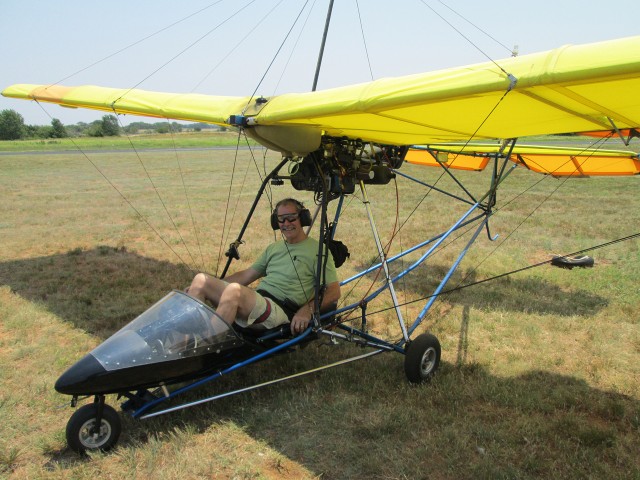
I always take portraits of the MXL in front of the hangar before a flight so I thought for a change I would feature my other ride. Remember! When you buy a Mini you aren’t just buying a car – you are joining a cult…
After topping off my fuel tank and pre-flighting the plane I started the motor, warmed it up, strapped into the seat, checked the controls one more time, taxied to the active and eased the throttle forward. In short order I was airborne and lifting at 500′-800′ per minute. As I turned West I reached 1,000′ AGL sooner than usual…
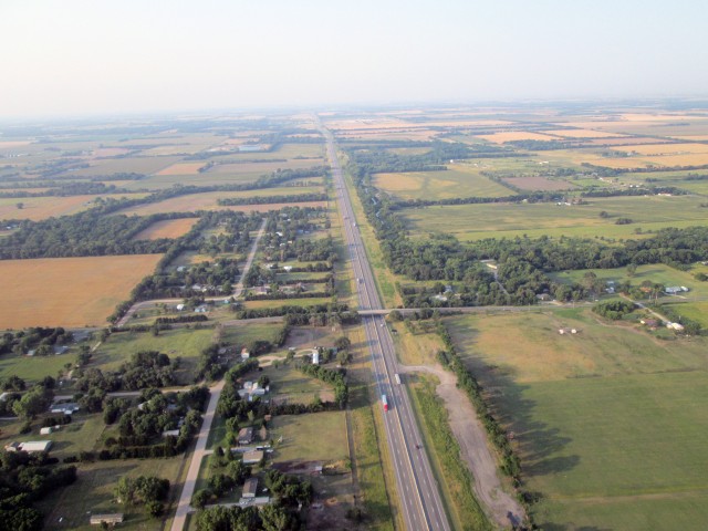
It is about 7:20 am looking South at the Kansas Turnpike section of 1-135 from 1,000′ AGL right after takeoff
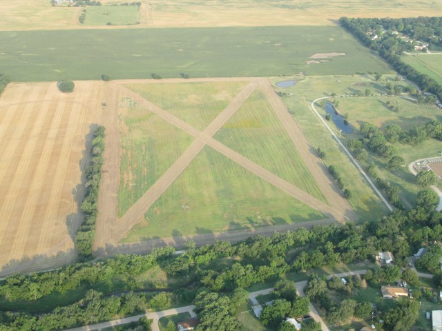
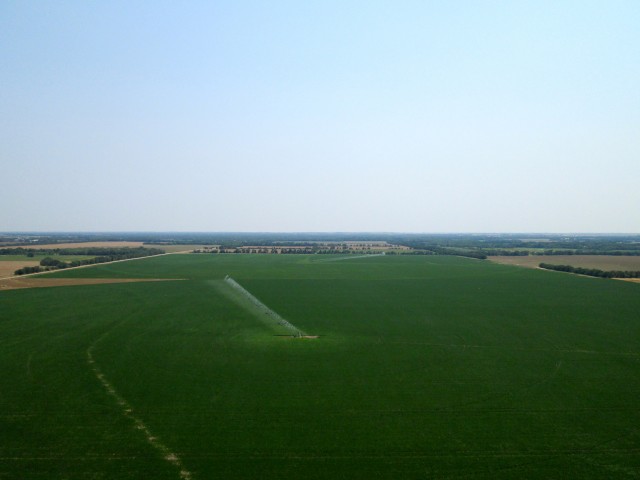
Just as I crossed I-135 I see this farm field with a huge “X” in the middle of it in front of me. As I frequently remind everyone, I am not a farmer so maybe someone can tell me what is the reason for doing this?
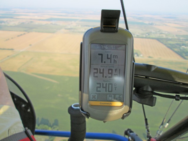
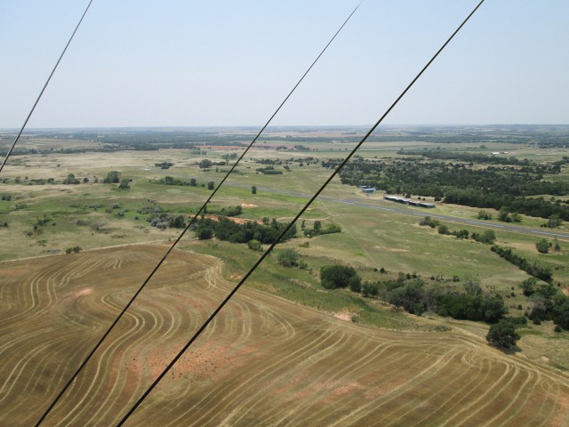
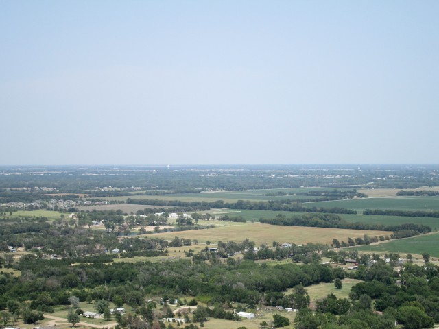
Because I must cross over some 2 to 10 acre rural/residential plots to the West of my field, I climb to 1,000′ in order to not disturb their sleep on a Saturday morning. The picture above shows what this did for my ground speed, though, and this was with an airspeed of 45 mph. I was only 3 minutes into my journey and I was starting to think I would have to pick another destination. By quick mental calculation I determined I would need to yield at least 30mph across the ground in order to have enough fuel to make my Medicine Lodge destination. Experience reminded me that this early in the morning the winds at 1,000′ are dramatically different than they are at 200′ or 300′ AGL. So, before scratching the trip I decided to check the headwind velocity down lower. As soon as I passed over all the “country” houses I mentioned South of Haysville I descended to 300′ AGL to check it out. Just as I hoped, the wind was much reduced down there and my GPS was showing me getting a solid 30-34mph. The trip was a GO!
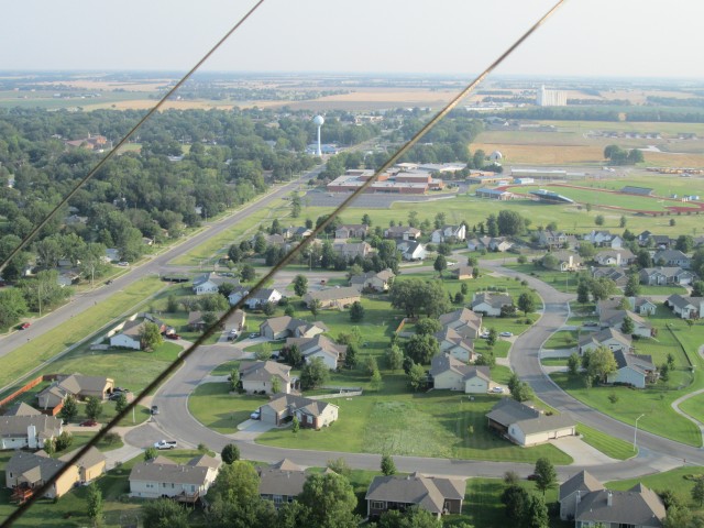
The South edge of Clearwater, Kansas from about 300′ AGL looking NNW
Even though the wind was less of a detriment to my ground speed at 300′, it was quite turbulent that morning. I hate getting flying wires in my shots but I snapped the one of Clearwater above while trying to keep the MXL from attaining “unusual attitudes”. Many times when on these photo travelogs I will circle back in order to line up a better shot of something on the ground. Today I did not want to use extra fuel for that purpose so some of the shots I am less pleased with than others.
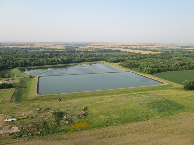
Above you see just to my left after taking the previous shot of Clearwater. It is this large reservoir complex. I figure it must be their water supply.
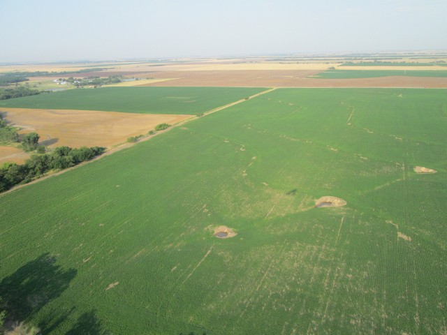
I took the shot above to indicate how green the non-irrigated crop land was in this area. I was glad to see this because last year I flew over this general area and it was dry as a bone. I called the post “Intense!”. Something else interesting in the shot is portrayed by the shadow of my flying machine. My direction of travel is straight ahead in the photo. The sun is right behind me so we are getting a good silhouette of my MXL. From this you can see the degree of “crab” I was maintaining into the South wind in order to head West.
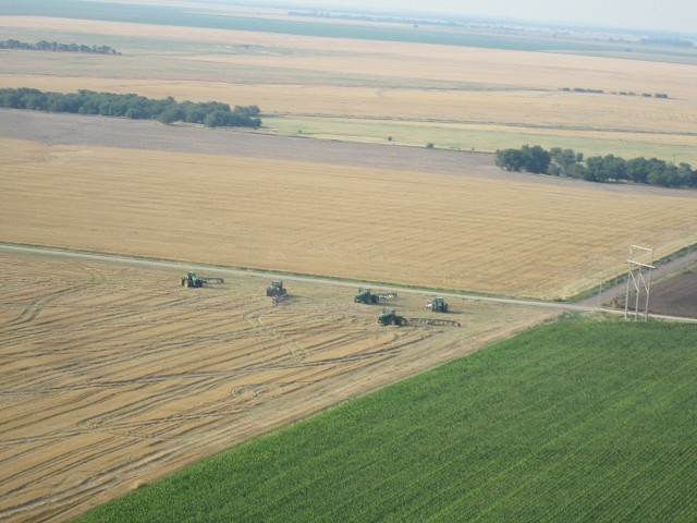
I was wrestling with the plane in the turbulence and had allowed my camera to get stuck under my seatbelt so I had a hassle getting it out in time and didn’t get this shot until I had passed by. I had to shoot it over my left shoulder but I really wanted to get it. I was very impressed to see this team of tractors moving into position. It’s a scene that would make John Deere proud. It looks like 4 out of 5 of these monsters are what I call “Dual Duelies”. If you have never been up close to one you should take the opportunity some time. They are very impressive machines.
It was still about 75 degrees on the ground and these folks above were taking advantage of the morning hour coolness to get some work done on this new house.
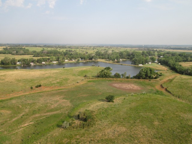
I am now quite a bit past Norwich, Kansas and I think I was North of Harper, Kansas when I passed by the lakeside community seen above. Actually it was directly in my path but since I was now flying at about 100′ AGL I swerved over to the South so as not to buzz them. While writing this I spent about 5 minutes scanning Google Earth to see if I could get the name of this place but did not find it.
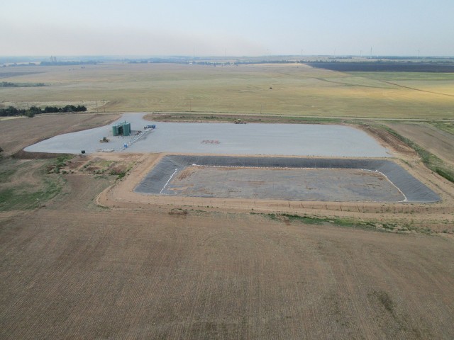
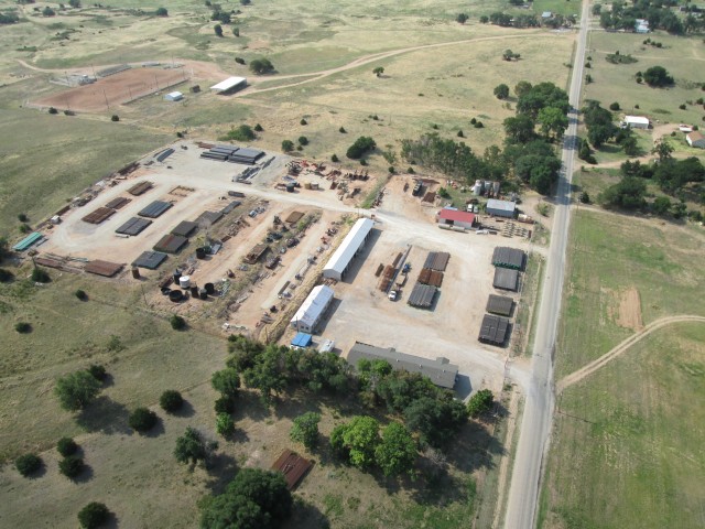
From the look of this layout I would say this oil well had been completed recently. I also suspect it is one of the newer “horizontal” wells that have been drilled in this area lately. From the size of the tank farm they must be producing pretty well.
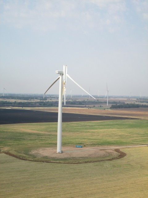
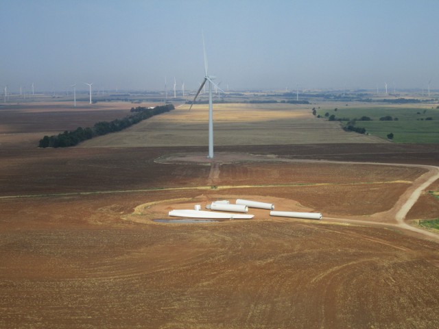
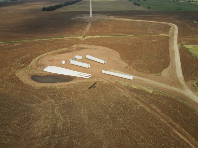
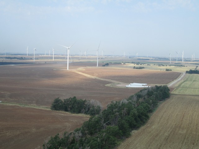
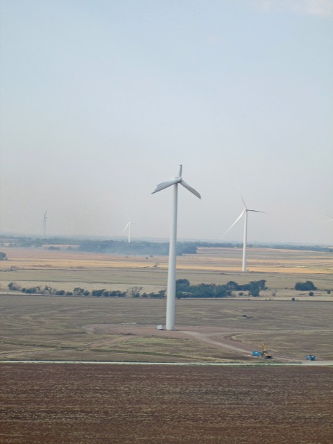
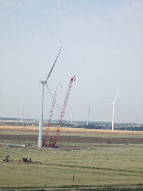
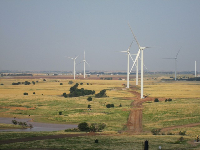
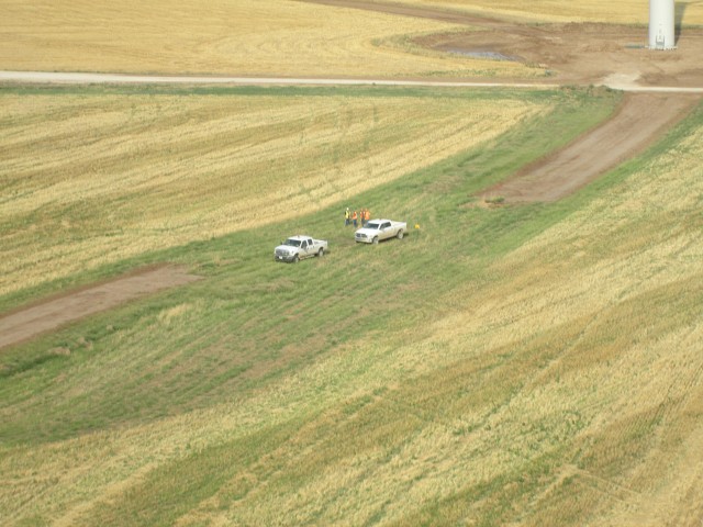
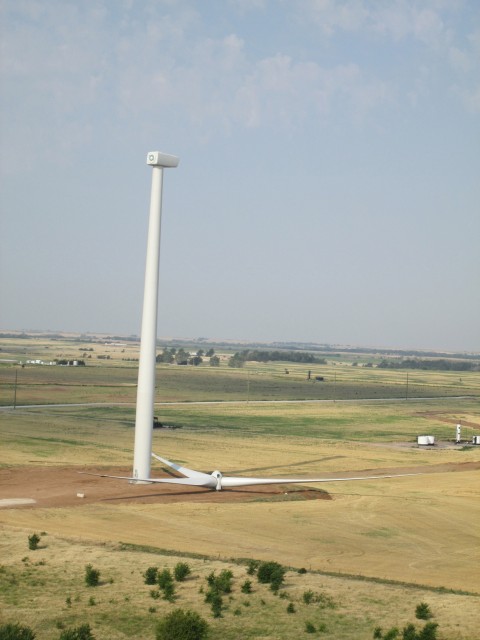
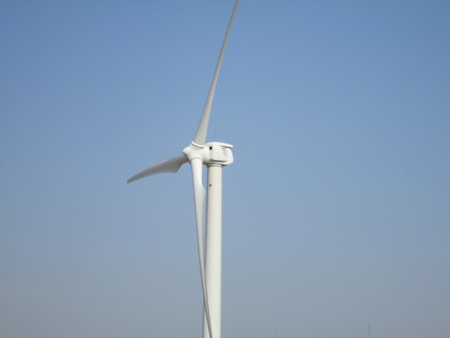
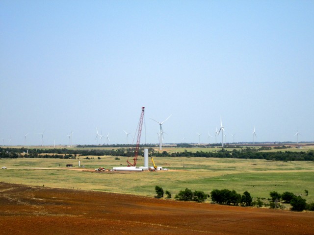
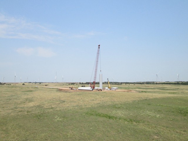
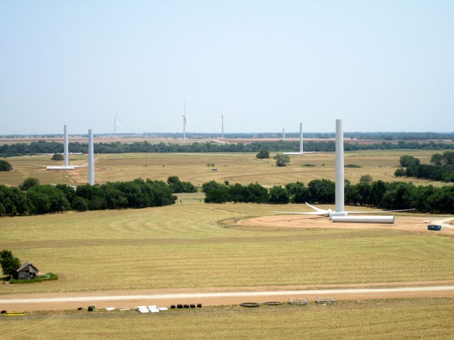
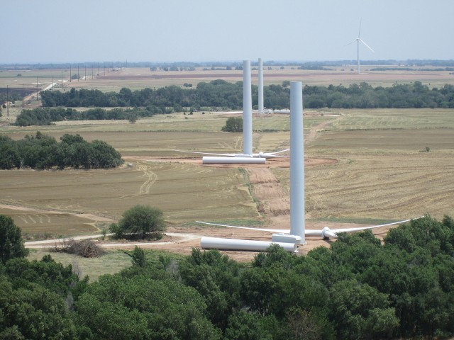
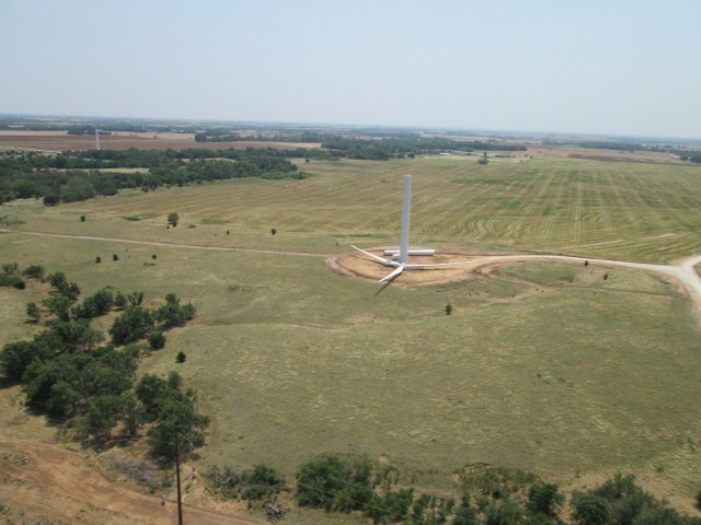
In the distance, directly in my line of travel I spied a familiar site. It seems like I can’t go anywhere anymore in Kansas without seeing Wind Generators. I had heard there was a big field South of Kingman, Kansas but I had not seen it. As I got closer I could see that this was a very large Wind Field indeed. There was a lot of haze in the air but I would estimate upwards of 200 windmills in this area. As I got closer I saw something odd about one of the Windmills but I couldn’t figure what it was. It seemed like a crane working up near the hub at first but as I got closer I could see that was not the case. Finally I realized it was a Windmill that had sustained some catastrophic damage. I figured this was good enough reason to make a slight detour from my flight path.
This first shot is taken from about 100′ AGL. I was using my pocketcam’s telephoto lens so I could give you a sense of the size of the entire Windmill Field. You can get a feel for the size of these things by noting the blue garbage container sitting near the base of the Windmill above. That is the type you see brought out to construction sites on a skid-bed truck.
Statistics on these machines are hard to find. What I have found indicates that in Kansas the height to the hub is from 215 – 328 feet above the ground and the blades are from 115 – 150 feet long. Here are some sources: GE Wind Turbine; Government; WikiPedia.
From what I understand I think they adjust the hub height depending on average wind measurements for the specific area. It is not unlike the comments I made at the beginning of the trip regarding the huge difference of wind speed at 1,000′ versus 200′ AGL.
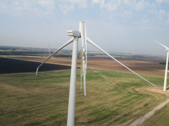
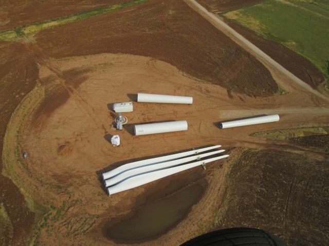
Like modern aircraft wings, these Windmill blades are made in a composite manner. Looking at the one that failed above I think it must be made of fiberglass and aluminum. I mentioned seeing this destruction when I got to Medicine Lodge and was told that someone has some “iPhone” video of one of these coming apart in a big storm we had earlier this spring. Not knowing any better, it appears to me that they probably can get the thing working again by replacing the two blades. The stand and the hub do not appear to be damaged.
As I continued down the North Side of this great expanse, I saw more evidence of damage from the Spring Storm. You can see it in the distance at the Left Side of the shot above.
Another interesting observation regarding this Wind Farm is that it is on top of a huge oil field. All around the windmills you see working pumpjacks. I think this is God’s way of telling us to use what works best. If Wind Energy can prove itself to be cost effective and compete with petroleum, fine. But, don’t eradicate oil out of some “green religious zeal” until – and IF – wind and other alternative energy proves itself. I think these windmills are neat and all but I do remember that they failed after the first “run through”. If you remember, back in the 1970’s, wind power advocates convinced the government to give subsidies to wind generator operators. As soon as the subsidies stopped so did the windmills. Let’s hope this newer and bigger technology is built on a more solid fiscal foundation and that when the subsidies are finally removed they can prove themselves viable.
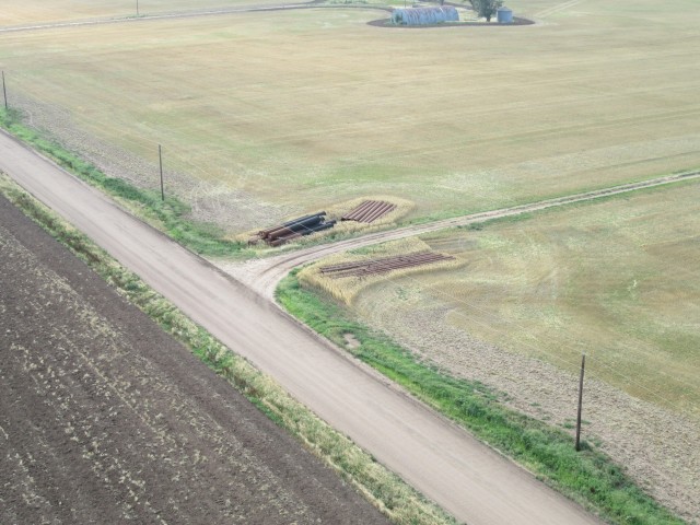
I have heard stories of Wind Generator farms being built without the power lines available to transport their electricity. Above is the evidence that this is not the case with this field.
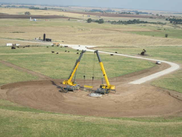
Above, in addition to the completed base for a new Turbine, you can see more evidence of the huge oil field underneath the wind field.
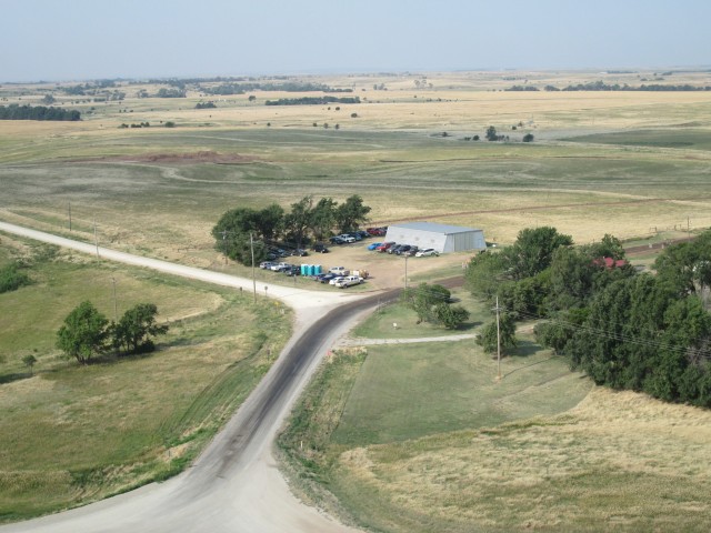
As I finally passed the West end of this huge Wind Farm I saw what must be either a Bunk House or a dining location for the men working on the Wind Farm.
OK. Maybe you’ve had enough of the Windmills but I had to take a picture of this one because I noticed the hub/generator of it is a different design from all the other ones I have seen around the state up to this point. Gee! Do you think there might be some actual competition in this Wind Business?
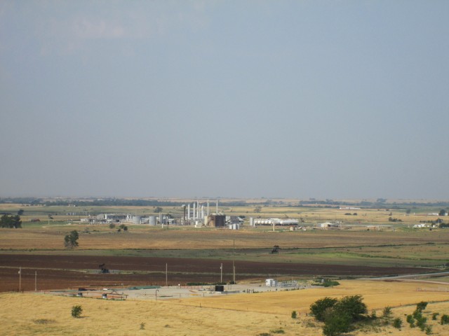
Above, in keeping with my “Wind Field on top of an Oil Field” observation, you can see a Gas Plant which is on the West edge of the Wind Field. Also in the foreground you see yet more oil wells.
After passing through the Wind Generator Field, I am starting to hope my destination is the town seen in the distance in the shot above. I took that picture with the long lens so at this point it is still about 5 miles away. The problem is that my wacky GPS is telling me that Medicine Lodge is to the right (North) of this town. Having experienced similar problems with this device before I fall back to navigation methods of an earlier era. I figure at the ground speed I have been holding and the time I have been in the air and the absence of any other towns of this size in sight – this must be Medicine Lodge. If it is not, it still doesn’t matter because looking up at my fuel tank tells me I have to stop there and find some gas anyway.
I turn to the South Southwest and head toward the town.
The picture above was shot with the wide angle lens to include the wing. Because it is “wide angle” the town is about twice as close as it seems in the shot. By now the terrain is rising up and I am getting closer to it. This is because I want to hold as low a power setting as possible to conserve fuel. So even though I am holding altitude, I am coming closer to the ground. I am low enough that some of the tree banks are obscuring my vision of the surrounding area.
A Google Earth Sidebar: Before going to new airports I always avail myself of satellite technology. I get on Google Earth and look down on the town and airport I am going to in order to get a good visual reference of my destination.
I was pretty sure this was Medicine Lodge but I was so low I couldn’t tell for sure. I could see the water tower in the distance but I couldn’t read the name on it. I figured it was time to climb and get a better look of the area. It wasn’t 2 minutes after I started a gentle climb that I saw exactly what I was looking for.
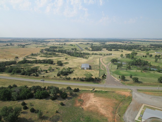
Medicine Lodge Airport on the South Side of Highway 160
Just like clockwork, as soon as I cleared the “east/west” ridge I was behind, there was Medicine Lodge Airport‘s newly covered, hard surface runway directly ahead – right where it was supposed to be!
A couple of other things are evident in this shot that I didn’t notice at first and were not apparent in the Google Earth imagery. Some areas of the planet Google does not provide in very high resolution. Try as I might, I could not figure out what type of business I was seeing North Northwest of the airfield. Once I got there and flew the pattern I could see it was their Golf Course! At the moment I took the picture above, though, I was concentrating on the airfield and the potential for other airplane traffic in the pattern and did not notice it.
Also, the sign over the road leading back to the airport is of great significance. I will reveal it shortly.
After I touched down, I shut the engine down and got out of the cockpit to stretch out a bit. I looked at my gas tank and could see I had plenty left to make a circuit of the town before landing again to walk/hitchhike into town in search of gasoline. I wanted to make this recon flight for a few reasons:
- From the air I could see how close a gas station might be from the airfield.
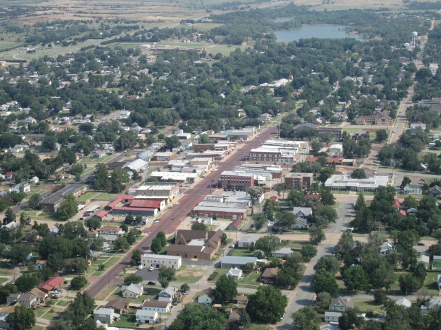
- In case the gas station was on the outskirts and I did not go into town, I would have some aerials of Medicine Lodge to post on “Sky Surfing”.
- Often after circling a small town, an aviation enthusiast will come out to the field to check out my flying machine and then give me a ride into town to get some gas.
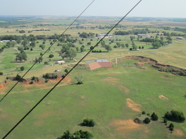
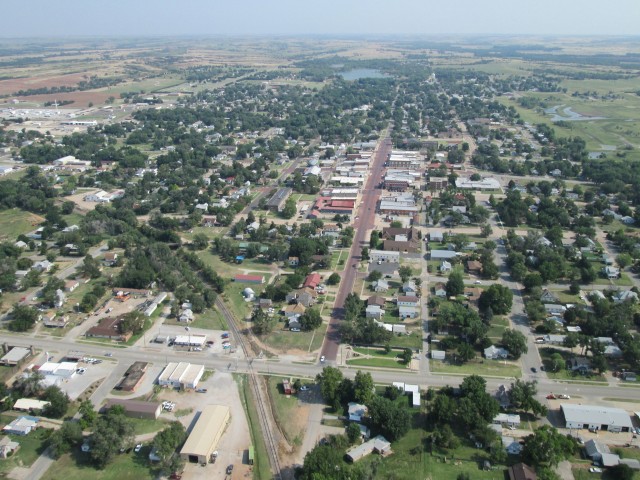
The shot above was taken on the edge of the airport pattern to the West. While taking it I realized ground pattern I couldn’t decipher on Google Earth was a Golf Course. I couldn’t make up my mind what the “open plains auditorium” at the bottom of the shot was, though. Sometimes I can figure things out in a flash of inspiration. Other times I marvel later at my obtuseness. Now granted while this shot was taking place I was constantly scanning the sky for traffic and could not dedicate my entire intellectual firepower to this puzzle. Still you would think it should have clicked seein’s how I was in Medicine Lodge and the Pageant is what this place is known for. It wasn’t until hours later that “Eureka!” hit and I realized this is where the pageant is performed. (Also that sign over the road I mentioned earlier that seems to lead to the Airport actually says “Pageant” in big letters) As I was passing over, though, I deciding these folks of Medicine Lodge are so far out in the country they have rodeos without fences. The next shot made me lose faith in even that hypothesis, though.
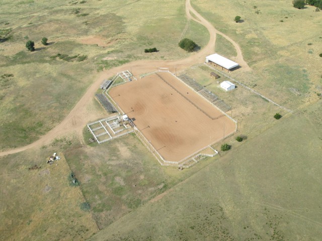
Just South of town is this substantial rodeo arena that indicated to me Rodeo is not a casual thing around Medicine Lodge
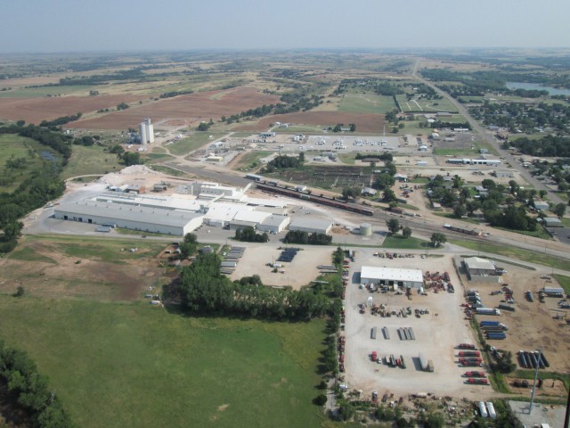
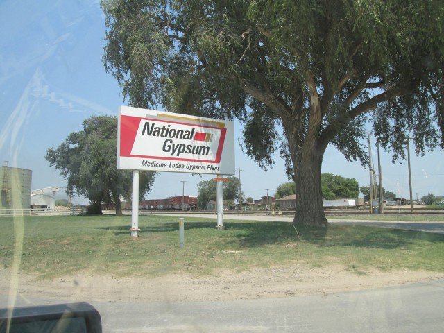
Above I determined that the facility to the left must be processing the minerals around this area. After all, they do call this region the “Gyp(sum) Hills”. This time I was correct. After landing I found that the series of buildings at the left of the shot is called National Gypsum and this is their Medicine Lodge branch.
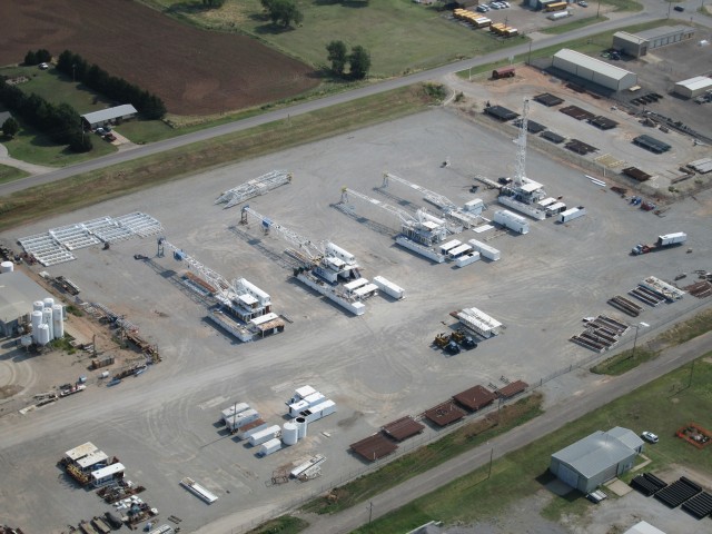
I recognized these Oil Rigs staged on this parking lot. They look new. Probably they are “out of staters” who have come into Kansas since oil hit $100 a year ago.

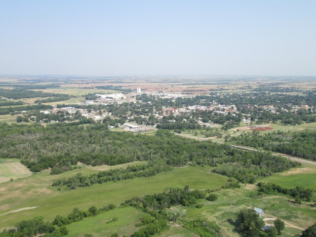
Barber State Fishing Lake is on the North Side of Town
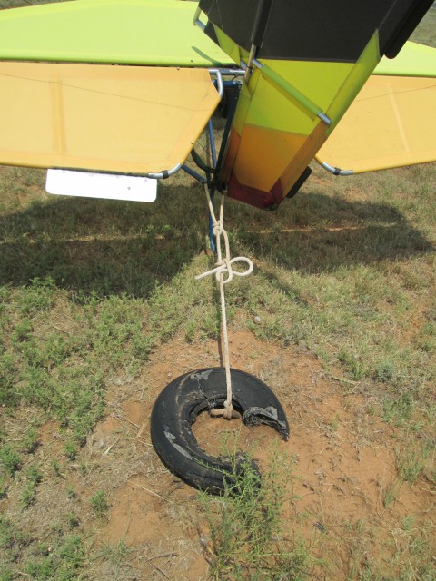
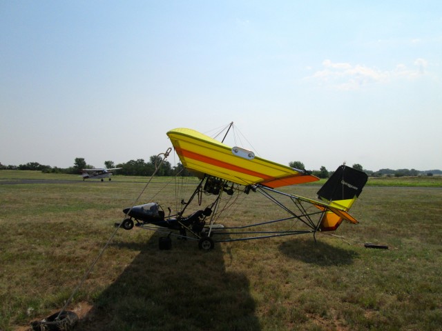
After I shot the aerials of the town I landed again and found a great tie-down. This was important because the wind was now a steady 20 mph on the surface. I could not leave the airplane unattended in that condition because it will blow away. I bring tie downs with me but it is always better when the airport has them anchored solidly in the ground. Medicine Lodge Airport had one for the tail and one for each wing and they were all long enough to reach. Excellent!
I was getting ready to walk into town to look for gas when a Citabria entered the pattern and landed.
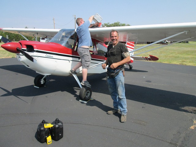
After they taxied in and shut down the engine, I walked over and introduced my self. It turned out these guys were on a mission of instruction. Instructor Josh Hill had just taken Harry Dawson up to get some tail-dragger time. We talked for a while and found out that Josh is a commercial pilot based at Stearman Field in Benton, Kansas. (Here is a previous post regarding Stearman Field) He and his wife have Tallgrass Aviation there. They both have lots of professional aviation “tickets” and teach people the art of flying.
Shortly after I took the picture of the guys a pickup came around from the hangar behind me. Since there is no fuel available on the field, Harry’s associate Frank McAnarney had brought a couple of tanks of gas from town for Josh to top off.
Soon after, Josh took off for Benton. After finding out what I was doing, Harry asked if I would like a ride into town to get some gas. He didn’t have to ask me twice!
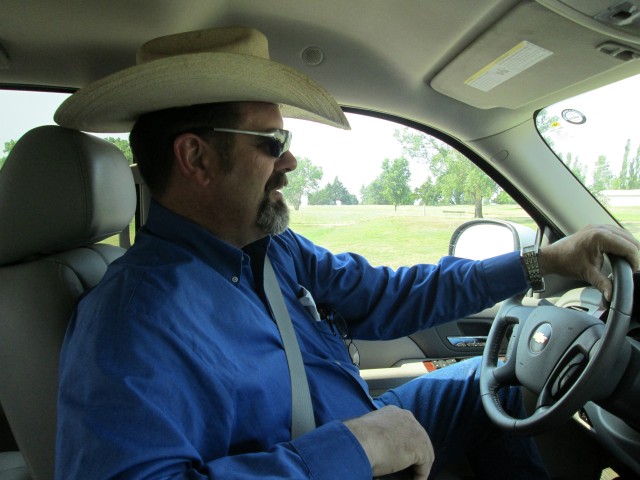
I snapped a couple shots as we were driving West from the Airport into Medicine Lodge on Hwy 160. Above you see Harry in his more natural attire. He was wearing the ball cap when flying the Citabria but switched back to the Cowboy Hat I figure is more his natural attire. His Chevy is a King-of-the-Road type with a flat screen on the dash and an air conditioner that changed the outside, 100 degree ambient air down to cold a minute after we closed the doors. He said he would buy lunch if I could take the time. He didn’t have to ask twice.
We went over to the restaurant Harry had just bought and had an excellent lunch. Chicken Tacos and French Fries with Lemonade. By that time Frank McAnarney showed up to eat lunch and then Harry’s Mother Georgi joined us. Also, “Monte from Oklahoma” sat in and told a few good jokes. We had quite a crowd and had a good ole time talking about a wide variety of things. Even though I fully intended to get a picture of the place and all of us sitting there “living large”, I failed to get it done. There was so much going on I plain missed the shot. Sorry but occasionally when reading The Flight Blog you will be responsible for exercising your own imagination…
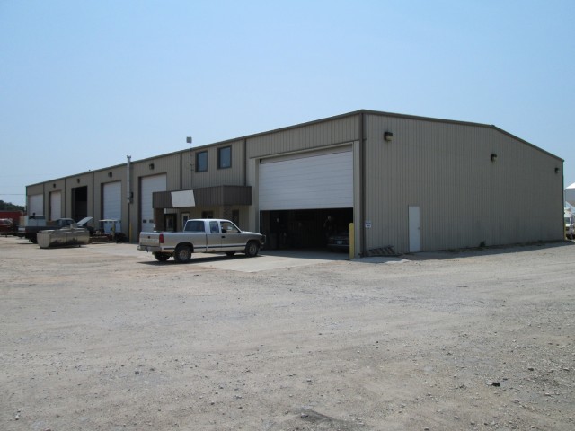
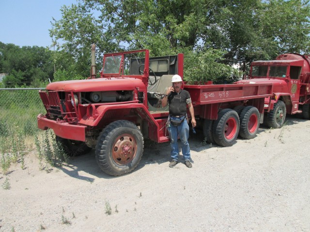
During lunch I found that Harry Dawson has a number of enterprises around the area including ranching, restaurants, a car dealership and gas stations. He also has a business called Hellfighters LLC. They specialize in eradicating the Red Cedars that are continuously siphoning all the water out of the prairie. I learned that each of these trees pulls about 30 gallons of water a day out of the ground. Getting rid of them allows prairie land to graze more cattle and for all other types of fauna to thrive. Experience has shown that when the Cedars are eradicated the range is able to support more cattle and wheat. Before going to the gas station, Frank showed me around Hellfighters.
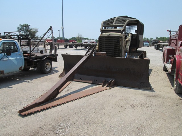
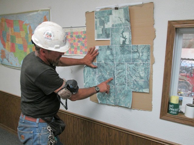
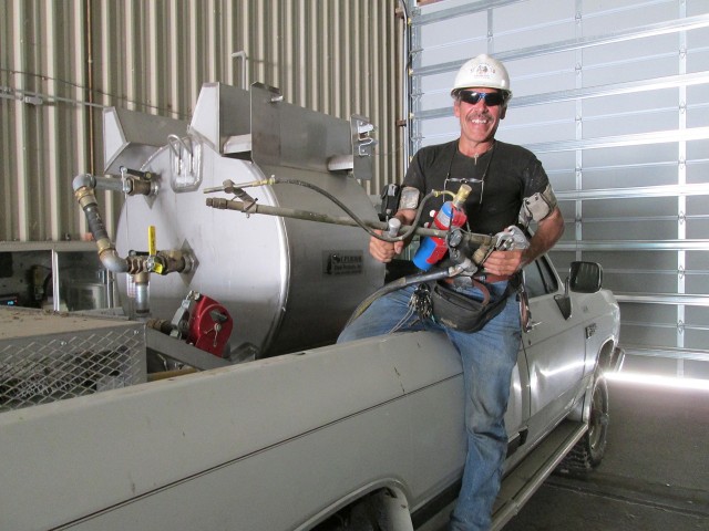
I’m the kind of guy that likes to ask questions. In my experience it is one of the best ways to learn. My trip with Frank to Hellfighters was short but very revealing regarding this Red Cedar eco-nightmare and the solution. Not only did I learn about the scourge of these trees but I got a first-hand look at some of the tools used to beat them back.
One of the scariest weapons of World War I &II, Korea and Viet Nam was the Flamethrower. But even though it was terrifying to have one deployed against you, flamethrowers were arguably of marginal use on the battlefield for a variety of reasons. When it comes to the war against the water-robbing Cedars, though, the Flamethrower is just the ticket. Cedars are hard to burn and the napalm is necessary to stick to the cedar long enough to burn it down to the roots. Anyway, I was really impressed by this whole deal.
After Frank showed me around the shop we went to the gas station. I grabbed 5 gallons and mixed it with the 2 stroke oil I brought with me and I was back in business for the flight home.
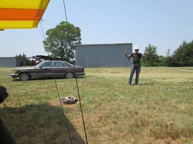
It was pretty hot and windy by this time. This is part of my excuse because unfortunately I did not get a chance to impress Frank with my ability to start my Rotax motor in the two pulls as I would have liked. I flooded it and had to pull it through about 12 times to get it started. The Rotax gets real touchy on a hot day. Once I got it started, though, it settled down purring like a jungle cat. I told Frank I was going to demonstrate the extreme short field takeoff capability of my yellow bird. This, I was able to prove in spades. With a gusty 20 mph wind right down the runway, I pulled onto the active, gave him a “thumbs up”, throttled up to Full Military Power and was airborne within a car length. I waved goodbye and set my course for Selby Aerodrome.
At lunch I had told the guys about my concept of “Sky Surfing” in this extremely low wing-loaded plane I fly. To me it perfectly describes the method I use of floating with the air currents. Sometimes the “surf” is gentle and sometimes it is Waimea Bay with the Yellow Flag up. This day was a mild Waimea – enough challenge to make it interesting but not too much to make it unpleasant. This shot will give you a feel for it.
Hey! If checking out Waimea gives you a desire to travel to or get more info on the Island Paradise of Hawaii, you can’t do better than by reading “The 100 Best Things to Do in Hawaii”. It was researched and written by Janice Rogers. Everything you ever wanted to know about Hawaii and more. Check it out HERE.
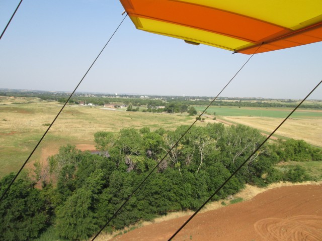
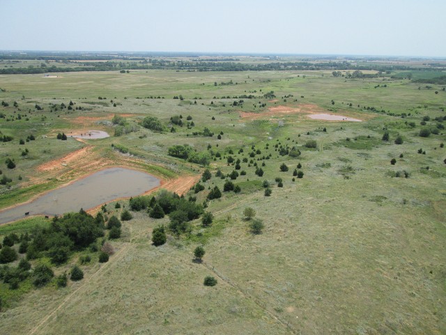
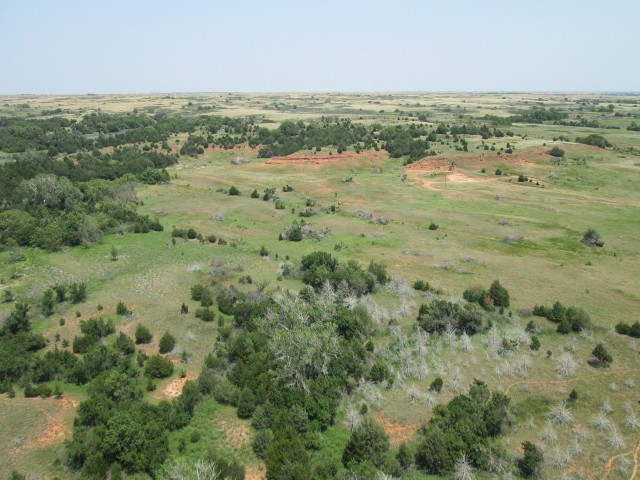
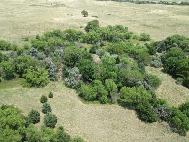
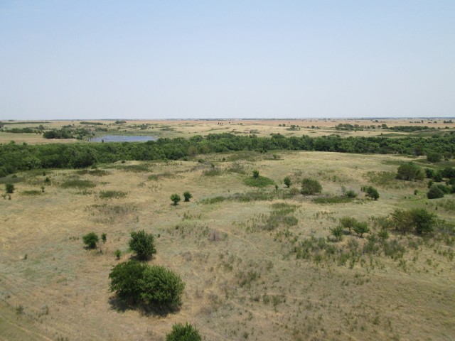
As I cruised back toward my home field I took these scenic shots just East of Medicine Lodge. They were taken from about 100′ AGL. After talking to Frank about it I suddenly realized just how many Cedars dot the landscape.
In some places, the Cedars completely obscure the creeks.
As I passed the Field of Windmills again, I could not resist taking a few more pix.
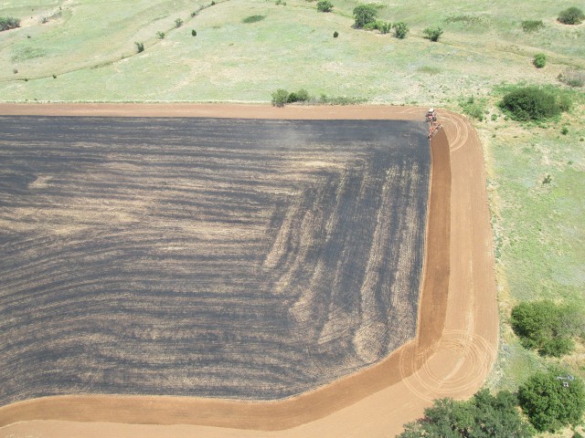
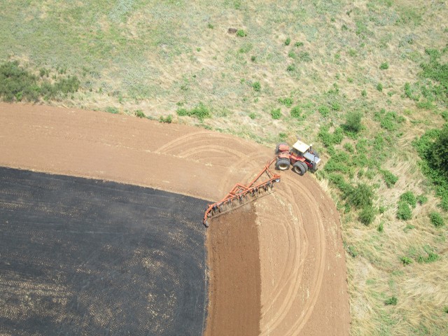
Since I was basically traveling over the same ground as I had crossed earlier in the day, I didn’t want to duplicate too much of the same stuff. I did see some new things that were interesting, though. After harvesting the wheat, some times the farmers will burn their fields to clear the stubble. This guy was plowing a recently burned field and it was interesting to see as I passed directly overhead.
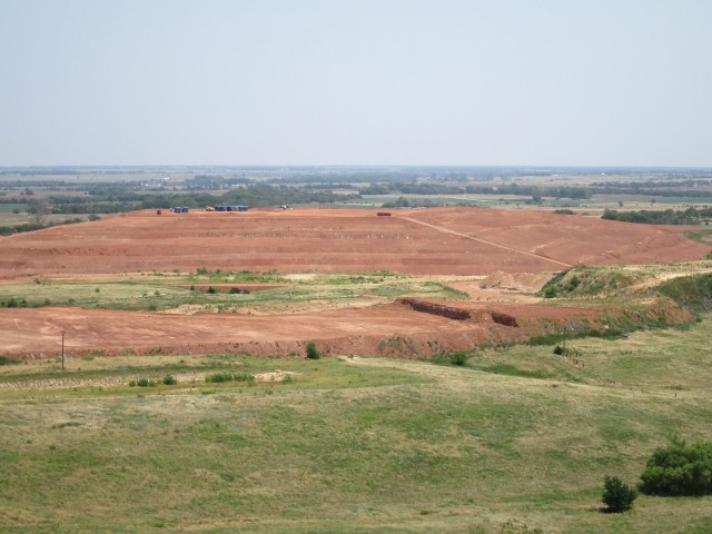
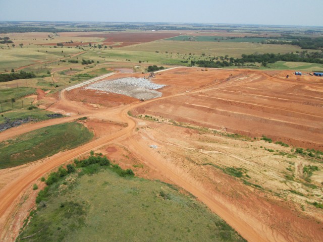
As I continued East I saw something huge I missed somehow on the trip to Medicine. It is a large, mountainous landfill. We have a couple big ones on the Northwest side of Wichita but this one is out in the country completely by itself. I looked on Google Earth but didn’t find it. I am guessing it is Kingman County Landfill.
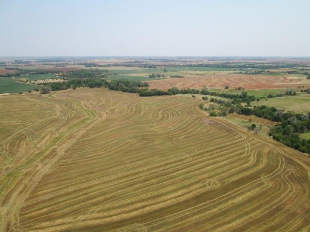
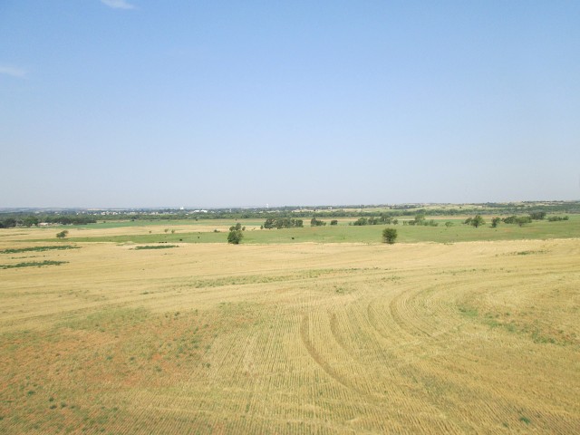
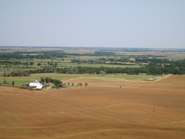
Heading East, again I was impressed with how green everything was compared to the same time the previous year
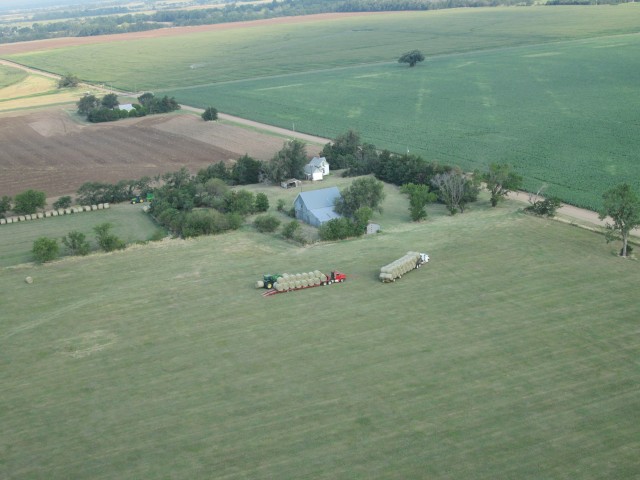
The folks in the shot above had more hay stored up than I have ever seen in one place. What you can see in the shot is only about a third of it. Keep in mind that those are multiple rows of the big cylindrical bales.
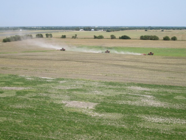
A slightly smaller flight than this morning’s group of monster tractors at work about 7 miles Southwest of Haysville, Kansas
You can judge from the dust trail behind the tractors above as to what the wind was like.
I took the last picture above before I decided to put the camera away. I figured I had taken enough shots by that time and I really needed both hands “on the wheel” as the air was very active. When I came into the pattern at Selby Aerodrome the air was quite turbulent but I made three circuits of it nonetheless. I seem to be the only guy I know that likes the “lively” air.
The shot below has nothing to do with flying. It is but a small sample of the artistry my dear wife Debra puts into cooking. This was part of what we ate at a dinner over at her parents house later that evening. It tasted every bit as good as it looks, too.
Indeed the “icing on the cake” after a great 4 hours in the air!
Blue Skies & Tailwinds!™
Brian FitzGerald

