Visions of the Old West
Continuing my On-Going Campaign to fly my Quicksilver MXL to all the uncontrolled airfields I can reach in Kansas, my eyes lit upon the town of Sedan, Kansas while scanning the map a week ago. The previous Saturdays I had journeyed West and South so I was looking for something new to the East or Northwest. I saw Sedan, Kansas and put it on my mental list of candidates. Toward the end of May I recorded one of the best flights of my life which was to Moline, Kansas. Also deep into the Flint Hills, Moline is about 15 miles North of Sedan. When I first saw it on the map I discounted it to look elsewhere as I did not want to cross the same territory again. I thought crossing The Flint Hills again so soon would be redundant. Over the next few days, though, Sedan kept coming back into my mind. I had never been there before and the time seemed right. It proved to be a good choice because in retrospect, after making both treks, I am pleased to report that the scenery I passed over was almost completely different from the previous trip to Moline. It is amazing how much the landscape changes in Kansas over such a small number of miles.
As has been my method, I left early on a Saturday morning to avoid the winds that typically build through the day. Unusual for this region, the wind was coming out of the East that morning. Experience has shown when I start early and use my “nap of the earth” flight plan, the countering winds just a few hundred feet above me do not affect my ground speed. That is until about 10:30 or 11 am. By then I am at my destination.
Before heading to the airport, I had some TCB to accomplish. I needed to mail some invoices to my advertising customers and wanted to mail them on Saturday so they would be received on Monday. Our post office is very good here in Wichita. You can see by the photo below that it was early in the morning. The light in the foreground is from a street light under which I was standing.
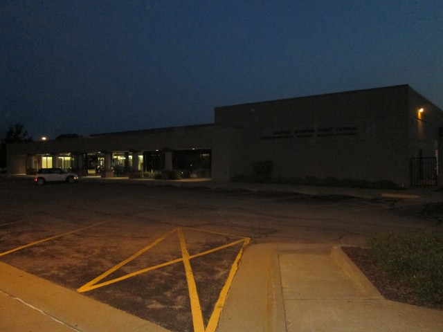
Corporate Hills Post Office – Wichita, Kansas
When I rounded the corner at my airfield I was surprised to see I was not the first one there. Actually I was surprised to see anyone there. All Summer I have been making these trips and had yet to run into anyone when I left the Selby Stables. Today Paul Fiebich had pulled his Airbike out in order to run the motor in. He and another guy had recently rebuilt it and now he needed to perform the run-in. His configuration uses a Rotax 503 in a “free air” mode without the cooling fan. Apparently they had tried to perform the run-in procedure a few days earlier but the CHT/EGT temperatures became too hot to complete it. He was there early to take advantage of the unseasonably cool temperature that morning and brought some electric fans to help the effort.
And cool it was…
It takes me a while to learn things but a few years back I started bringing my windbreaker along on Summer morning flights. Even though the temperature would hover around 100 degrees later in the day, the 75 degree temp on the ground and the wind chill factor aloft would combine to produce a definite chill to the hands. It’s the kind of thing where you have to “split the difference”. I didn’t want to overdress knowing it would be hot later in the day but I also didn’t want to fly for a couple of hours shivering in “the wind”.
The Solution
The solution has been a tip from my Dad. He was an avid Golfer. When we were young, on Saturdays, he would get up super early to play the game. His situation was similar to mine in that many times it would be cold at Tee Off and then get really hot as the day progressed. His solution was to use one of those pullover windbreakers sold at the Golf Pro Shops. I have found the same clothing to perform well in my sport, too. This day, after I landed, it took my hands about 15 minutes to stop tingling from the cold. The windbreaker kept me from dealing with “the shivers” for the flight, though. At about 11 am when the temperature started to spike, I just took off the windbreaker and tied it around my waist.
Make or Break Time
This morning the prevailing wind was an unusual direct headwind from the East. As I said earlier, I have found that I can fly into the prevailing winds on a cross country trip if I start early enough in the morning and fly really low. Starting out in any direction from Selby Aerodrome does not allow for immediate ground hugging, though. There are too many houses around so I need to stay at 1,000′ AGL until I clear them. This takes about 15 minutes during which I am able to calculate the headwind using the desparity between my airspeed shown on the ASI and the ground speed shown on my GPS. This day at sunup the headwind was already pretty stout. At Angel’s One (1,000′ AGL), I was only getting 18 mph forward ground speed! I was pretty confident that would change down at UFL75 (Ultralight Flight Level 75′) but you just can’t say for sure until you get down there. My rule of thumb is that I need at least 30 mpg ground speed to make my destination. If I could not yield that I had decided I would head East for an hour or so and then divert over to Strother Field between Arkansas City and Winfield, Kansas and see what was happening there.
After passing all the farmhouses I was able to descend to UFL75. I was pleasantly surprised to be able to “Net Zero”. At 75′ off the ground the wind did not affect me at all. Ground speed was equal to air speed – Net Zero! The mission was a GO!
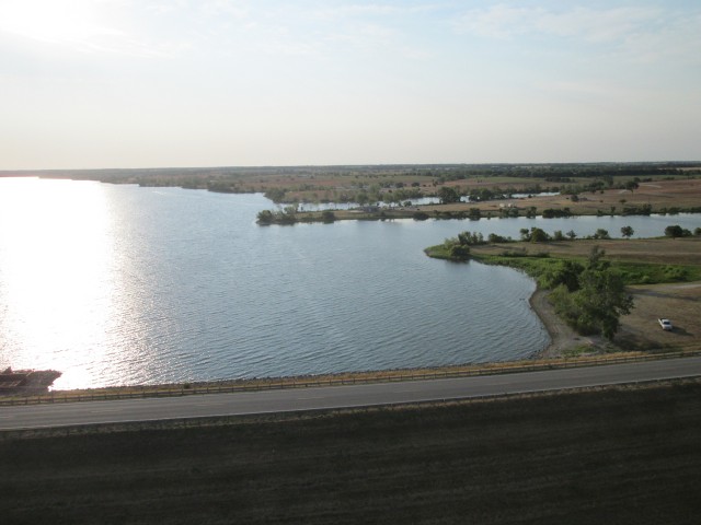
The evening before I had perused my sectional map to get an idea what I would be passing over. It had shown that I would be passing South of a lake. As the lake came into view, though, my whiz-bang GPS had me passing right over the center of it. Let It Be Known. Prudence when flying an aircraft powered by a 2 Stroke motor restrains one from flying over lakes at low altitude. Any time I fly my MXL I am making constant mental notes where I can land should the (mostly) trusty Rotax 503 suddenly go quiet on me. Following that line of thought, good sense dictates that a water landing without floats would turn a fun day sad. Therefore I swerved to the South of the lake known as Winfield City Lake.
Unexpected Terrain
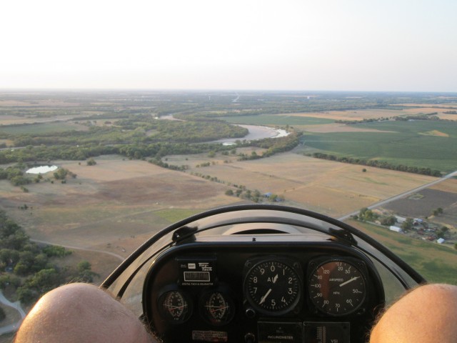
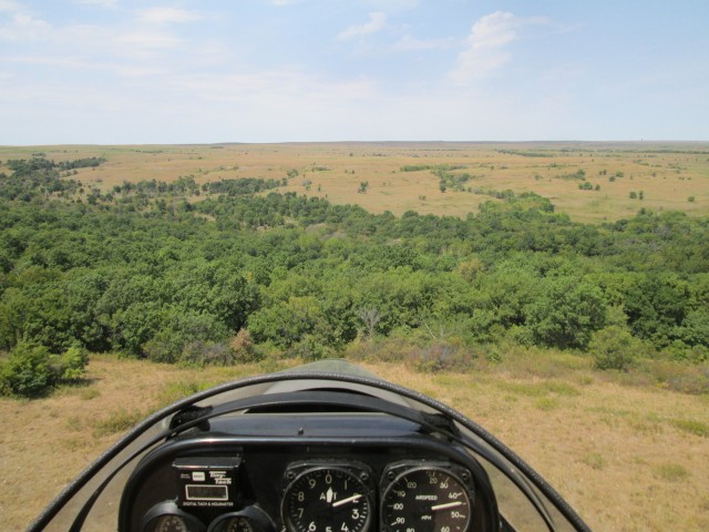
As I continued to follow the arrow on my GPS, I was surprised at the terrain on the bead toward Sedan. On the previous trip to Moline, Kansas, slightly North of this course, there were a few trees but nowhere near as many as on this first leg of the trip to Sedan. This presented a corollary to the “water flyover” dictum outlined above. While it is an unwelcome surprise to land unexpectedly in a lake, it is no finer joy to land in the tops of trees. When taking “the low route” as I was this morning, you cannot tell if the group of trees you are approaching are merely a thin band or a wide expanse. Prudence again calls out and says “Climb and Look Farther Ahead”. This I do with the minimum power and altitude necessary to accomplish the deed. When the expanse of trees was deemed too great I would cut around the edge. If fuel exhaustion were not a consideration I would just climb high enough over the wooded areas to enable an “engine out glide” to a safe landing outside the glen. On these “high efficiency distance flights” though, every climb costs fuel and also pokes the plane into the burdensome head wind aloft. Flying like a butterfly is a thinking man’s game…
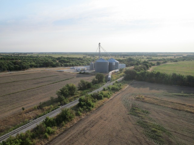
I have been flying for about an hour and the inhabited homes are increasingly sparse. In the middle of this great expanse I see a granary with a railroad siding.
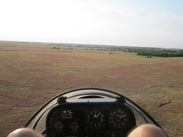
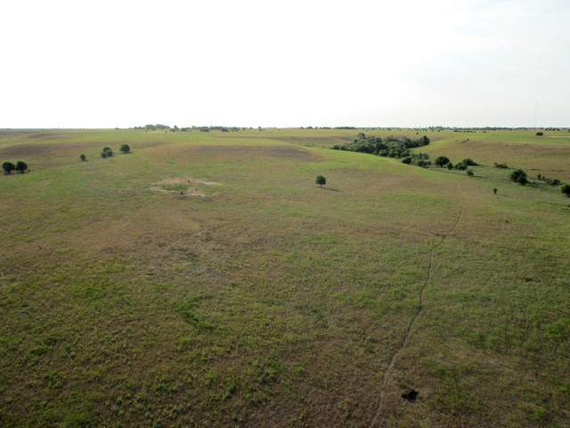
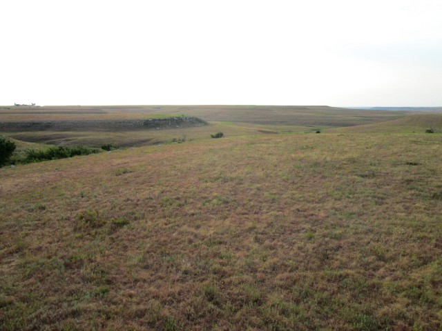
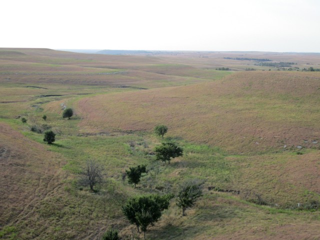
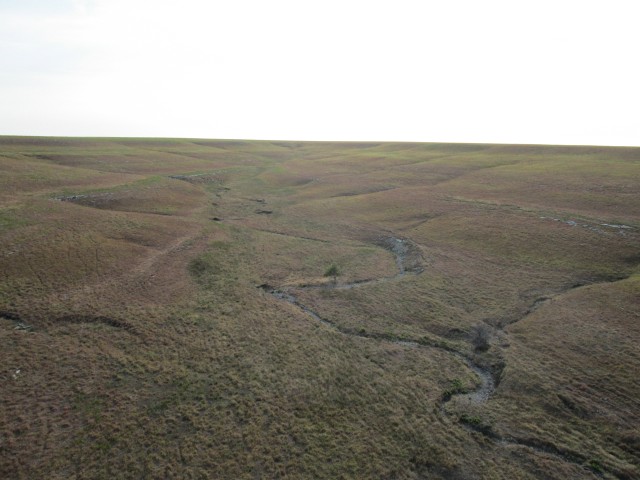
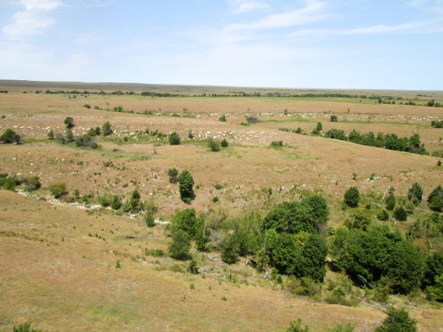
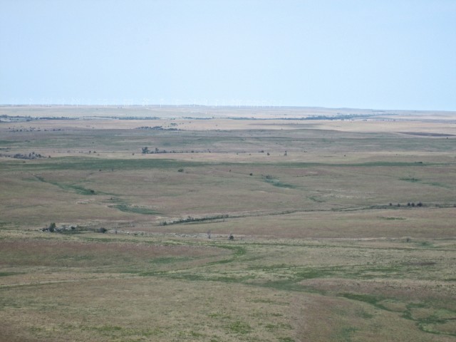
Suddenly the trees fade away… I am struck how the scenery reminds me of the Cowboy and Indian movies of my youth. Gulches, Canyons, Ravines and Plateaus! This is the stuff of the Old West! This is what the movie makers were showing us! I half expected to see bands of Indians running Buffalo down with spears. Truly Timeless American Beauty – Majestic to Behold.
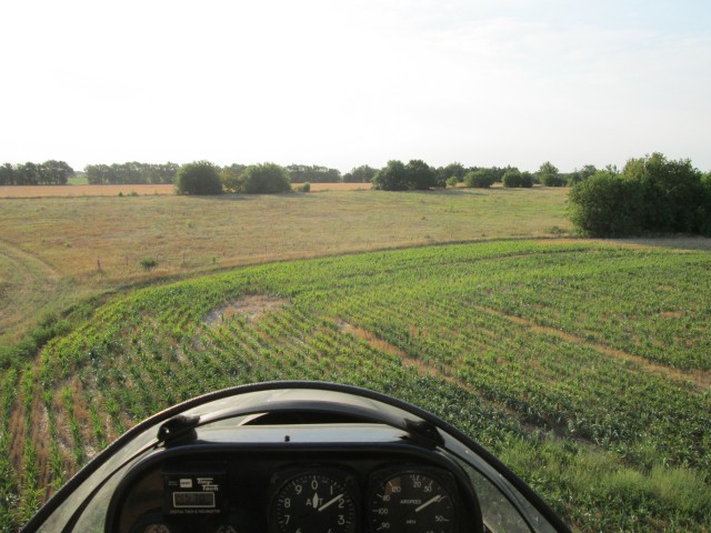
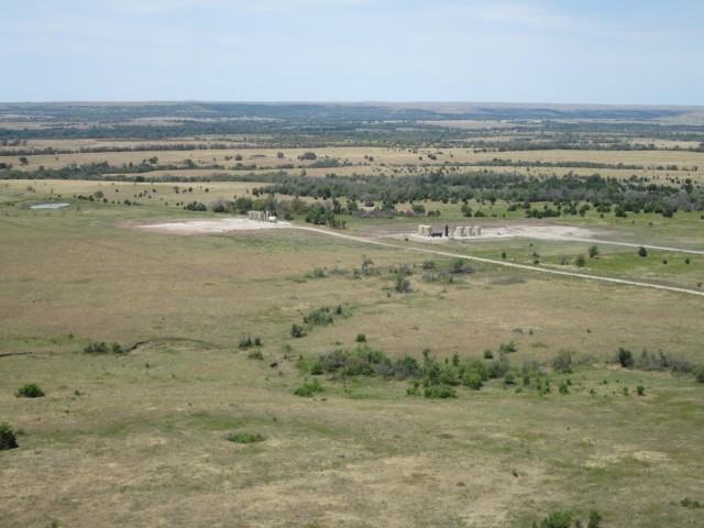
Next I am presented with a gradual rise to the top of a ridge seen at the horizon seen below. I increase power just enough to maintain my 100′ AGL altitude.
As I crest the ridge I see some action directly ahead. There are cattle in a pen and a pickup with a trailer is starting to pull away. I change my course to the South (right) just enough to guarantee I will not spook the beeves.
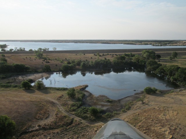
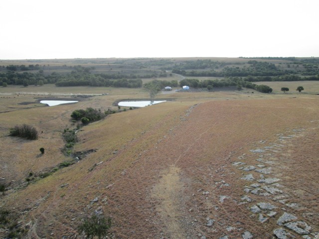
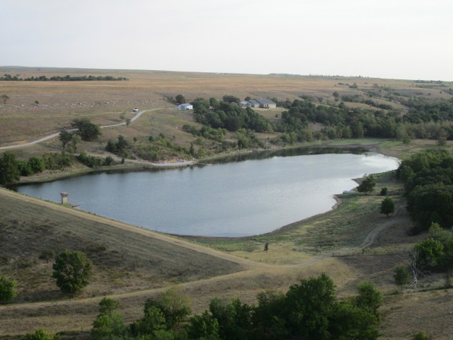
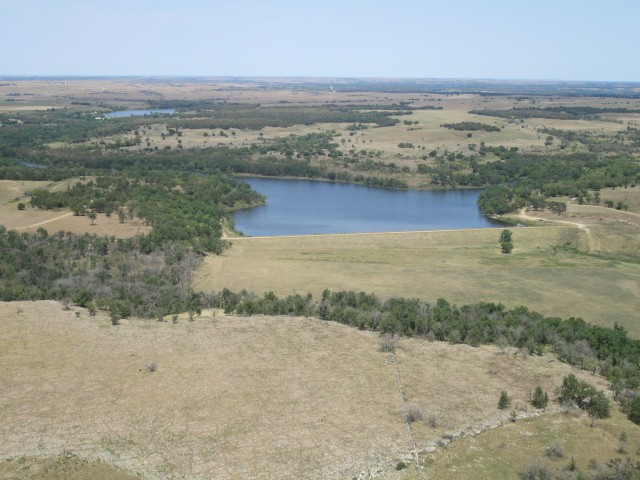
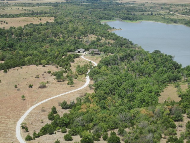
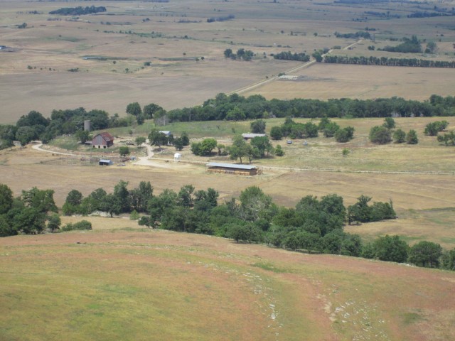
After passing the roundup junction, I see the first of a few spectacular abodes I will show you on this trip. This first one was too far off my chosen path so I used the telephoto to try to capture it. These folks have built a dam to provide a lake and then perched their house on the hill overlooking it. I did not see another dwelling around them for 25 miles.
The Coyote Manifestation of the Day
I really wish these coyotes would be more polite and give me just a slight warning to ready my camera. As it is, I keep the pocket cam on a lanyard around my neck for quick draw shots. But, in the time it takes to fire the camera up, set the throttle and then get a bead on the canine, occasionally the photo is not sublime. So, that’s my excuse. But man, coyotes really don’t like to be caught out in the open… This guy was smart enough to cross under me at one point during the process, further complicating things. Two other shots were worse so I didn’t bother posting them.
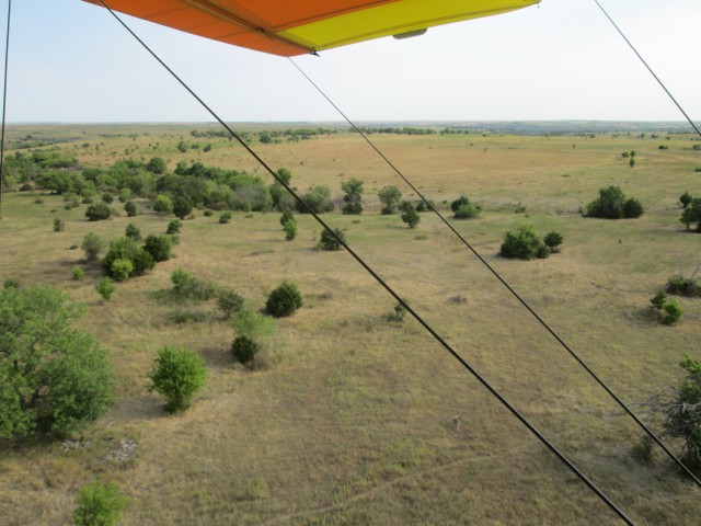
Note the fuzzyness near the lower wing cable toward the bottom of the shot just above that deer trail
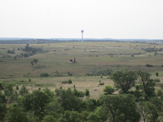
I had been flying for 2 hours and figured Sedan should be showing up. That’s when this statuesque water tower appeared in the distance.
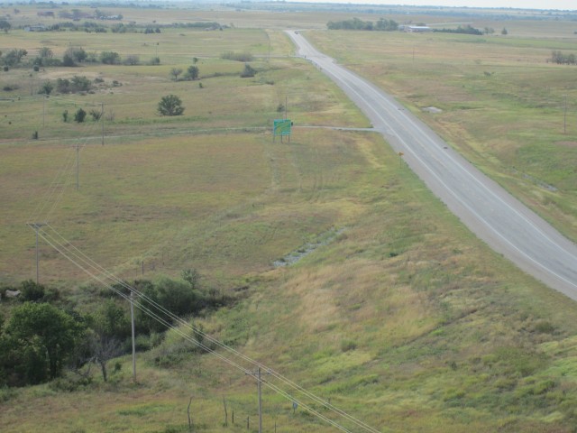
Shortly after that, after passing to the right of the water tower, I am presented with the scene you see in the photo below. I can make out the green sign. It says “Welcome to Sedan!”. The (made for hiking in the woods) GPS I use to navigate tells me Sedan is farther straight ahead. Here’s what goes through my lightning fast mind in order of occurance.
- Sedan is NOT that building on the right side of the highway.
- Sedan has a population of about 1,100 people. I don’t see that many folks out ahead on the plains in front of me.
- The GPS has “Played Horse Shoes” with me again (“close enough is good enough”)
- It is time to climb and get a “look see” before I run out of gas.
- I couldn’t be that far off. It has to be around here somewhere…
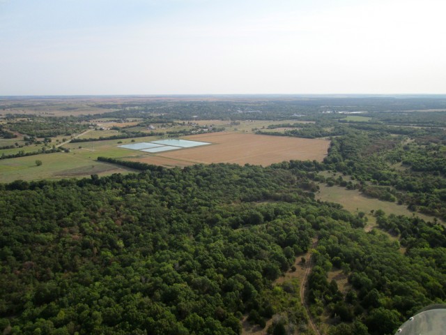
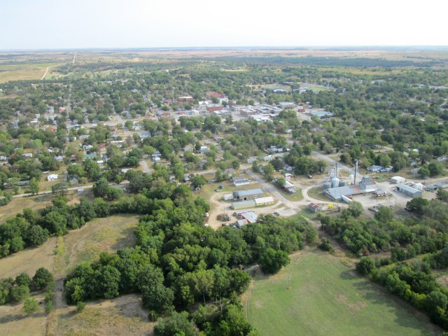
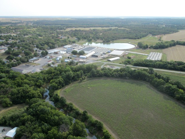
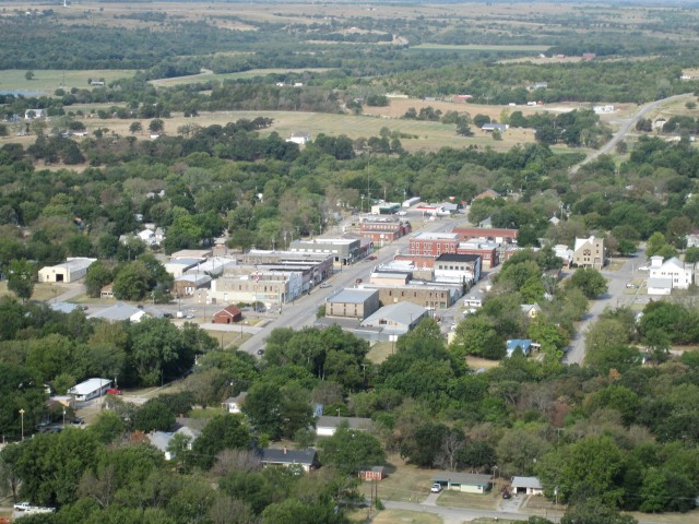
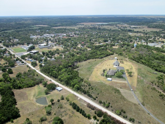
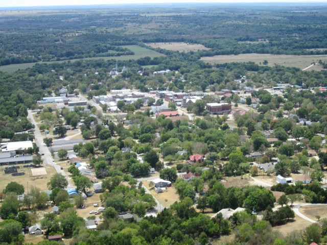
Having reviewed my situation, I allocate some fuel and take the elevator to the 8th Floor (800′ AGL) and start looking around. Below, you see what I saw as I looked Northeast of my position. Even though I wasn’t seeing the town yet, I saw telltale signs. The “water boxes” seen in the shot were clues. A lot of small towns use these type of ponds for fresh water (I think) so I know it is farther off in that direction. Sedan must be in the valley. I change course and set off toward it.
The guess was good!
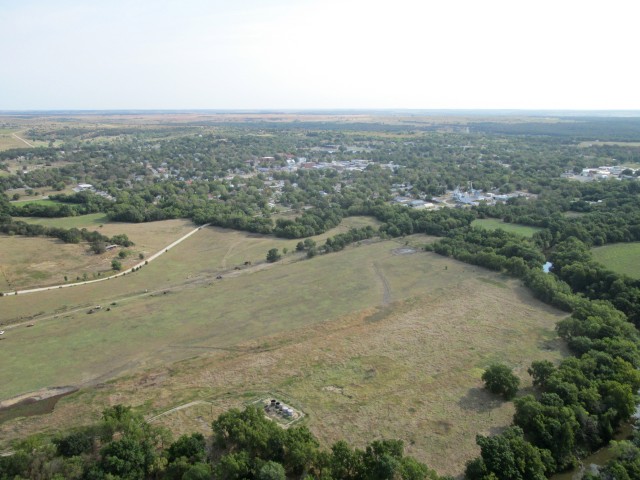
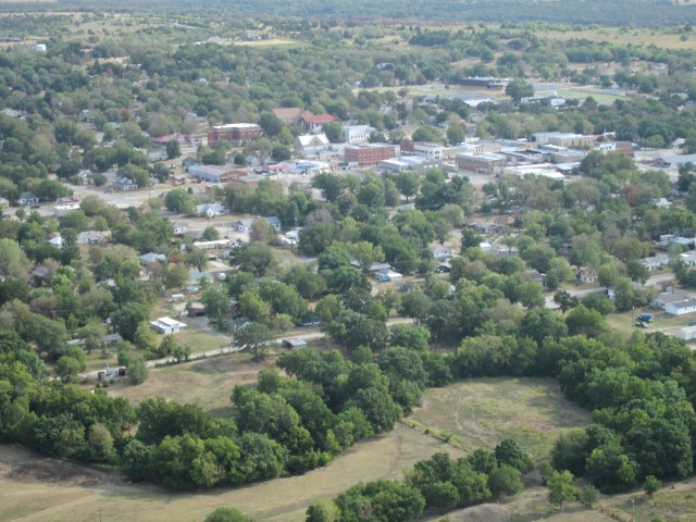
Sedan, Kansas from 800′ AGL Looking Northeast
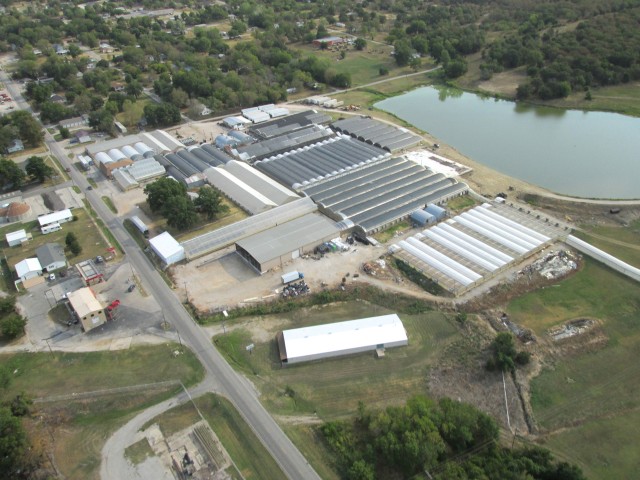
A business on the South side of town caught my eye. It looked like a greenhouse operation. I looked it up on Google Earth and it is Sedan Floral.
Time to Land
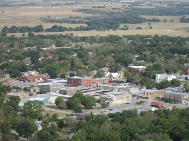
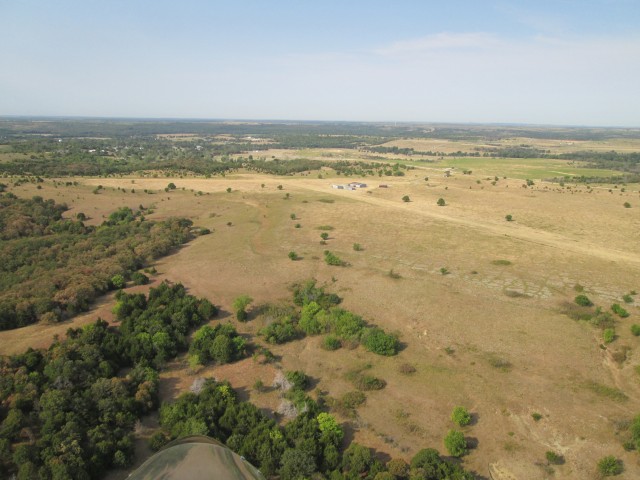
Sedan City Airport is Northeast of town about a mile and a half. I swung North of it to get the shot you see below with the town in the background. Although crosswind landings are no big deal in the Quicksilver, it is always more pleasant to land into the wind. When checking the airfield on my favorite resource AirNav.com I had not noticed there was an “Easterly” runway (Runway 12/30). Seeing this from the air then, rather than land on Runway 18, I changed my pattern and dropped onto Number 12. The surface wind had been building up as I circumnavigated the town so my arrival timing was perfect!

Nobody was anywhere near the pattern so I slowed down and took this shot on “high base” before descending rapidly to land on Runway 12.
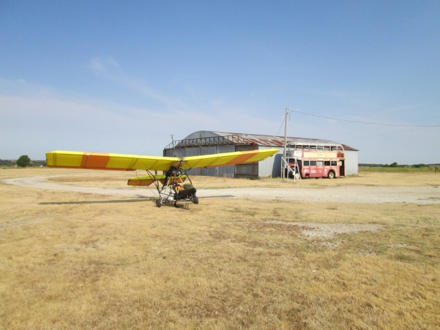
As soon as I shut down the motor, turned off the fuel tank and climbed out of the cockpit I did the next most important thing – I took some pictures of my plane in its surroundings…
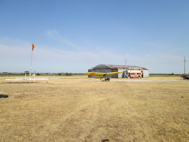
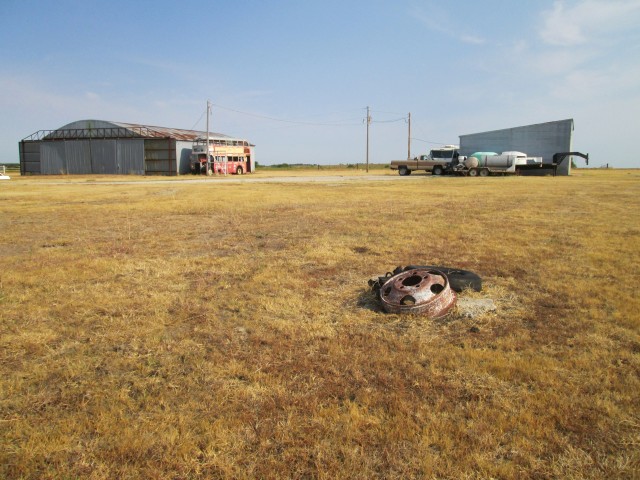
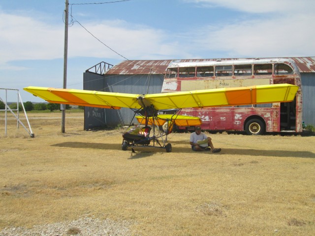
A Proper Shot of Sedan’s Airport Must Include the Quicksilver, the Windsock and the Double Decker Bus
I decided the best course of action before walking into town would be to pull the plane off the plain and put it next to the Double Decker Bus. This would put it between the two hangars and shield it from the wind. I didn’t see any reason to tie it down. Also this spot gave the MXL some caché perched next to the exotic bus.
My flight time to Sedan, Kansas from Selby Aerodrome was two hours and fifteen minutes. Since the distance between the two points is 67.7 miles, I covered it at an average speed of 30.08 MPH. Smokin’ Hot!
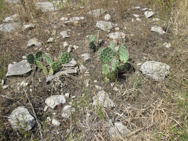
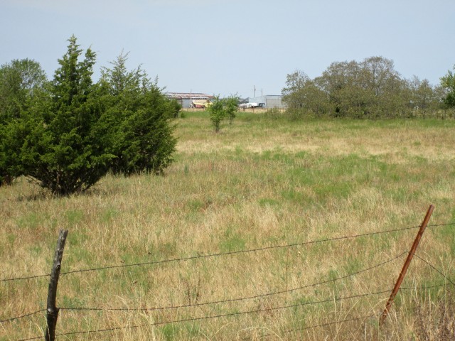
Behind the seat of my MXL, I had brought along two 2 gallon plastic gas containers to carry into town to get some gas. I also brought my Pennzoil 2 Stroke Oil to mix with the gas. I unfastened the tanks from the strapwork I designed to hold them securely and set out for Downtown Sedan. As soon as I walked off the end of the runway, I noticed I was walking on a completely different type of ground than I see in the Wichita area. For one thing, there are flat stones that nearly cover the surface in some spots. This should not have surprised me as this area is called The Flint Hills. While we do share the same evidence of cattle around Wichita, the cactus is a stranger, too.
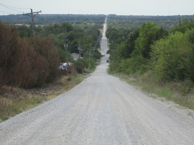
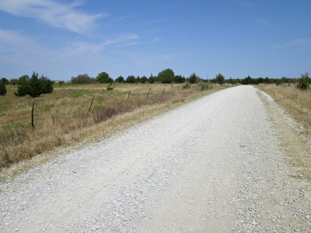
I had to make my way through two barb wire fences to reach the road seen below which would take me into town. I had seen this road from the air and even though it did not directly serve the airport, it looked to be a faster way into town after crossing the field. As I stepped on to the road, I taken by the way it continued off into the distance. The Beatles have a song called “The Long and Winding Road“. It is definitely not about Kansas. One of the things I love about this region is the Wide Open Spaces! It is an environment that fosters freedom of thought and independence of character. Roads that are “straight as a rail” and seem to lead off to infinity are part of that mystique. To me they speak of “No Limits” or as our State Motto proclaims “To the Stars Through Difficulties” (Ad astra per aspera). I Thank God My Children Were Born In and Grew Up in Kansas.
By the way, I’m told if you want to learn to play the guitar like a Beatle, you can do it on the web at “How to Play Guitar Like the Beatles“.
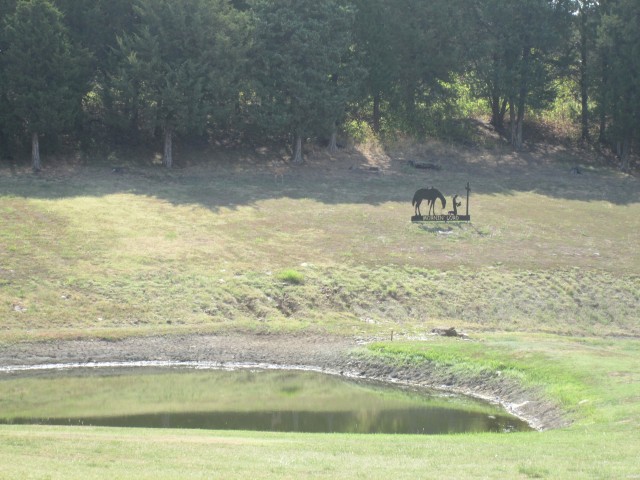
As I walked South down School Street I see evidence that Sedan is blessed by folks unashamed of The Gospel of Jesus Christ. I had seen similar decals on cars and trucks before but this touching monument was made from thick plate steel. As I reached for my camera I saw motion in the corner of my eye and realized there were 3 deer in the shadows. As carefully as I could I slowly brought the camera up to frame the shot hoping they would not scamper away. Two of the younger ones did get away. But, if you look carefully you will see the Mom(?) standing at the edge of the treeline about three lengths of the statue to its left.
Adjacent to the field shown above is a “Flintstone Garage” that would have pleased Fred and Wilma. It seemed to be of fairly recent construction and is probably the main reason the yard shown previously is clear of stones.
Since I was a stranger in their town I was not surprised or angry to have its guards challenge me as I walked down School Street. I did have to use my plastic gas cans to protect my ankles from the big bad boy featured below. He was intent on biting my legs and no one was around to call him off. He drove me completely off the sidewalk.
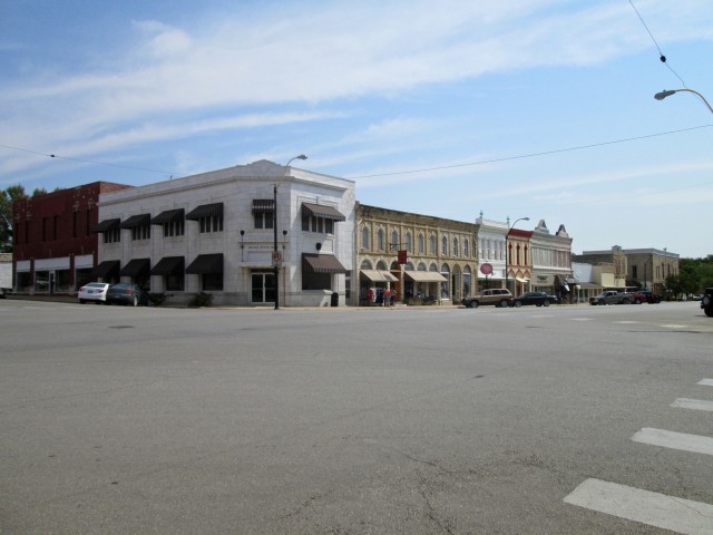
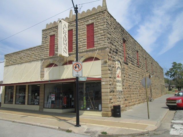
Just after leaving the Dachshund’s territory a couple pulled up in their car and asked if I wanted a ride to the gas station. Even though I was enjoying the walk, I thought their offer very neighborly and accepted so as to acknowledge their kindness. They took me to one of the two gas stations in town. It was on Main Street. They said they would wait while I filled up the gas and take me back to the airplane. This was very nice but I wasn’t ready to go yet and had to politely decline. I told them I was going to wander about to take some pictures and then grab something to eat before heading back to the airport. They said “Great Idea!” and bid adieu. They were not enthusiastic about the prospect of having their pictures taken for The Flight Blog so I let them go and set out about investigating the town.
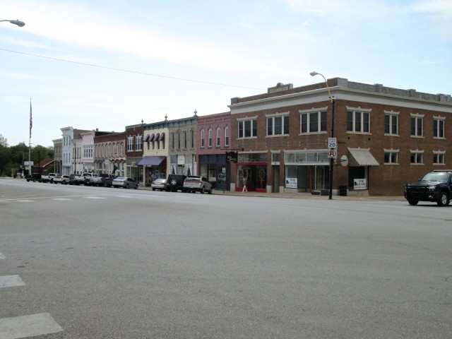
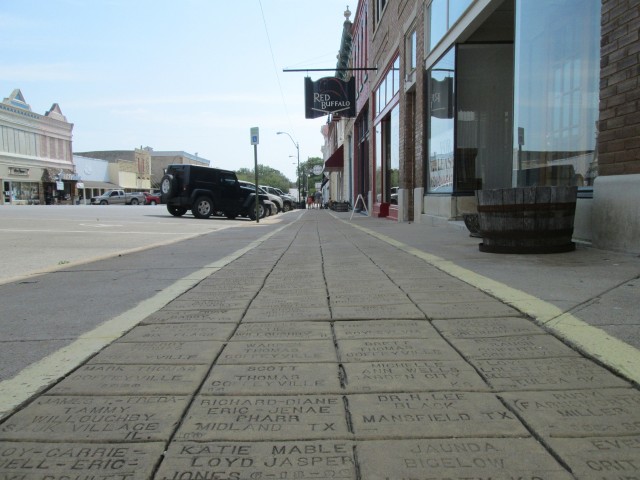
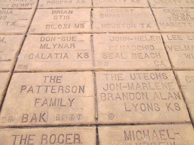
A days earlier when I had decided to make my next journey to Sedan, Kansas I told my lovely wife Debra about it. The first thing she said was, “Oh, the Yellow Brick Road”. Since I think I know everything, I gently corrected her and informed her The Yellow Brick Road was in Liberal, Kansas – not Sedan. Well, that’s half-right California Boy. Liberal has a Yellow Brick Road, too, but Sedan’s is probably older and longer. It has 10,650 bricks featuring many famous folks from countries all around the globe. I will think twice before challenging my Kansas Girl regarding Wheat State Factoids in the future…
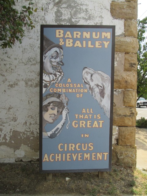
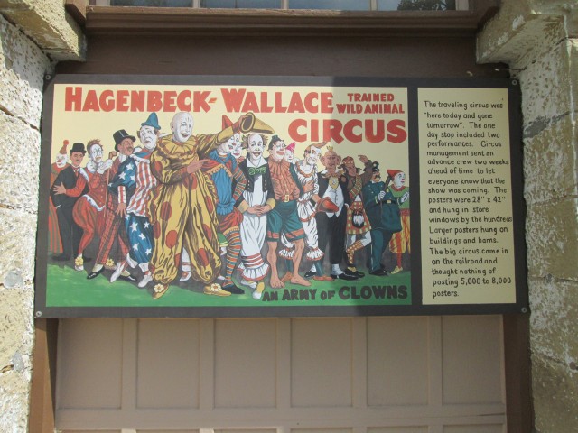
The big attraction of Sedan is The Emmett Kelly Museum. Mr. Kelly was a home town boy who made it big in the outside world. I remember seeing him on TV when I was young and I think I saw him in a circus once. He was “The Sad Clown”. Known throughout the world, Emmett Kelly died in 1979.
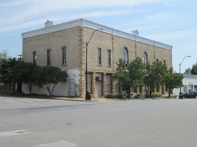
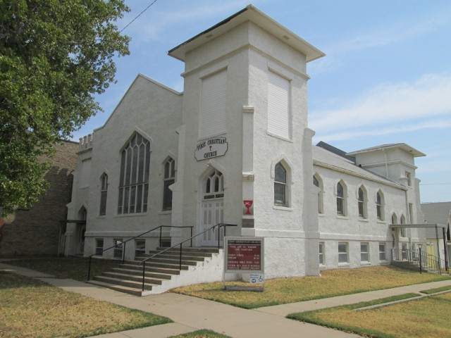
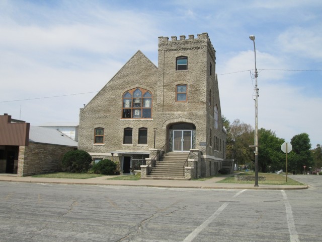
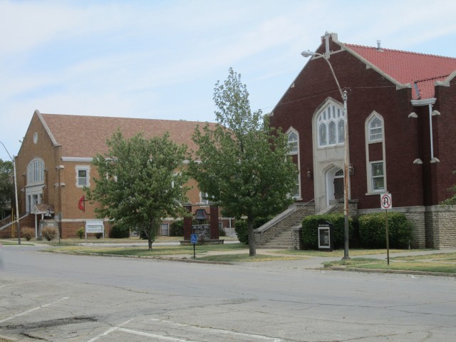
One thing I look for when visiting a town is how many Church Buildings are evident. While the real “Church” is the People of Christ, Church Buildings are clues that Christians are probably around. Here are some pictures of Churches I saw in Sedan.
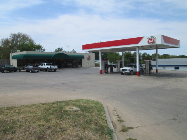
My Father in Law is an oil man. Years ago when his daughter and I first were married I asked him who sold the best gas. His answer was Phillips 66. Ever since then I look for the 66. When the folks gave me a ride into town, there was no question between the two gas stations which one I directed them to.
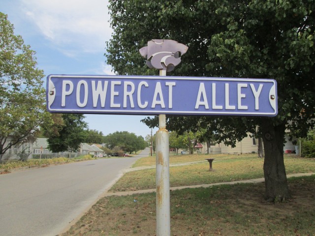
After wandering around Sedan and taking in the sights I decided it was time to head back to Wichita. I bought some gas and mixed in the oil at the Phillips and headed back toward the airfield. It was going to be about a mile and a half trek. I really did not find it tiring or a drudgery. Both “Flying Low (in a Quicksilver)” and “Traveling by Foot” give you a perspective of places that is entirely missed coursing the same territory by automobile. Realize, I might have missed walking down Powercat Alley if I had been in a car.
It took me a while to walk back to the airport. Even though I became turned around a bit after being dropped off by the couple earlier in the morning, I was pleased to see my bearings were correct. I headed right for School Road. At the top of the hill was Sedan City Airport with my Quicksilver waiting to grab some air. I took the shot below as soon as I could see my plane through the sparse trees surrounding the airfield.
You can also see one of the two barb wire fences I had to negotiate to get back to the hangar area. Whoever built these fences was quite adept. Usually the wire is relatively slack and it is easy to hold the wires apart as you step through the strands. Even though they may not look like it, these fences were strung tight as a piano. I had to do a “limbo” maneuver to make it through and even then managed to take a hit on my left elbow.
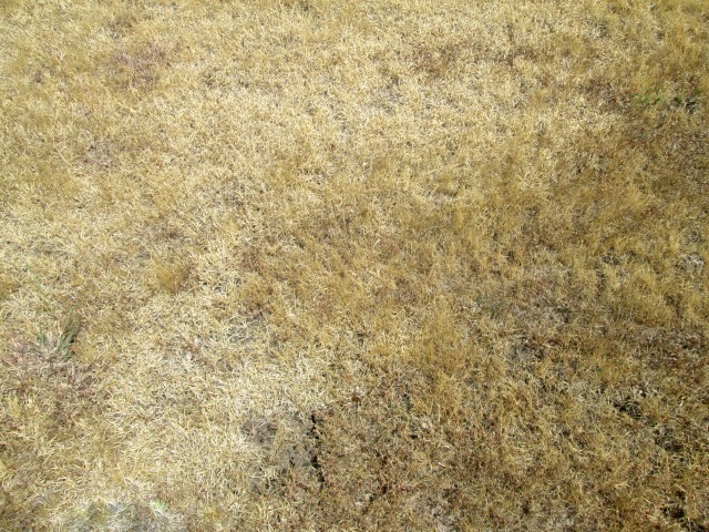
For the past month we had been having 100 degree weather almost every day. This and the corresponding lack of rain had yielded a drought that was devastating Kansas crops. While the area around Sedan is not farmed as much as it is ranched, I was suddenly aware of the resilient grass under my feet. Even though it was as dry as a bone, it was still alive. Below is a picture of it. At that moment the temperature was bumping 100 degrees. I started thinking it was time to ascend into the cooler air above.
The ingenious little pocket camera I carry can pretty much think for itself. I set it on the bed rail of a pickup truck across from my plane while I perused my sectional. It captured this candid photo of me in deep concentration studying my map.
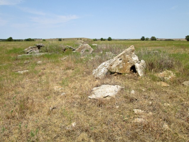
I was trying to decide whether to head directly back to Selby Aerodrome or to stop somewhere in between. My two “short stop” candidates were Alley Field in Douglass, Kansas or Cherokee Strip in Udall, Kansas. I know guys at both places and on a Saturday such as this the odds were good that one or more of them would be at their respective airfields. After a bit of pondering I decided I would fly first to Alley Field for a “recon”. I would circle above the field and if I saw any evidence of activity I would land. If not, I would continue Southerly to Udall. After developing this plan I still wasn’t ready to “light the fires” yet. I had noticed an interesting rock formation just Northeast of the hangar area. It did not look “natural” so I went over to see if it might be a building remnant of the 1800’s.
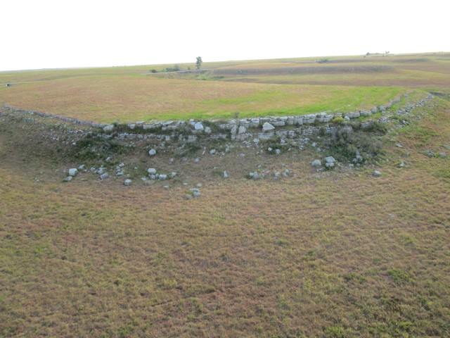
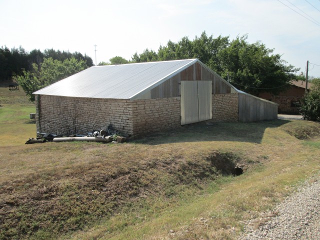
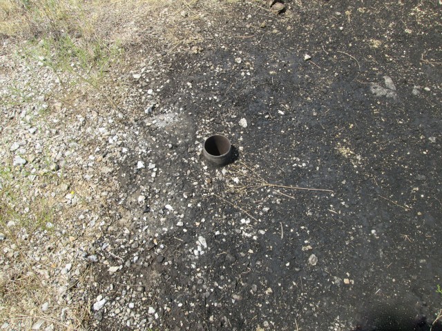
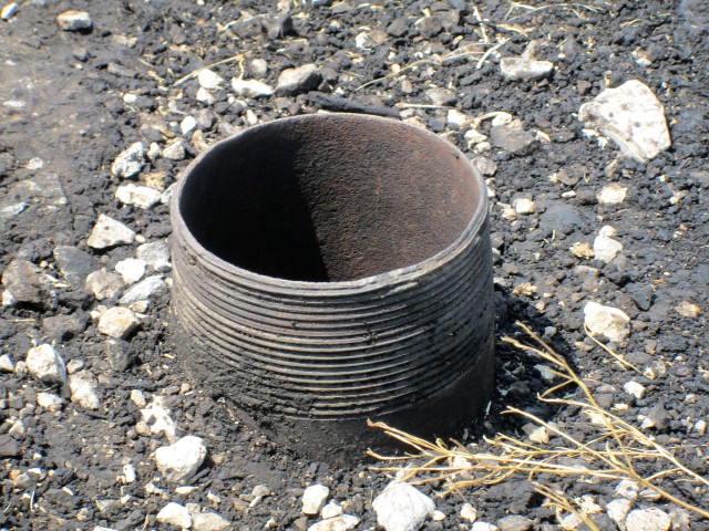
Once I crossed the fence to get closer the thought occurred to me that this spot would also be a prime location for rattlesnakes. I changed my walking mode to half speed and began to monitor the ground ahead of me carefully. There were no snakes. I was correct in my assessment that the stones were placed by human agency. Continued search determined that at one time there had been an active oil well there.
Time to Fly!
Having satisfied my curiosity regarding the rock pile I performed a short pre-flight inspection of the plane, started the motor and popped into the air. I say “popped” because by then the wind had made its way to the surface of the earth. I caught a good gust on my takeoff roll and was in the air in no time flat. I felt compelled to snap a few more shots of Sedan as I left the area bound for Douglass, Kansas. In the speech mode of “Ocean Surfers”, “The Sky Surfer” got a “good vibe” out of Sedan, Kansas. I’ll be back.
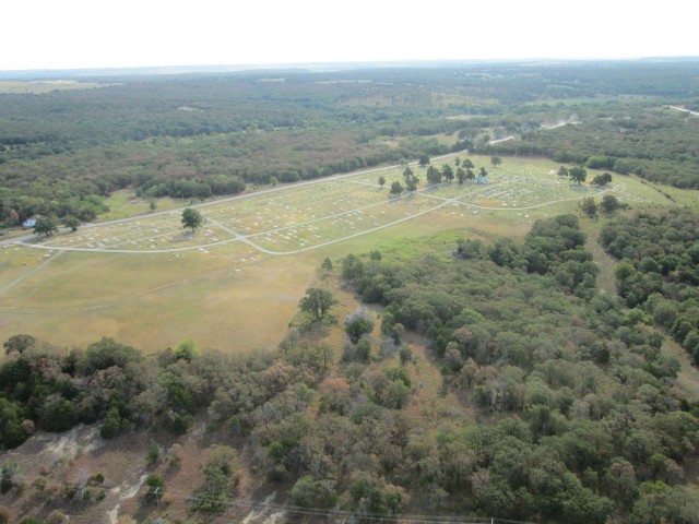
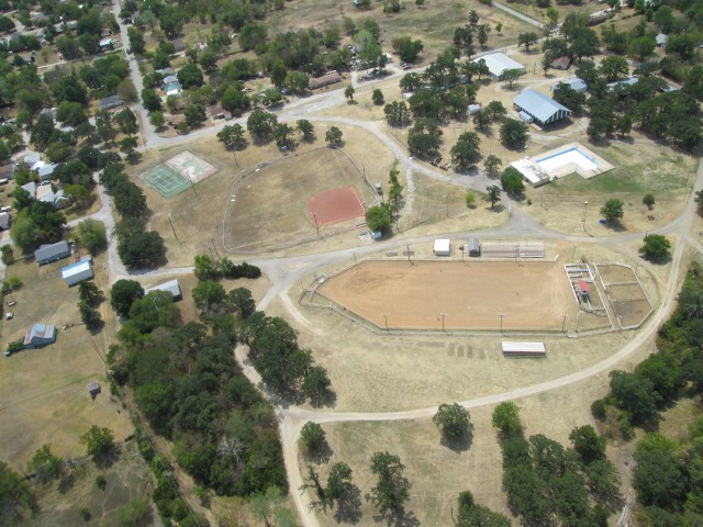
If we go by square footage allotted, the image below tells us that sports in Sedan, Kansas are favored in this order:
- Rodeo
- Baseball
- Tennis
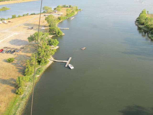
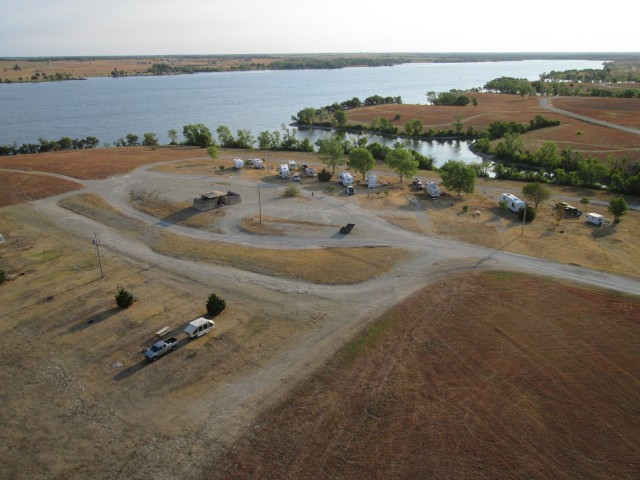
North of town are two lakes formed by what looks like the damming of a small creek. I have determined that one is called “Old City Lake” and the other is “New City Lake”.
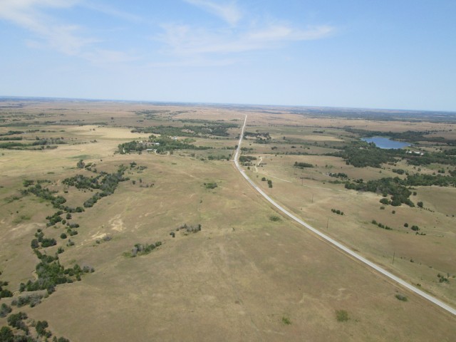
3 Miles from Sedan Looking North from 1,500′ AGL – Highway 99 Appears Heading to Infinity
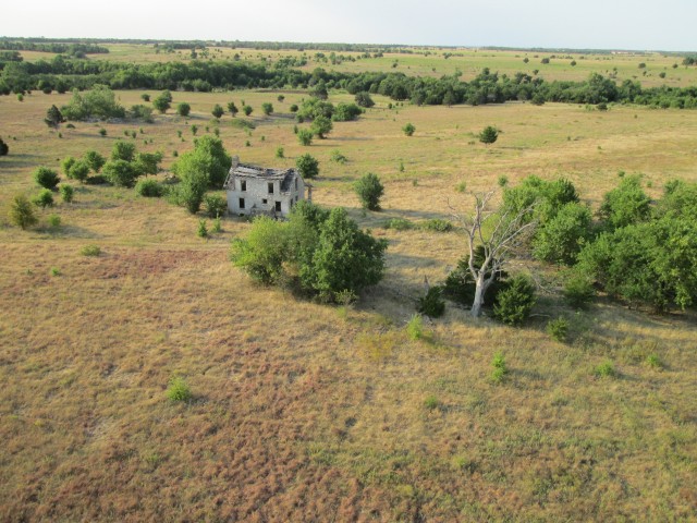
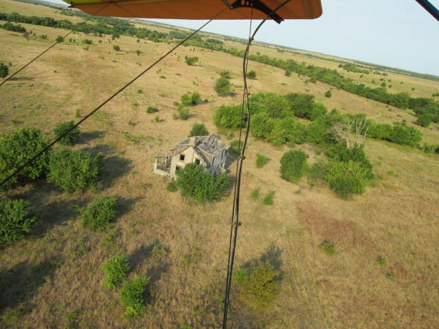
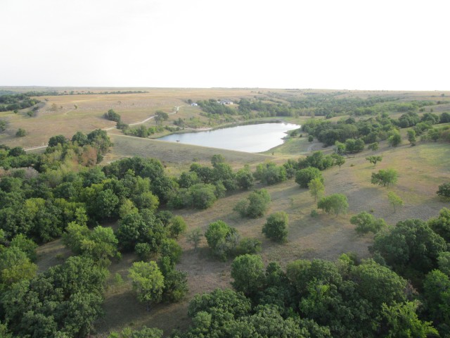
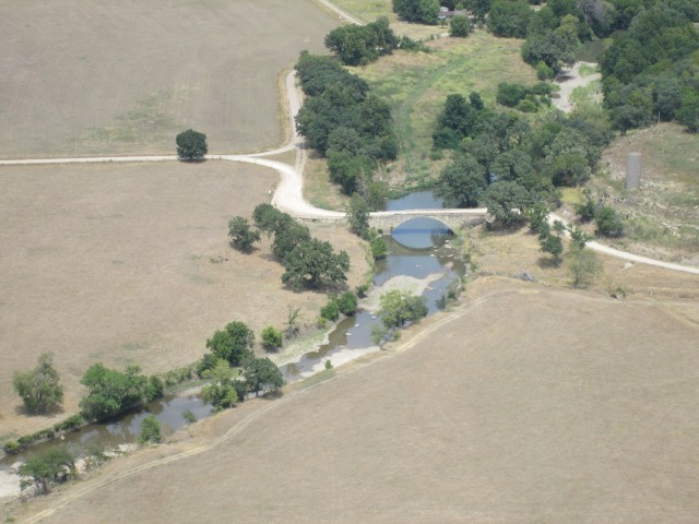
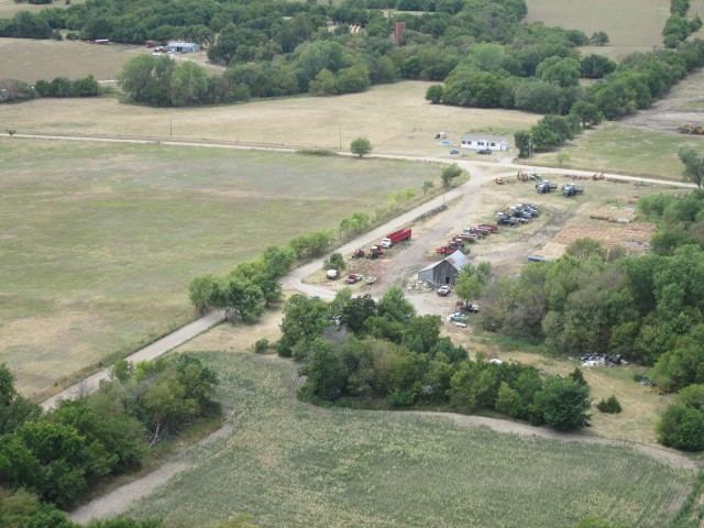
Earlier in this report I told you I saw a number of idyllic, solitary domiciles during this trip. I showed a couple on the flight up but now on the homeward leg you will see more.
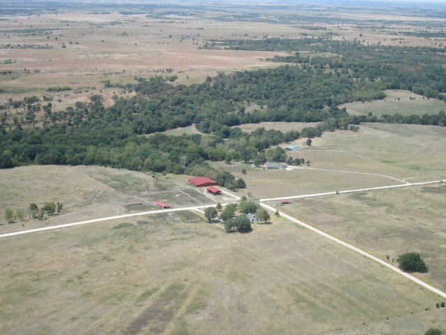
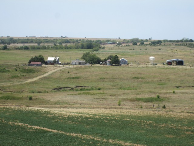
These folks appear to be ranchers and have some attractive “out buildings” in addition to a fine looking home.
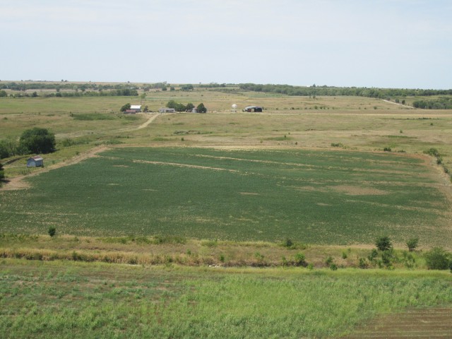
These folks appear to be farmer/ranchers. They have a beautiful view in the direction from which I am approaching.
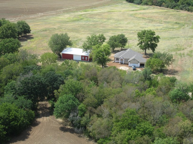
This Place is at the Bottom of the Dam Pictured Previously. (These are the only two homes this close together in this entire series)
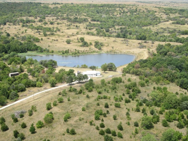
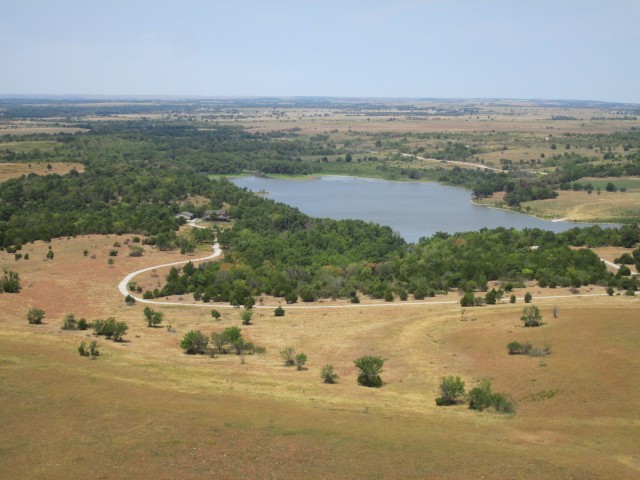
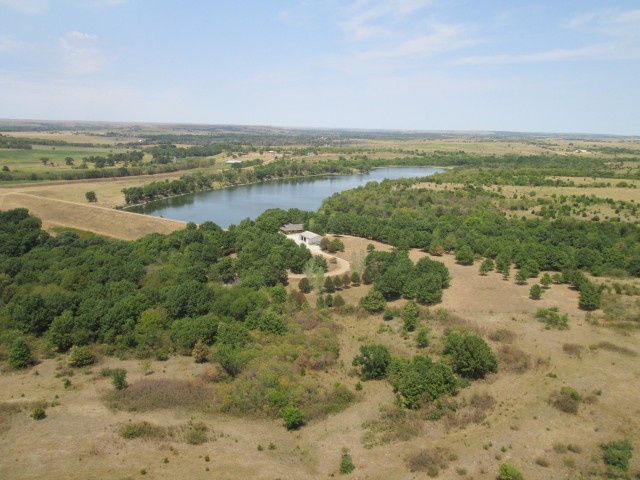
This home has a lake that appears to be a bit more “natural” than the others. Very little earthwork is apparent.
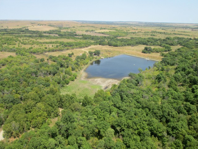
I shot this one with the telephoto because I didn’t want to depart that much from my course. You can barely make the house out behind the tree group on the left side of the lake.
So as not to give you a false notion, I must make clear that, even though they are pictured serially, the homesteads featured above were MILES apart from one another. These people live out in The Flint Hills almost like the settlers back in the 1870’s. They are very remote from each other and from any town.
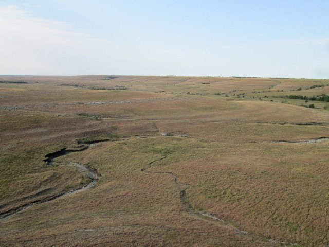
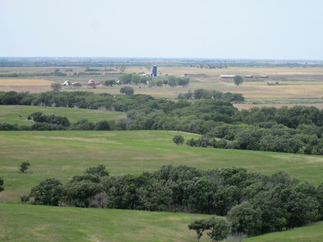
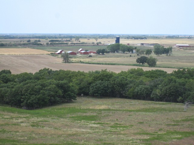
Since I had picked a path a bit North of the one I had taken in the morning I was passing over new ground as I headed to Douglass. Again I marveled at the different looking terrain unfolding beneath me even though it is relatively close to the path I took earlier that morning. Soon I was to see just how different it was…
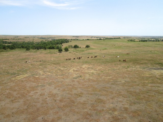
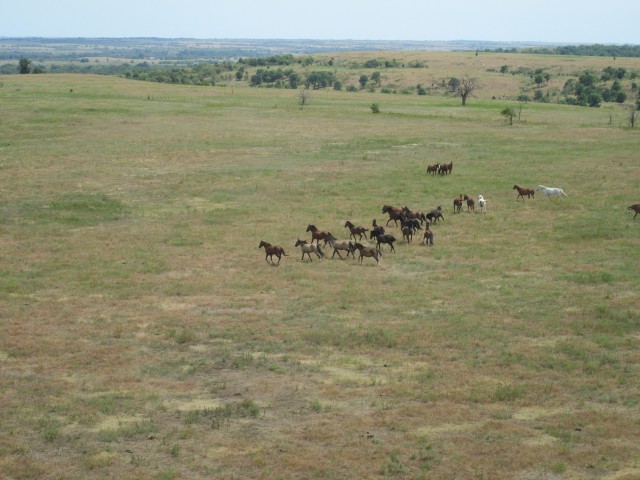
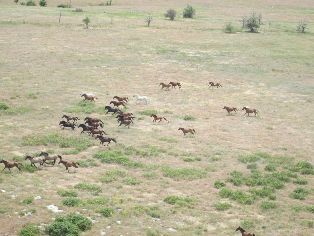
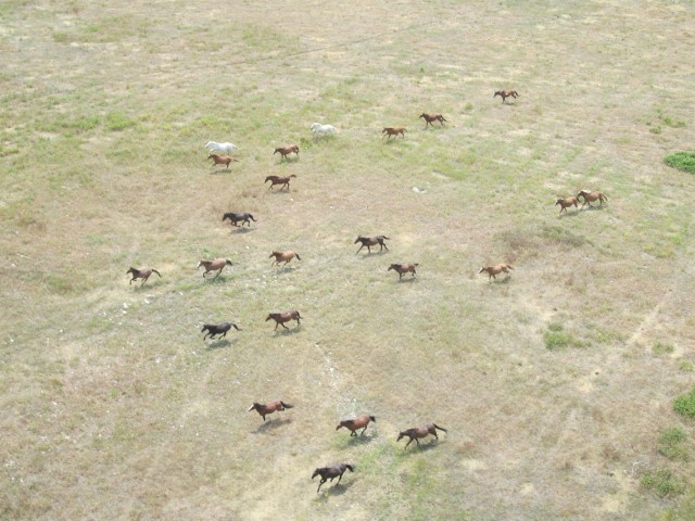
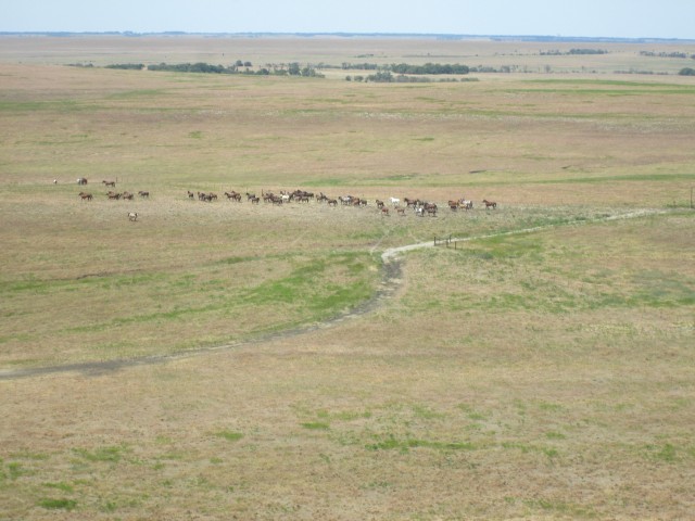
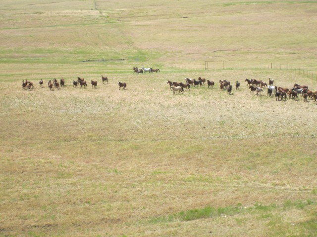
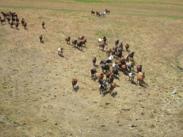
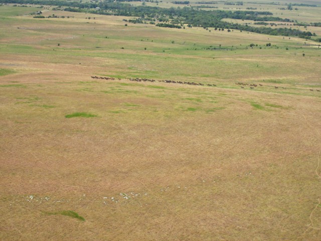
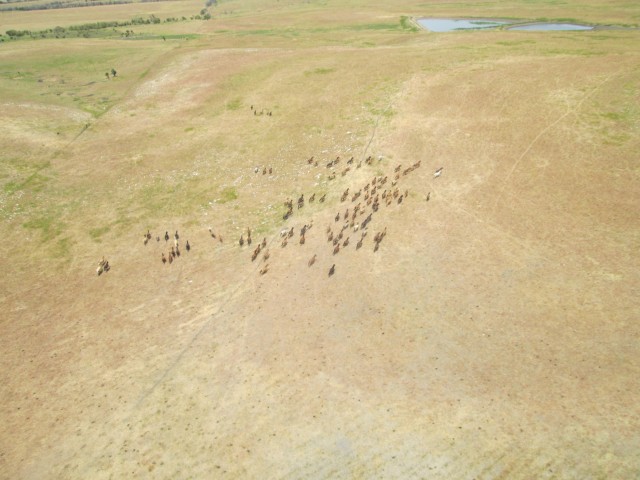
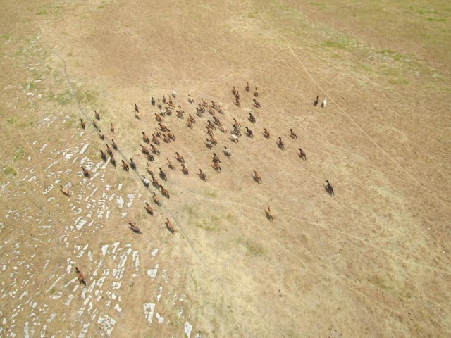
As I break over the top of the ridge shown above I see three different herds of horses milling about at various distances from me. The more energetic individuals are vying with one another to determine who will lead each herd. On my foray to Moline, Kansas back in May I came upon a herd of these horses but was so transfixed by their beauty I forgot to take any pictures. This time I knew what they were and snapped away…
Wild Mustangs!
I converge on the group shown above and they finally pass underneath me. In the distance I see another herd and head toward it.
Farther still but along my path I see another group and decide to pass over them higher up to get a different perspective.
By my guesstimation, I figure I saw about two thousand horses running about. I did a little research on the web and have discovered that these horses are a project of The Bureau of Land Management. Some reports say there are over seven thousand of these wild horses in this area. You can see by the landscape above that this is very arid territory. These horses are not living off the land. Although not pictured, I saw a feeding station for one or more of the herds. It was reported in May on KSNW TV-3 that last year, The Wild Horse and Burro Program cost $75 million a year. They are fantastic to watch as they run across the plains but I am not exactly sure why the government is using tax money to keep them out here…
After loitering for about 5 minutes around the Mustangs I continue West.
I fly on for about 20 minutes over this vast uninhabited territory occasionally seeing some cattle but virtually no human presence. Then slowly farm/ranch operations start to appear again but they are few and far apart.
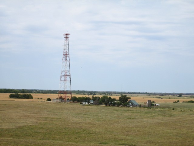
Alone on the prairie, this large tower presents itself in my path. I wonder what the folks receive as rent for keeping this monster next to them. It is not a cell tower. I suspect it is a microwave repeater.
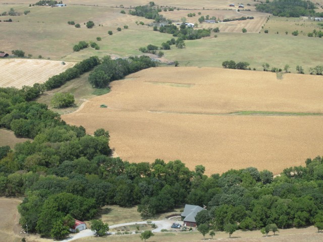
As I slowly approach Douglass, Kansas from the East I see the attractive farm shown below at the bottom of a slight rise I am gliding over.
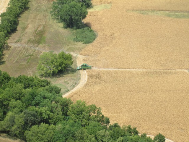
On my trip to Ponca City a week earlier I was stunned to see miles and miles of dead corn browning in the sun. The problem is evident in Kansas, too. The drought is affecting the entire region. Further below we see the farmer cutting it down for silage.
Just past the shot above I came to Alley Field on the East side of Douglass, Kansas. I circled a few times and saw no one around or even any open hangar doors. It was cool up at my altitude and hot down there. I figured I would head over to Cherokee Strip and I cut to the South.
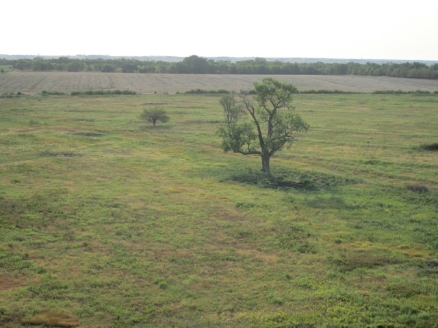
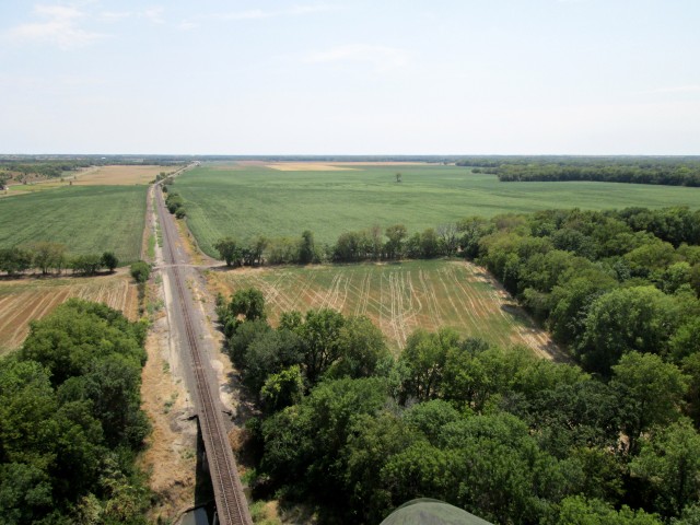
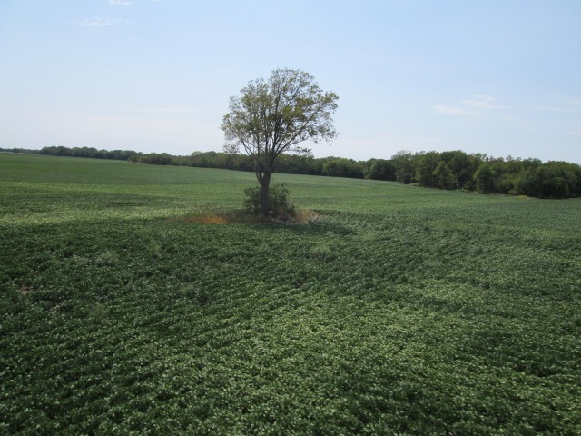
The shot below features the railroad tracks that pass by Rock, Kansas. In the following sequence I will drop down to about 10′ above the bean field and then take a picture of the solo tree they have left out in it.
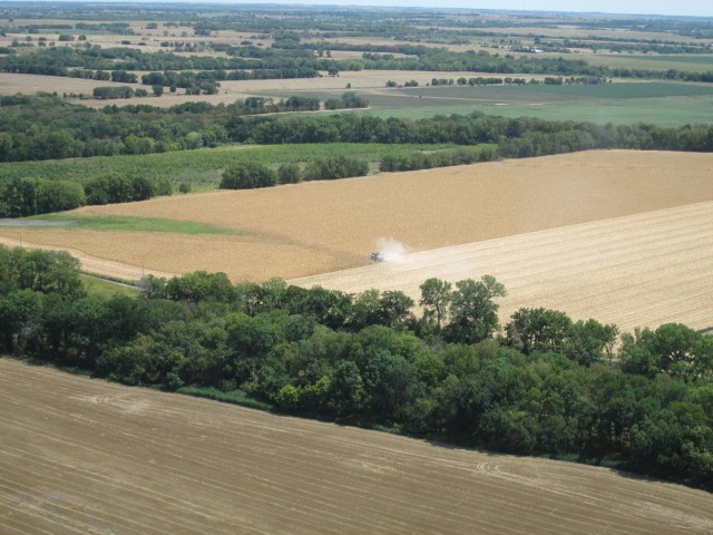
Just past this green soybean field I see more dead corn being cut down for animal feed.
Just before I get to Cherokee Strip I see some kayaks down on the Walnut River just East of town. They wave at me so I take the opportunity to drop down and make a pass next to them down the river. We all wave. The air was pretty turbulent so I did not think it prudent to fool with my camera while making this pass. By their enthusiastic expressions I could tell they thought it was pretty cool.
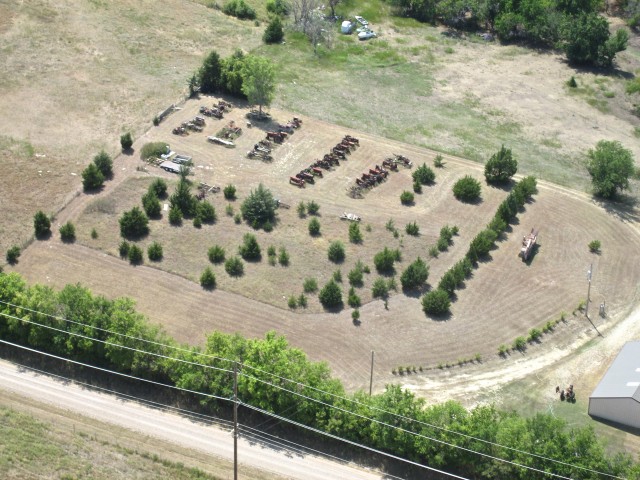
Just past the Walnut River excursion I spy a rather extensive tractor collection in a field next to a farmhouse.
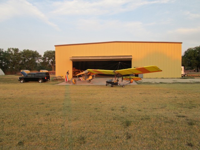
Soon thereafter I enter the Cherokee Strip pattern and start looking for any signs of life. Eureka! I see one of the doors of my buddy Tommy Randall’s place open. Tommy can fix anything. His business is Ranco Custom Products. I drop in and taxi up to his spacious facility.
Working on his pickup in the bay next to Tommy is Alex Sanchez. Alex lives a few miles East of Udall. While we are talking I mention the group of kayak-ers I passed a few minutes earlier. Alex said his Mother and a few friends were out kayaking. I figure this must be one and the same. I look forward to getting a confirmation from Alex about that after I post this story.
I was in no particular hurry to get back to my home aerodrome. Tommy has an interesting shop with no shortage of cool projects to look at. Suddenly, though, my phone vibrates on my belt. It is my lovely wife Debra. She says “Where are you?” assuming I had returned to Selby Aerodrome and was hanging out with the boys. Unbeknownst to me, she had made reservations for us at The Prairie Rose Chuckwagon show that evening. The music is excellent, the jokes are funny and the food is delicious. If you have never been there make a date to go. Anyway, I really like going to The Chuckwagon but it was a surprise announcement to me and it would require a prodigious effort on my part to get there on time. I hate to be late to an event. This put the pressure on. Providentially, the conditions are perfect for a quick flight from Cherokee Strip to Selby Field. It was 4 pm and the wind was at its highest for the day – about 15 to 20 mph out of the South Southeast. PERFECT. This provided me a direct tailwind for the hop. I did a quick pre-flight and waved goodbye to the guys and took to the air.
Since I had plenty of fuel I throttled up to the Rotax 503’s “best torque” RPM of 5500. I figure this to be the fastest cruise setting and best use of the motor. It gave me an average 60 mph airspeed. This, combined with the average 15 mph boost of the tailwind at about 1,200′ AGL, yielded a rather consistent ground speed of 75 mph. I know this is not going to impress any aviators out there (or probably even go-kart enthusiasts) but it is near phenomenal for the Quicksilver. I was in the hangar at Selby International in no time at all. I hurriedly buttoned it up and drove home. After I performed a “quick change”, Debra and I bopped over to The Prairie Rose with time to spare. They have horse wagon rides and lots of Cowboy Memorabilia to enjoy before dinner – all of which we were able to do.
A delightful dinner with Debra graced by the soothing sounds of genuine Western Music completed my day’s Vision of The Old West – out on (and above) The Kansas Prairie.
Until next time…
Blue Skies & Tailwinds!™
Brian FitzGerald





Thanks a lot for the Sedan, KS flight. I’ve flown over the area many times but never really
seen it like you did. The photos were just great and the story made it an interesting trip. I hope
your flight home was uneventful. I’m interested in reading about more of your trips.
Keep flying
Joe Sigler
Hi Brian. I’ve been looking at the pic’s from your Sedan Jaunt and made to think that route is going to make good day trip materiel. We sold our Mooney 20 some odd years ago, but I enjoy the Buick nearly as much. My Wife, of 54 years, and myself have always enjoyed traveling together and I think Sedan, with a side to Coffee Ville, will be a treat. We purchased a new raised top van in 1997. First thing out of the box was a 7 week un-planned trip to the western US. Got to see 6 Air Force Museums plus every National Park in the Western half of this Great Nation. So. Keep up the good work. I very much appreciate it. Dorsey
Dear Mr. Edwards,
Thanks for the kind note. I’m glad you liked the pix and story. I think you will have an excellent trip to Sedan and Coffeyville. There is a museum in Coffeyville my family has gone to about the Dalton Brothers raid. It is very interesting.
I love aviation museums and am glad to see you had the opportunity to visit so many. Have you been to the one in Liberal, Kansas?
It is worth the drive.
All my life I read about both the Smithsonian Air & Space and the Dayton, OH Air Force Museums. Then in 2010 I was able to visit both in the same year. They were every bit as interesting as I could have hoped. I could easily return many more times to either of them and still enjoy the time there.
Last Saturday I flew to Bartlesville, Oklahoma so I will be putting out a new story on that trip. It was quite interesting, too.
I’ll let you know when it is done.
Hi Brian:
Getting caught up on my reading. Super pics, as usual. When I think about it, it is amazing that towns like Sedan have airports. A look at AirNav shows no fuel, no service, and 3 airplanes based there. Where do the owners of the 3 airplanes get fuel. Kansas does not have the large number of “no ethanol” gas stations that Oklahoma does and certified aircraft engines cannot use ethanol laced fuel. Maybe they stop at Independence, fuel up and go back to Sedan. Kudos to Sedan city fathers for continuing to support the airport, even at minimal levels.
Don De Witt
Hello Don,
Re: Why do Kansas towns have airports… I think about it a lot. My first impulse is “let’s don’t talk about it too much or they may just stop paying for them”.
I love the fact that so many Kansas towns have these airports I have been flying into lately. But, unfortunately, there is hardly any activity at any of them.
When talking with local pilots you will hear that the expense has driven a lot of guys out of sport flying. I think that is valid particularly in the “licensed” variety of sport flying. When you take into account the expense for annuals and any AD’s that may arise, the mandated medical license for Private, and the OUTRAGEOUS prices for parts, it does get hard for the average guy to make the case for owning a small plane.
Smaller machines like you fly and the Ultralight I fly are much more affordable, though. Being able to use car gasoline helps, too.
Also, I don’t think people really consider how much it costs to own a 5th Wheel Camper, or a Bass Boat or a Big Dog Motorcycle or Play Golf twice every weekend. All of those pastimes are relatively expensive, too.
Overall, I think our guys just need to “get their thinking up” and look to the skies again. They need to be reminded how sublime it can be compared to all the other pastimes.
That is my mission and I can see you are on board, too.
Blue Skies & Tailwinds!™
Brian
ps: I flew to Pratt Regional yesterday and it was excellent. I will be working on that story this week and will post it ASAP.
After posting the above comment I saw this ominous report:
http://www.avweb.com/eletter/archives/bizav/2317-full.html#207330
The Feds are kicking around the idea of aviation “user fees”. If they want to put the final nail in the coffin of General Aviation – that could very well be it.
Hi Brian,
I just ran across your site and flight to Sedan, Kansas. My grandparents lived there when I was a small boy and I actually lived in Sedan when I was 4 and 5 years old. Later, I participated in the yearly parade they had down main street (70’s) and of course the county fair and rodeo. It was great seeing your pictures from the great point of view. I will send to relatives and I am sure they will get a big kick out of it.
My other grandparents had a farm/ranch North east of Peru, Kansas and just North of Niotaze, Kansas. Very small. I would love to see pictures from the air over that area. From Sedan, it is about 15 miles east give or take.
Keep up the great work.
Michael Palmer
Dear Michael,
I am glad you found Sky Surfing. My trip to Sedan was the genesis of this photo-journalistic project I call “Sky Surfing – The Flite Blog™”. At that time it was the longest journey I had made over new terrain to a place I had not been before. Even though it was not my original intent that day, the subject matter of Sedan was so compelling I began to take pictures. When I returned from the flight it occurred to me to do more than just post pictures but to write my impressions as well. So, basically, Sedan was “the light bulb over my head” that got the ball rolling.
As you can see I have visited many other interesting small towns in Kansas and Oklahoma since then. I have a continually growing list of towns I would like to visit in the future. I just checked the area where your Grandparents live. I see that Caney, Kansas has an Airpark. Even though I landed in a regular field (not an airfield) next to Foraker, Oklahoma, last Fall, I much prefer to land at airports.
So, I have added Caney to my “Future Fun Flight List”.
This is providential because I have been thinking about returning to that area and now you have given me the destination!
Maybe when I go I will be able to swing over your Grandfolks’ farm and take a few pix. I can’t promise but it looks do-able. I will do my best to remember to contact you before I go because I will need as accurate a fix as possible to find it. GPS coordinates would be perfect.
Thanks for informing your relatives about my website. I want as many people as possible to see these wonderful places I am truly blessed to visit. I am honored that you would refer my work to them, too.
Blue Skies & Tailwinds!™
Brian FitzGerald – Wichita