Oklahoma Salt Flats or Bust
A couple of weeks ago I was talking to my buddy Steve Ewing about the flight I made earlier this season to Medicine Lodge, Kansas. In the conversation he asked me if that was near the Salt Flats where he said Clyde Cessna tested his early designs. Salt Flats? I vaguely remembered hearing something about some salt flats or sand dunes or both in Oklahoma but I didn’t realize they were within flying distance. Suffice to say, A New Quest Was Born! Later that day a quick look on the map revealed the Oklahoma Salt Flats just South of the Kansas border. On the flight sectional map shown below, the FAA even shows the Salt Flats as WHITE (Other than that, though, the color coding effort falls apart. I can tell you the cities don’t look yellow from the air…). This trip to The Oklahoma Salt Flats would be my longest flight to date but after my two hour flight to Medicine Lodge I knew my MXL had the range capability under specified conditions.
The Necessary Atmospheric Conditions
As I have noted before, because my MXL has a best fuel cruise airspeed of 38 mph, any “long” distance flights must be made either across the prevailing wind or with a tailwind. Starting a flight with a tailwind, though, is out of the question because there is a good possibility that the leg back home into the wind might likely result in fuel starvation short of the destination. This would make a fun flight – NOT.
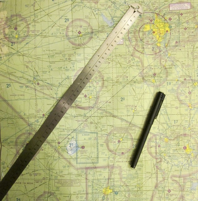
For the first time since I can remember I actually drew a line on my map. I was so pleased with my self that I took a picture of it so you could see it and also get an idea of the course.
In our area the wind comes mainly from the Southwest. (The Indians who inhabited this area when the settlers came in called themselves “People of the South Wind”) If you can see the line I drew from Selby Field to the Oklahoma Salt Flats, you will note it makes the opening leg of the trip exactly in a Southwest direction. My plan would be to wait for a day after a front had passed through. Typically this results in a “stationary front” with mild to nil winds for as many as 4 days. This happened between 12 – 14 July 2012.
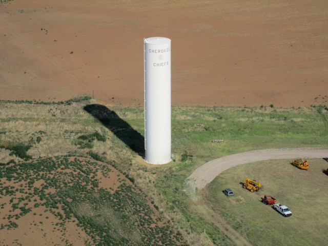
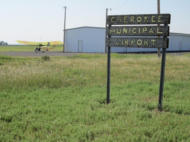
My destination would be Cherokee Municipal Airport which belongs to the town of Cherokee, Oklahoma. it is just a mile or two West of The Salt Flats
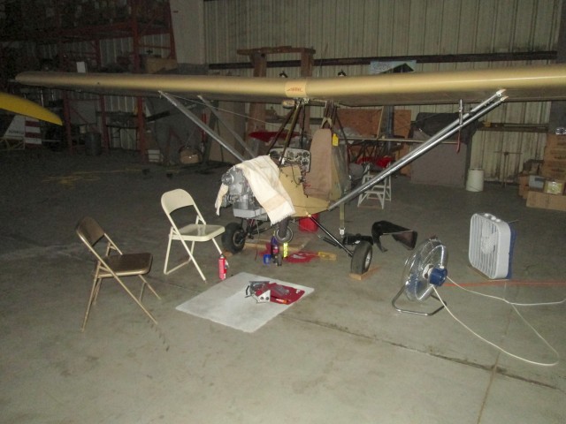
When I got to the airport that morning the sun was still below the horizon. I started the trip that early because I figured that even while the general wind velocity had been minimal the previous two days, I would do best to get an early start just in case this would be the day it started building up again. I opened the hangar and saw that Paul Fiebich (aka Airbike Ace) had apparently made some headway returning his wings to service in the previous few days since I had last been in the hangar. As you can see in the photo below, his engine was back on “The Bike”. Perhaps soon he would be again airborne…
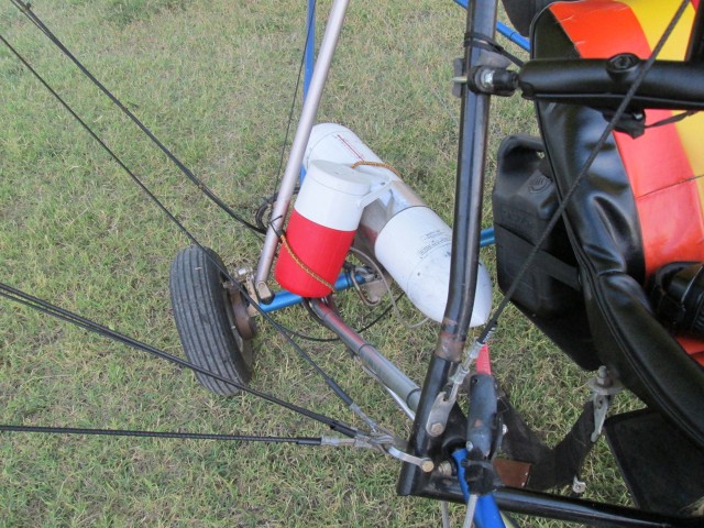
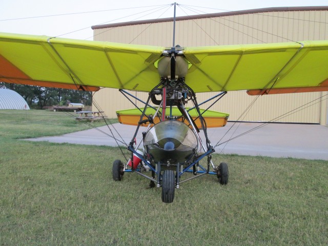
My lovely wife Debra has always wanted me to take water with me when I go to shoot a commercial or fly my airplane or whatever. Up until recently I have always thanked her for her concern but did not think it was worth the effort. Today I took the advice. I knew Cherokee Airport had no fuel and assumed it didn’t have any water either. With the temperature expected again around 100 degrees, I figured I would be parched by the time I landed in Oklahoma. So, I brought an old Coleman Thermos we have had for decades. Now, bringing the thermos is one thing – attaching the Coleman Thermos full of water to the airplane is another thing altogether. Below you see my solution and why I keep a couple of bungee cords handy at all times. After my first landing I improved on this lashing. (NOTE: That long, white torpedo attached to the axle is my Second Chantz ballistic parachute.)
Right after takeoff I immediately grabbed my 155 degree heading. Because we have a belt of houses to the West of the field I always climb to 1,000′ AGL to cross over them. When heading SW I will stay that high until I pass Peck, Kansas. After that I let down to anywhere between 10′ and 300′ AGL for the remainder of the trip. Not only is it more fun to fly the plains down low, but today it would be a necessity if I expected to make my destination. Because, even though the wind was nil on the surface, the head wind at 1,000′ was 20 mph and the sun had just risen!
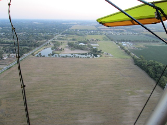
Selby Aerodrome as seen from about 300′ looking directly North
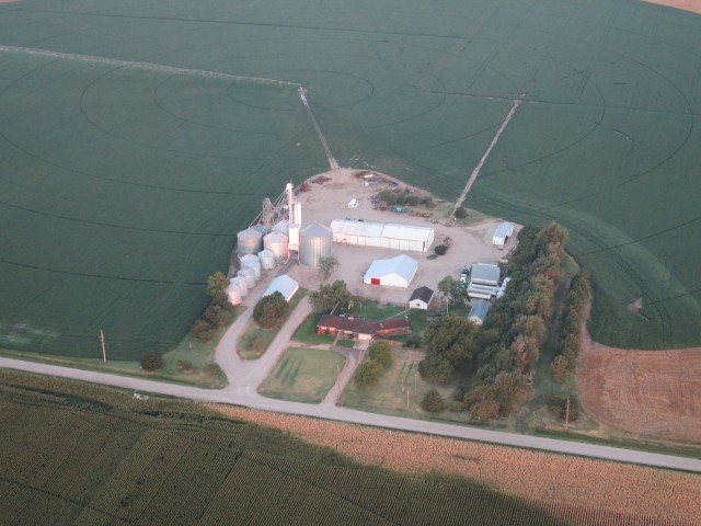
A picturesque farm operation glows in the early dawn light 3 miles South of Haysville, Kansas
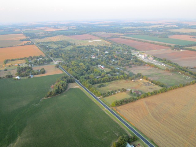
After passing Peck, KS, I started to let down to my average 70′ AGL cruising altitude. It was very humid that morning as you will see in a number of these photos. Even though the ambient air temperature on the ground was about 80 degrees +, the humidity in addition to the 40 mph breeze I was sitting in actually produced a wind chill! Also I was sitting under the shadow of my wing and received no warmth from the sun’s rays. After about an hour in the air my fingertips actually got a little numb and I caught myself shivering a couple times. It was very strange for an otherwise hot summer day.
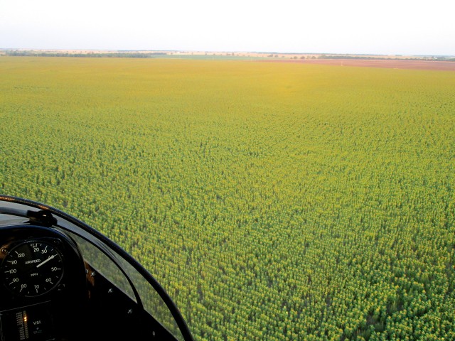
At first I couldn’t tell what crop I was flying over in the shot below. Then I realized that the Sunflower Heads were turned away from me. But, even though they are turned away, you can see the bright yellow of their pedals peeking around the edge of their collective heads in the distance where you see my shadow with the sun reflecting directly back from behind the camera.
The “Turning Heads” Myth is Busted
Note: The shot below proves what I had learned a few years ago while shooting the sunflower segment of my “Lil Prop / Big Prop” ultralight music video. While scouting for a suitable sunflower field and talking to farmers who grow them, I learned that one well-known Sunflower Myth is not true. Most people think the sunflower faces track the sun during the day. Sorry, but that is not true.
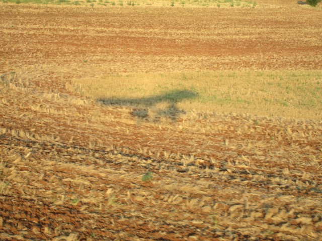
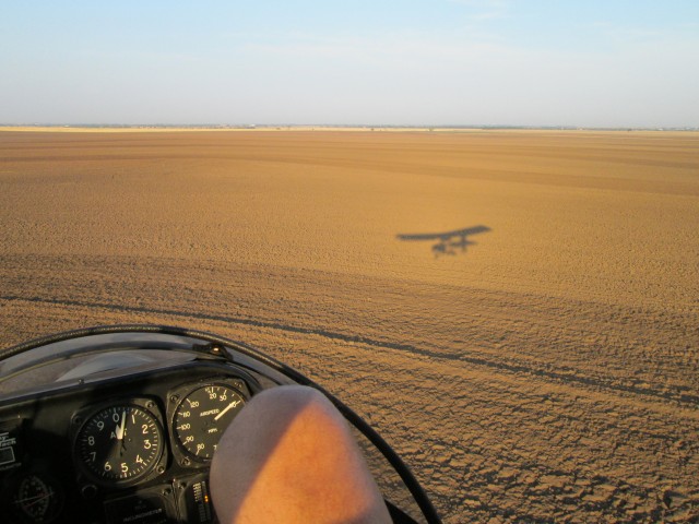
I tried 4 times to get a shot of my silhouette against the rapidly changing farmland just below my wheels. Since I had my pocketcam on “auto”, though, it was leaving the shutter open too long in the relatively low light. This resulted in a “smear” or “streaking” look. The shot below has a little in it but I think it is OK so I put it in.
This one is sharper.
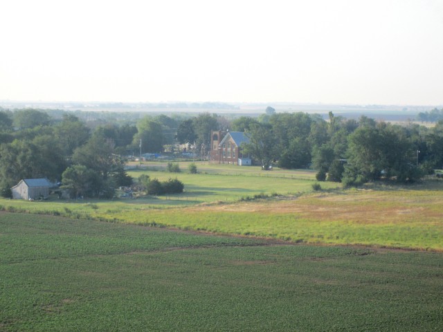
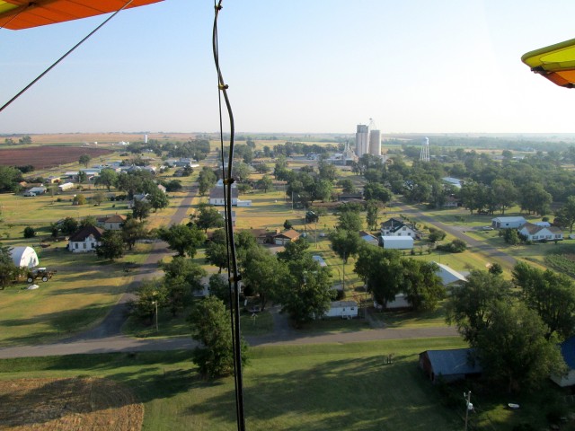
I think this is Anson, Kansas
A “Teachable Moment”…
Unlike driving a car, when you are flying a relatively straight course in an aircraft you can take your hands “off the wheel”. Airplanes are designed to be stable and will stay pretty much on course and at the pitch you leave them when the air is not turbulent. This allows me to sometimes use both hands for a camera shot if I need to. As I was approaching the bluff shown below I liked the way my favorite John Deere tractor was posed near the top. The good thing about my little Canon A1300 Powershot is that it has an actual “see through” viewfinder just like ALL cameras had in the old days. A “keyhole” or “see through” viewfinder is particularly useful when the sun is behind you. This tends to “blank out” the viewing screen all these little cams use for sighting your shot. So, if you can’t see your viewing screen, you put the cam up to your eye and see what you are shooting. One problem with this model, though, is what is called PARALLAX and it becomes extremely pronounced when the lens is zoomed in to its 5X limit. The net effect is that you must “tilt down” dramatically more on the scene you see in the viewfinder to arrive at the composition desired for the final shot. It can be a “trial and error” thing and sometimes takes more than one or two tries.
A contributing factor to the situation I am describing below was a “Conflict of Primary Missions”. I really like flying to these places but at the same time I have made the photo documentation of these flights an important thing in my mind. This trip would be near the limit of my flying machine’s fuel range. Even though I really wanted the tractor shot, I wasn’t going to circle back to do it again on account of fuel considerations for my journey. This caused self-imposed “pressure to perform” and an “over concentration” on one task to the detriment of the other.
As I slowly approached the tractor the first 4 shots just weren’t framed right. So I kept trying while I was moving toward the bluff at 40 mph. As I noted earlier, the airplane was trimmed for level flight and in the smooth air it was basically on “Auto Pilot”. The problem developed from the rising bluff. Even though it wasn’t very high, it was constantly, gently, slowly rising up to meet me in the air. It was obvious I was getting closer and closer to the ground but I just kept thinking “one more try and I’ll get this…”. After about the 5th shot I finally registered the alarming sensation that the ground was rising up to smite me. I’m figuring “No Problem” because I know the MXL intimately and knew it would respond immediately to a bump on the throttle and a slight pull back on the stick. The problem was that as I dropped the camera onto my lap and hit the throttle with my left hand, my right hand missed the control stick. Bummer… The MXL has a high thrust line that tends to pitch it down when power is applied. In the 1/2 second it took me to circle my hand back around to grab the stick and pull back, the plane’s main gear popped the red dirt once soundly and bounced back into the air. I was so angry at my stupidity for doing this that I yelled aloud at myself. It was so loud I think people could hear me two miles away.
I assure you… this will not happen again…
As if the entire episode wasn’t bad enough, the shutter was too slow and the shot is kinda smeared. I left it in, though, so you could see “the shot that might have been”.
After the incident for about 10 minutes my “left brain” castigated my “right brain” over the stupidity of allowing the “Art of Photography” to “backseat” the “Art of Flying”. Finally, I remembered to thank God for my good fortune and chalked it off to experience. Soon thereafter I passed a little town that I believe was Manchester, Kansas.
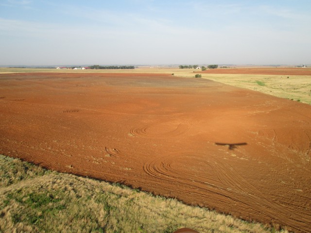
Beyond Manchester the dirt really started turning “red”. This (and my timepiece) told me I was entering Red Dirt Country – otherwise known as Oklahoma!
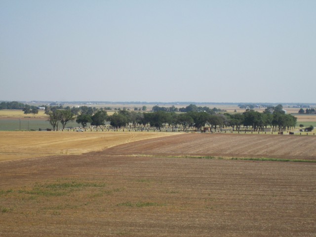
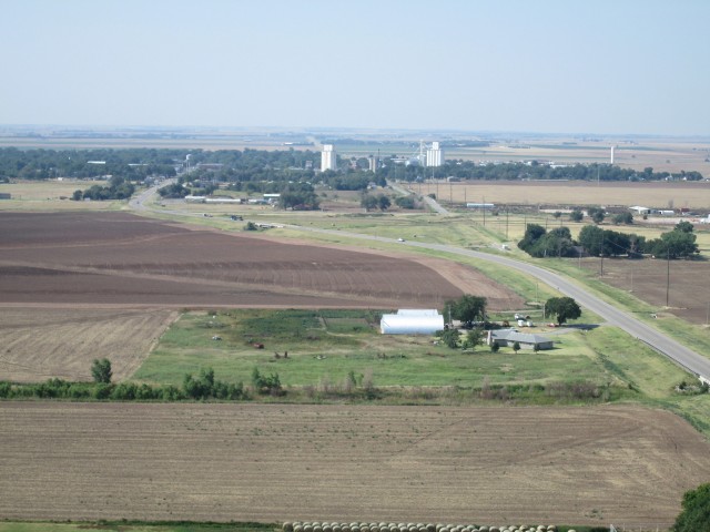
I had been flying for about 2 hours so I knew I was getting close. Since I was hugging the earth, though, I didn’t have a visual of my destination yet. Not far after passing the field shown above the landscape changed dramatically. The ground became very rough-looking and filled with bushes. I still had places to land if my engine quit but I decided it would be better to seek out a spot to land and check my map and GPS to better ascertain my position. I have had instances when my GPS seemed to lead me astray. I figured it wouldn’t hurt to set down and look at the map.
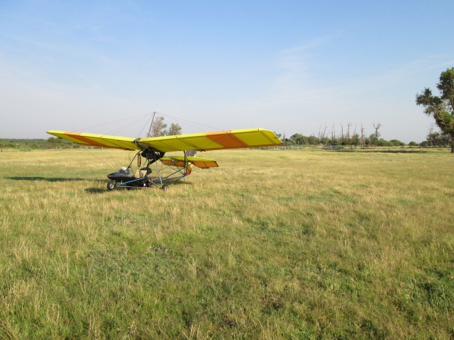
A suitable candidate presented itself off just a little to the left of my path. I made two really low passes over it to check the field’s condition and determined it to be good enough for a safe landing.
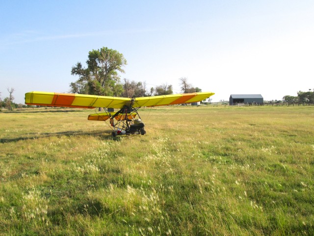
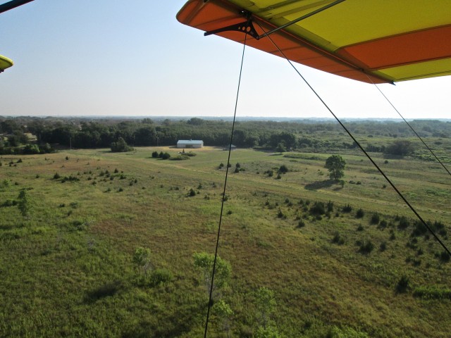
I made my approach just to the right of that tree in the background. The field was flat and almost perfect for landing…
“Minefield” Miraculously Avoided
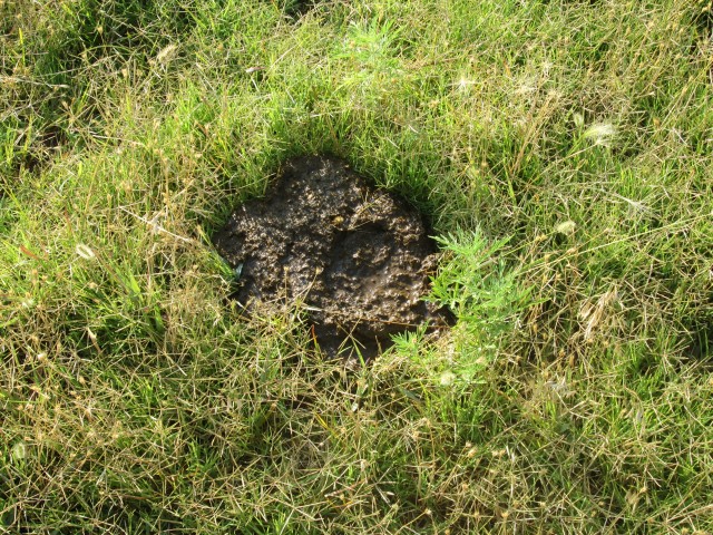
Although there were no cattle to be seen when choosing the field I landed in, I was fortunate not to run through the evidence of their recent departure as shown below:
The cattle calling card shown above was only 6 feet from where I stopped the MXL after landing. It pleased me greatly to have missed it and the many others like it that turned out to be all over the landing field I had chosen. If I hadn’t missed ’em, you would have seen evidence under my wings in the rest of the pictures of my plane on this trip. If you hit one of those pies with a spinning landing gear tire – you have just redecorated your plane.
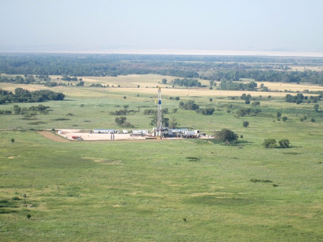
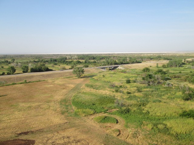
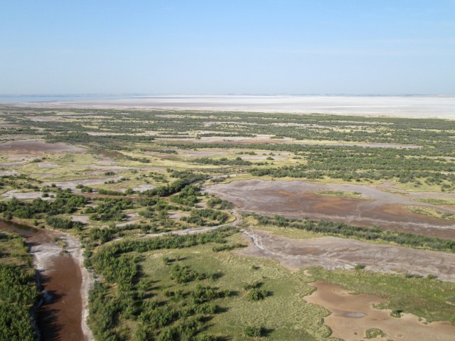
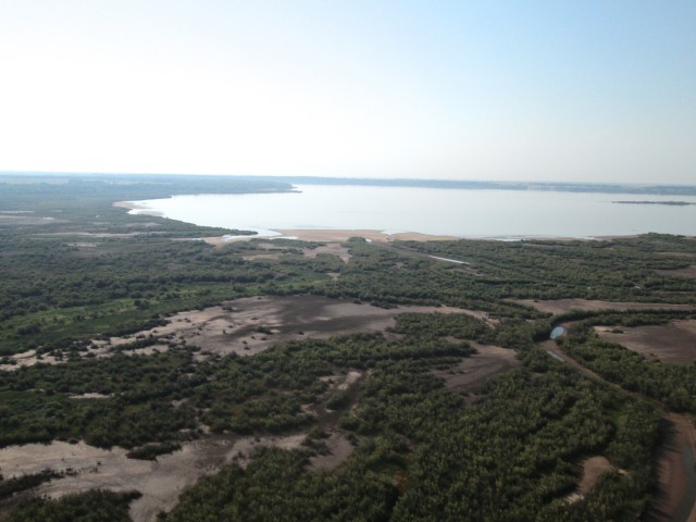
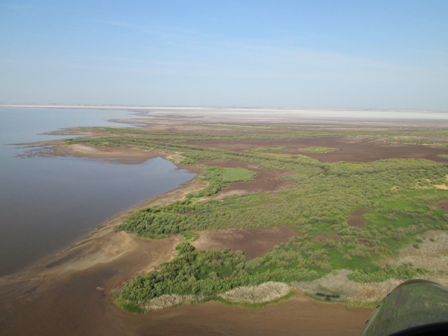
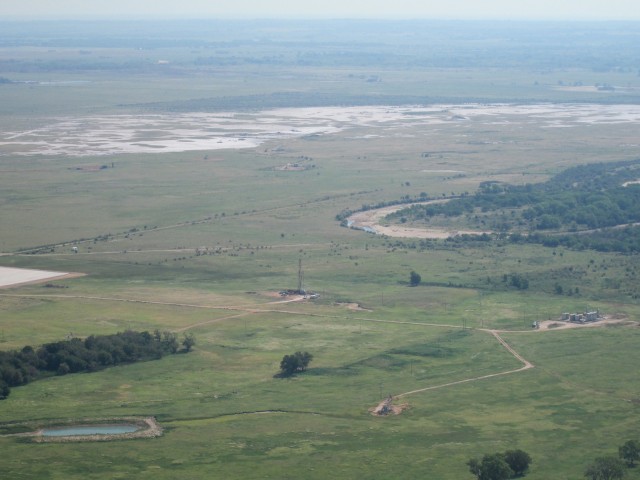
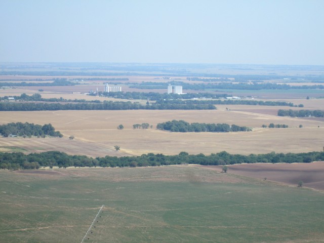
After checking my map and GPS, I determined I was just a few miles from my destination. I took off and decided to invest in a little altitude. I figured if I got up about 300′ to 500′ AGL I would be able to see The Flats. This assumption turned out to be true. The shot below was taken just moments after taking off from The Cow Pasture. If you look at the horizon in the shot below you will see the Salt Flats in the distance with The Great Salt Plains Lake to the left.
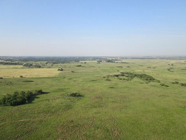
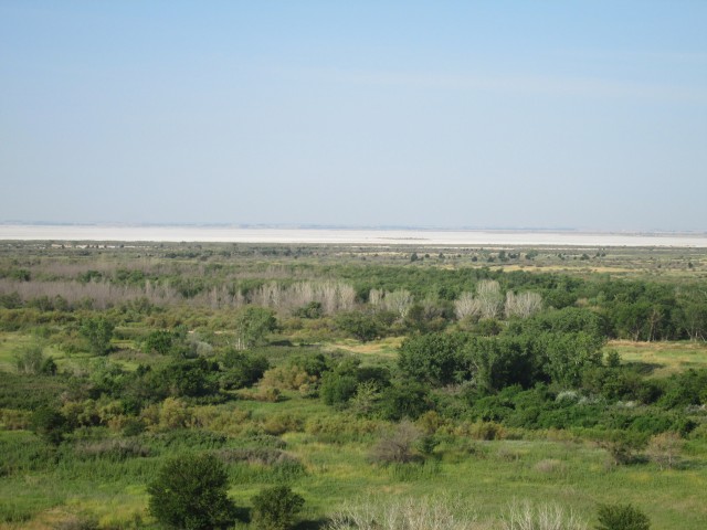
At 500′ AGL you can see The Great Salt Plains Lake and The Salt Plains on the horizon
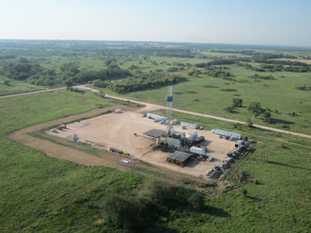
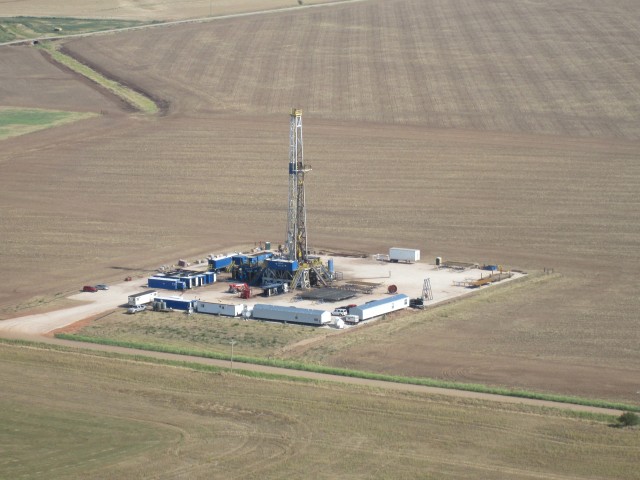
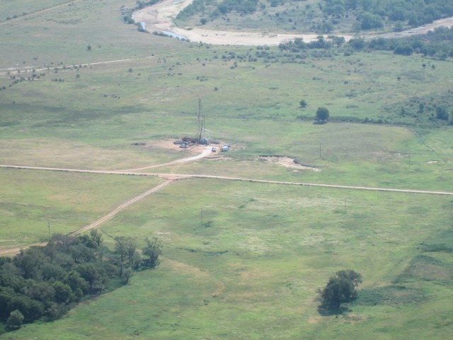
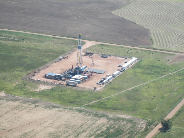
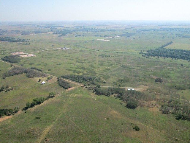
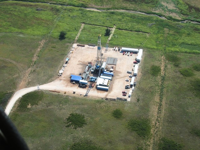
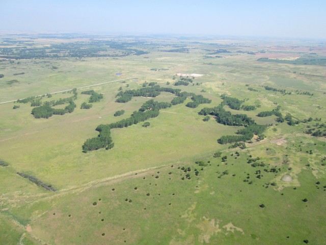
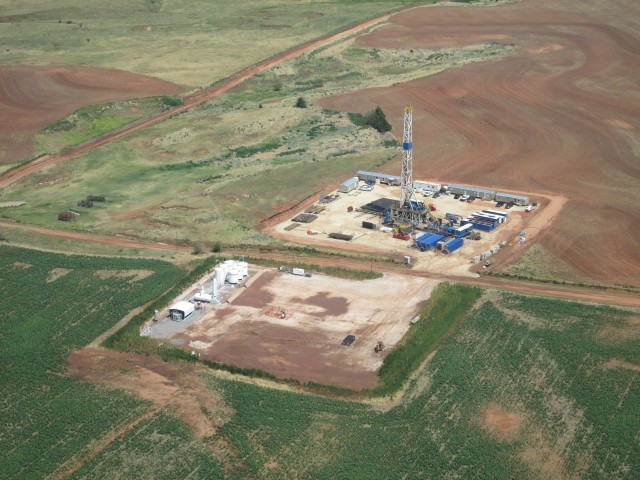
Above you can also see how the landscape had changed from the earlier pictures. Next I will show you some shots of just one of the dozens of drilling rigs scattered throughout the area. By its nature, the oil business is fairly secretive but “the word” I get is that these are horizontal drilling rigs. Regardless whether they are drilling straight down or sideways, they are much larger than we typically see in Kansas.
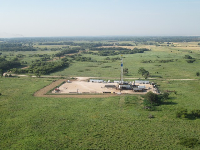
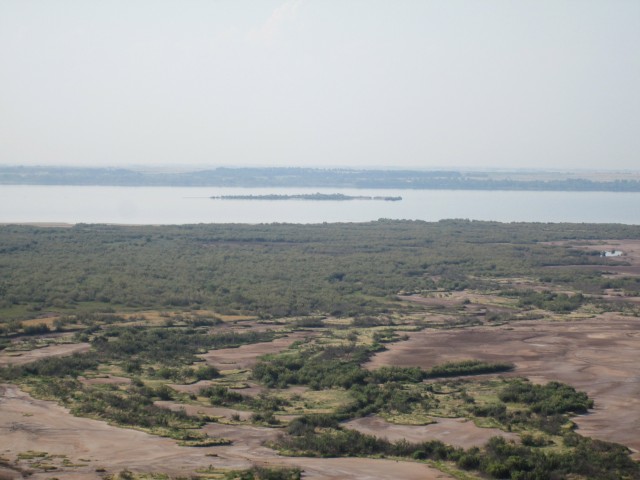
Even though it is hazy, you can see The Great Salt Plains Lake just above the drilling rig at the horizon
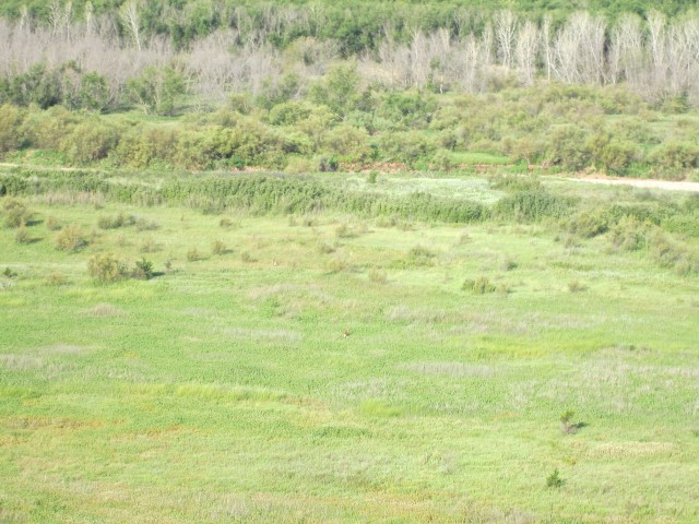
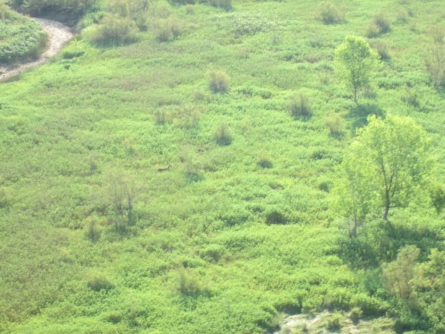
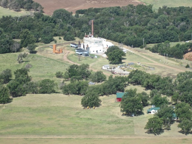
I started seeing whitetail deer everywhere. The noise of my plane was startling them and they were coming out all over the place. Just after passing over the building in the shot below I realized it was the lodge for a hunting facility. As I continued in a Southerly direction past this building I encountered about 8 permanent deer stands. I figure you pay to get up there early in the morning or around dusk and take home a deer. They were everywhere.
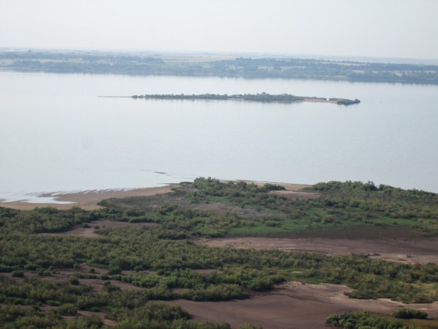
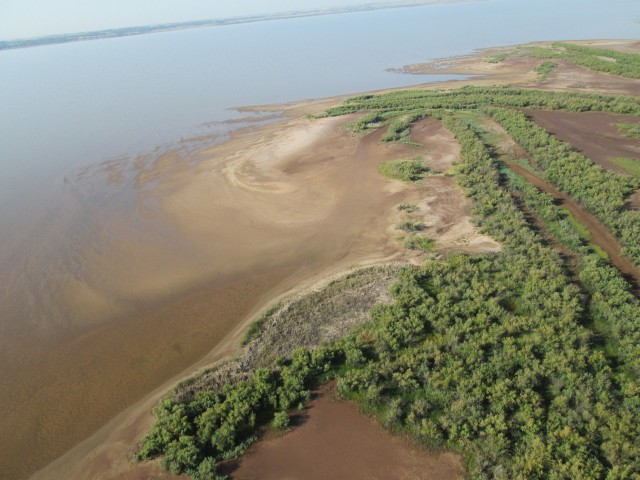
As I crossed the alluvial plain I became interested in the island I saw out in the lake. I decided to swing a little to the East in order to get a closer look at it before heading over to The Salt Flats.
I was holding some additional altitude in case of engine failure. This new Rotax pushing me through the air has been wonderful but then 2 stroke motors always run great right up until they stop. Keeping a little altitude over rough terrain like this allows more options for picking a landing spot should that possibility become a necessity.
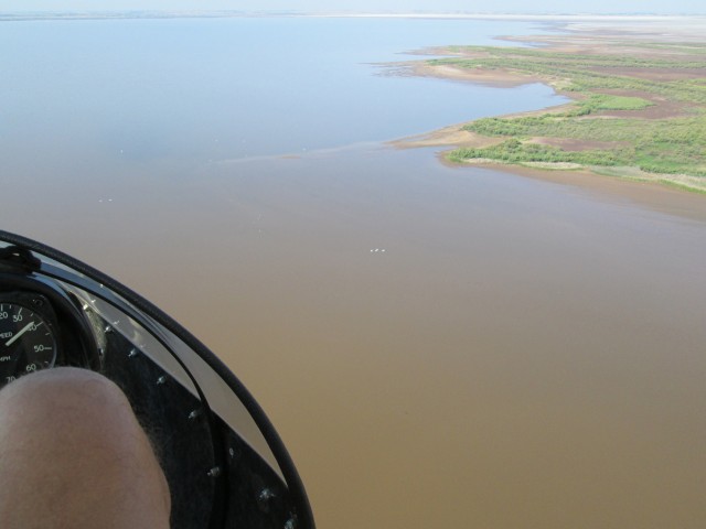
For just a moment I allowed myself to cross the water. It looked like it was only a few feet deep but it would not be a place to have to land with an engine failure. You can see a number of water birds flying below.
By now, because I saw some 4-wheeler tracks I decided that the surface would sustain a forced landing if I needed to do so. I started a slow descent and headed East toward the Salt Flats.
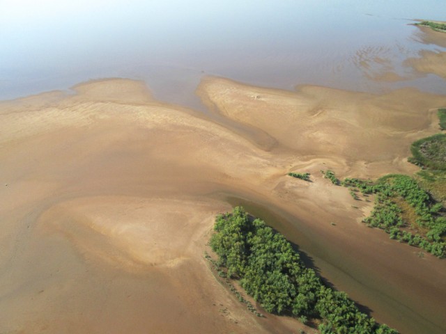
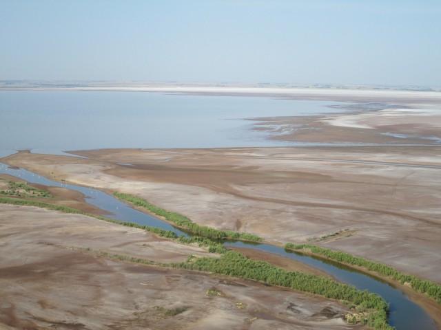
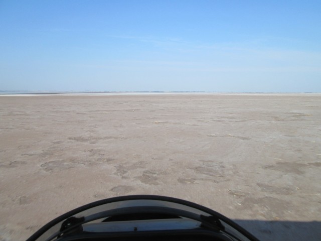
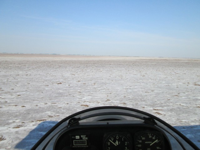
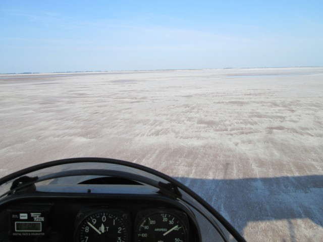
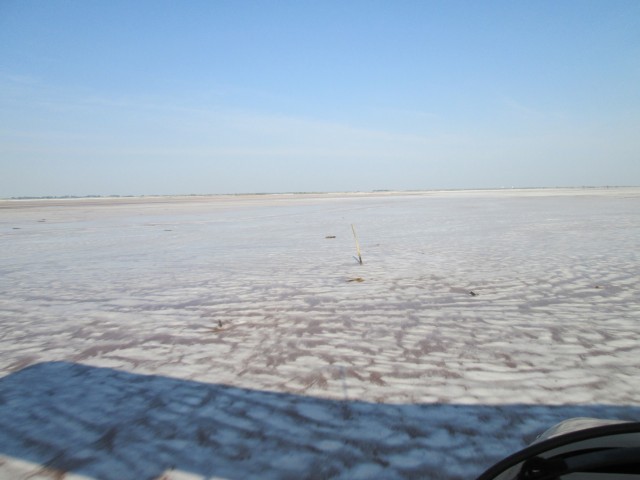
I dropped down into the ground effect about 3′ to 6′ above the surface and just floated above the Salt Plains for a while at a very low power setting. Here are some of the views I saw.
Hey! Why Not Shoot A Movie?
As I was drifting along taking it all in, I suddenly remembered that my little pocket camera can take MOVIES! So, I figured I would give you a look at what I saw from the driver’s seat. Check it out:
This Experiment Proves That Salt Repels Ultralight Airplanes!
I was entranced by the seemingly endless expanse of white below my wings. Flying at about 6′ off the surface I made long, slow gentle turns. A side benefit of a rear-engine airplane like the Quicksilver MXL is that the pilot can smell different aromas while traveling through various air spaces. The smell of The Salt Flats is not unpleasant but it is not like the ocean as I expected it would be. I don’t have anything to compare it to and am at a loss to describe it. It did not strike me as smelling like anything else I can remember.
There was virtually no wind and it was still relatively cool – maybe about 85 degrees. The whole time I was out there I had not seen anyone since the car had passed under me when crossing HWY 11.
Well, a guy can only have so much fun AND with the fuel tank directly over my head I had a constant reminder of my finite range. So, after enjoying this unique place for about 15 minutes, I decided it was time to seek out Cherokee Municipal Airport. Gas was getting very low. I started a gentle climb and headed over to the airport. Out of nowhere I suddenly beheld the next scene under my left wing.
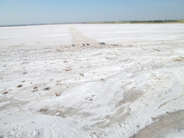
Selenite Crystal Seekers viewed from about 200′ looking Southwest
While I was down low over the salt expanse I did not notice in the distance the people who were out digging for selenite crystals. In the shot above you can see a corridor that the government has staked out for cars to drive over to this apparently known crystal mining location. Folks there were waving at me so I decided to fly over them and do a tight turn or two before heading to the airfield.
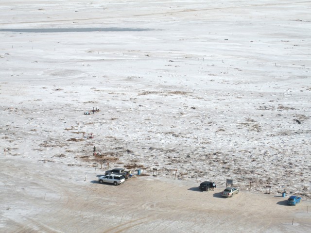
After passing to the West I circled around the South of the “dig” and took this shot from about 200′ AGL
Until I saw what you are seeing in the previous two pictures, I had no intent on landing on the flats. I know that Clyde Cessna used them for testing aircraft back in the day but, I could not ascertain while flying over The Flats how firm the surface was and really had no desire to find out experimentally. It could have been soft like sand or hard like asphalt. Seeing that people had driven their cars out there, my thinking changed. I decided the corridor staked out for car traffic would make a perfect landing field!
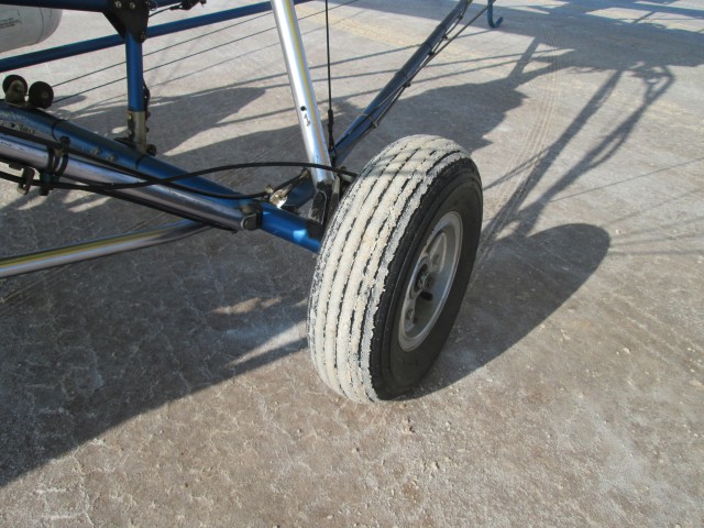
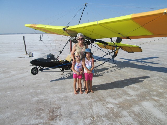
A breeze of approximately 3-5 mph had developed out of the Southwest. Rather than land into the wind as is standard procedure, I elected to land downwind (Northeast) on the traffic corridor. This would keep me from crossing over the folk’s heads on final. It is “bad form” to buzz people who don’t know you and I figured a faint tailwind like that would have no negative repercussions for my landing. This proved to be true. I eased to a stop and made sure the first thing I did was to take the picture below documenting the salt covered tire.
Moments after taking the picture above I was greeted by a nice lady and her granddaughters. They were talking excitedly at me but I couldn’t figure what they were saying. It took me a moment to pull the earmuffs off and earplugs out of my ears so I could do better than lip-reading. They had come out early in the morning to look for crystals and thought that my arrival had made an interesting morning even more so. I asked them to pose for a shot intending to get their names for this story but then some more folks came up and they left to go back hunting for crystals. This made them “The 3 Unknowns”.
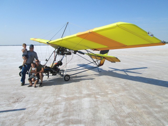
I did write down these guys’ names who walked up right after the 3 young ladies.
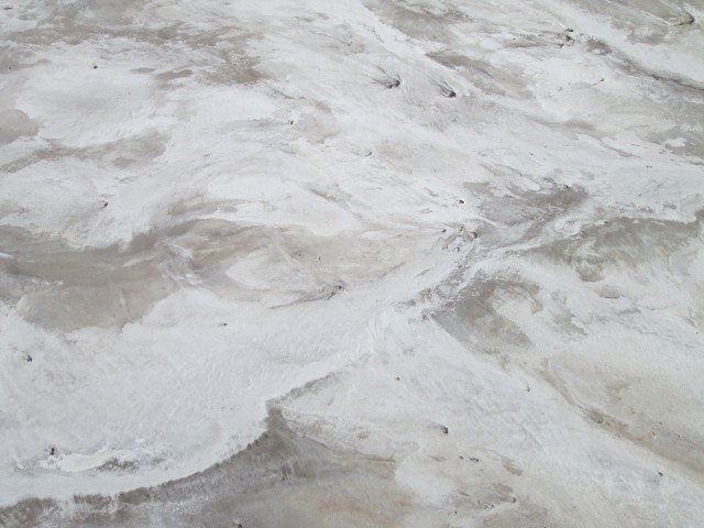
I talked with the guys at the dig for about 20 minutes. Before leaving I took the two shots below.
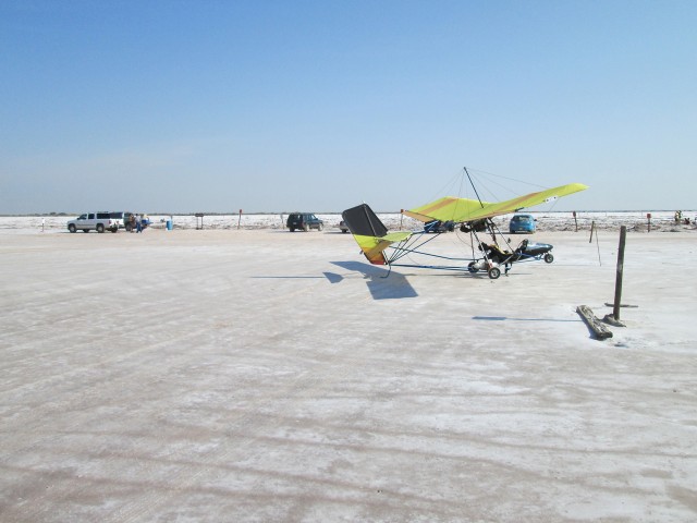
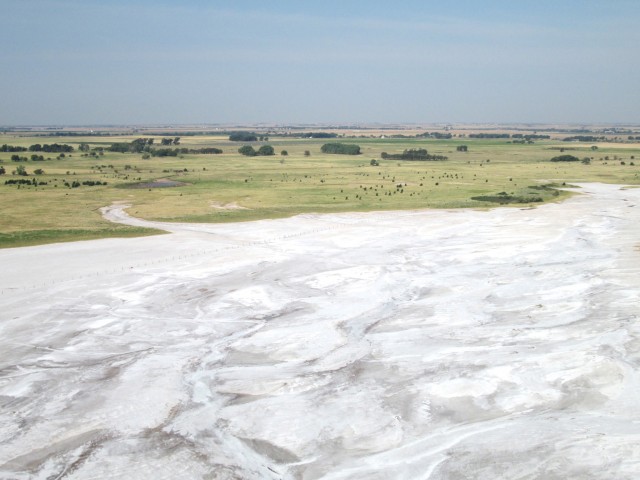
A panoramic view of the Selenite Crystal digging area
I told the guys I would demonstrate the MXL’s extreme short takeoff capability and dramatic climbout. After a quick pre-flight and then strapping in, I proceeded to perform those maneuvers. After topping out on the “max climb departure”, I then cranked it over into a tight turn and flew past the group to their North side waving goodbye. I set a course to curve around the South side of Cherokee, Oklahoma and then look for the airport which is just outside town on the North side. The scene captured below was amazing. The salt flows right into the grass. Next time I go there I will land near this nexus between salt and green. The plants that grow next to the salt must be very hardy and unusual.
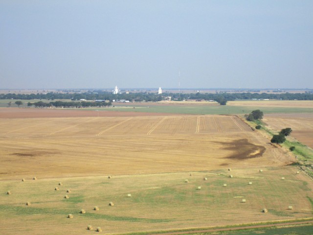
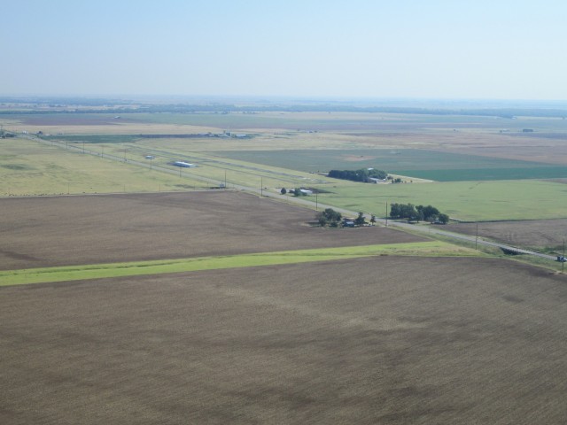
Amazingly, scant yards from the Salt Flats are producing farm fields. The town of Cherokee, Oklahoma is in the distance.
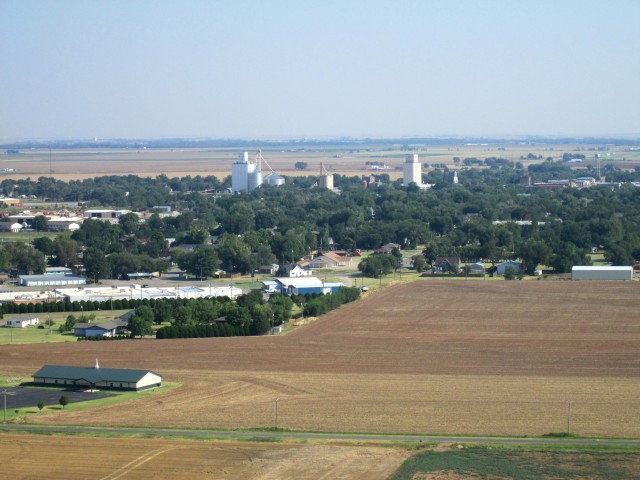
Cherokee, Oklahoma – 100′ AGL Looking North
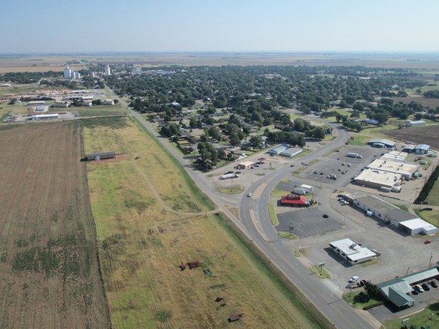
Cherokee, Oklahoma – 200′ AGL Looking Northeast
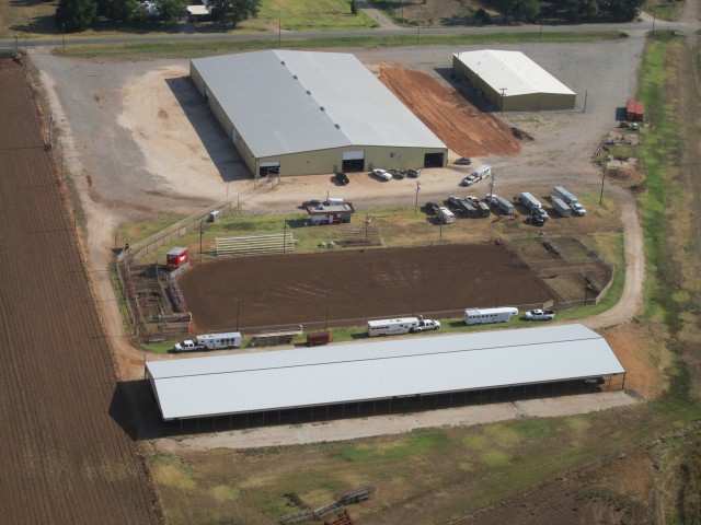
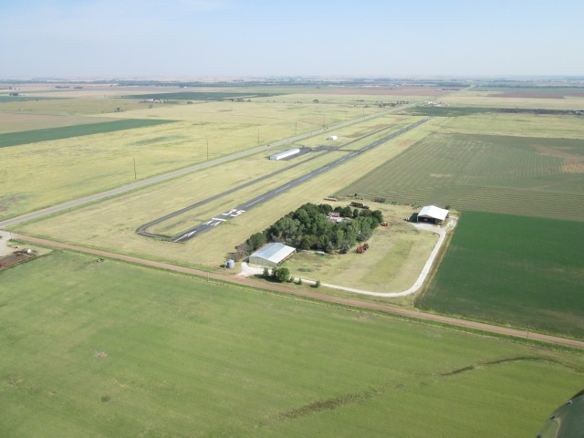
After thoroughly checking for any possible air traffic and finding none, I pulled my camera out for a shot of Cherokee Municipal Airport.
By now it was about 11 am. After landing and taking a couple of pictures and drinking some water I noticed it was suddenly getting very hot. I think it topped 105 degrees that day. Also, which was part of my plan, the Southwest wind was picking up. This would aid my flight home.
My plan was to head over to Anthony, Kansas’ airport to get some gas and then make my way back to Selby Aerodrome. Right after takeoff I took the picture seen below of Cherokee, turned crosswind and then exited the pattern at the end of the downwind leg headed for Anthony.
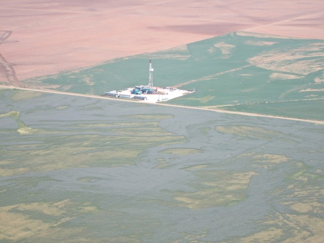
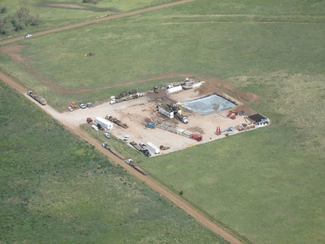
Just West of the desert area there looked like a “workover” rig re-opening an oil well.
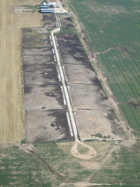
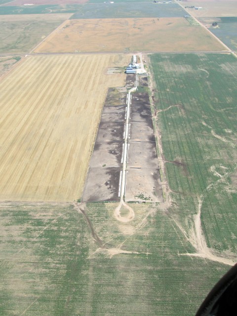
I saw two of these setups below on the flight but the other one was too far away to make a good picture. It looks to me like some type of feeding operation whereby they drive a truck down that middle lane distributing feed to animals in the different pens and then make a 180 degree turn (at the bottom of the picture) to go back up and feed the other side.
Action In The Oil Patch!
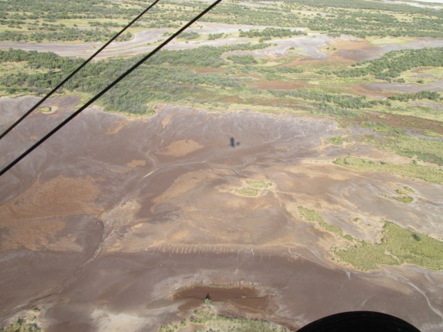
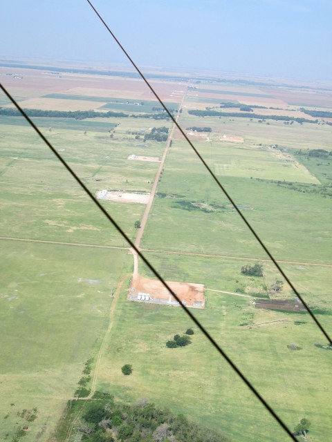
Another downfall of my latest pocketcam is that it has this “target acquisition”-type automatic focus finder that is seemingly impossible to control. My other cameras were such that you could sort of “manually” auto focus in the center 1/4 of the frame. With that ability, you can swing the camera out to infinity, set the focus and then point it back to your shot. This is what needs to be done in a situation like the shot below when there are flying wires in the foreground. This current camera just wants to glom onto the closest object and focus on it. That is what happened for the first two tries at this shot and that makes the background all blurry. This last try which you see below was OK and I kept it. There was a similar scene under the right wing but I could not get the camera to focus out to the distance. Suffice to say, it looked very similar.
The reason I wanted to show it is that you can see more evidence of all the drilling activity going on in this area near the Kansas/Oklahoma border. It is as busy for the Oil Business as it has been in years.
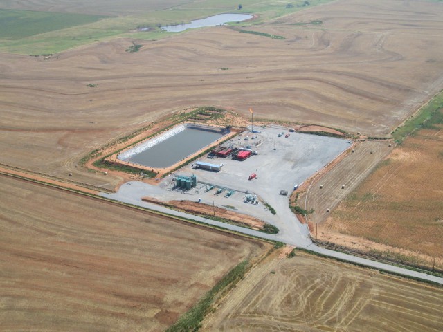
I don’t know for sure but I think below might be a fracking site. I saw the gas flare (the big flame) from the distance and went off course a couple miles to get this shot. You can’t tell that well from the photo but the gas flare rig is a portable machine sitting on wheels with outriggers that can be removed so it can be towed around.
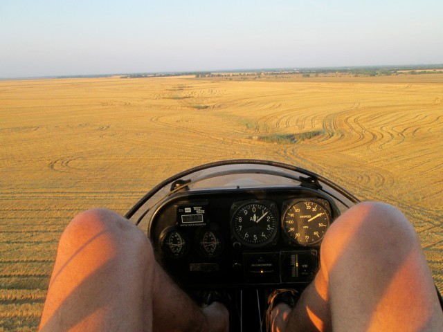
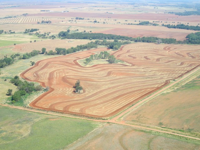
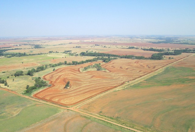
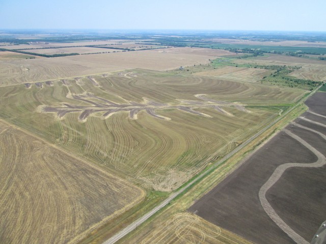
I took the next two pictures because I really liked the way the contour plowing produced a beautiful earth tone design. It definitely looks like the inspiration for an “Earth Tone Quilt”.
As I said at the beginning of this post, the atmosphere that day was very humid and the haze maintained the entire flight. I must note, too, that this was not attributable to smoke from burning fields. That looks different. This was humidity.
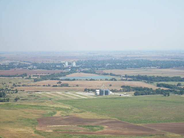
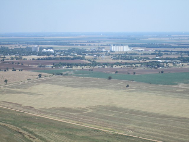
Anthony, Kansas Takes Shape in the Distance
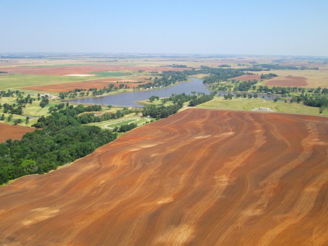
The Anthony Municipal Lake – Again Set Off Beautifully by another Earth Tone Tableau in the Foreground
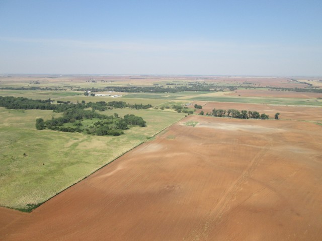
Anthony Municipal Airport Just Two Miles West of Town
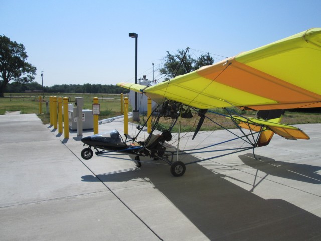
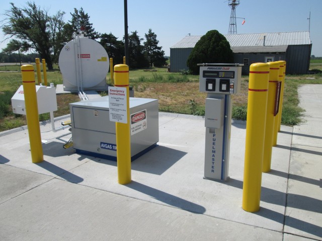
As I pulled up to the self service pump at Anthony Municipal, the only action I saw were some guys inside a hangar. They left while I was fueling up.
The 100LL self-service gas pump looks to be brand new. Earlier in the week I had called the Anthony City Manager’s office to see if they had gas at the field and he told me about their setup. It is modern and worked as advertised. I carry my own two-stroke oil to mix with the gas as I put it in the tank.
I had already called my lovely wife Debra when I landed at Cherokee Airport 4o minutes earlier. So, I needed to call somebody else at this stop.
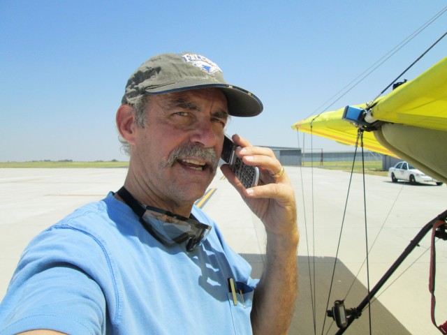
I have been trying to encourage my buddy Captain Doug Moler to fly with me on his Team Airbike on some of these adventures. So, I called him up to tell him what I was doing. To impress myself with my wondrous dexterity, I suddenly had the idea of seeing if I could fish my camera out of my pocket with one hand and take a self portrait whilst talking to Brother Doug on the cell phone with the other hand – all while carrying on a conversation. Apparently I can do this. The proof is below.
(At the time, in my mind this would reassure myself of my competence to perform two tasks of no simple dexterity coincidentally. This self demonstration was needed after nearly grounding myself earlier in the morning while attempting to take the picture of the John Deere tractor…)
It was “smokin’ hot” at the Field Anthony. So, after regaling Doug with some of the details of my adventure to that point and fueling up the plane, I lifted back into the somewhat cooler air found at 1,000′ to 1500′ above Summertime Kansas. As hoped and planned, I had a 10 mph boost from a tailwind carrying me back homeward.
Just Northeast of Anthony I see evidence of more money being made. Yes, I am Pro Oil Business.
My flight back from The Salt Flats was performed at higher altitude than the flight to The Flats so I could make use of the tailwind. Also, this gave me a different point of view to shoot pictures. Since I added a leg to the North to get gas at Anthony, I was traveling a different route home than the one I took to The Salt Flats. So the following are a few things not seen on the way down earlier that morning.
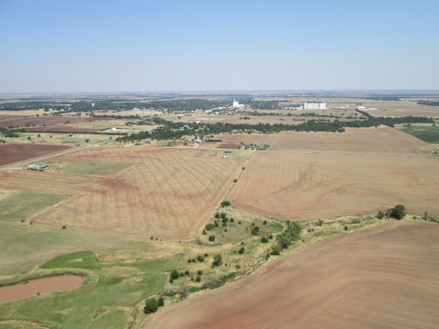
I think this was Wellington, Kansas somewhat South of my Course Line
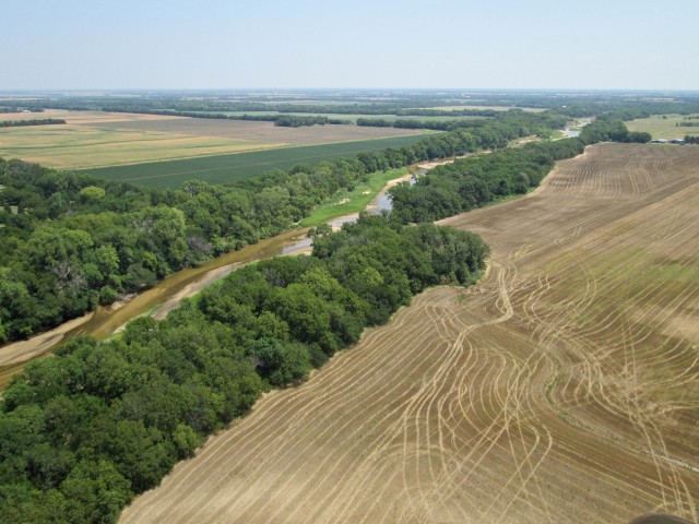
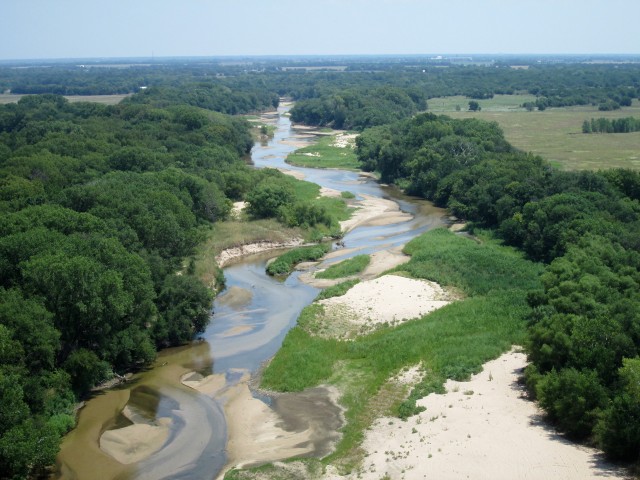
A series of shots as I passed over the Ninnescah River again.
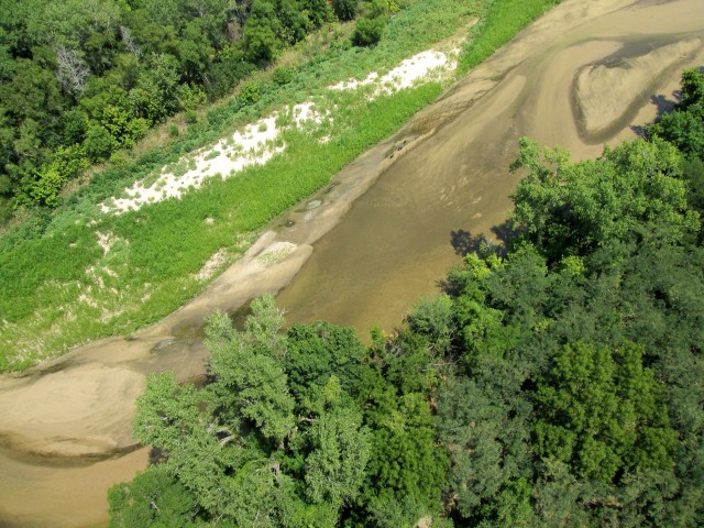
If you look closely on the riverbank you will see a pack of three farm dogs that were out for a fun run
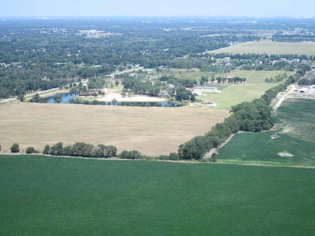
Below you can see my destination as it looked right before I entered the downwind leg of the pattern. This was taken from about 800′ AGL looking Northwest. The Selby Home is surrounded by a lake stocked with fish and features a nice, sandy beach to the right of it. The horse stables are hidden behind the numerous trees adjacent to the beach. The airfield is the green stretch to the left of the tree belt near the right side of the photo. You can see the hangar on the left side of the runway.
The Salt Flat Safari garnered a total of 5 hours in the air. I saw many interesting sights and was again reminded how beautiful The Great State of Kansas is!
I hope you enjoy looking at these pictures nearly as much as I did taking them and being there.
Until next time…
Blue Skies & Tailwinds!™
Brian FitzGerald








Mr. Fitzgerald – I was doing a Google search for current sunflower fields in KS & OK and came across your blog. I must say that I know very little about ultralights but I still very much enjoyed seeing the photos and reading the commentary about your flight – it’s very clear you enjoy your flying. It must be a magnificent way to see the countryside!
I was in the Mulvane area this past weekend looking for sunflower fields to take photos of but I only came across a couple that were well past their golden prime – which is why your sunflower field photo really got my attention. Could you possibly give me some help with the location of the sunflower field you saw in your flight? From what you wrote, I take it that it’s S/SW of Peck, KS in route to Cherokee, OK but that’s too much area for me to cover in one day randomly searching without some directions from you. Plus, if I have a better idea of the location, I can plan my drive to coincide with the less harsh light of a sunrise or sunset (depending on which way the sunflower heads are facing). Anyway, I’m sure you’re a busy man but this amateur photographer (who LOVES sunflowers!) would greatly appreciate any help you could give. Thanks so much and keep up the nice blogwork!
M Stevens
MStevens1962@yahoo.com
Dear Mr. Stevens,
I’m glad you found Sky Surfing! The field I passed over on the way to the Salt Flats was large but not the best one I have seen out in the area. I will be flying tomorrow and if I see a good one I will do my best to get a fix on its location so I can tell you.
For my movie “UFM2” (http://fitzvideo.com/pages/UFM2Pages/UFM2_Making2.html), I spent a great deal of time on a music video called “Lil Prop/Big Prop”. A significant segment of it was shot over one of the most beautiful sunflower fields I have ever seen. In order to line up the shoot I researched the area about 6 months in advance to find a farmer who was growing the “big head” variety. They are only picturesque for about 3 to 5 days. After that the heads point down too far. The particular farm I used was near Peck, Kansas. I just looked through my emails to see if I had his name but nothing came up. I know I have a credit for him at the end of the movie but I don’t have time right now to look for it.
TIP: I think the way I found my sunflower farmer was by driving to/and calling a number of Co-ops to see where the sunflowers were being grown. I tried as far away as Hutchinson but ended up getting the best one closer to my field. People are very helpful and will do their best to find one for you.
Thanks for the reply – I’ll check out the co-op angle and if you did come across some sunflower fields on your most recent flight, I’d love to know the location(s). Thanks so much for your help and advice!
MStevens
Dear Mike,
Glad to be of service.
I am writing up my flight to Ponca right now. Unfortunately I did not see any sunflowers this time out. If I see some soon I’ll let you know.
Later,
Brian
Thanks! Btw, I forgot to mention that I watched your “Lil Prop/Big Prop” online at fitzvideo.com – nicely done!
Brian:
I have read your many blogs and enjoyed them all. The photos make relatively short trips interesting. I hope to do some similar photo essays for the local area I fly around Norman/Oklahoma City.
Do you fly anything besides the MXL? I definitely admire your ability to fly an ultralight in 20 + mph winds!
Best wishes.
Don De Witt
Dear Don,
I really appreciate hearing from you about Sky Surfing. I’m glad you like the travelogs. If you would like to post your Norman/OKC photo essays on The Flight Blog I would be very happy to host them and tell my mailing list when you put one up.
The only plane I fly is the MXL. I have had this one for about 4 years. Prior to that I had an MX with a single surfaced wing and no ailerons.
On flying in the wind…
First, thanks for “Hi-5” on the wind flying. I find flying in the wind both fun and challenging. It is real “stick & rudder” practice. I really like doing it.
I built up my skill for flying in windy conditions over a few years. Part of it was in developing confidence in the airframe. Quicksilver makes a strong plane and it has a lot of control authority. I think the main thing, though, is this concept I call “Sky Surfing”.
If you have ever surfed or watched guys surf you notice that it is a sport of constant challenge adjusting to the minute changes in the wind and the waves of the ocean. Surfers are working a force of nature to their advantage. That is the best parallel I have found to describe the extreme low speed flying I do. Some of my technique involved “un-learning” what they teach in pilot training. I am not saying they are teaching “wrongly” but they are teaching for a different purpose. Specifically I mean the constant attention to “Straight & Level”. That is what you want when you are flying at 100+ mph and trying to get from one place to another most efficiently. When flying a very lightly wing loaded plane like I have, it is my contention that you get your best performance by “riding the waves” rather than “bucking the waves”. Some of this was also derived from observing butterflies in flight. I have had the interesting opportunity on rare occasions to watch butterflies fly INTO a rather strong wind and move against it in a continuous manner. What I noticed is that they seem to “bob & weave” their way through the air similar to this “sky surfing” thing I am positing.
Most people picture wind as a monolithic mass moving along, all at once, pretty much at one speed and in the same direction. This mental image fits if you are traveling through the air fairly fast. When you fly through it at slower speeds, though, you find that the air moves in more of what I think of as “fingers” or “rolling tubes” of different velocities.
My method is to try to let the plane find the easiest pathway through “the tubes”. I believe this is what the butterfly does instinctively.
BTW, I shot an interview with a great guy named Fred Kimmel, and a short music piece featuring him flying his Kolb in Norman, Oklahoma years ago for my documentary “HangarTalk – Ultralight Tips, Tricks and Techniques”. It was back in the 1990’s. Fred lived on an airstrip and had a really nice setup and was teaching people to fly ultralights. Unfortunately he developed cancer and passed away prematurely.
Tomorrow I am making my first flight to Ponca City, Oklahoma. Norman/OKC is more than twice as far as Ponca but definitely worth consideration for a momentous adventure. If/when I decide to make the trek I will let you know!
Hello Brian:
Thanks for your response and the kind offer to post my photo/trip reports. I need some additional practice taking the aerial photos, but hope to have an offering or two in the near future. I fly a Fisher Celebrity experimental bi-plane and currently have a photo report that covers my trip to the 2012 National Bi-Plane Fly-In at Junction City, Ks. Might I post it? How do I upload it?
Looking forward to reading about your Ponca City trip. If you ever venture as far south as the OKC metro area give me a heads up. I’d be pleased to meet you and even spring for lunch or dinner.
Don
Dear Don,
I just upgraded your file to “Author”. That should allow you to start a thread and upload pictures. As Administrator, I don’t see the exact screen you see so when you log on next time look around for something that will allow you to “Post”. A good size for photos is 640 x 480 or something close to that. I have used 960 x 540 on occasion. If you have trouble getting started just give me a call and I will walk you through it. Once you see how it is done it is fairly easy.
I flew to Ponca today and it was excellent! It took me two hours to get there. My flight home was filled with side trips so it took a bit longer. I am shooting a commercial this week, so I need to get it posted before Wednesday. That will be my deadline.
I met Gene & Pat Henson at Ponca.
I will be flying to at least one of their monthly fly-ins either this season or -for sure- by next season. They are held on the first Saturday of the month. We can coordinate and meet at a Ponca Fly-In.