Home on the Range
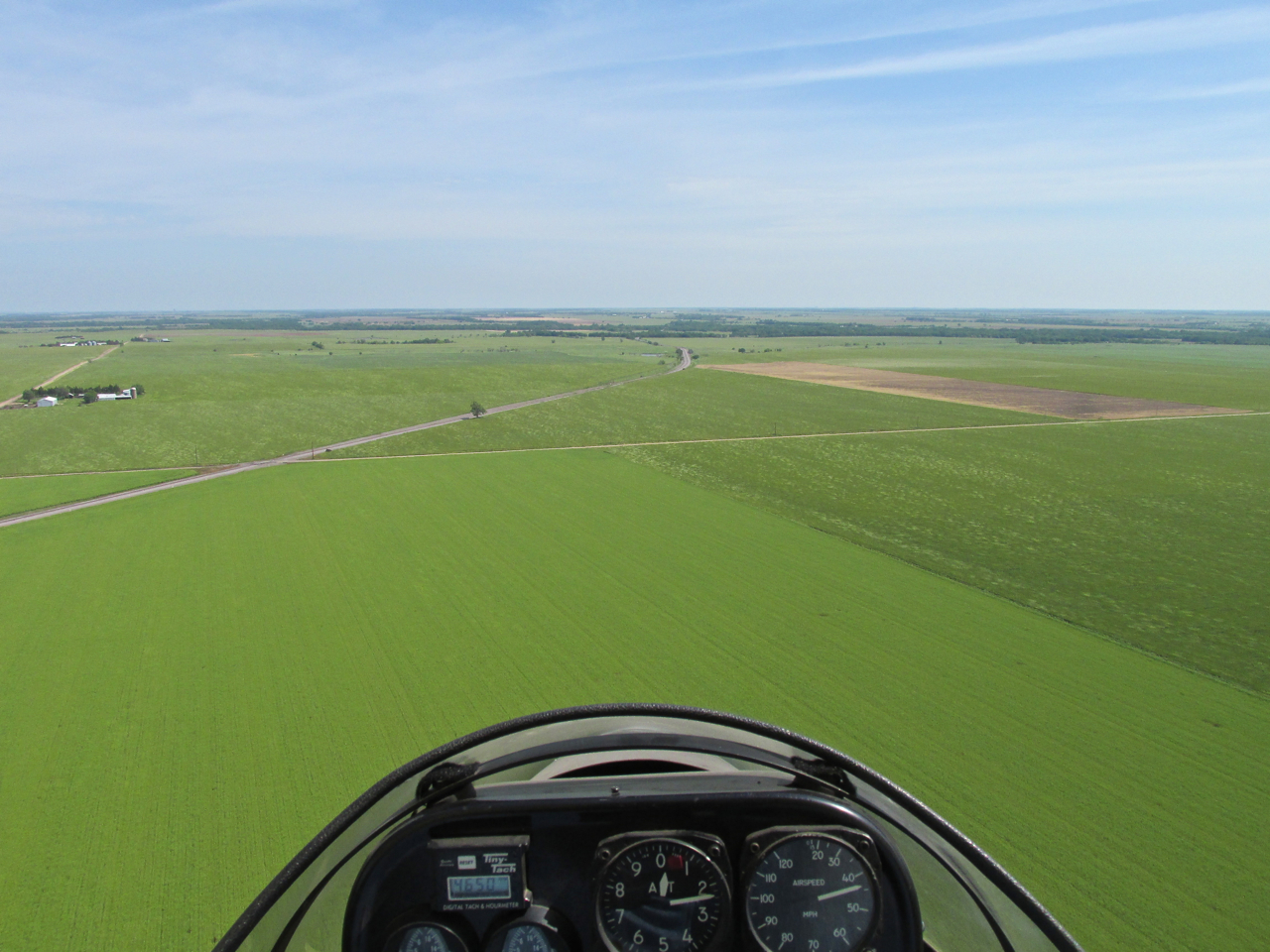
Checking the weather Friday, I was looking for a place to fly upwind from Selby Aerodrome, my home field. I like to start a Fun Flight early in the morning heading into the wind so I can fly home with a tailwind. If I start early enough, most of the time the wind near the surface is nil. This general operating principal makes for the best ending to a Fun Flight – a tailwind home. Of course, the best of all flights is a tailwind in both directions. I have had that happen three times so far but obviously it is an exceedingly rare event. (More on The Sky Surfer’s Fun Flight Strategies HERE)
Plan Not Perfect
The Saturday of this flight was on Memorial Weekend. I was hoping to have two Fun Flights over the holiday, Saturday and Monday. The Saturday flight to Caldwell, Kansas was “iffy” from the start, though, because the wind was high through the week and continued strong through Friday night. Rather than blame the meteorology, though, yours truly must bring himself to task for dithering around that morning. I must confess to having had a “negative attitude” of the type I scold others for having. I had decided in my mind the wind would be too strong for me to fly any distance so I did not pursue the endeavor with the proper enthusiasm. I got up early enough, but wasted a half hour at the gas station. Usually I am pre-flighted, fired up and rolling down the runway at sunrise. This Saturday the sun was already above the horizon when I reached the hangar.
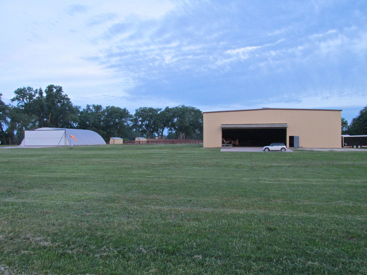
From the wind sock you can see the wind at the surface was already about 8 mph.
The sun was already above the tree at the left side of the picture.
Give It The Old College Try
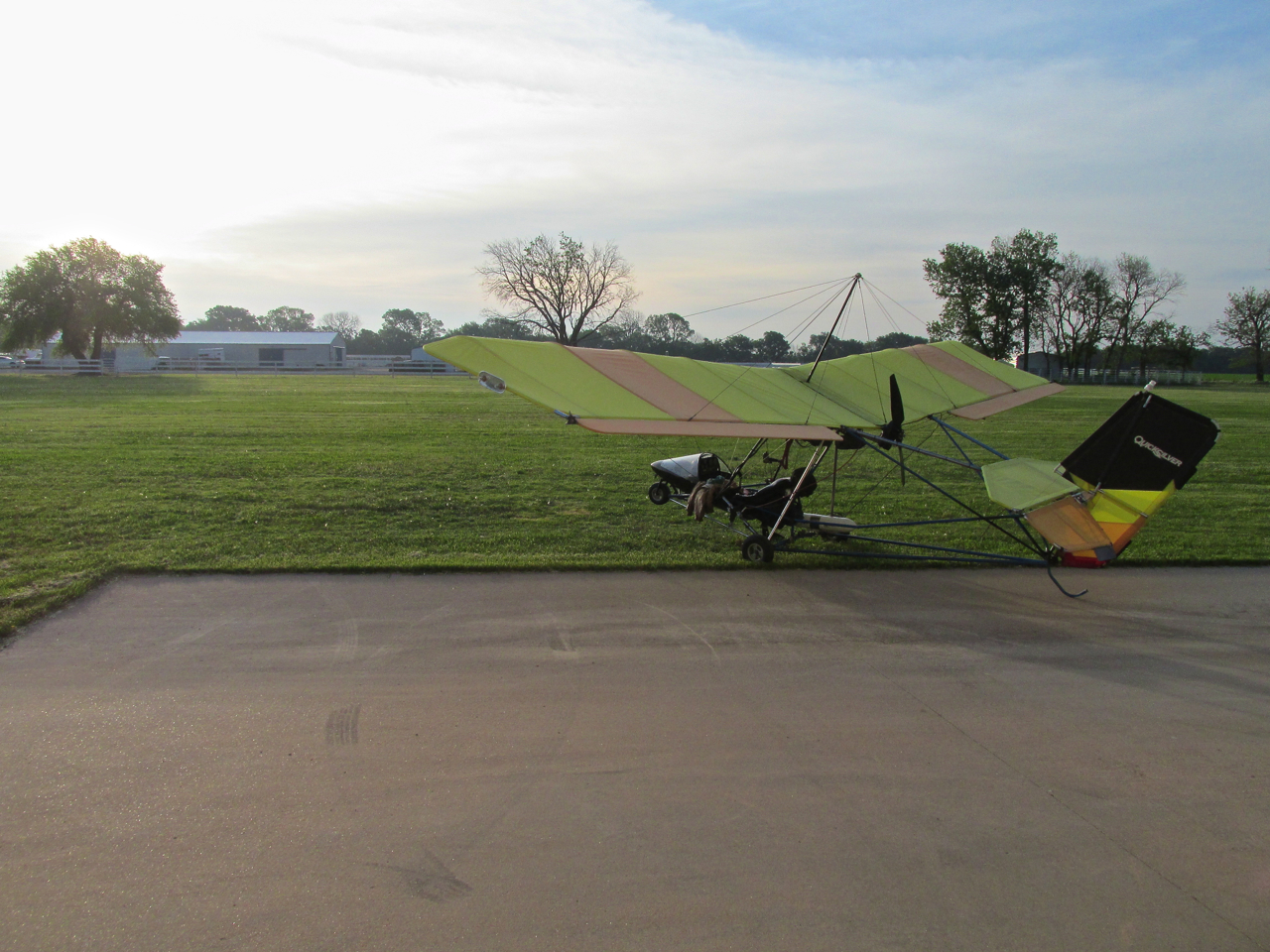
The act of rolling the plane from the hangar completely changed my outlook. Like Clark Kent donning the Superman suit, I mental-morphed into The Sky Surfer and quickly transitioned into Flight Mode. I decided I would at least get airborne and see what type of headway into the wind was possible. I took to the air and set a course for “The Border Queen” – Caldwell, Kansas.
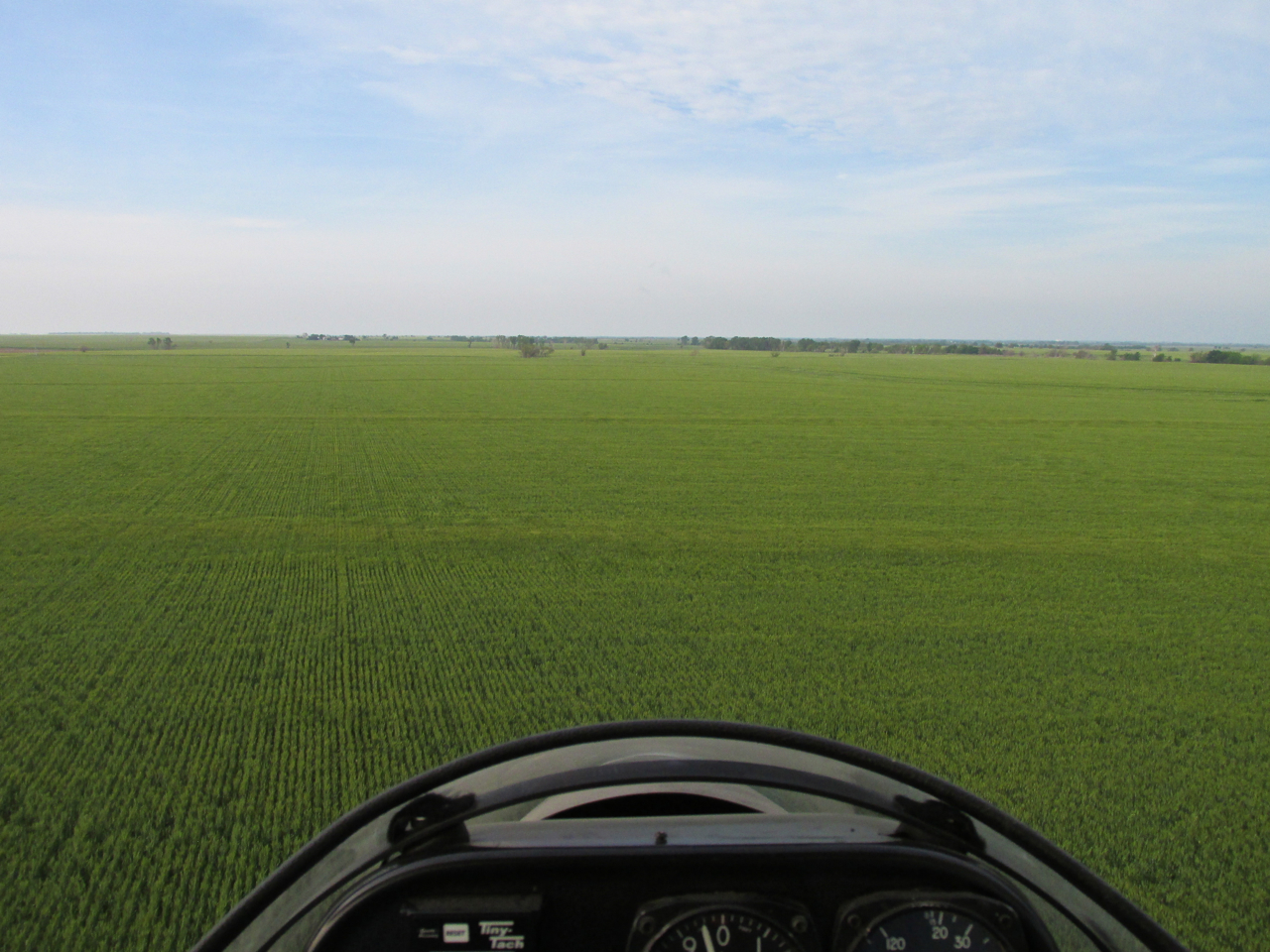
A Study Of New Wheat
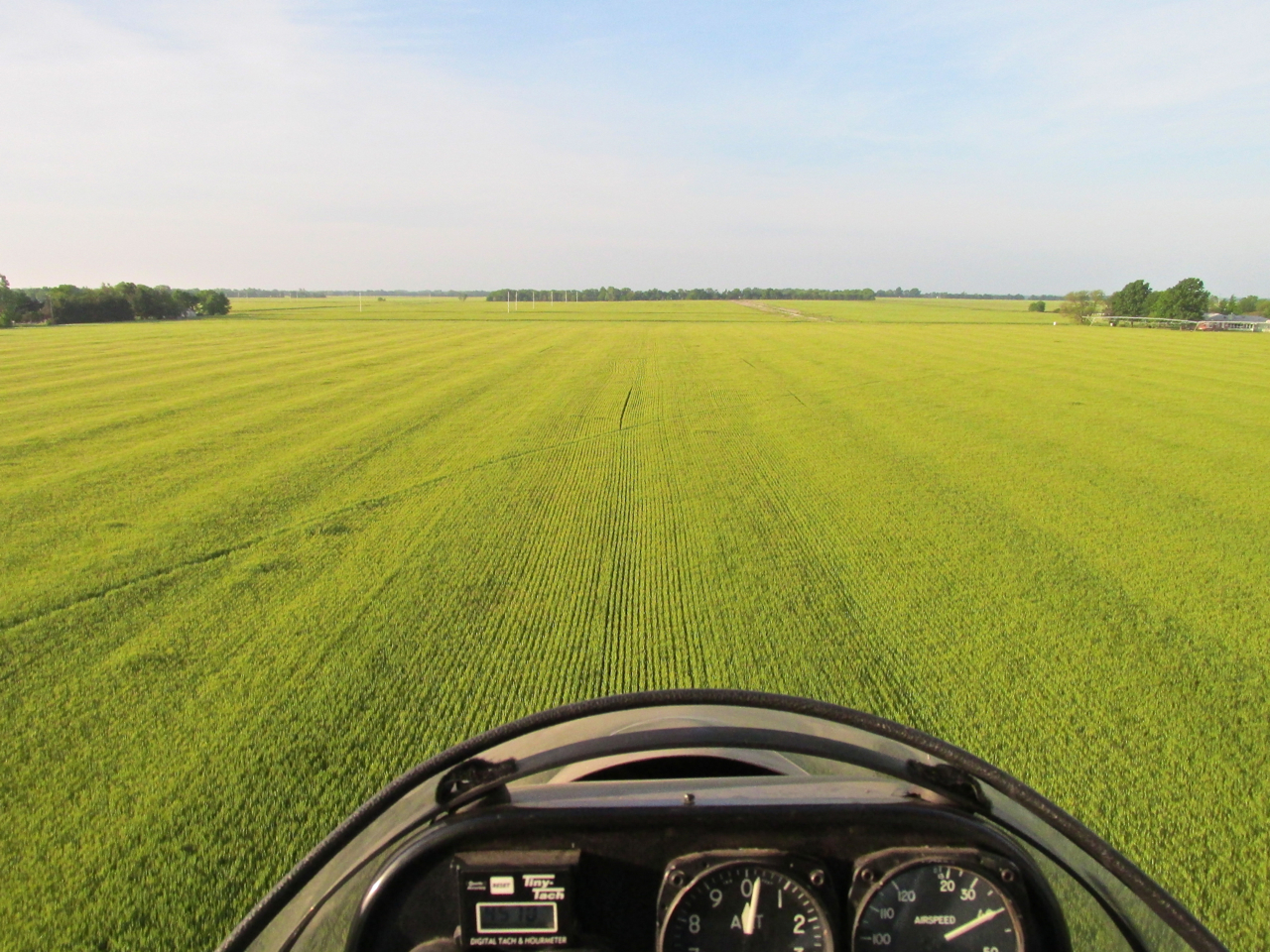
Wheat Doing Well
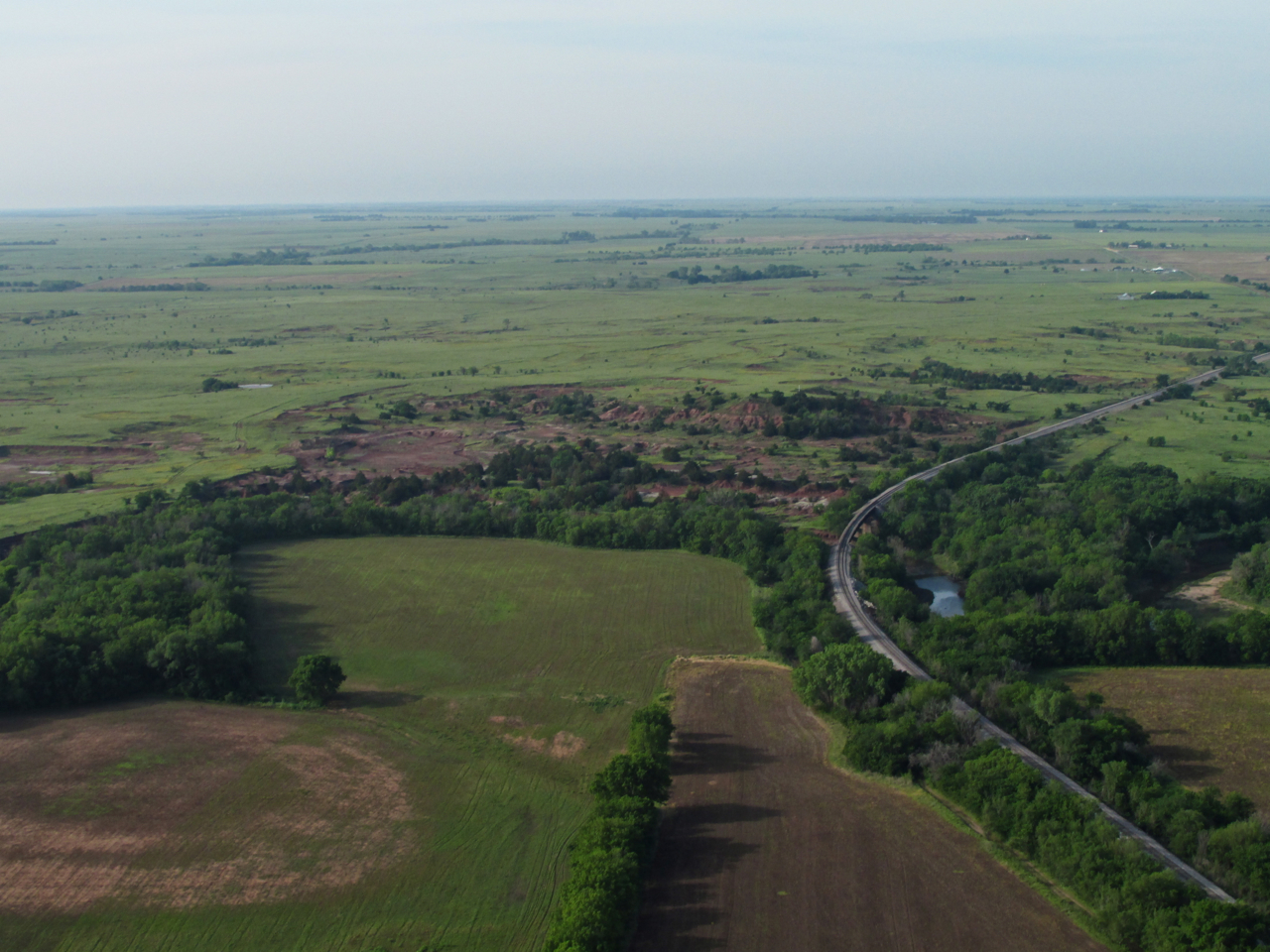
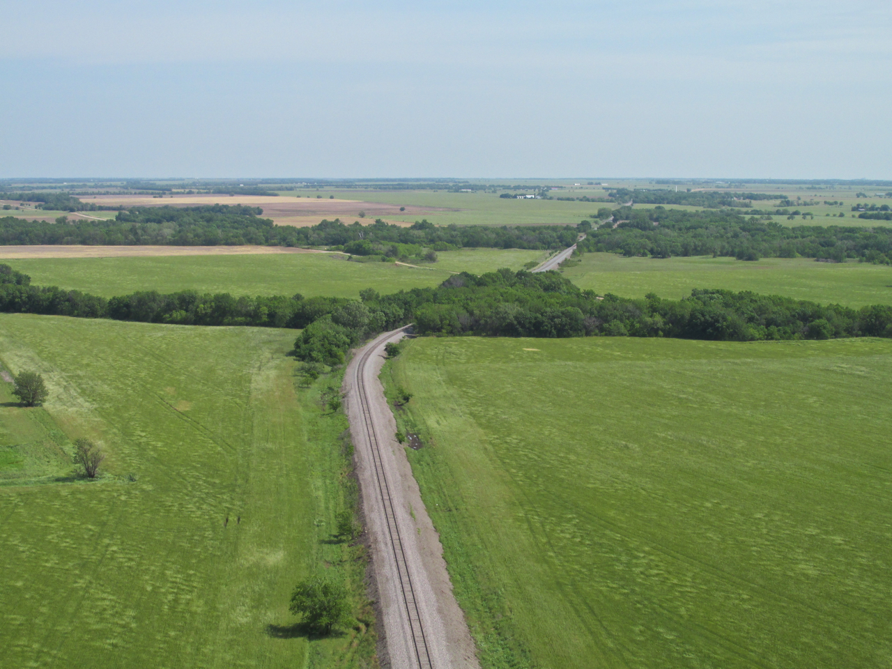
The Barber Pole Of The Plains

There was no traffic so I passed low to the Northwest of Wellington Municipal Airport. This was shot from about 75′ AGL looking Southeast.
Wheat To Cattle
Because it will figure large in this story, I included the three previous photos showing the long expanses of thick, green, healthy wheat. What you can’t tell from the still photos was the almost mesmerizing, steady waving motion the wheat made in the wind. Over the years I have developed a “proprietary interest” in my psyche for the wheat crop of Kansas. I don’t make or lose money on it but I am happy when it thrives and distressed when it doesn’t. The same goes with cattle ranching.
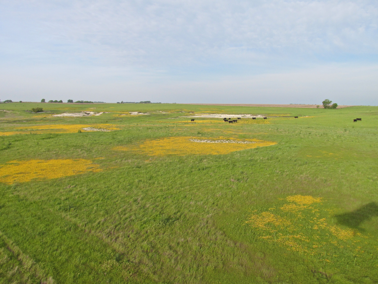
Suddenly the wheat gave way to a cattle field. Moving along low and at a steady pace, I had to whip the camera into action to grab this shot with the yellow flowers and interesting topography – a small group of cattle grazing nearby.
Cattle In The Eyes Of The Sky Surfer
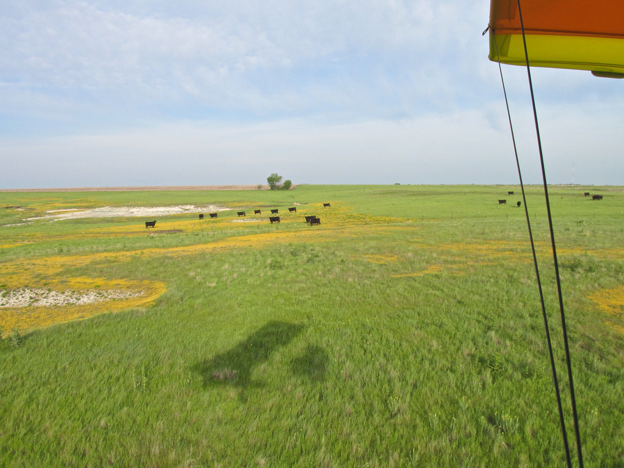
The reason I took the shot above and its companion photo below was to demonstrate a principle I have developed out on the plains. As I mentioned earlier (and all the time) I have found I can make good headway into a general headwind if I fly “nap of the earth” (that means really low). Particularly early in the morning, there is a boundary layer near the surface composed of relatively still air. When flying low, however, it is important to circumvent farms with milk cows or penned animals, but more common than that – small herds of cattle. The game is to sight these obstacles ahead and then adjust my course around them such as to make the least detour possible in order to conserve fuel and thus increase range. “The least detour possible” is one of the keys for cross country success. I stay no less than 1,000′ away from a dairy farm or horses, goats or sheep in pens. Unexpected noise can unsettle dairy cows and make horses rear up against fences and stalls. What I have learned about cattle, though, was something I had to “un-learn”.
Hollywood Cowboy Myths
When I was young, every Cowboy Movie I ever saw featured a CATTLE STAMPEDE. Hollywood taught me that cattle launch-off crazy en masse at the most minor of real – or imagined – disturbances. Cowboys laughing too hard, the camp cook rattling pans, a coyote howl and FOR SURE a gunshot were all guaranteed to set any herd off running until they trampled the camp, decimated a town, ran off a cliff or plunged headlong into a river to drown. The only way cattle stopped was when they became too tired to continue. They were as unpredictable as a tornado and every bit as destructive. Nothing could stop them.
Back in the 80’s, I moved to The Plains from California. When I began flying Ultralights in Kansas, I experienced “cattle cognitive dissonance”. Even though I wasn’t flying as low as I do now, I noticed that cattle didn’t seem to even notice my noisy Ultralight as I flew over them at 700 to 1,000 feet. At most, they might gaze up for a moment and then drop their heads back down to concentrate on the grass. It didn’t make sense. I couldn’t figure it out. As per my Hollywood training, these beeves should have been raving out of their minds at the buzz saw sound of my plane.
Experimentation
I sold my Quicksilver MX at the end of the 80’s. After a hiatus from flying, I bought the MXL about five years ago. Since then I gradually, cautiously, developed my “long distance” Fun Flight concept. Big breakthroughs to proving this idea were: 1] Finding the slowest I could turn the Rotax and still stay airborne and… 2] Flying below a headwind – what I call “Nap of the Earth” flying. The only way the “nap of the earth” technique worked, though, was to “look up the path” and detour when necessary. At first, I would give cattle 1,000 feet or more of leeway. Then one flight, I was detouring a herd by that distance when I inadvertently came upon another herd as I crested a hill. “Herd 2” was about 500′ in front of me so I turned back toward “Herd 1” and split the difference between the two herds. Not a hoof stirred. A few hundred heads turning in unison watched me pass by but not one moved from his place. It was a stunning revelation. I was forced to re-evaluate my understanding of the beeves. On ensuing flights I studied their behavior intensely.
Don’t Threaten
To “cut to the chase” (what an ideal place for a genuine plains metaphor), I have discovered that the trick to maneuvering around cattle is to be “non-threatening”. You must never approach them directly. As long as you are not appearing to come “at them”, they will just watch you go by. In the shot above, my path was taking me directly over the cattle. When I saw them, I adjusted it to glide to the left of them. As you can see below, they just watched me go by. Still, that is as close as I get to them and usually stay even farther away.
Grazing and Gazing
Cattle Back To Wheat
After the very short interlude photographed above, I crossed from Cattle Country back into Wheat Country. Even though it is not evident from the photo below, the air was now quite choppy. Choppy enough that I was concerned I might not be able to walk into town if my plane could not be protected from the winds and properly tied down. I had only been to Caldwell once before. That day was fairly calm and I didn’t need to tie down the plane so I didn’t even look to see if they were available. Upon landing that day, there was a guy on the field driving around on a 4 wheeler. It was Tim Schmidt, another aviation friend, who is an instructor with Kansas Aviation, Inc. He was checking the field condition at Caldwell Municipal because he likes to bring students there to practice landings. I think Tim grew up in Caldwell, too. (Tim is featured in this story: HERE)
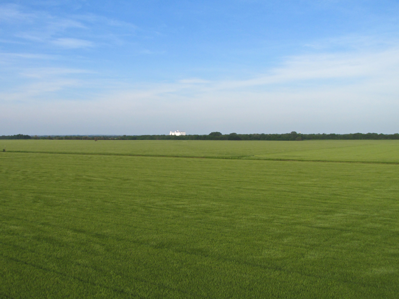
The Breadbasket
I want you to know that I was awestruck by the MILES of uninterrupted green wheat I saw while heading to Caldwell. It was strikingly beautiful. Also, the fragrance of it was quite nice. I took the picture below to give you some idea of this place on The Plains. If the air hadn’t been so turbulent I would have shot left and right also to give you the panoramic view. Suffice to say, consider the scene below and imagine it looking like that in ALL directions. Now you understand. This was a special thing.
Not just acres of wheat – MILES of Wheat!
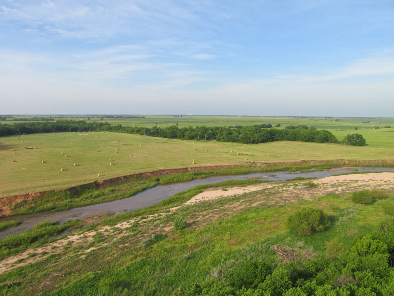
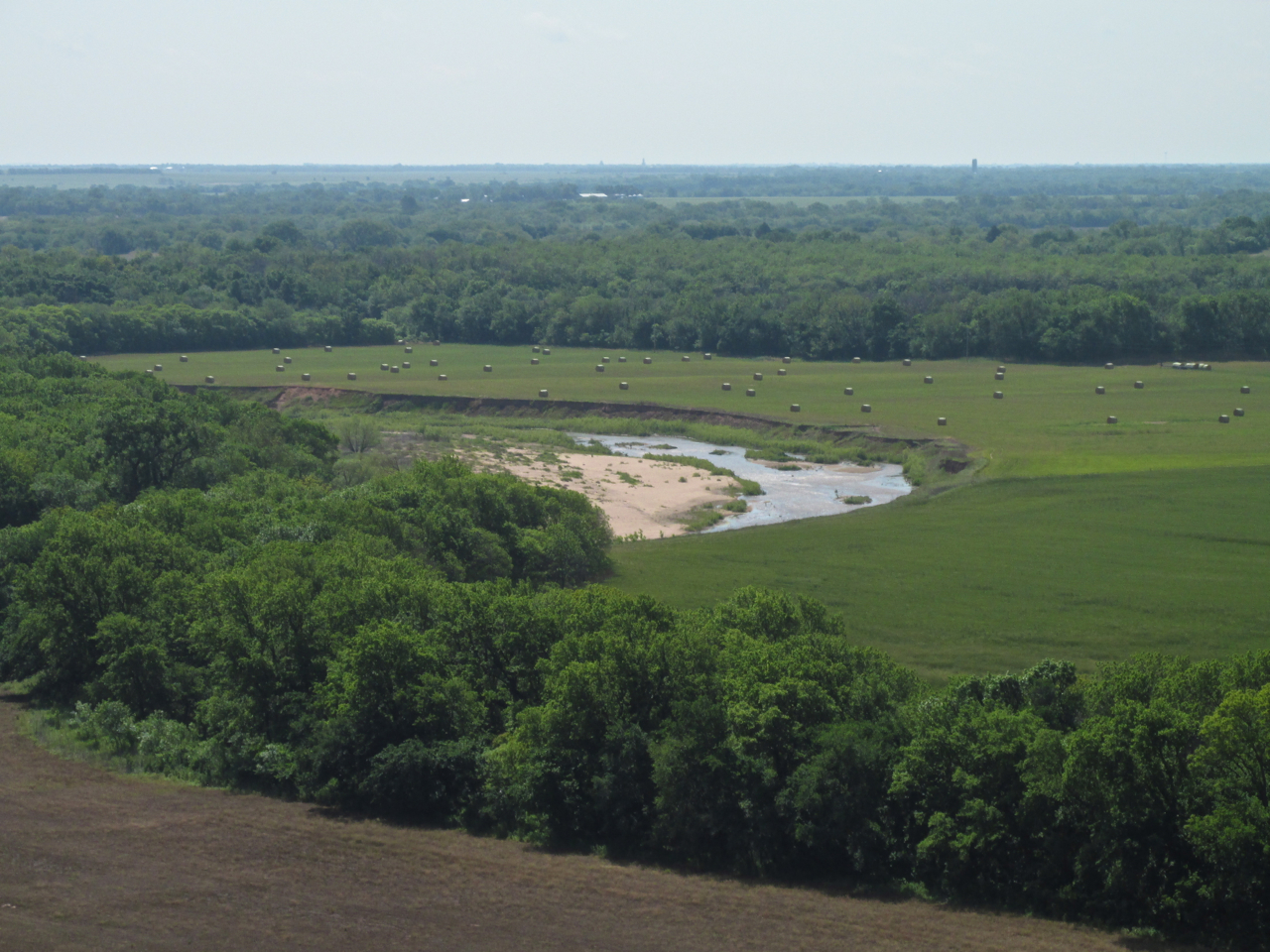
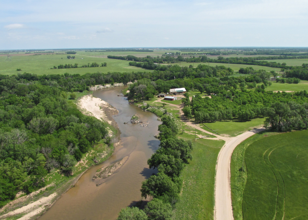
Crossing The Chikaskia River – Caldwell In The Distance

The Chikaskia River Under My Right Wing
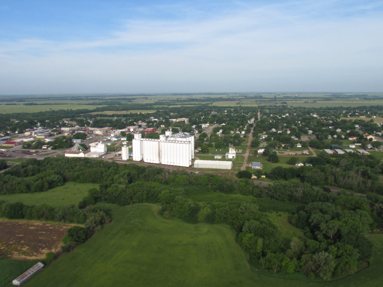
The Wheat Capital Of The World
Kansas is known as “The Wheat State” and Sumner County is known as “The Wheat Capital of The World”. Caldwell, Mulvane and Wellington are the main towns in Sumner County but Wellington claimed the title “The Wheat Capital of The World” for itself. Suffice to say, you won’t see better wheat anywhere than this part of Kansas.
One Last Marvelous Stretch Of Wheat Before Reaching Caldwell
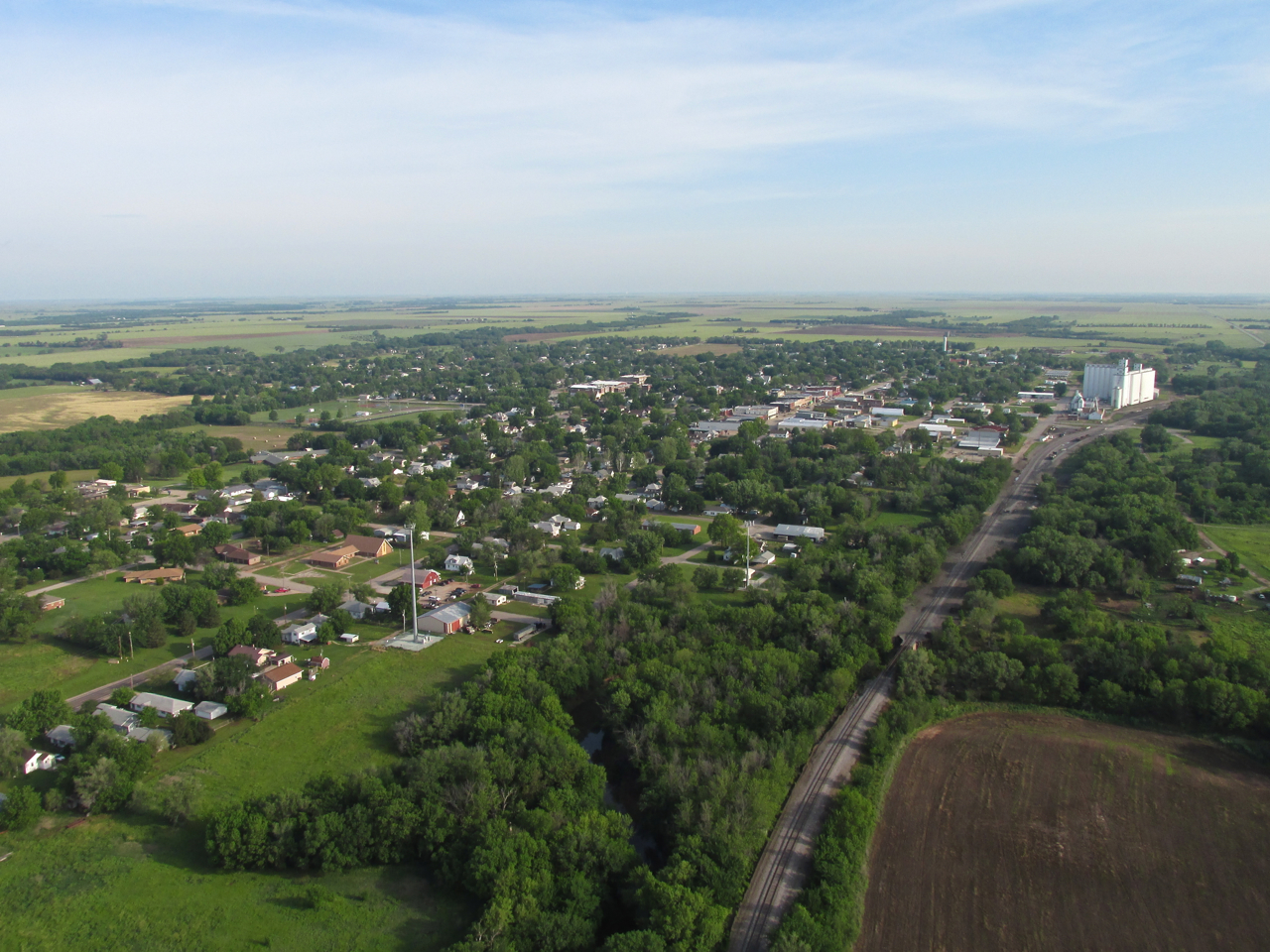
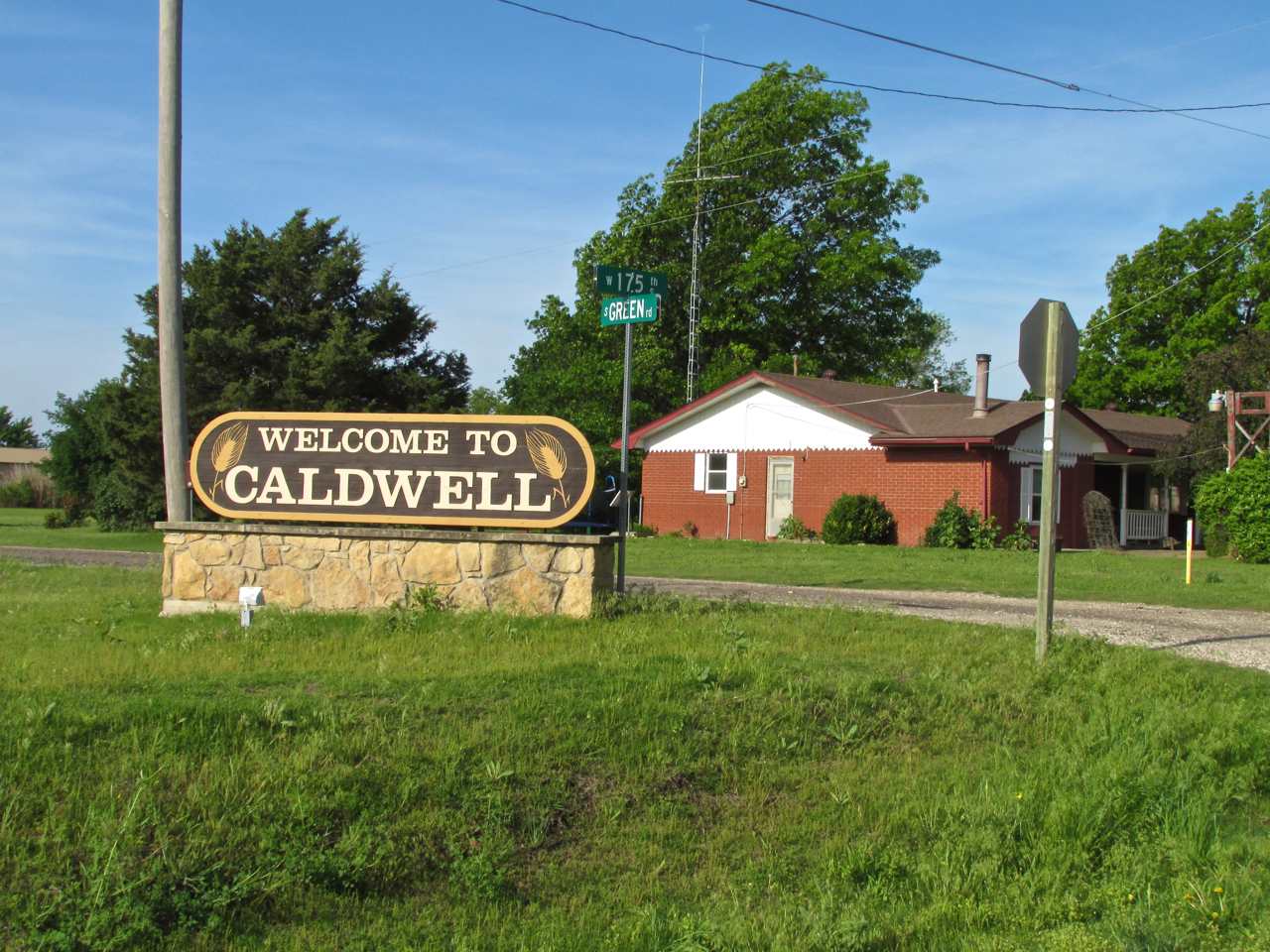
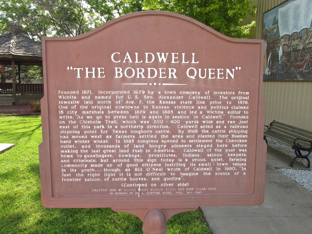
Caldwell, Kansas – The Border Queen
I had plenty of gas left so I skirted the airport and climbed to take some aerial photos of the town. By ascending to this altitude, I encountered a steady 20 mph wind from the South with gusts to 28 mph. That made for a “rock ‘n roll” camera platform but nothing for The Sky Surfer but nothing he hasn’t ridden before.
Caldwell From 400′ AGL Looking West
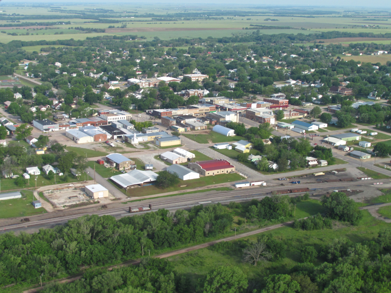
Caldwell’s Downtown Area From 500′ Looking Northwest
From a position at the Southeast edge of town, I saw this interesting landscape just South of town next to the railroad tracks. Shot from 750′ AGL looking South.
Just after taking the previous shot I wheeled around and took one more aerial of Caldwell. This is from 700′ AGL looking North Northwest.
This is looking Northeast from the same position as the earlier photo. I don’t know if that is sewage treatment or drinking water…
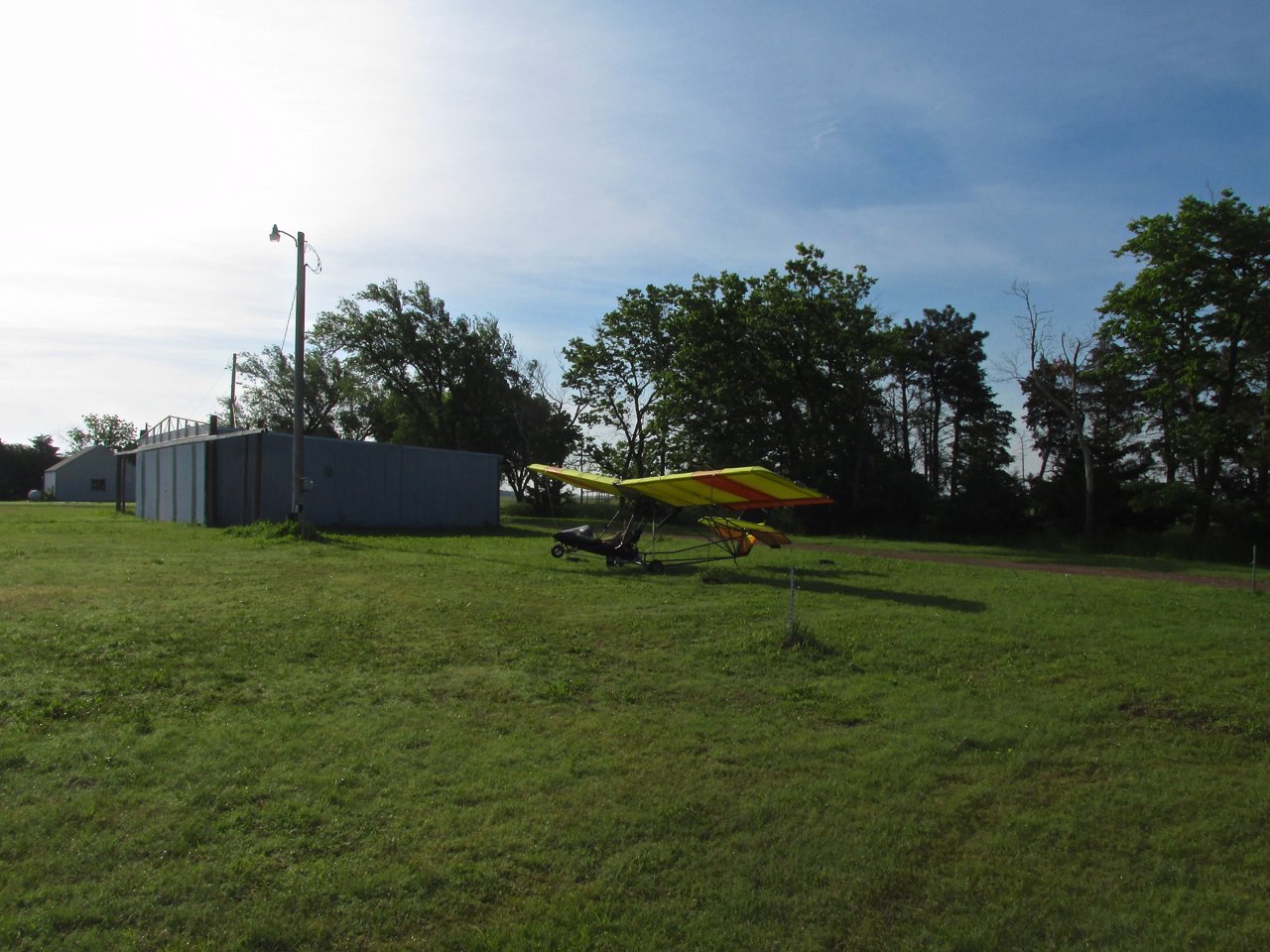
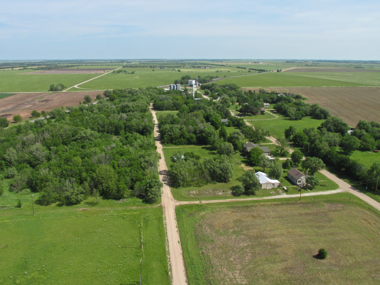
Caldwell Municipal – A Mile East Of Town
Couldn’t Be Better!
One thing I like about many of the small town airports is that they are close enough to town that I can walk downtown from the airport. That is a real plus. Caldwell Municipal is only a mile from town. Besides being close, Caldwell Muni features a perfect tree line/wind belt at the South end of the field. There were excellent tie downs for my Ultralight as well!
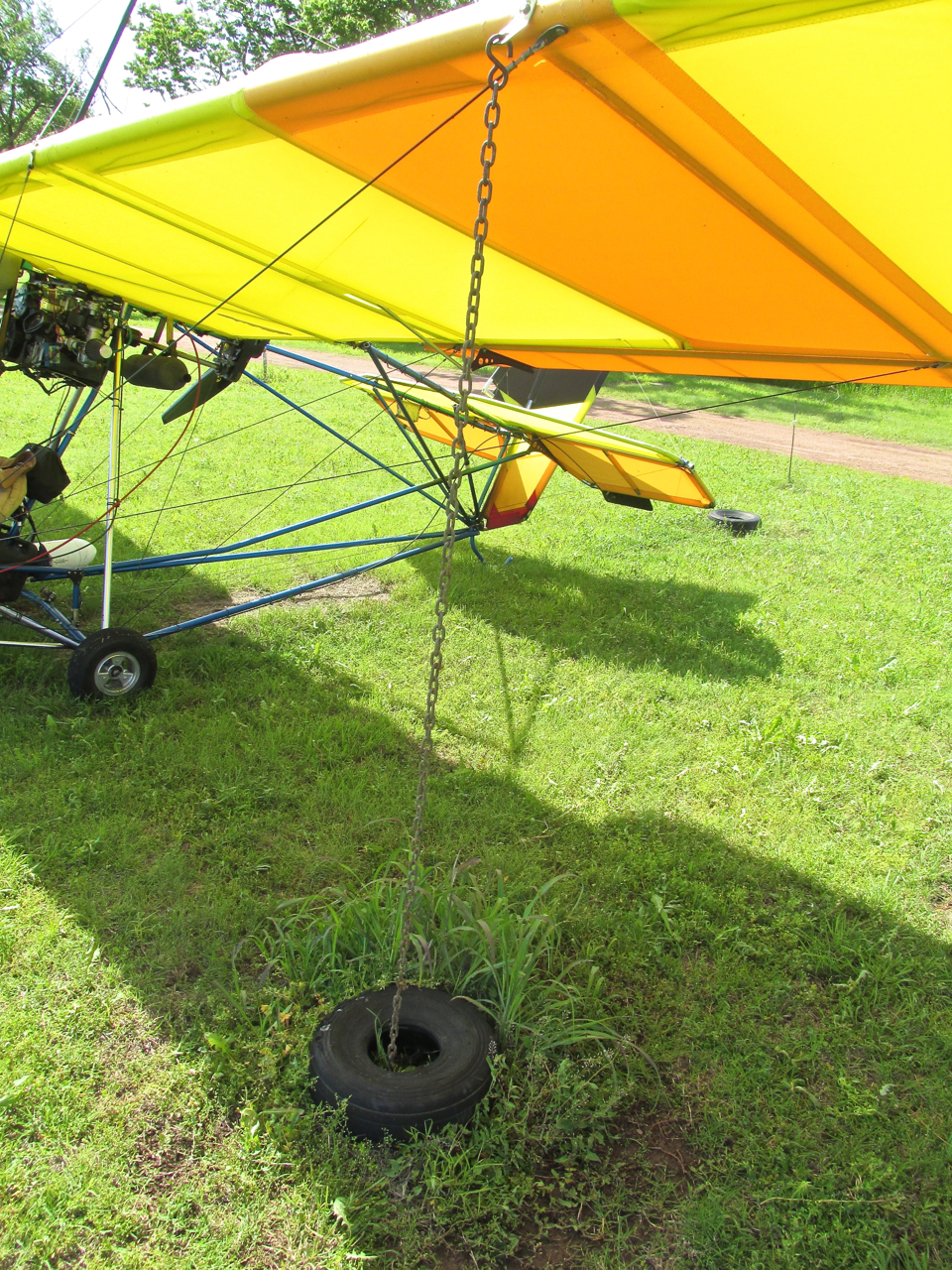
I had no doubt tie downs like this would keep the Quicksilver grounded until I returned from my tour of Caldwell.
A Last Look As I Headed Into Town

On the Southwest corner of the airport is “Border Queen Aerial Spraying“.
A Walking Tour Of Downtown Caldwell

Highway 81 abuts the airport’s South side and enters Caldwell from the East as Central Avenue. I walked along seeing many interesting things. This house on the South side of the road is what I would call “partially earth sheltered”. I see a good number of earth sheltered homes out in the country on my flights. They are said to be good for heating and cooling and I’m sure are an advantage in a tornado.
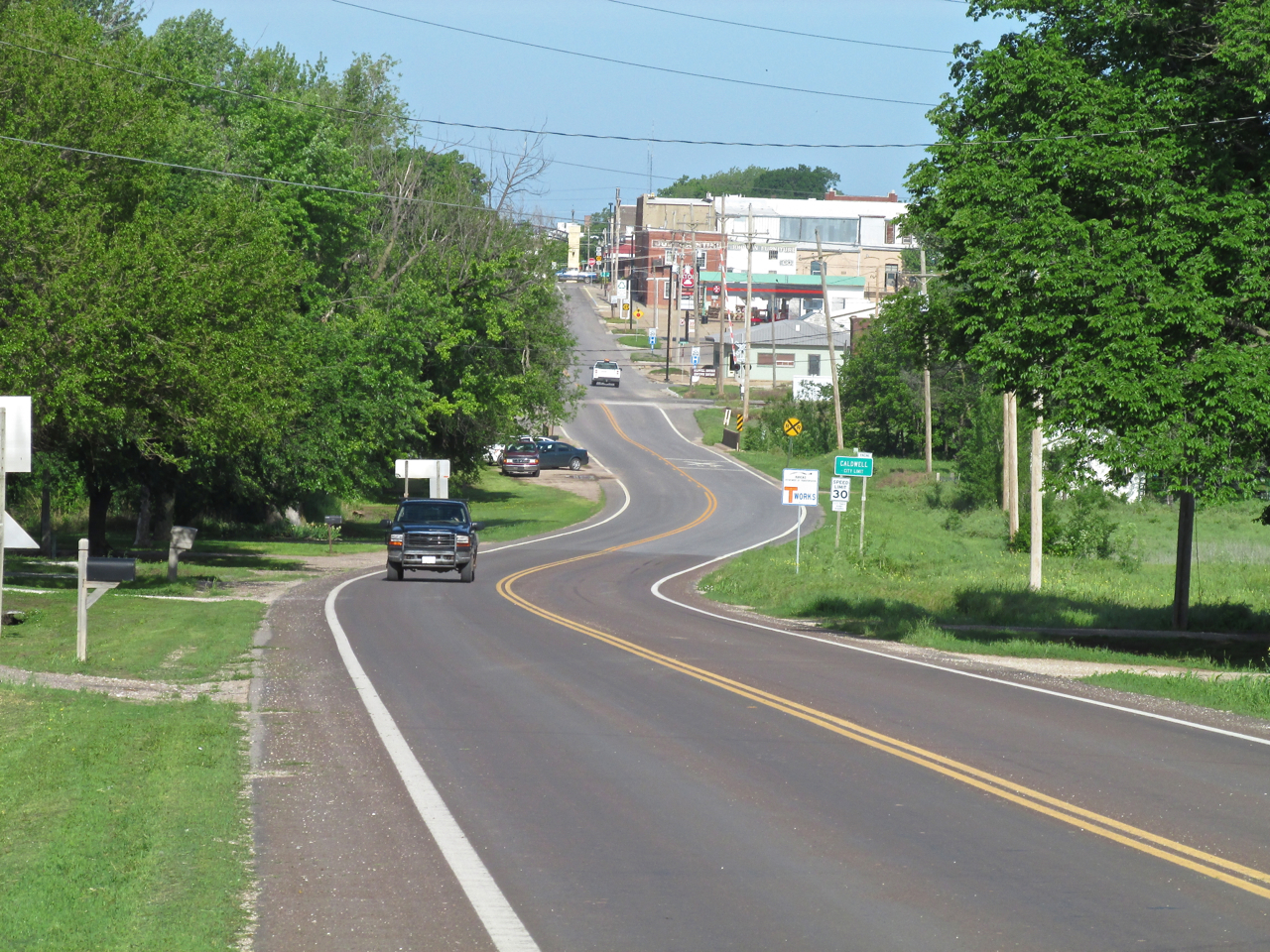
There is a slight dip in Hwy 81 approaching the downtown area from the East. It made for an interesting telephoto shot.
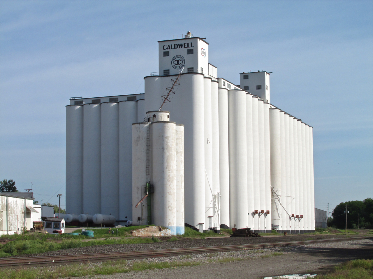
You gotta have places to store that wheat!
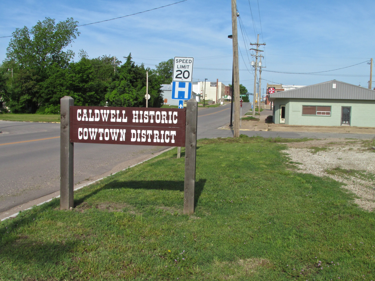
A Cowtown is a Cool Town
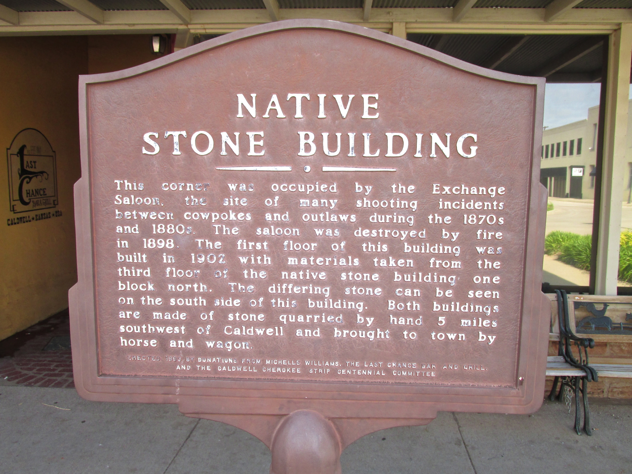
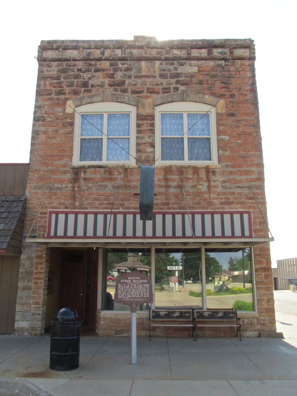
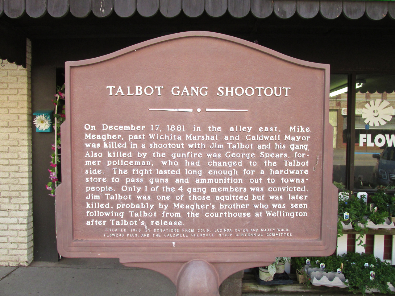
I still remember my surprise when moving to Wichita from California back in the 1980’s. At that time, many of the City’s Movers & Shakers were loathe to embrace the project called “Cow Town” (more properly called “Old Cowtown Museum“). I was shocked to discover that many of them believed anything connecting the phrase “cow town” to Wichita was a disparagement. To me, they were failing to see the huge promotional aspect of this worthwhile endeavor. Thankfully, these days that misplaced angst has abated and The Museum is doing well. In view of this experience I was happy to see Caldwell has embraced its Cowboy Heritage and invested money to enhance the experience for visitors.
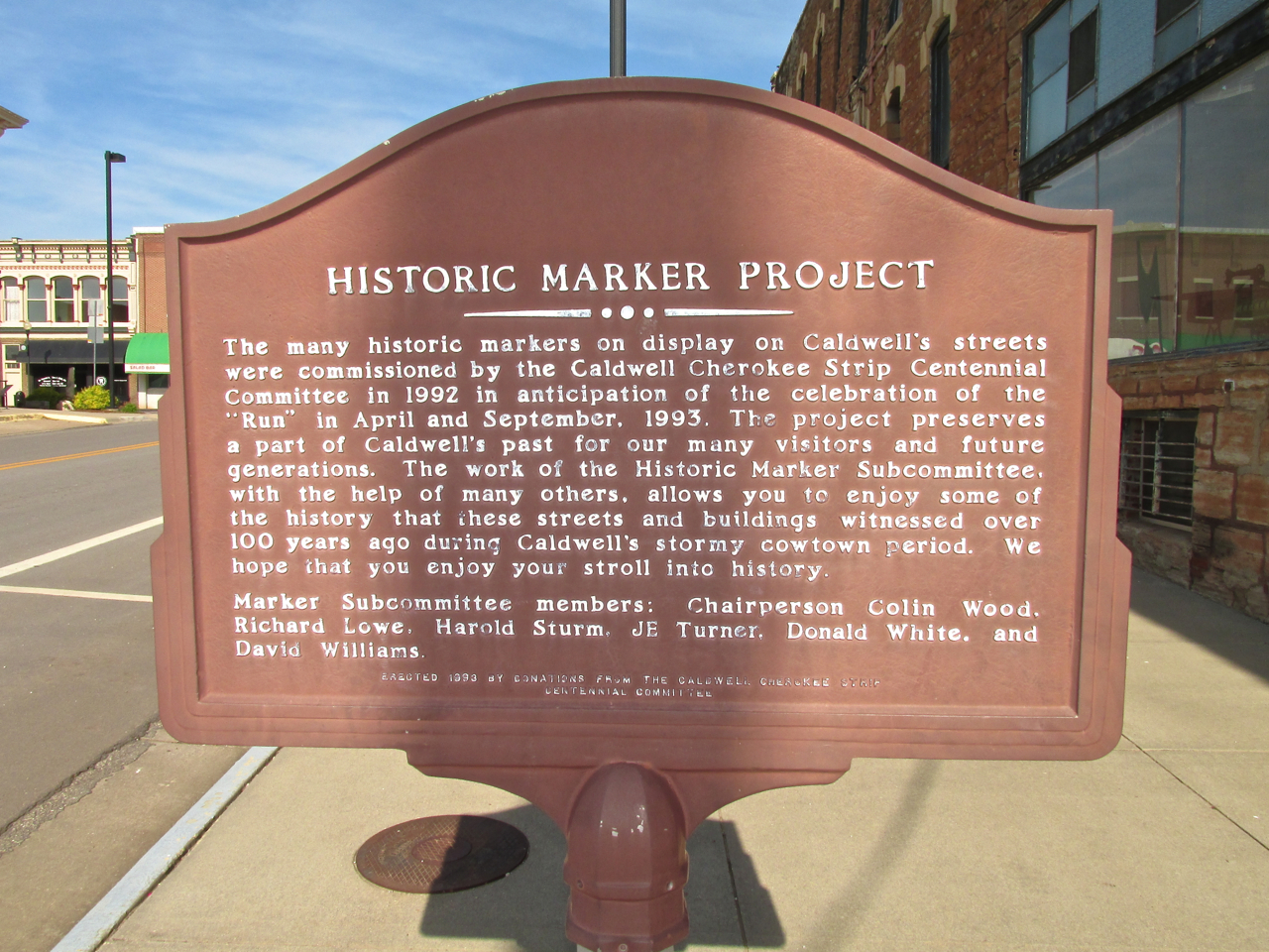
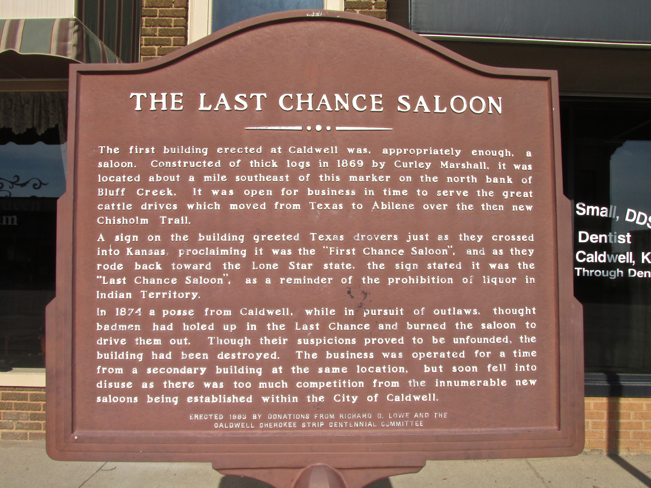
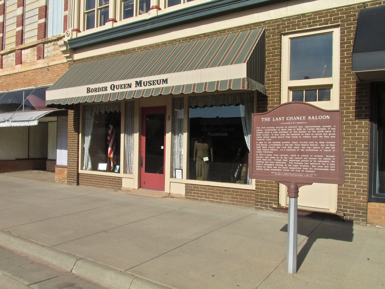
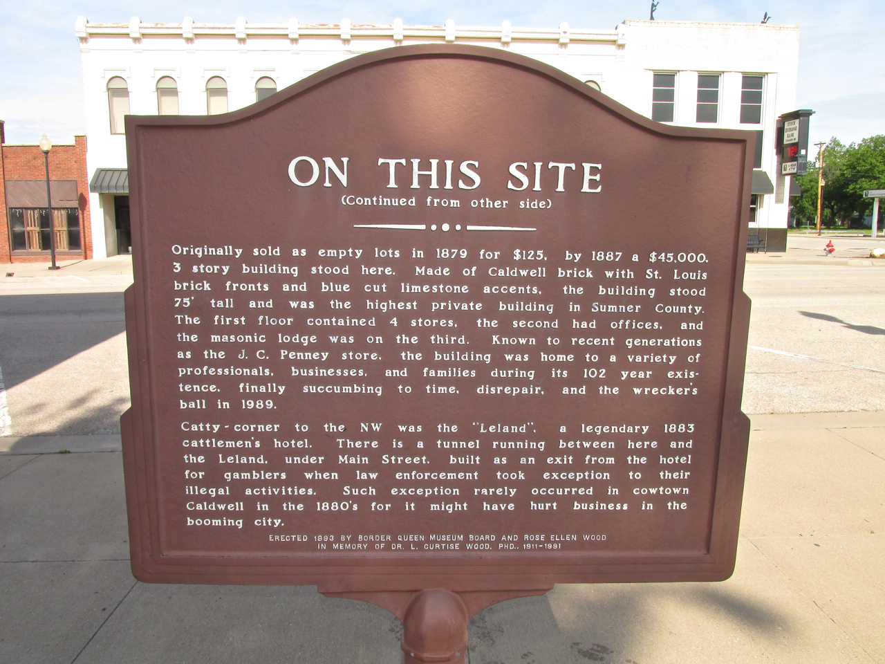
There are many markers of this sort in Caldwell. Rather than me reading them and then writing my summary of what they say, I have taken pictures of these markers so you can read them yourself.
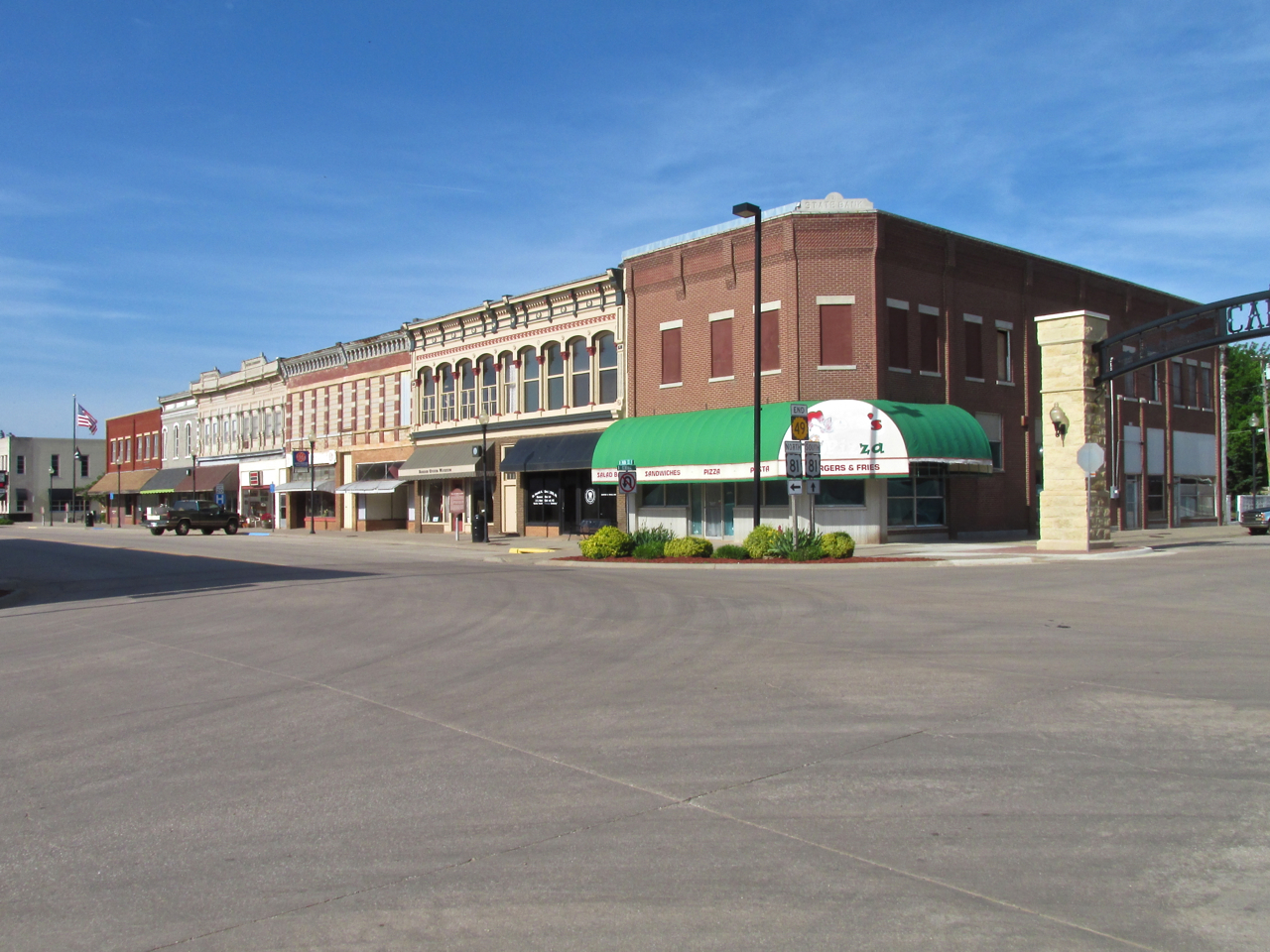
The corner of Main Street and Central looking Southwest.
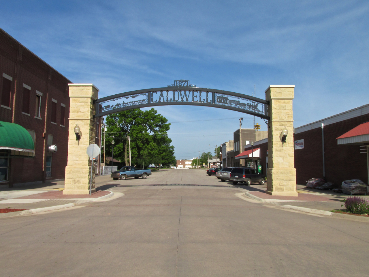
The town recently installed this magnificent gateway commemorating their part in the Texas Cattle Drives at the end of the 19th Century.
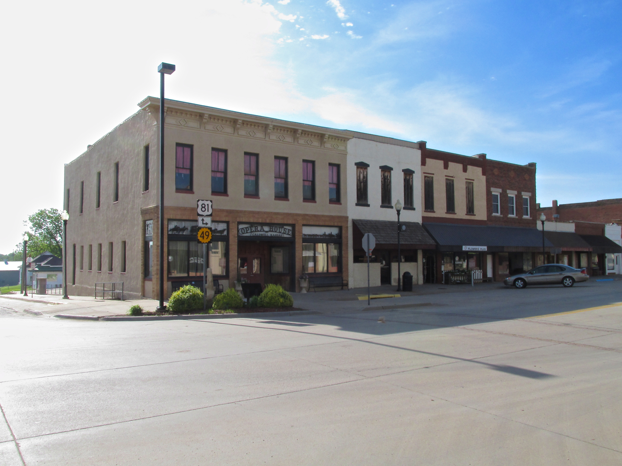
The Opera House and other businesses on the East side of Main Street.
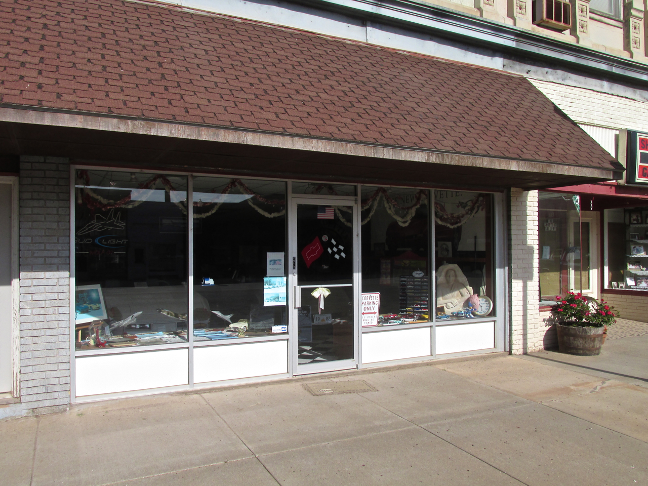
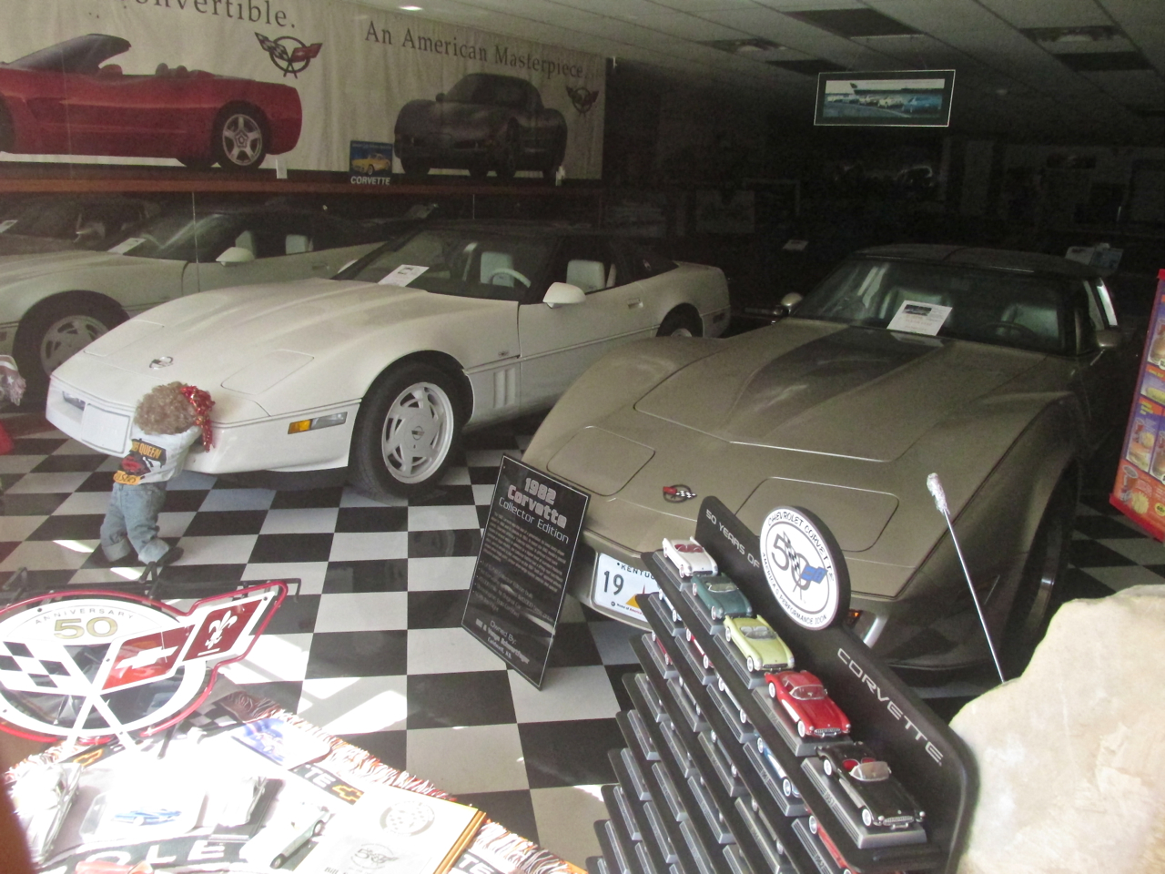
On the West side of Main Street is “B & V Vettes”.

On this Memorial Weekend I was heartened to see that The People of Caldwell respect and honor our Country’s War Veterans. This plaque is on the wall of a rest stop on Main Street.
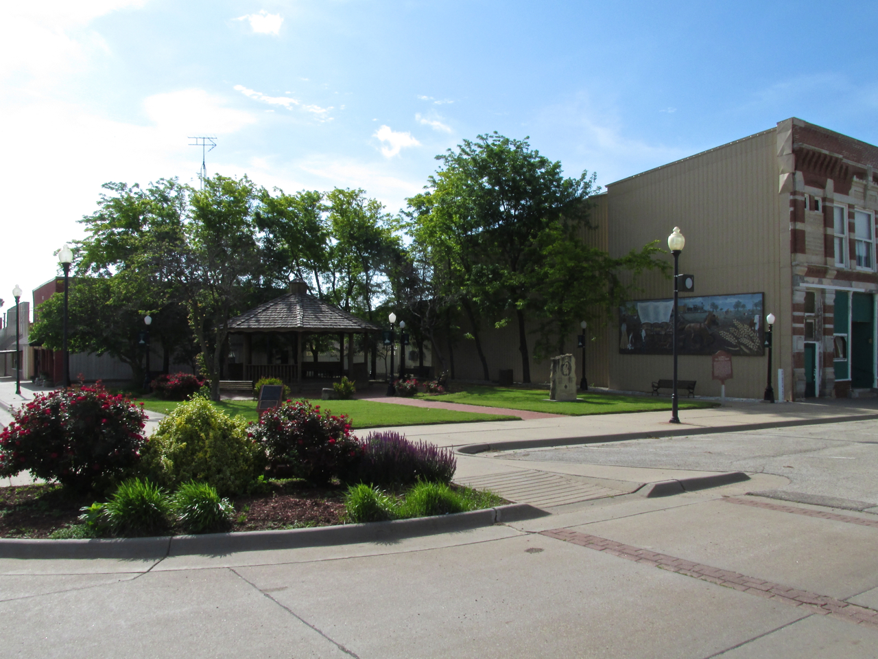
There is a delightful park at the corner of Main and 1st Avenue. The next few pictures feature it.
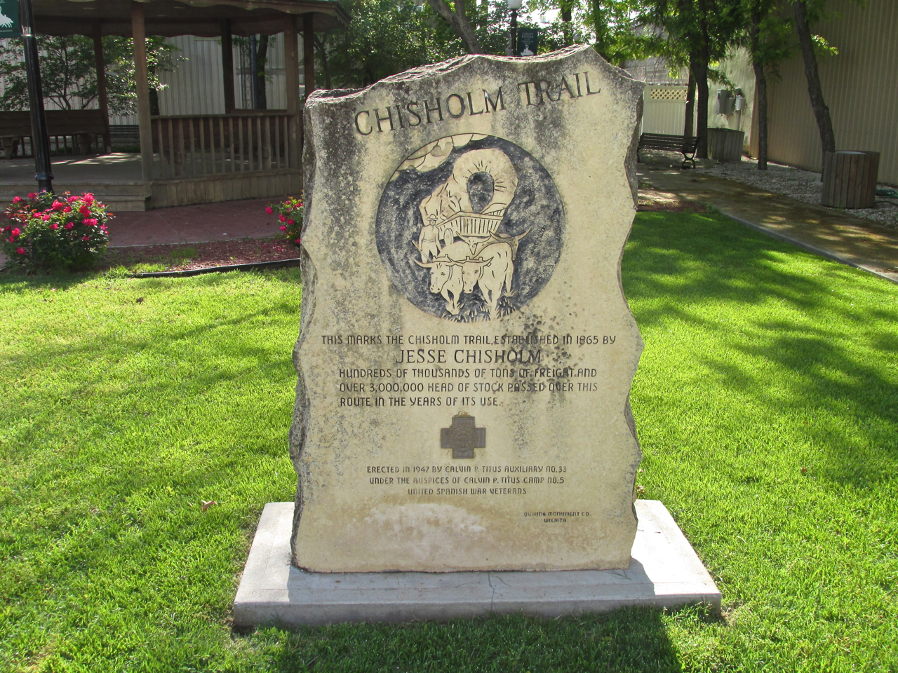

The Story Of “The Border Queen”
As I continued South on Main Street I happened across Jim Messing who works for the town.
Jim told me the new library had at one time been a bowling alley.

He said about every three years or so a cattle drive is taken down Main Street through town. I need to be here for the next one.
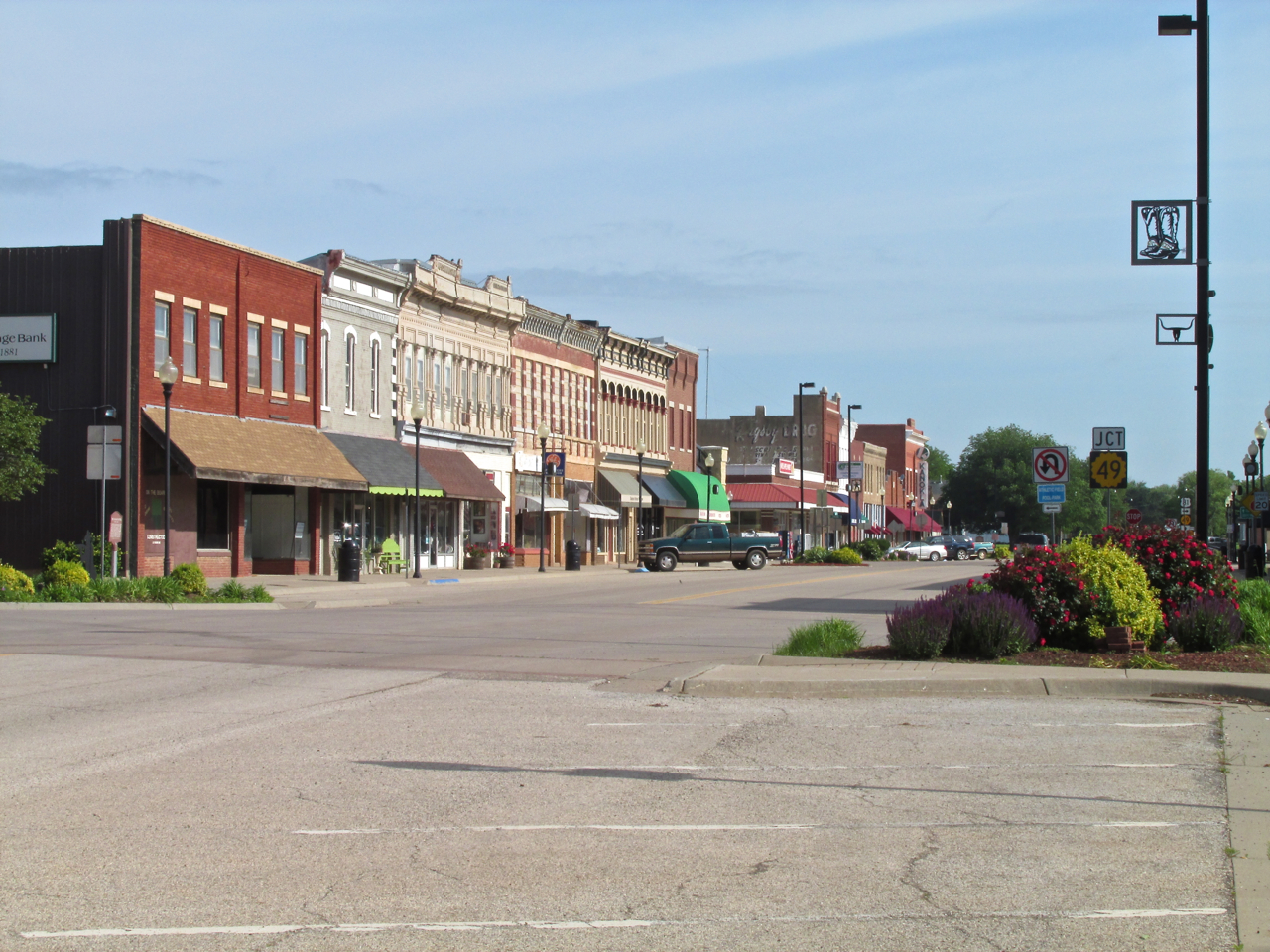
The corner of Main and 1st Streets looking Northwest. I was really impressed how well this downtown area is maintained. The flowers and shrubbery, signage and building facades impart graceful elegance to this historical place.
Time To Head Back
I retraced my path in the direction of the airport taking pictures all the way.
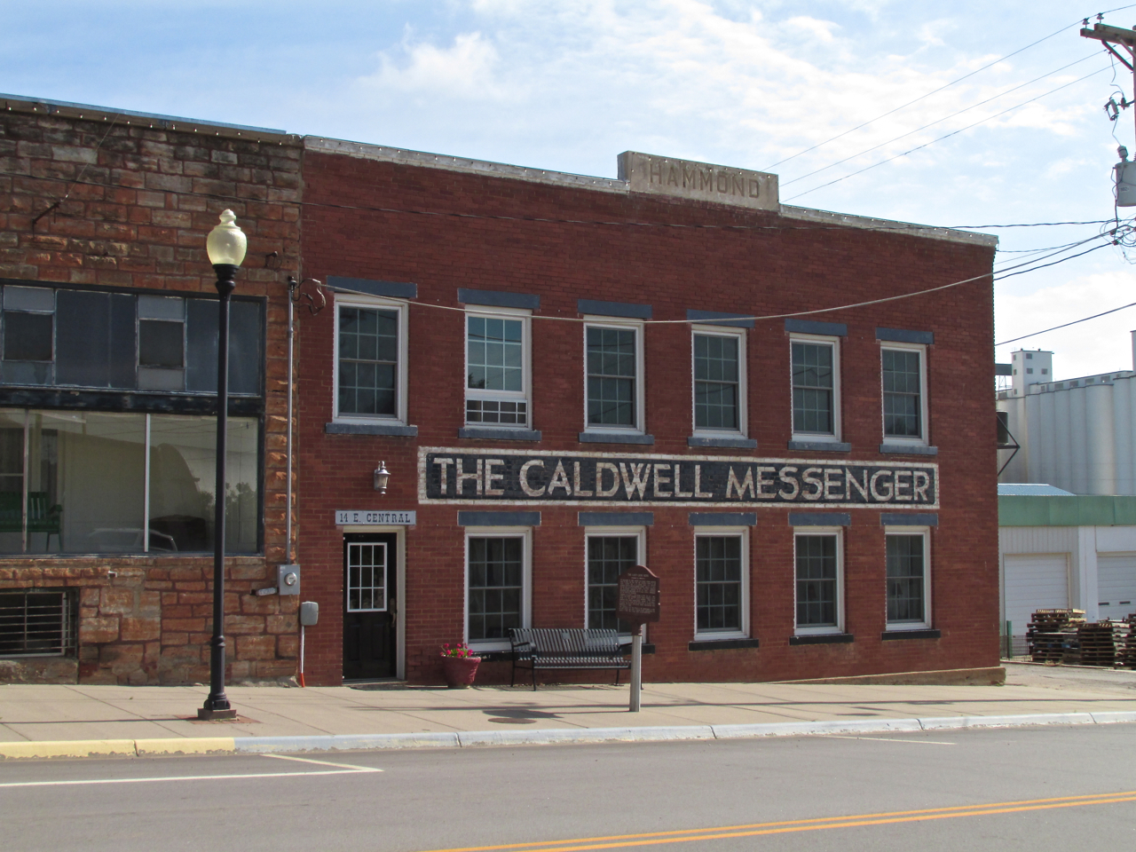
Caldwell’s Newspaper
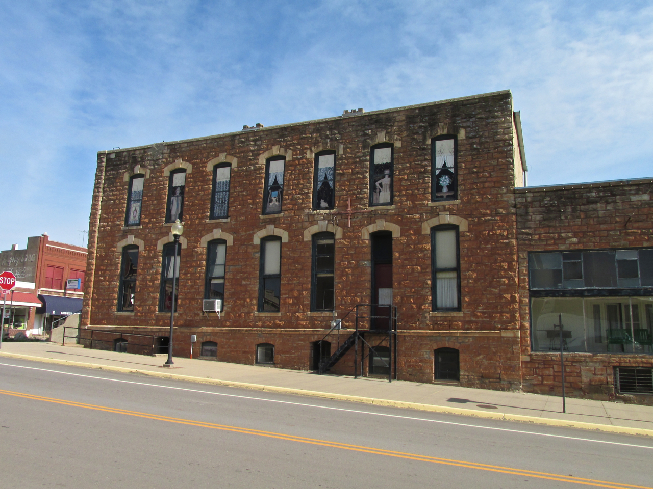
A very attractive stone building that now houses a photography studio.
Coffee – Friend Or Master?
A few years back (decades?) I remember a tremendous headache one afternoon. I had awakened very early that day because I had much work to do but it was not a “lack of sleep headache”. Nonetheless it was a mind bender. I mentioned it to my wife. She shot back her immediate and bullseye accurate diagnosis in the form of the question, “Did you drink any coffee today”. The question brought immediate realization. Thoughts flooded my mind at the implications presented by this query because: #1] NO – I had not had any coffee all day. 2] This meant I was having withdrawal symptoms. 3] Therefore I had to come to terms with this addiction and develop a plan for a cure.
America is a tough place for coffee addicts. With Starbucks and Quicktrips on every corner peddling the stuff, the only solution is to become a controlled user or at least one who likes to believe he has some semblance of control. One way I jumped out of this dark hole of dispair was to take my wife’s suggestion. I set High Noon as the absolute cutoff time for drinking the black juice each day.
Another way I have curtailed the habit was by making the mistake on two occasions of drinking my usual morning Java allotment before taking flight in my one seat, open air Ultralight aircraft. Einstein can talk about time expansion and contraction but there is nothing that can expand time like a full bladder and nowhere to go. A minute turns into an hour. The problem was soooo acute on a flight back from Kingman one day I had no choice but to land in a field a mere ten minutes after takeoff. I didn’t even shut the motor down before jumping out of the seat.
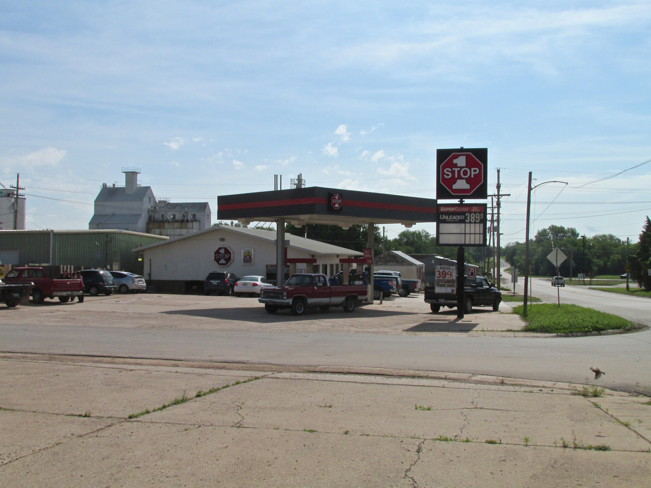
I provide this anecdotal medical history because about the time I shot the picture of the stone building above, I felt a familiar twinge in my cranium that I knew could only be assuaged by a medicinal cup of coffee. I know the sign of withdrawal. Providence was with me, though, because as I turned to the right I beheld the “1 Stop” shown below. Places like this crisscross the continent of North America ready to push oceans of coffee on struggling caffeinistas. I headed that direction when suddenly my cell phone buzzed. It was a message that my wife, Debra, had tried to call me – probably while I was in the air. I figured I could hold out a few more minutes so I dialed her up. But, instead of her sweet voice I got an unusually weird busy tone and a message on the cell phone screen saying “Emergency Use Only” (what could that mean?). Two more tries elicited the same result. I headed for the door of “1 stop” to see if they had a pay phone.
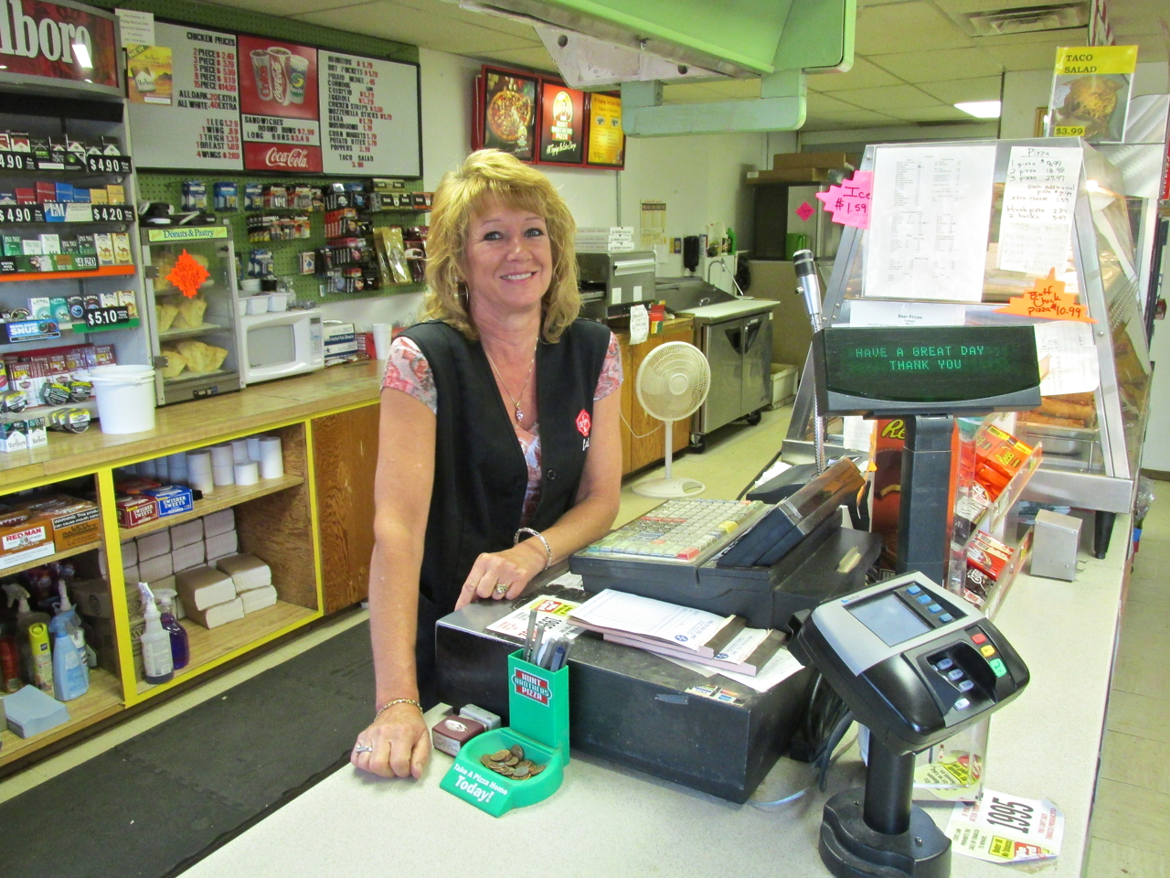
Lori Schmidt
Pay Phone?
The lady at the counter was being kind. Her name is Lori. Since the advent of cellular phones, I doubt there has been a pay phone in these parts for a decade. She politely responded that there was no pay phone. My problem was a known issue, though. She asked, “Are you on AT&T?”. I answered in the affirmative and she said my phone would start working about 3 miles down the road. When I explained I was walking back to the airport she volunteered me the use of her cell phone. I called Debra only to have her tell me it had become windy in Wichita and that she thought I should get back into town. I thanked her for the weather report and said I was on my way. I returned the phone to Lori and thanked her for the help. Finally, I was able to grab a cup of “Premium” coffee. I grabbed a spot at one of the tables and drank the hot brew slowly. The incipient headache left immediately.
New Buddies At The 1 Stop
Pretty soon I was in conversation with the group of gentlemen pictured below. Most of them were farmers – retired or active – in this area. I told them how wonderful the wheat looked from the air and how I appreciated their town. They informed me I had every right to be impressed with the wheat crop as this county (Sumner County) is known as “The Wheat Capital of The World”. I don’t know if my observation makes me really smart or really dumb. Mostly I liked the fact that “Wheat Capital” would be another great hook for this story already replete with Chisholm Trail and Cowboy references. As I learned about wheat from The Masters, Richard White cautioned me is that beautiful fields of wheat can be turned to junk this time of year if the hail falls. This brought to mind the plight of the folks of Norman, Oklahoma who had been devastated by a tornado a few days earlier.
The realization of how quickly things can change in life reminded me it is good to laugh, tell stories and drink coffee with friends while you can. And that we did. I drank my limit and told them I would take off and make a couple of circles above the field to the South of 1Stop so they could see what I was flying. Bob Burns offered to give me a ride to the airport.
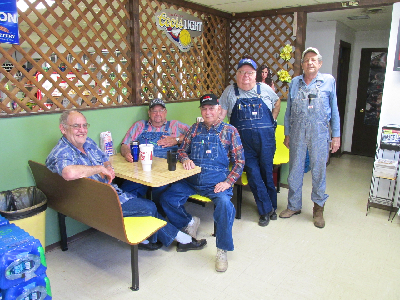
Bob Burns, Richard White, Don Schmitz, Gary Ginn and Jack Hajek
Airplane People Are Everywhere
On the drive to the airport I learned that Bob was retired from the aircraft manufacturing business. He probably knows more about my plane than I do. We arrived at the airport. I thanked him for the ride and he left.
After making a thorough pre-flight of the plane I taxied downwind a short bit, turned South into the wind, eased the throttle up full and took to the air. The MXL climbs almost vertically in this type of wind which by then was about 22-28 mph across the ground straight out of the South. I eased over to the empty field Southeast of the 1Stop and performed a couple high angle 360’s ending in a “pitchup” into the wind for the guys. After the final maneuver I turned downwind and left the area. I was clocking over 70 mph across the ground which meant my tailwind was 30+. This was part of my flight plan. Surf’s Up!

Wind On Wheat
Low Speed Aerodynamics
While the scene above may look like just another “wheat shot”, the main thing I want you to see is the wind rivulets deflecting the surface of the wheat. They give you some idea how the wind affects my Ultralight. Wind is not uniform. When studying for a Private Pilot License, wind is taught to be like a uniform mass. In fact, you hear the term “wind mass” used to describe it. I suppose this is a fair way to approximate the concept to beginners, but frankly, it is off the mark. How far off the mark becomes very evident at the slow speed I cruise at – 38 miles per hour. Moving through the air at that speed, the true nature of wind becomes more apparent. It behaves more like “tubes of force” moving at differing velocities at random positions throughout 3 dimensional space. Sort of like many fingers jabbing. The way it deflects the surface of the wheat provides a two dimensional “snapshot” vision of this concept. A motion picture would make it more clear but this is all I have for you at the moment…
Another thing about this wheat crop that is evident from flying above is the exceptional uniformity of it. Kansas Farmers have made High Art of growing The Staff of Life. This is The Best There Is Anywhere. Marvelous!
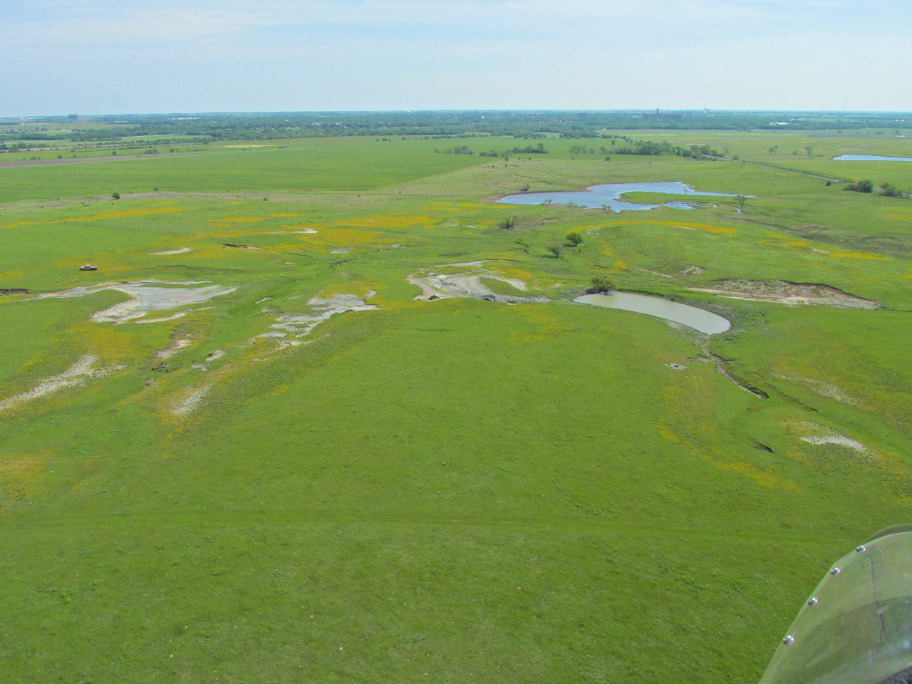
The vista I saw in front of me from 400 feet AGL Northeast of Caldwell looking North.
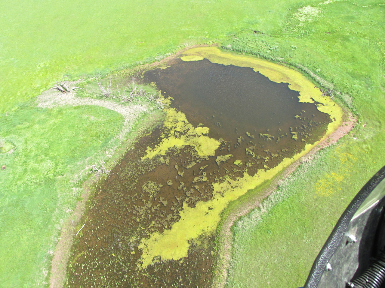
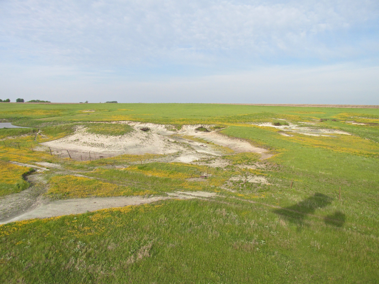
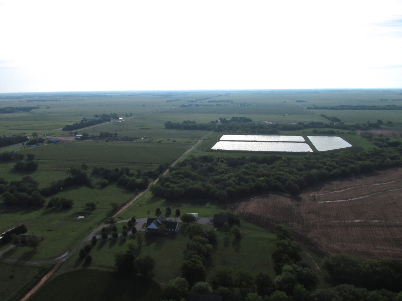
A couple of years ago when I flew in this area all the ponds were bone dry. I talked about that HERE. Even with the algae, this represents a resurgence.
About 10 minutes North of Caldwell I picked up this rail line heading to Wellington. Keep it in your mind for later in the report…
Looking East – 200′ AGL
Corbin, Kansas – I didn’t see anyone outside on that windy morning.
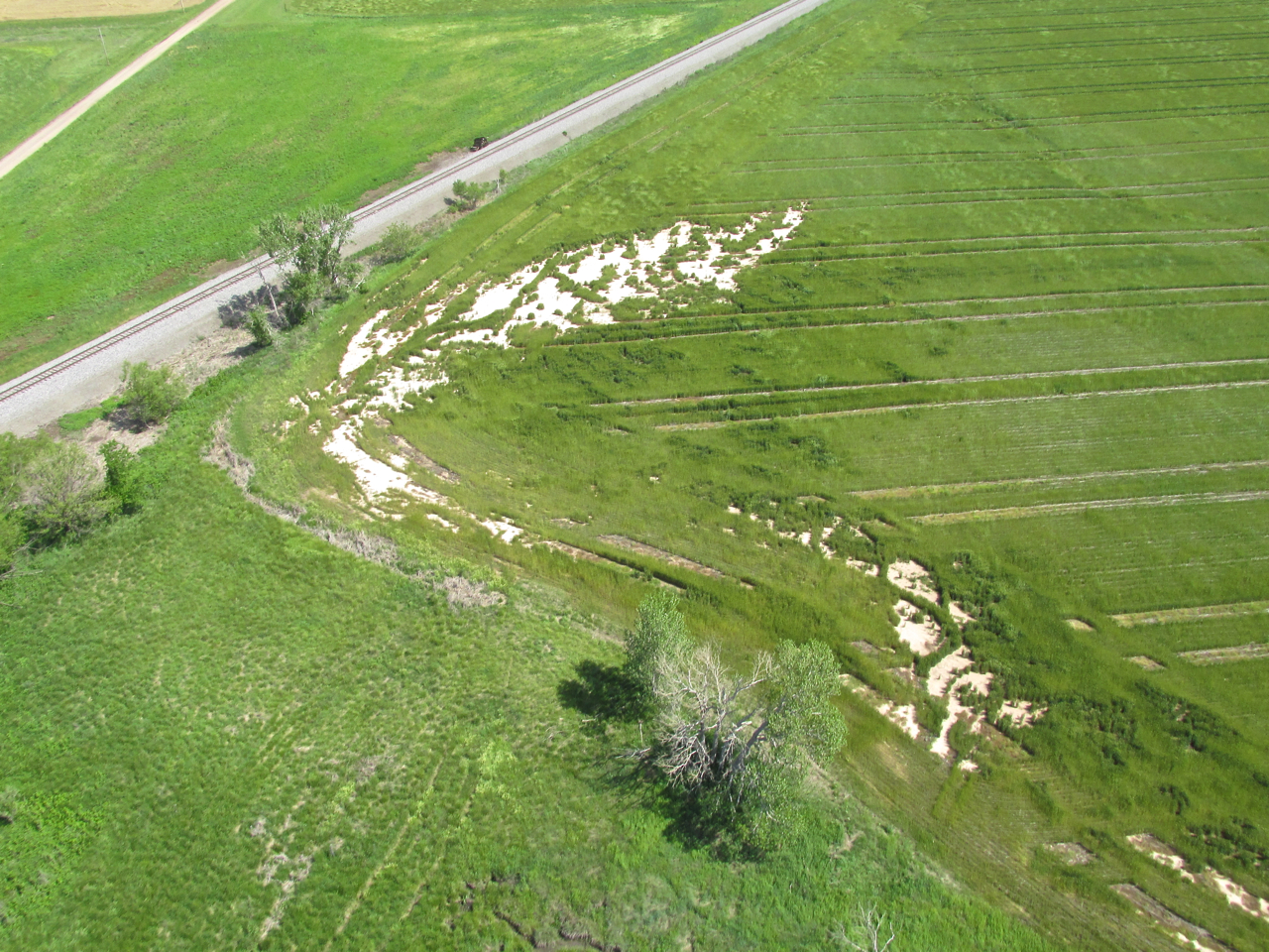
Still following the rail line, I noticed this patch of sand interrupting the otherwise seamless carpet of green wheat.

I think this is Perth, Kansas.
Railroad Concern
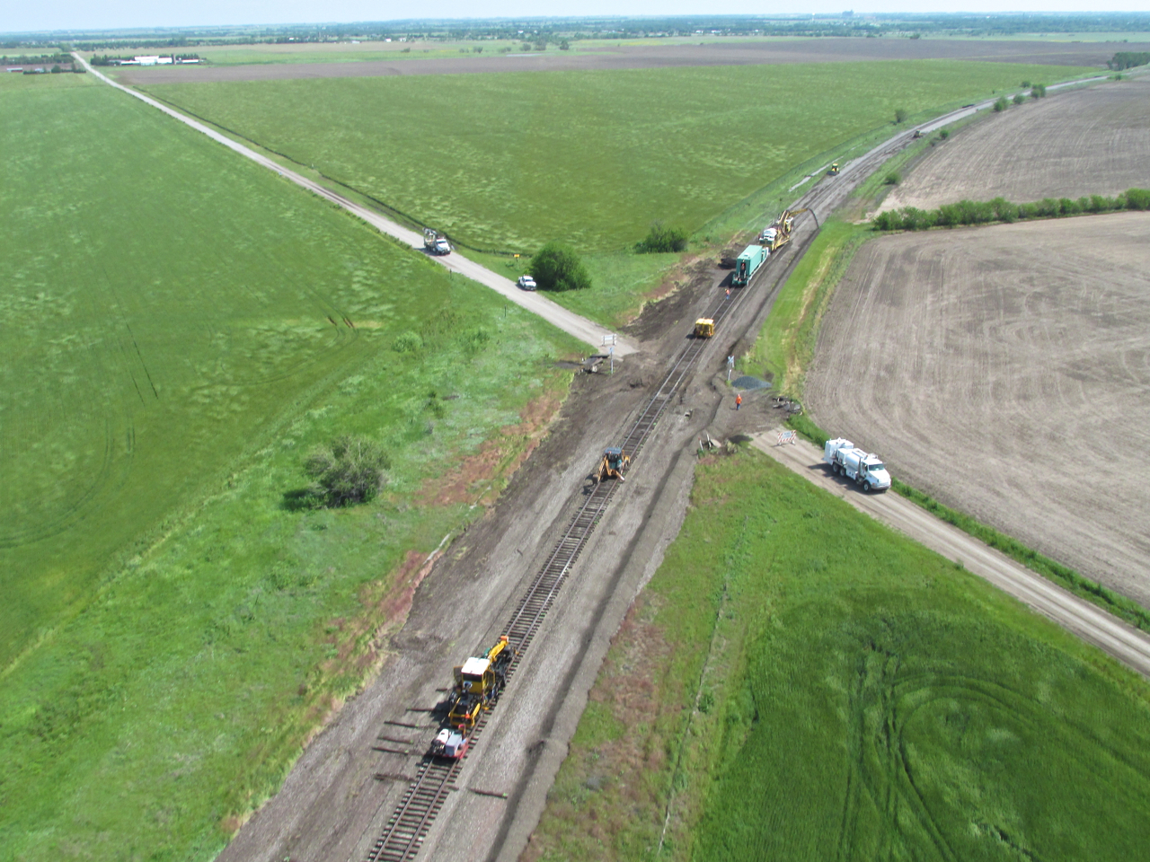
The railroad track was continuing to parallel my course. Suddenly, as you can see in the photo below, I saw a work vehicle on the track. I looked farther down the line and could see the lights of what I thought was an oncoming train. The work vehicle seemed to be moving pretty fast toward an intersection so I thought his plan was to get off the track before the train came by.

A Work Vehicle On The Track (Note the wind patterns on the wheat in the foreground. It was fairly turbulent by now)
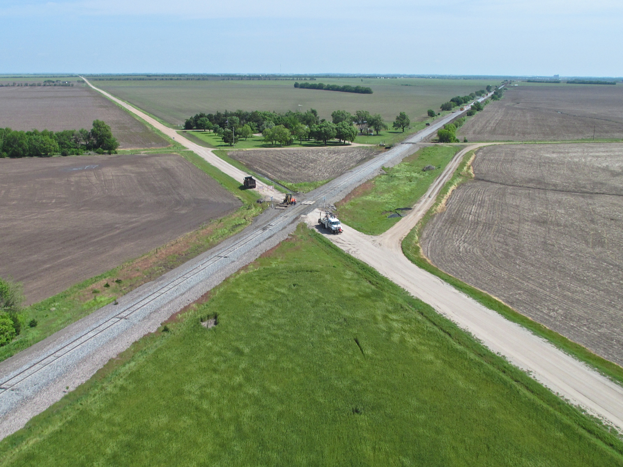
This intersection was in the direction the previous vehicle was heading. Farther down I saw what I first took to be an oncoming train. I was hoping he would get off before a collision. On the horizon you can see Wellington, Kansas.
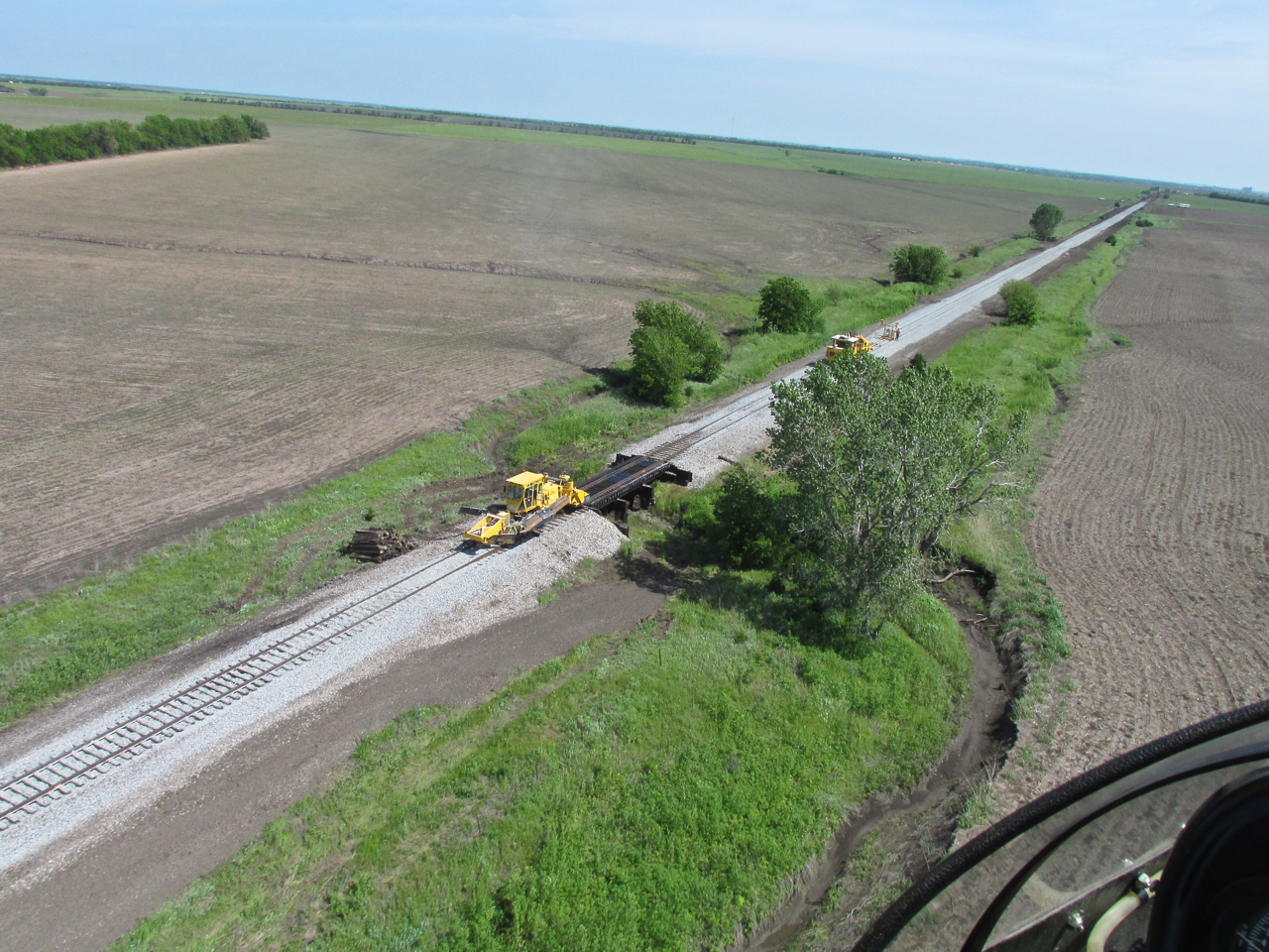
About now I realized this was a railroad track crew spread out for miles along the line. They were repairing and updating it.
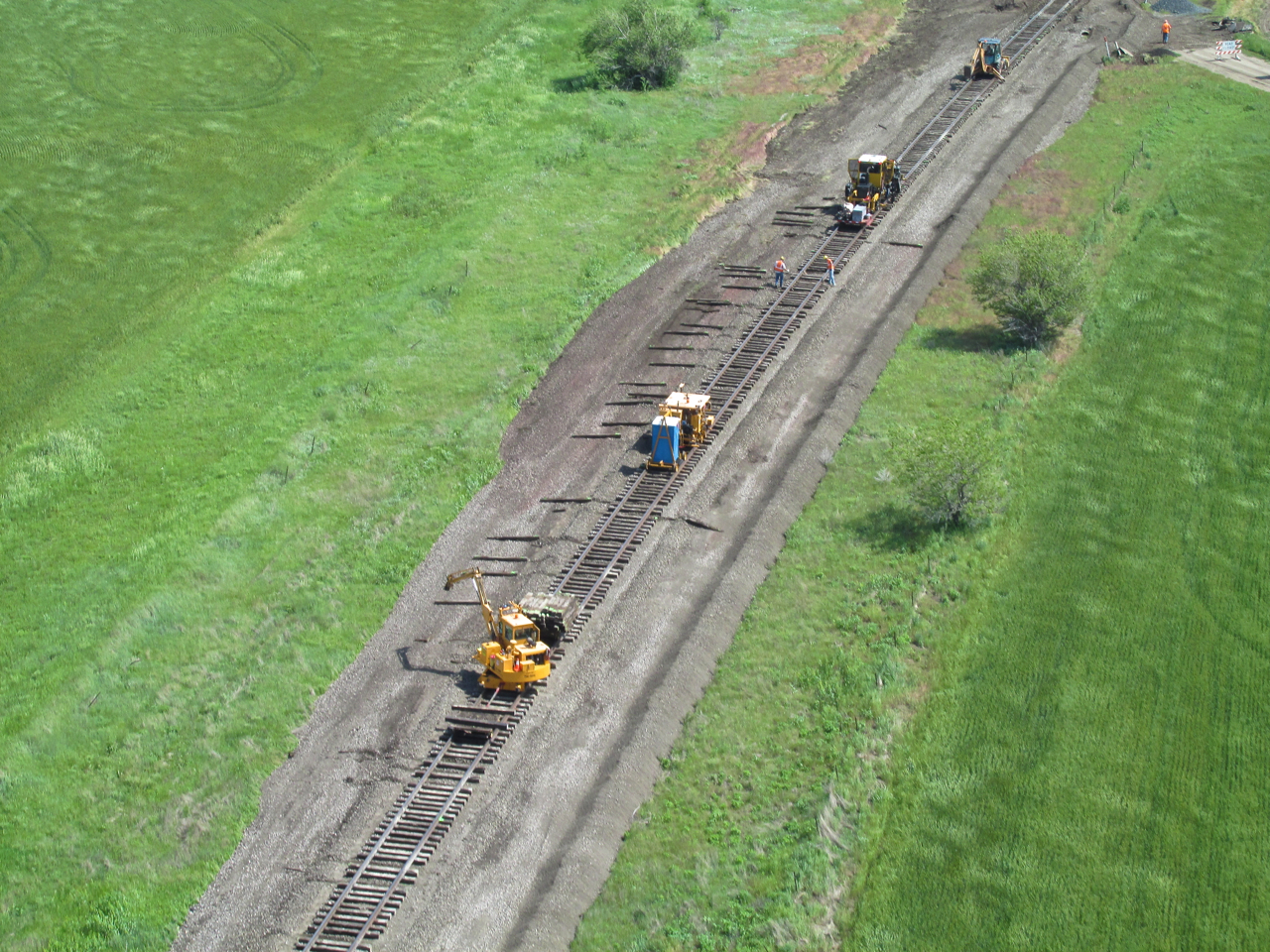
As I approached each work group I could tell the noise of the wind in their ears was masking the sound of my engine and propeller. They did not notice me until I passed by. I have seen a documentary featuring the equipment used to repair and upgrade rail lines. The machines are fascinating to watch. I did my best to take the pictures you see but the tailwind and the turbulence were doing their best to confound my efforts.
At this point I could see the largest rig of all but my course and the railway were diverging. I did not think this angle produced a good enough image. So, I crossed over the railway, continued in the direction you see ahead and made a 180 right turn over the field. Now slowed down flying into the wind I set up on the East side of the rail line. From there I took the photo below.

You can see the impressive nature of this heavy equipment better from this angle. I waved at the guys and you can see them waving back. After that I made a hard right and “caught the wave” heading South again.
I liked this scene for the yellow flowers and ponds. Wellington is in the distance and would be East of my flight path. A rancher was out checking the field in his pickup.

Suburbs on the Northwest side of Wellington, Kansas.

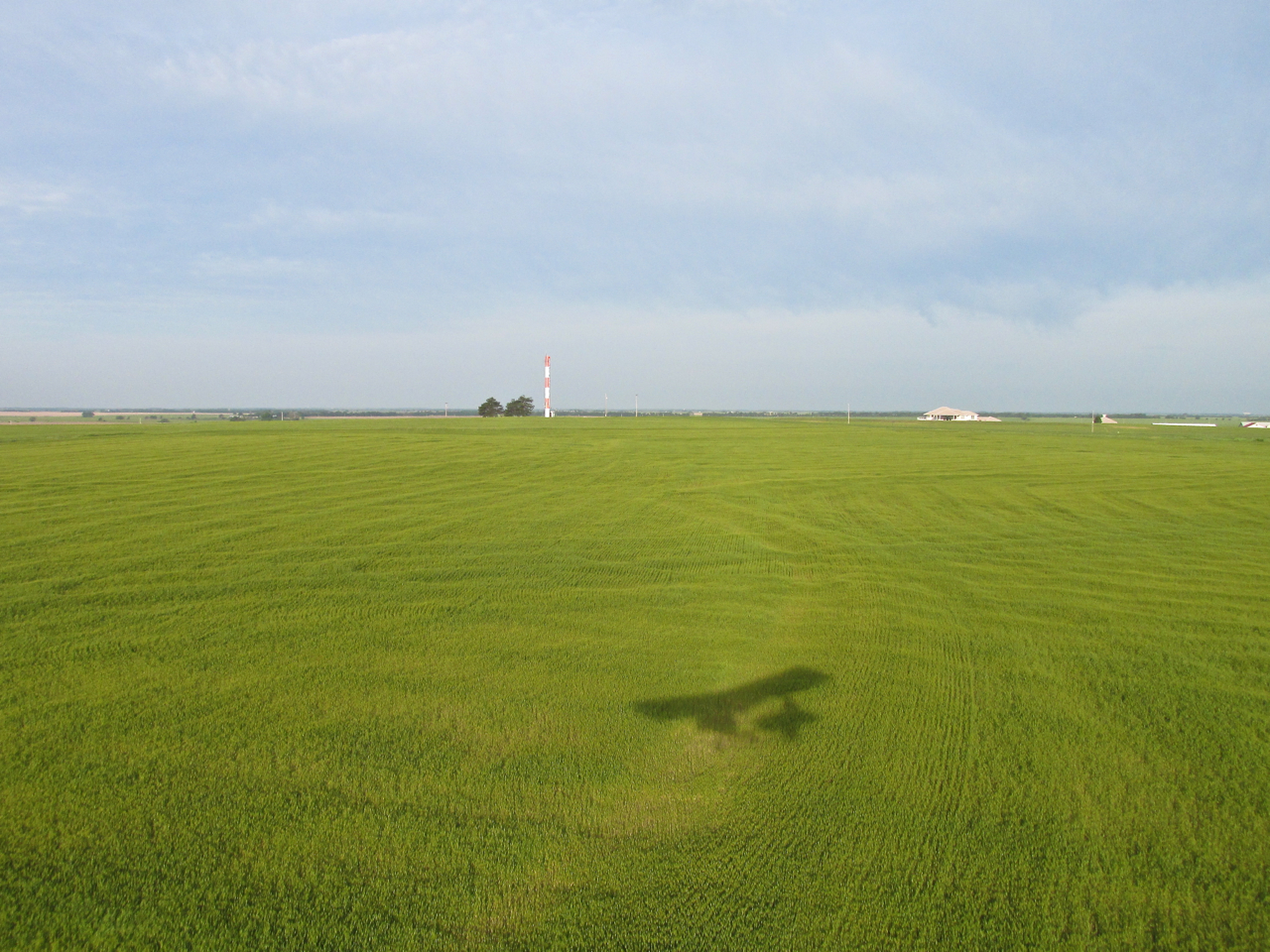
“Fleeting Shadow”
Wellington Municipal Airport. I have a story about the Fly-In held there in the fall of 2012. You can see it HERE.

This is my pick for “Best Homestead On The Prairie Seen That Day”. It is North of Wellington a few miles. I am at 100′ AGL looking East Northeast.

A little farther North I saw this “X” runway. I’m guessing the guy flies a Powered Parachute. Years ago I produced a movie called “A Beginner’s Guide to Powered Parachutes“. That was back when VHS was still King. It sold pretty well.
They were either expanding the building or putting a new roof on it. This spot next to the river is choice.

On the final stretch to Selby Aerodrome, I took a few shots to show I-135 coursing into Wichita, Kansas from the South. This one turned out best. It reminds me of the admonition to “Follow The Yellow Brick Road to The Emerald City”.
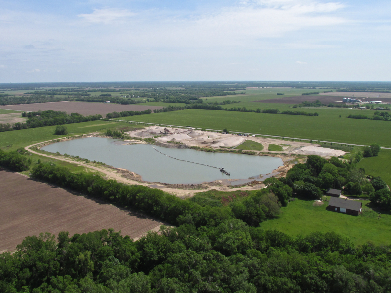
This sand quarry is 4 miles South of my home field. I am intrigued at the amount of sand they have been able to pull out of it over the years. It is neat to look at from above. I think it is called Aggregate Sand & Gravel of Mulvane.
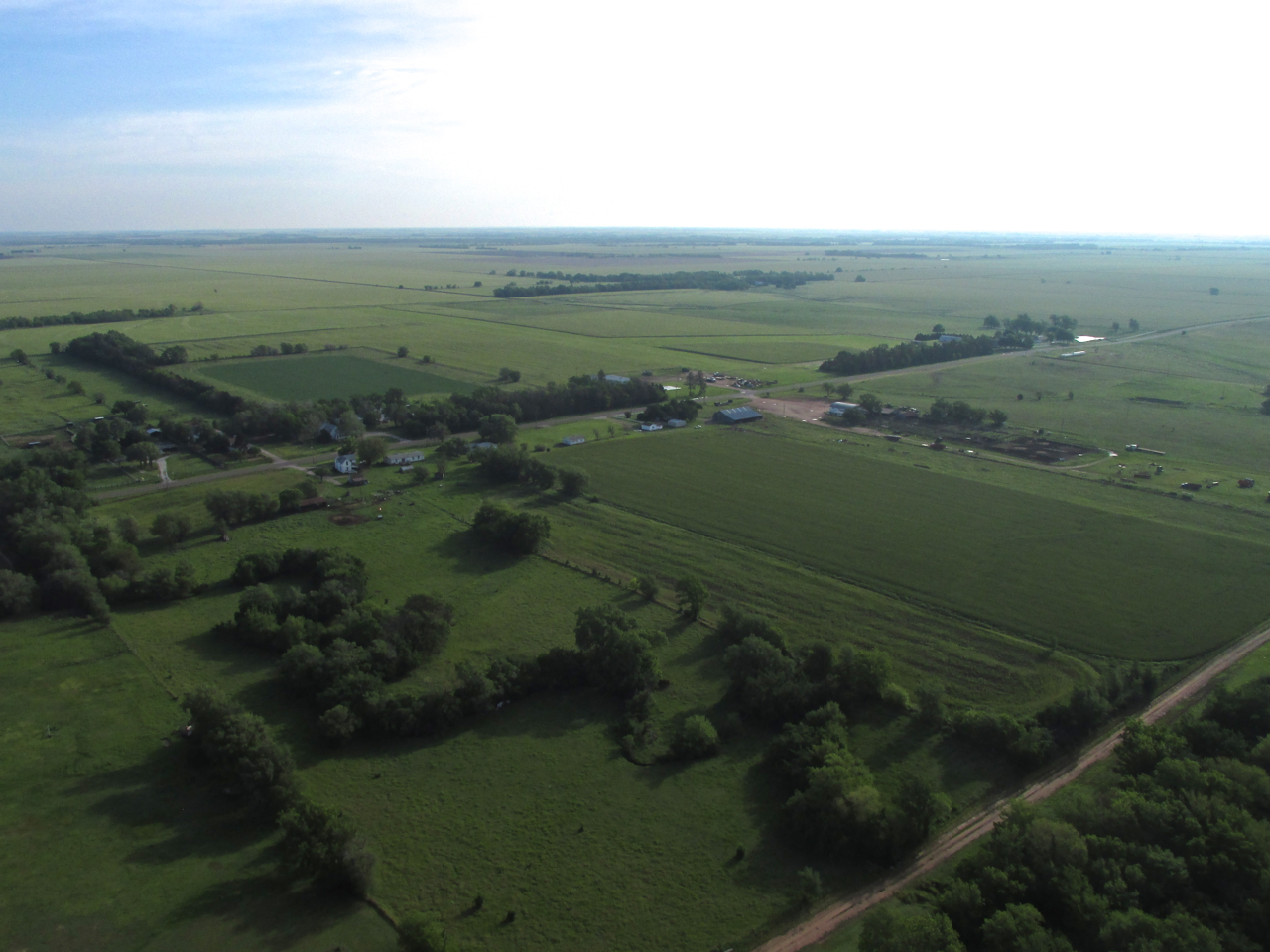
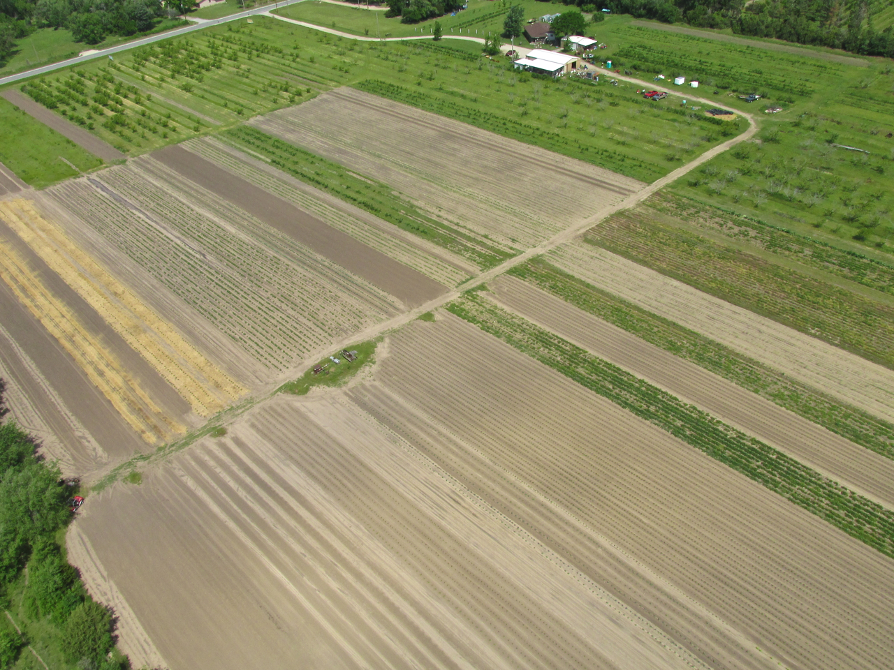
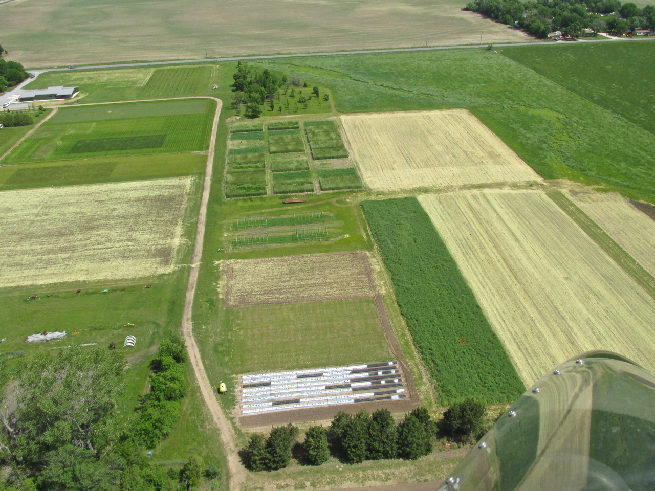
Test Plots?
The next two shots are fields just a mile South of Selby Stables & Aerodrome. I get the impression they are in the business of testing or improving plants or perhaps they supply shrubs and plants for suburban yards. I have not driven over there because my business is always at the airport. I think I will check it out this Summer.
In The Groove
Just North of the final picture is Selby Field. Because it was quite windy I didn’t think any of the other guys would be out. Nonetheless, I carefully scanned for traffic as I entered the pattern. The winds were 20 mph with gusts to 30. I made a few circuits of the field for fun and practice. Because of the breeze I decided I would have to land and taxi into the “wind shadow” of the round hangar so I could get out and open my hangar’s door. Wind that is gusting that high presents the real possibility for flipping my Quicksilver over on the ground once I de-plane. I was setting up to land when I saw the familiar truck of my Good Buddy Steve Ewing pull up at my hangar. He keeps three planes in the round hangar. Steve entered my hangar and opened the big door for me so I was able to land and taxi right into the hangar. Perfect! He said he heard me circling and thought I would like to pull right in.
This was the second time in two weeks Steve did this for me. Man, I’m starting to feel like I get Valet Service at the Selby Aerodrome. Thanks, again, Steve!
See you next time!
Blue Skies & Tailwinds!™
Brian FitzGerald
Awesome adventure Brian! I enjoy reading and seeing the images … keep it safe up there in your air adventures.
Steve Cannaby
Thanks, Steve. Last Saturday I flew up to the National BiPlane Fly-in at Junction City. 6 hours of air time round trip. It was fantastic. I will be writing it up ASAP.
I know you like to fly those simulators but all these Fly-Ins would benefit from the arrival of you and your trike.
When can we expect to see that happen?
I appreciate these excellent photographs so much, have shared them with other Misak’s and will keep them forever. I love the one photo coming into Wichita on the road from the east. That’s how we drive “home” twice a year to Grandma’s house!!!
Dear KK,
I’m glad you liked them. That was a memorable flight I have told many of my friends about. I have suggested they fly or drive to Caldwell, too. I probably caught the best time of the year with the new wheat but I am going to fly over again this season to see what it looks like at other times, too.
Blue Skies & Tailwinds!™
Brian