If At First You Don’t Succeed…
Those of you who follow The Sky Surfer’s exploits know that I attempted a flight to Ellinwood, Kansas on 18 May of this year (the story is HERE). It was not a complete success. A variety of issues forced me to abort the mission and head back home. This was a “first” for me but I guess all records count for something…
Keeping My Ear To The Ground (Sky?)
On the 27th of June, my Lovely Wife and I were returning from Denver. We had spent a few days with our Daughter and her Husband sightseeing and to watch his graduation from Tech School (see a video of his team’s Robo-Guitar HERE). We had a great time. During the eight hour drive back to Wichita that Friday, I asked Debra to check the weather report for the next day. I had only made one flight in June and was ready to Hit The Surf before the month was out. Usually during Summer in Kansas the winds are from the Southwest (We children of the ’70’s all know this from Kansas’ tune “People of the South Wind” written about the Kaw Indians from whom the name for The State of Kansas is taken). Anyway, as I directed our car down I-70, she utilized her iPhone to check the forecast. When she reported the wind on Saturday was to be from the Northwest, I knew vindication was at hand! The stinging defeat I had suffered in the middle of May had been ever-present in my mind. With winds typically switching South at the end of May, I faced the prospect of carrying this burden of defeat for six months or more until Northerly winds resumed. This untimely turn of atmospheric events changed everything! In the morning I would attempt the run to Ellinwood – again.

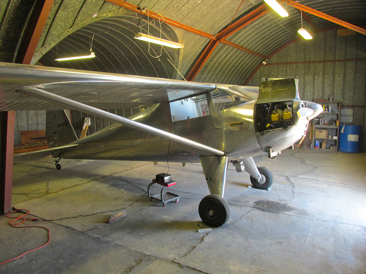
Before Sunrise, Saturday 28 June. The wind is nil and out of the Northwest – as forecast.
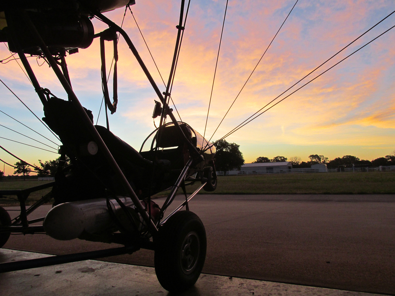
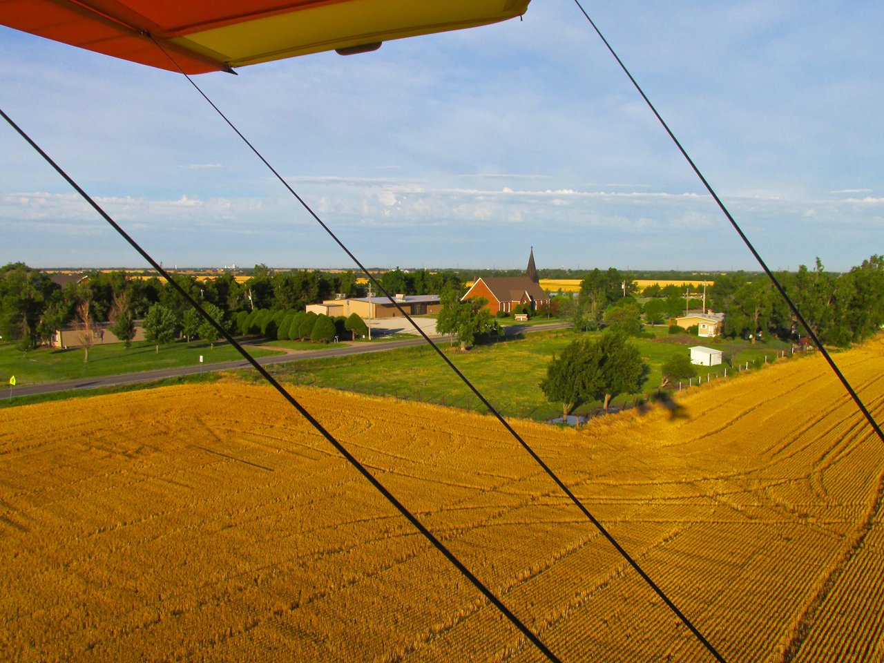
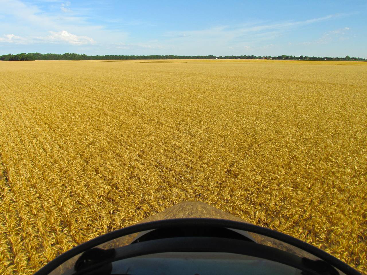
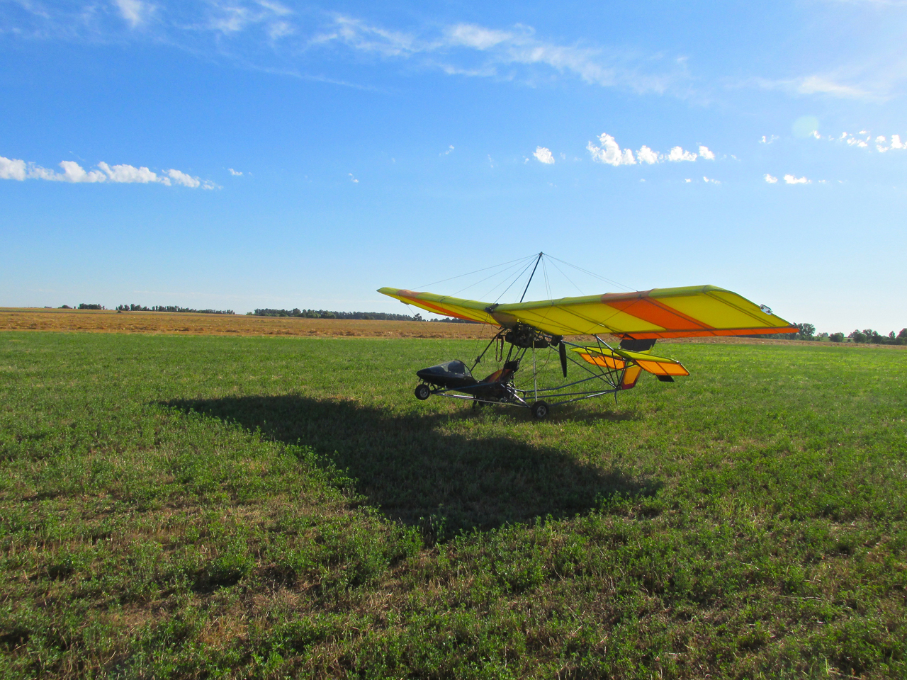
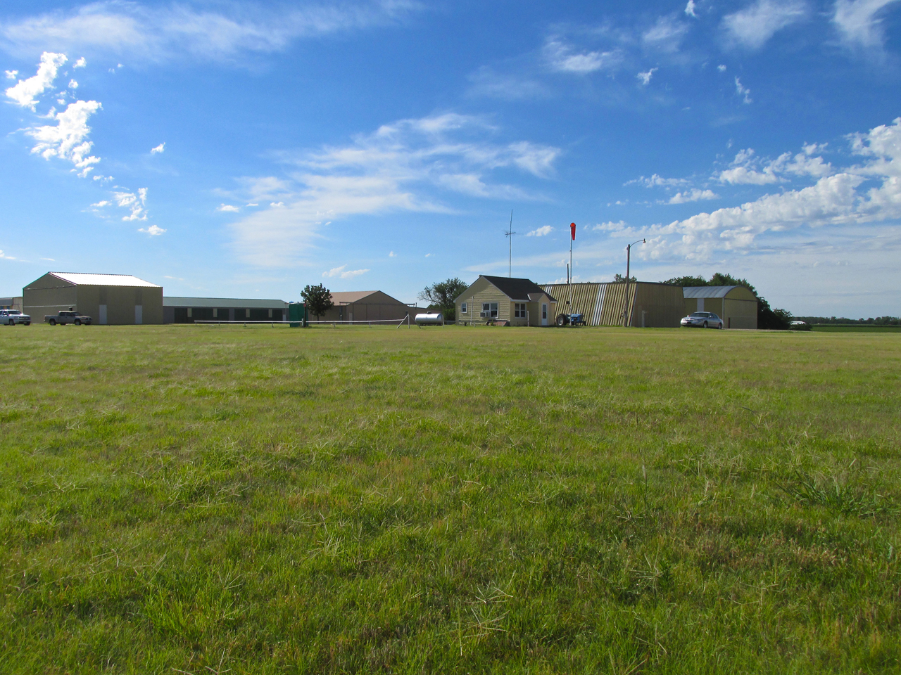
A “Plane’s Eye View” out the hangar door before rolling out to the runway.
Take To The High Way
Since the Middle Ages, the term “highway” has meant a primary road between cities or towns. With the advent of the motorcar, its meaning has changed to mean any road of substantial surface inside a big city or urban area as well as a connector conveying traffic between towns, cities, metro areas and States.
I see it a different way. My “High Way” is a point of view rather than a surface. It’s a way of seeing and experiencing the countryside without signals, crossings, traffic lights, traffic… Floating like a butterfly over an endless and ever-changing magical landscape… No windshield – a thousand aromas, constantly changing temperature and humidity. I rise higher when I want to see farther or to cross tree lines. I drop back down just above the surface to glide in “ground effect“. A solo activity. No radio. No conversation. Quite often not thinking about anything other than just being one with the air. In many ways, far less demanding than driving a car but, by the same token, absolute in its particular requirements.
(Hmmmm…. Having said all this, do I now call those long strips of concrete and asphalt ground-pounders drive their wheeled vehicles upon “Low Ways”?)
Ellinwood was a great “High Way” trip. In this next series of pictures you will see what I saw as I saw it.
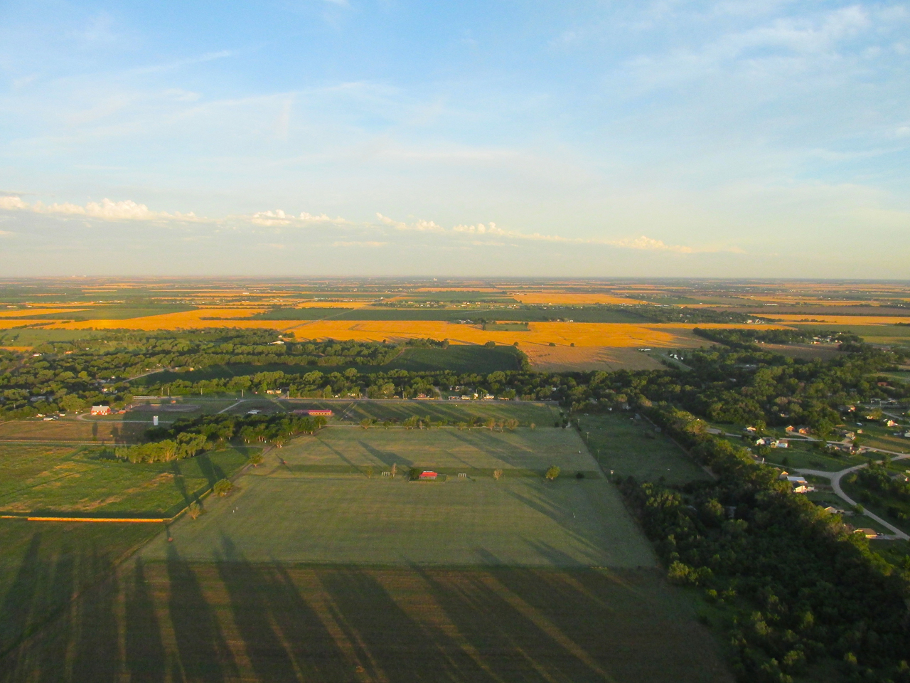
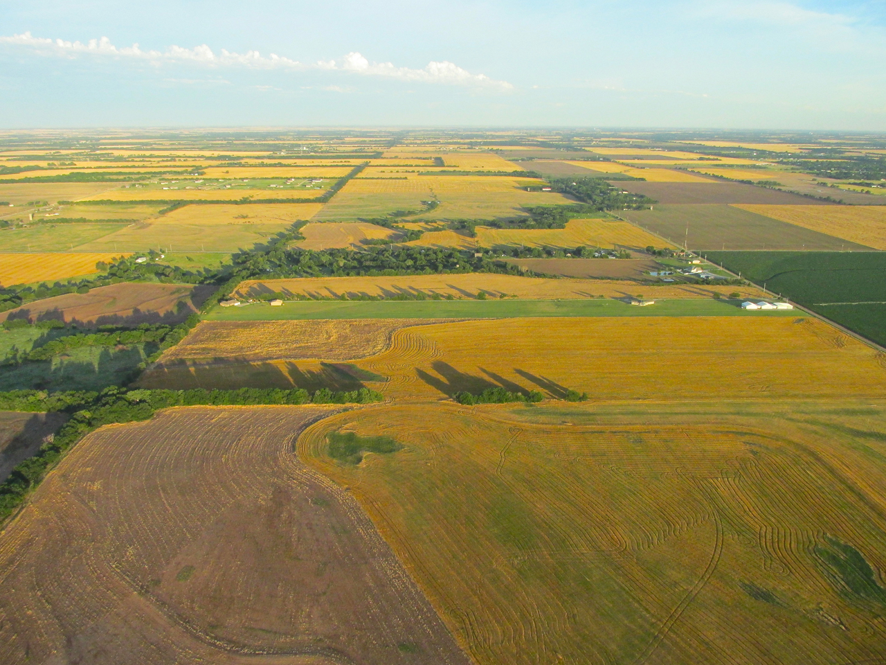
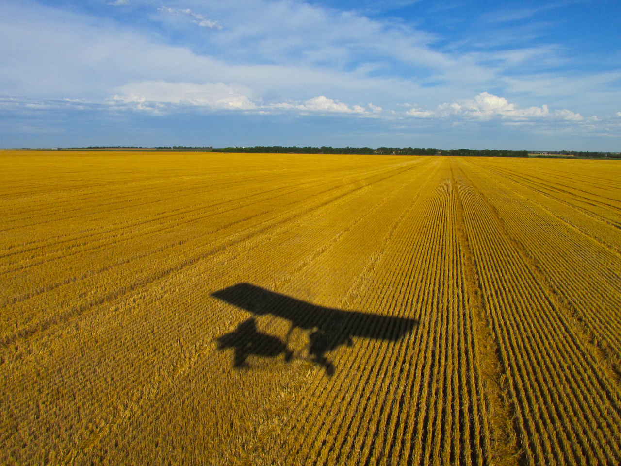
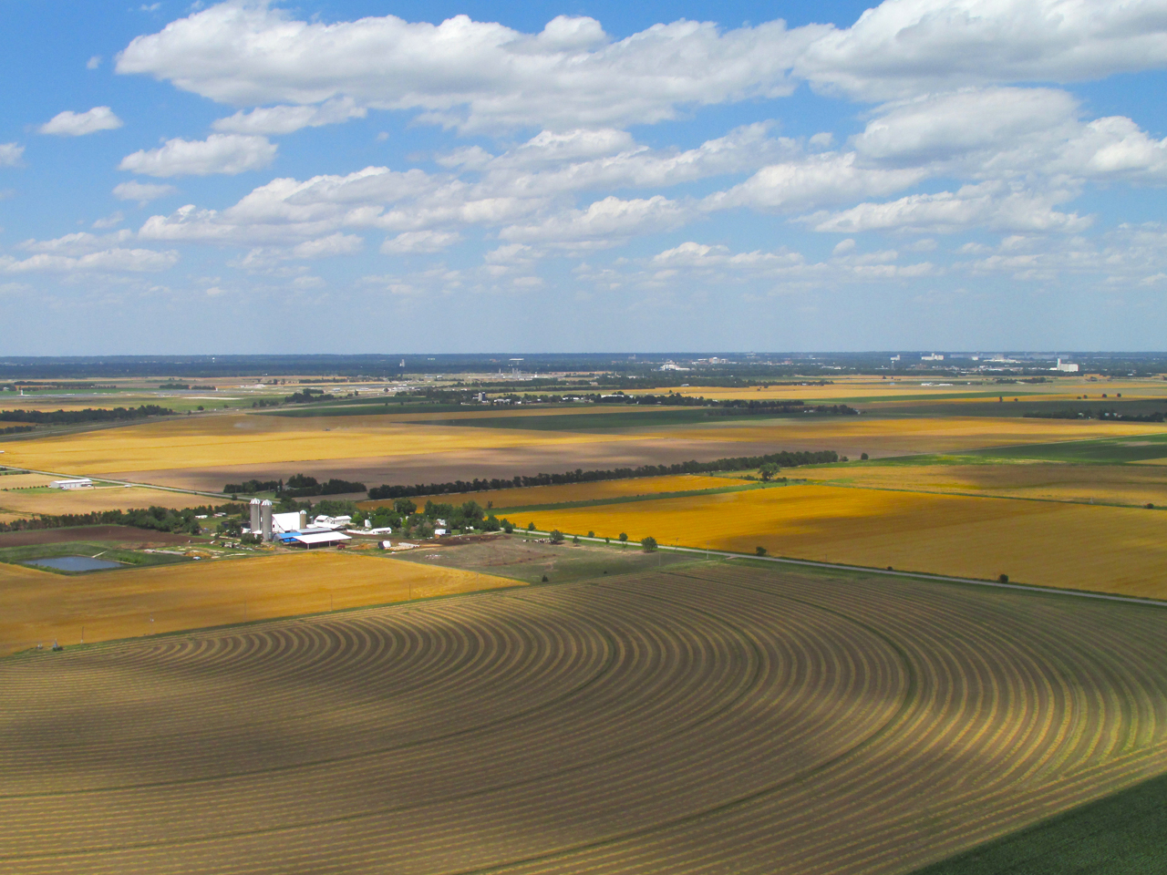
Just after takeoff about 1/2 mile West of Selby Aerodrome at 800′ AGL looking West.
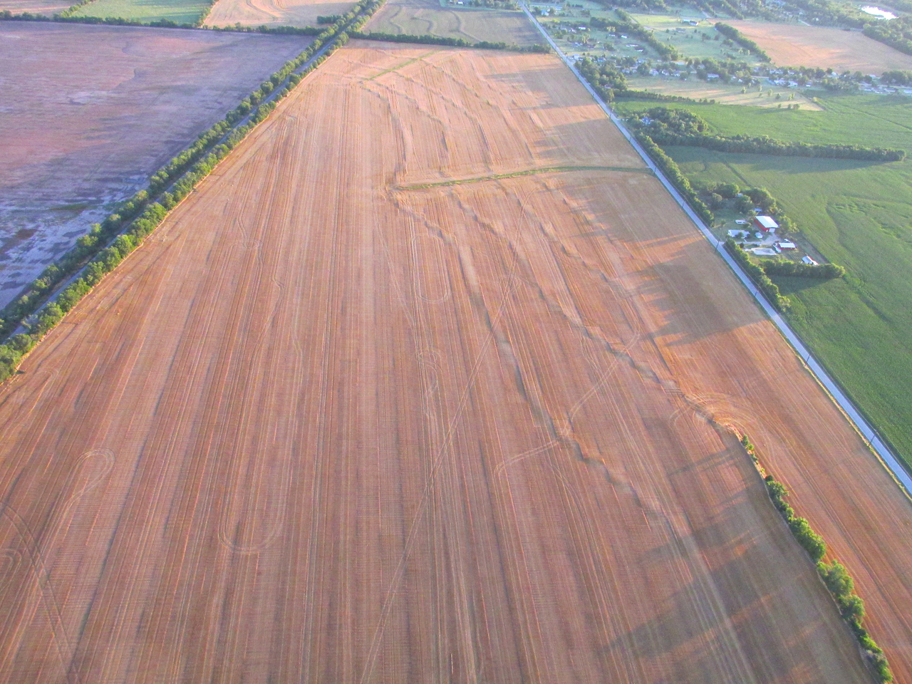
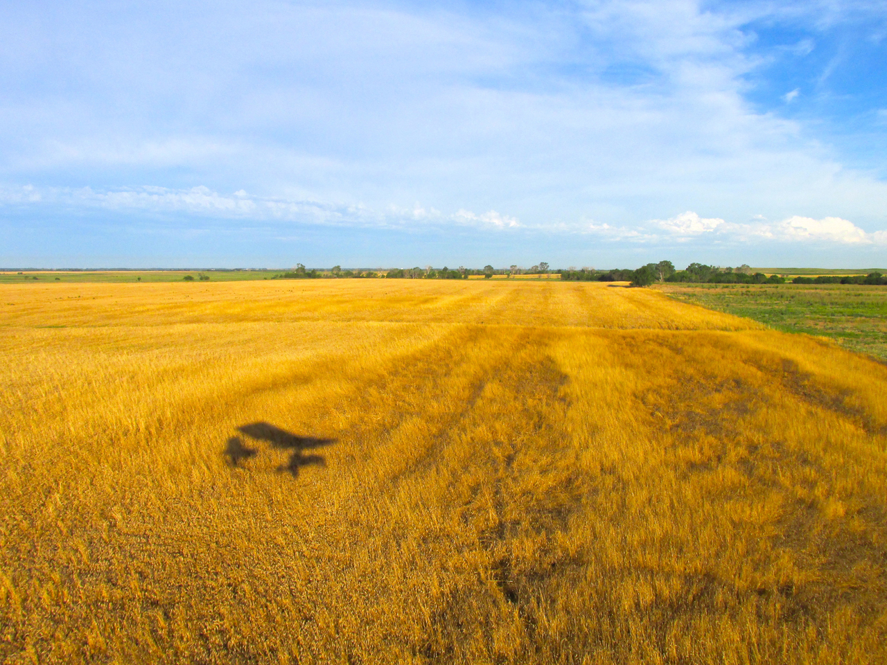
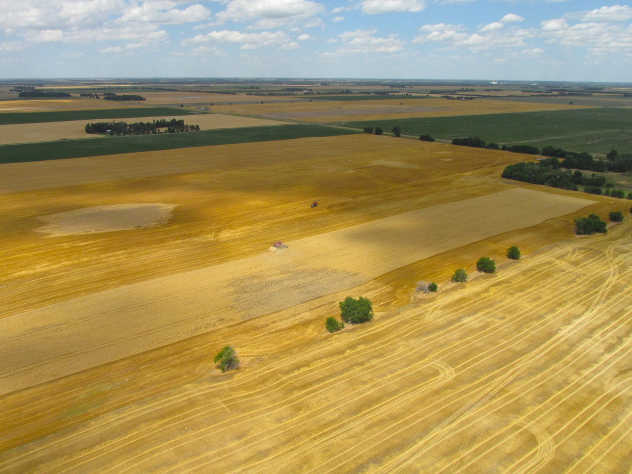
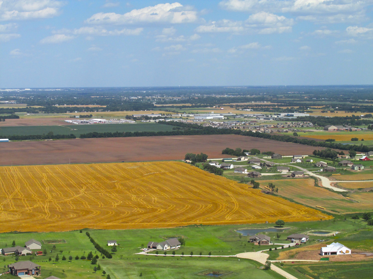
The contour ridges in this plowed field caught my eye.
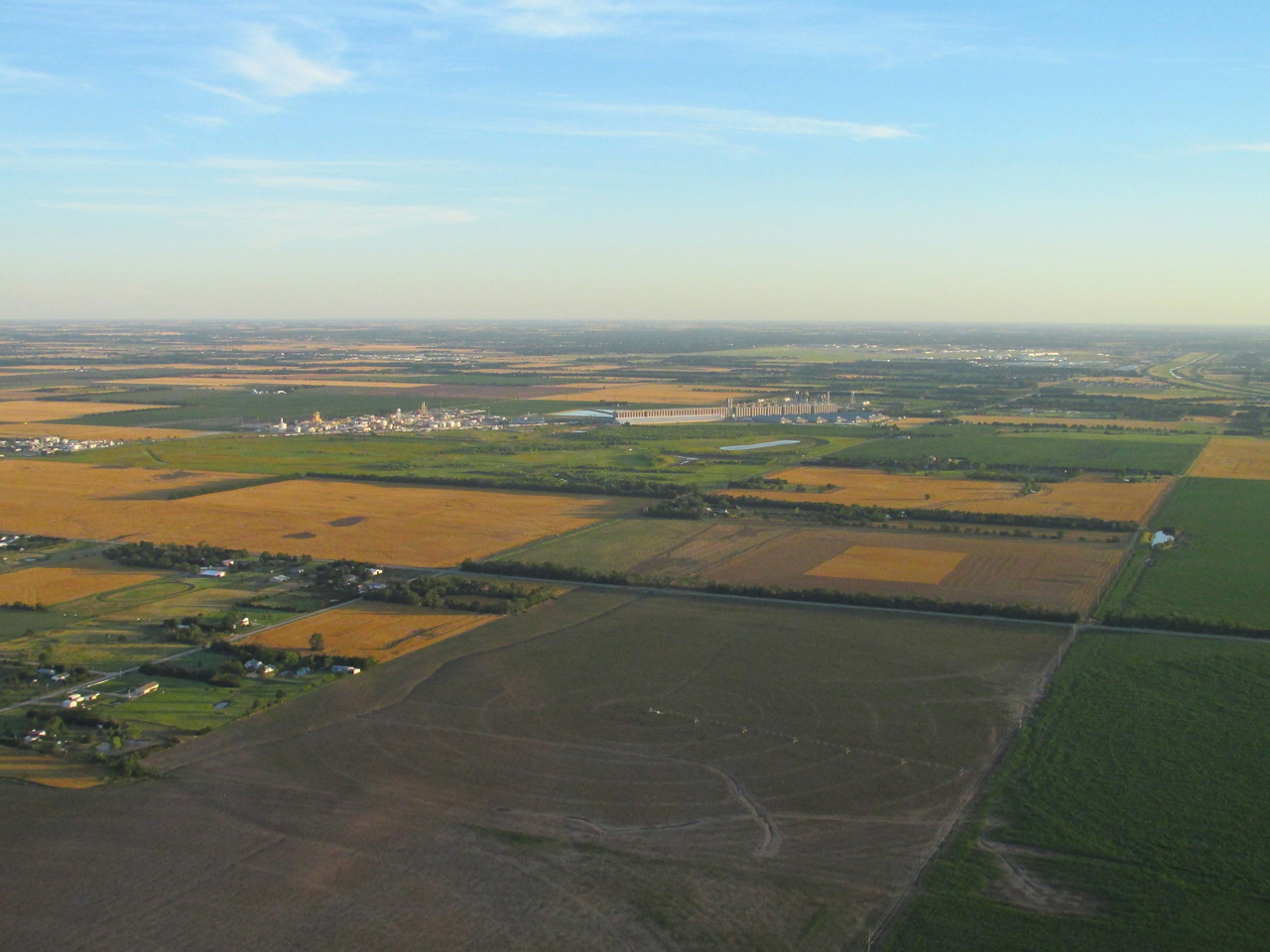
Only 5 minutes from takeoff looking Northwest from 1,000′ AGL. The sky is clear with only a slight yellow haze evident close to the ground – probably pollen!
Rucker Field Directly Ahead. This is from 1,000′ AGL looking West. The radio antenna at the North end of Rucker is on the edge of the control zone for Mid Continent Airport. That makes the field a convenient marker for me to keep out of their airspace when heading North or Northwest from Selby
Just past Rucker Field I look North to take this shot. The shadows of a couple hundred round bales of hay give 3 dimensional interest to a large field.
Better Plan This Time
The direct path to Ellinwood, Kansas from my field, Selby Aerodrome would take me directly over Mid Continent Airport. I could actually do this but would have to climb so high to get over the traffic area it would not be an efficient use of fuel. So I always go around it. On my first foray to Ellinwood, I cut between Mid Continent’s traffic zone and the town of Goddard. Because there has been so much suburban building taking place Northeast of Goddard, I had to maintain 1,000′ of altitude. This slowed me down in the headwind that day and was part of the reason I could not make the journey. This time I cut to the West of Goddard where there is not as much habitation and I could stay low. For a marker I picked the Dillons Grocery Store Warehouse.
Marker Ahead – The Dillons Warehouse Just West Of Goddard, Kansas
A “Standard Two Dimensional” Highway
Just after passing the Dillons Warehouse, I crossed Hwy 50 Hwy 54 (an “Eagle Eye Award” to Brother Stan Holmes for catching this error) which crosses Wichita East and West.
Getting Down To Business
After passing Highway 50 the landscape cleared out dramatically. I dropped down to “wheat top level” and went into cruise mode.
Dropping below the headwind I saw this interesting Church. I think it is St. Mary’s Church of Garden Plain, Kansas.
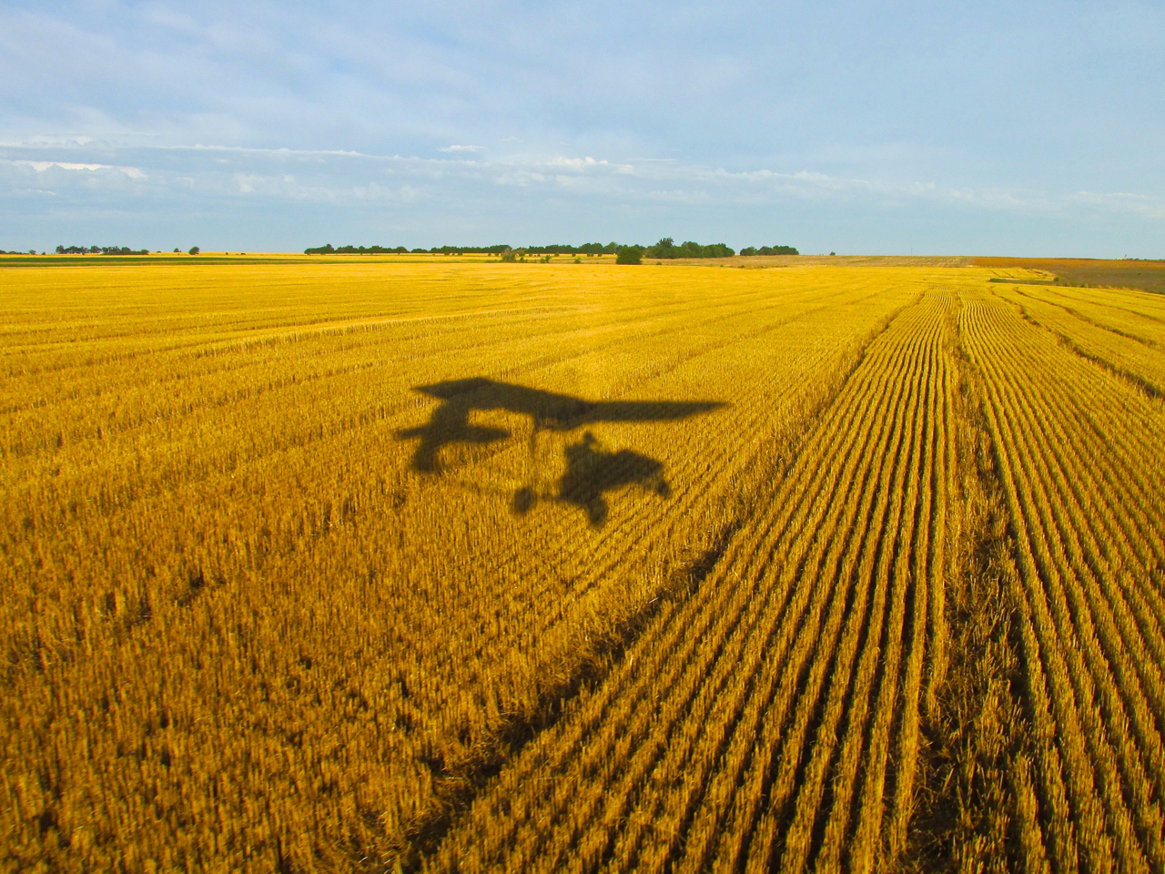
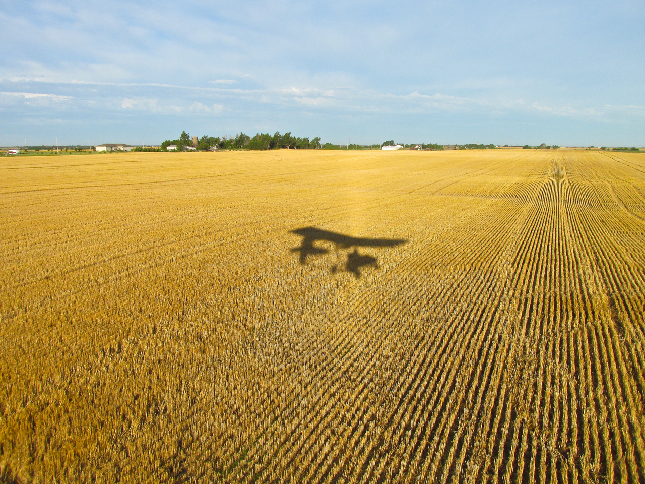
“Self Portraits In Wheat”
Still quite early, the morning sun provided the special lighting effect you will see in this series.
Things Change Quickly
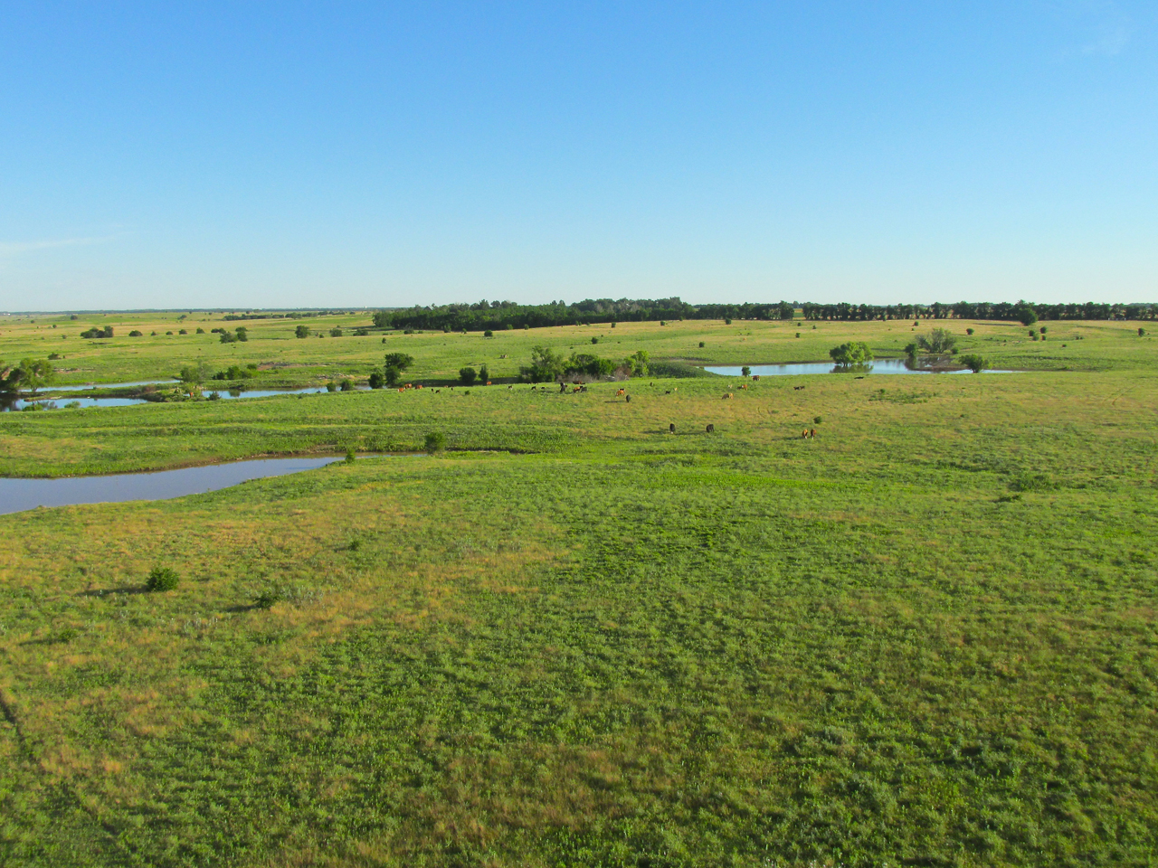
In moments, wheat land turned to cattle land…
…and then back to wheat again.
One Sheet To The Wind (to be continued…)
Note the sheet covering my knees in the picture below. I will explain that later.
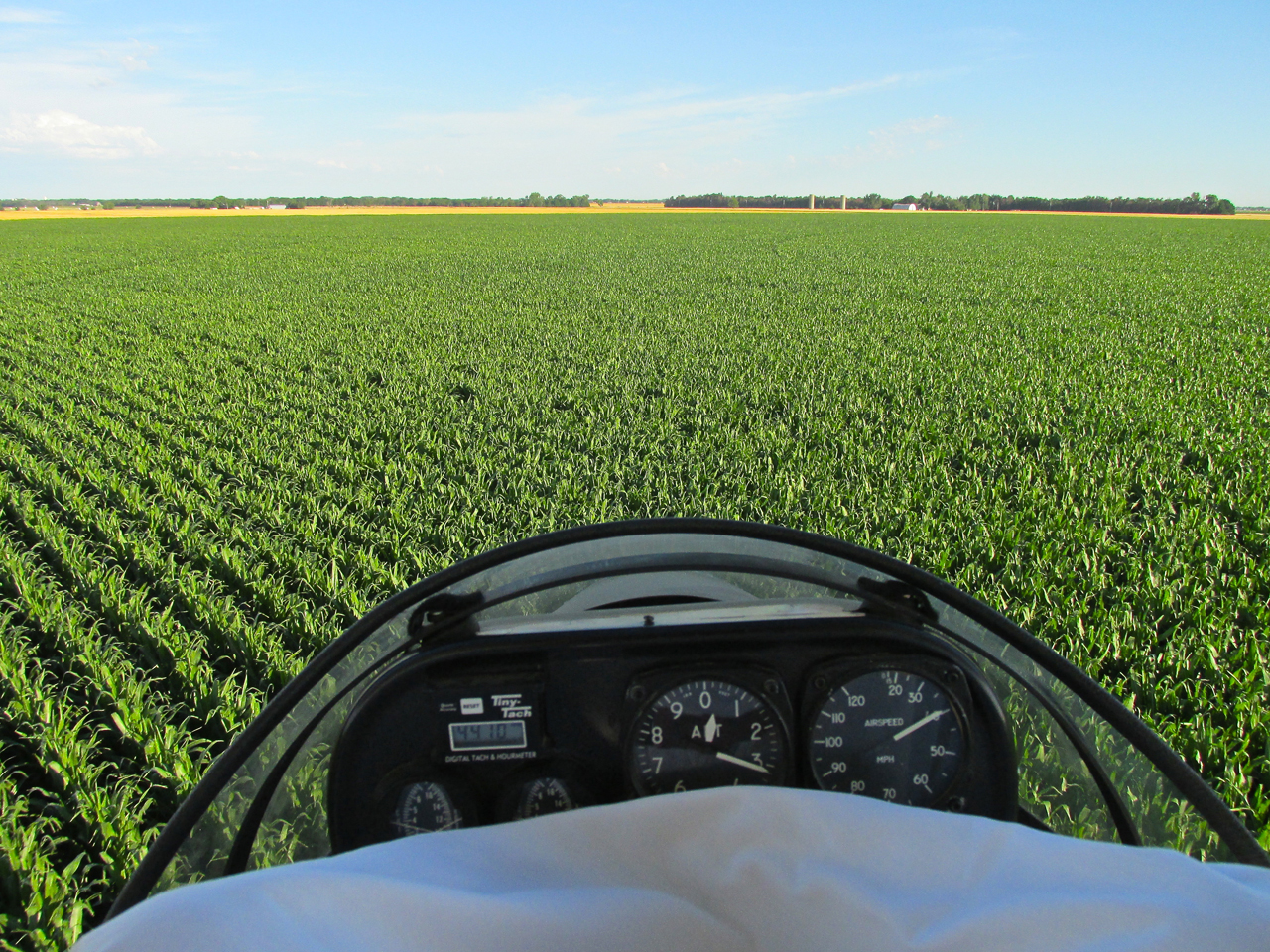
New corn on the rise. This is a “GlennView” photo (explanation HERE). I am at about 6′ AGL looking Northwest.
The next field over is wheat ready for harvest.
Hutchinson, Kansas And The Sunflower Aerodrome
After flying approximately an hour, I was Southwest of Hutchinson, Kansas home of a Jewel on The Prairie – The Kansas Cosmosphere. On the Southwest edge of “Hutch” is the remainder of the WWII Naval Air Station Hutchinson. In addition to now being an industrial site, these old runways are the home of “Soar Kansas“. They call their part of the field The Sunflower Aerodrome Gliderport. Powered Parachutes also fly from that field and that morning I saw one off to my Northeast. In the 1990’s, I produced a documentary called “A Beginner’s Guide to Powered Parachutes” that did quite well. You can read about it HERE.
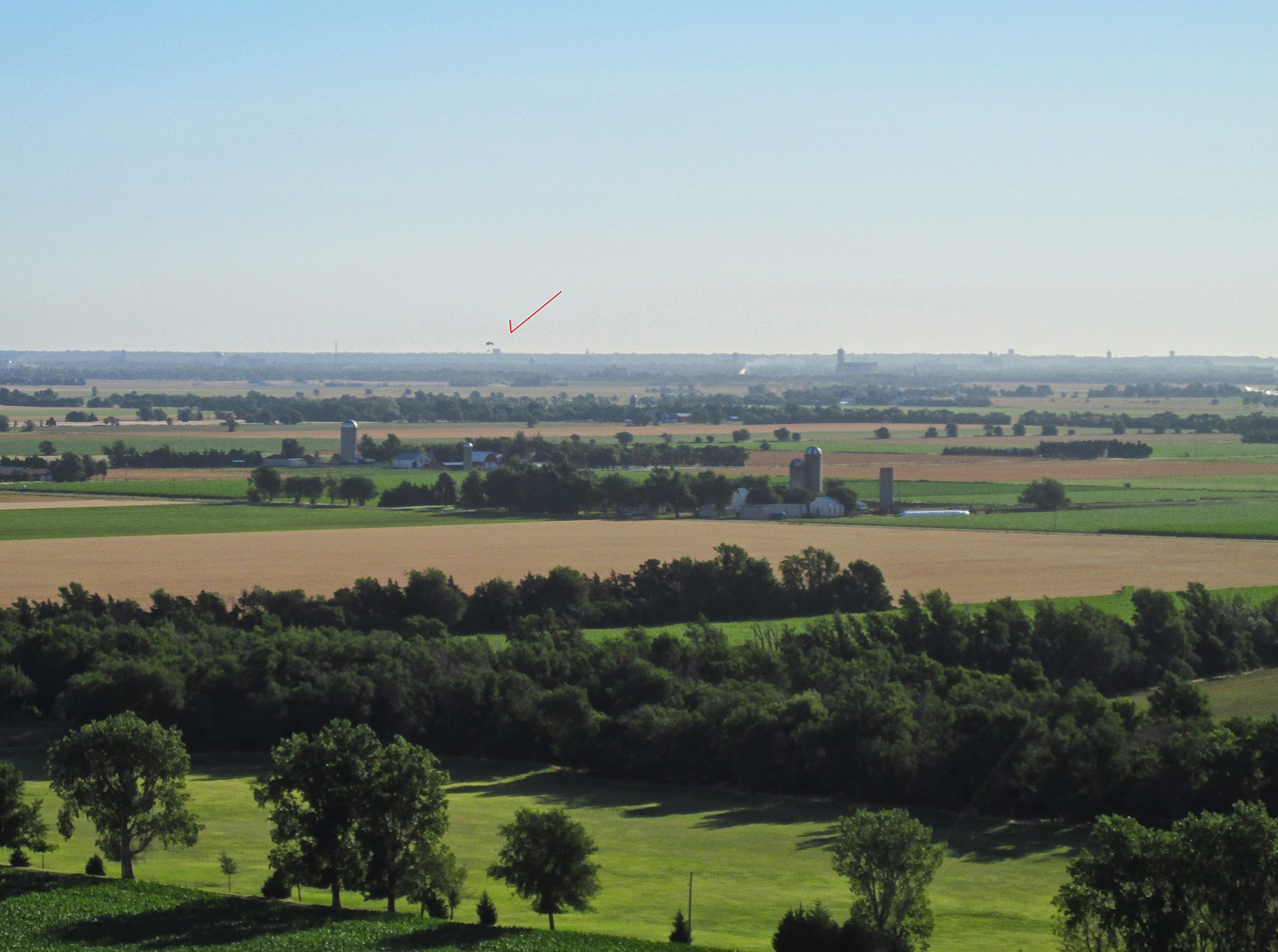
A Powered Parachute in the distance with Hutchinson in the background. 200′ AGL looking Northeast.
Buzz Not!
Approaching Highway 50 I maintained 500′ AGL so I could make sure not to pass too low over any cars or trucks that might be on it at that time. No one was near so after crossing over I dropped back down to cruising altitude.
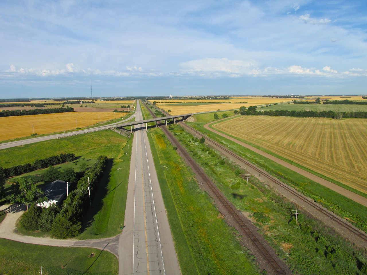
Highway 50 and Railroad Tracks heading Southwest from Hutchinson
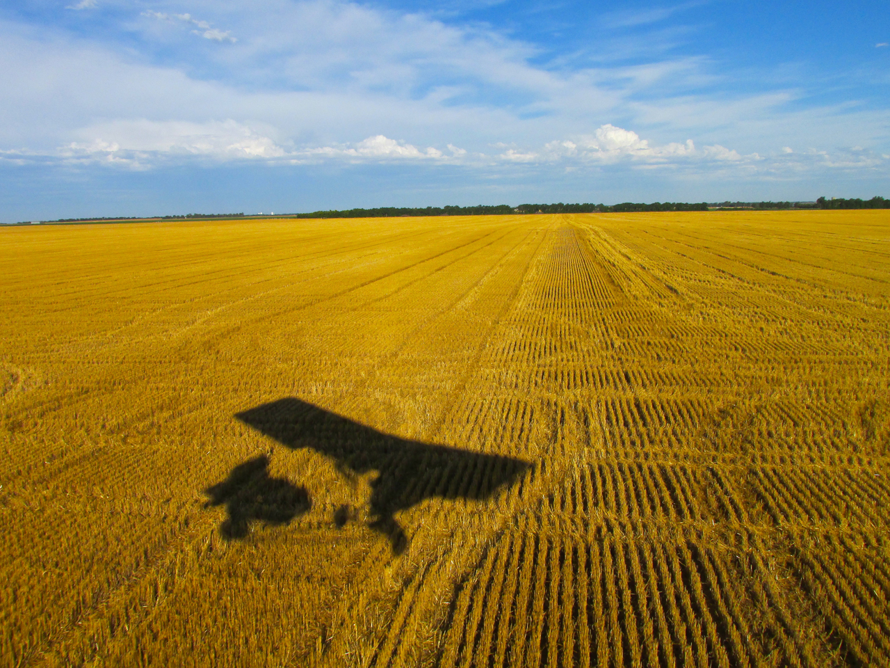
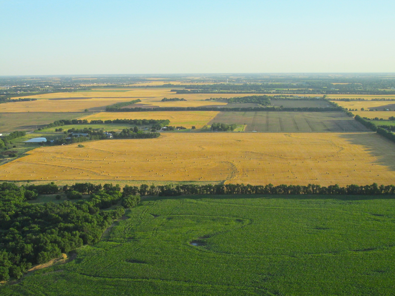
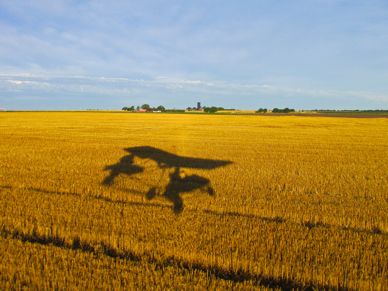
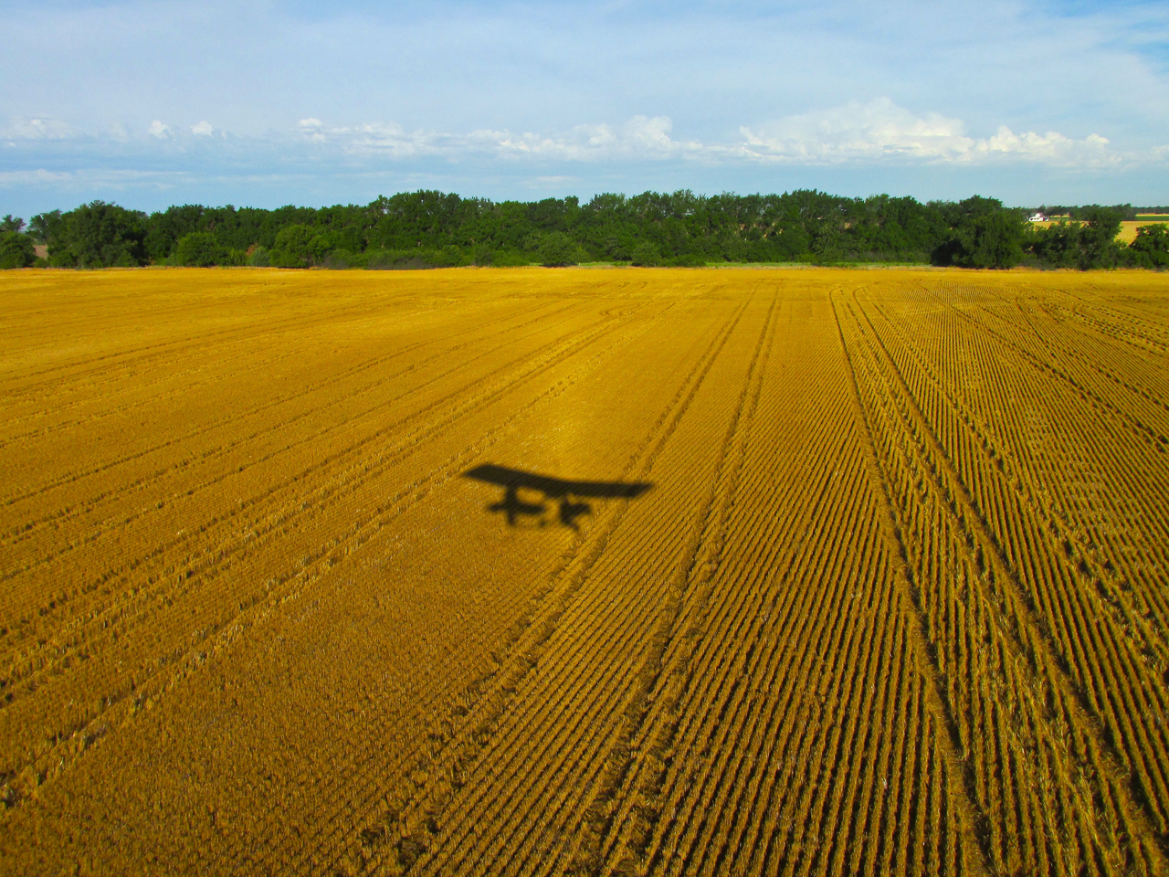
Another “Silhouette On Wheat”
Remember all these “mowed” wheat fields for a later observation…
Leg Stretch
Of great advantage to The Sky Surfer is the potential for landing just about anywhere in “The Flatlands”. Sure, there are a few places you can’t land but they are far outnumbered by the places you can. I had been airborne for about two hours and decided to take a break. I found a perfect fallow field, off by itself. After making a low pass, I circled back and touched down. I like to make stops like this to experience the peace, quiet and majestic beauty of The Great Plains. The people who live out here are quite fortunate indeed.
6′ 2″ AGL Looking Northeast.

6′ 2″ AGL Looking Northwest.
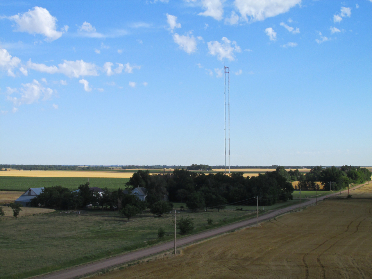
Twin Towers Of A Different Sort
Unfortunately since September 11, 2001, any mention of “Twin Towers” evokes images of mayhem perpetrated upon My Nation by evildoers using aircraft as murder weapons. This day, though, it seems the appropriate term to describe what I am approaching. I have seen this type of antenna before. Knowing a little bit about radio waves, I suspect the design either concentrates the waves in a particular direction or provides for a larger earth footprint (or both) without having to build as high. Anybody knowledgeable in these matters, please let me know.
Suddenly I come upon a field speckled with a Kansas Symbol – Wild Sunflowers!
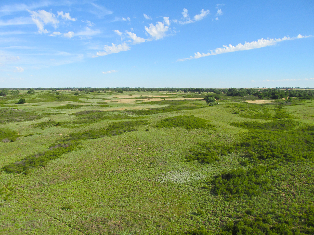
Constant Change
While earlier alluding to this countryside as “The Flatlands”, I don’t want to create an image of “boring sameness”. It is anything but that. As I approach Ellinwood I skirt the Northeast edge of Quivira National Wildlife Refuge.
KARD TV 3
In the 1980’s I was a Cameraman at KARD-TV3 (now KSNW) in Wichita. Back then, local affiliates still produced original programming other than just “News” Shows. I was fortunate to be part of the station’s documentary unit. We did a “doc” on the Quivira Refuge so I had been here in those days. We covered the marshland that the migratory birds use. It is quite extensive and NOT a place I would cross in my Ultralight because an “engine out” landing there would probably result in a the loss of the plane. The ground is wet all the time and the mud particularly sticky. I suspect a plane stuck in that stuff would have to be abandoned or taken apart piece by piece to be retrieved.
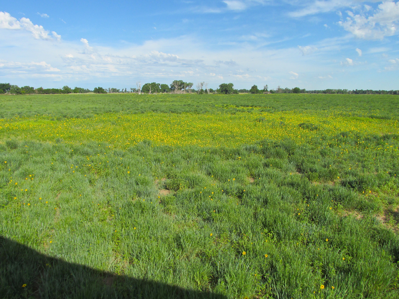
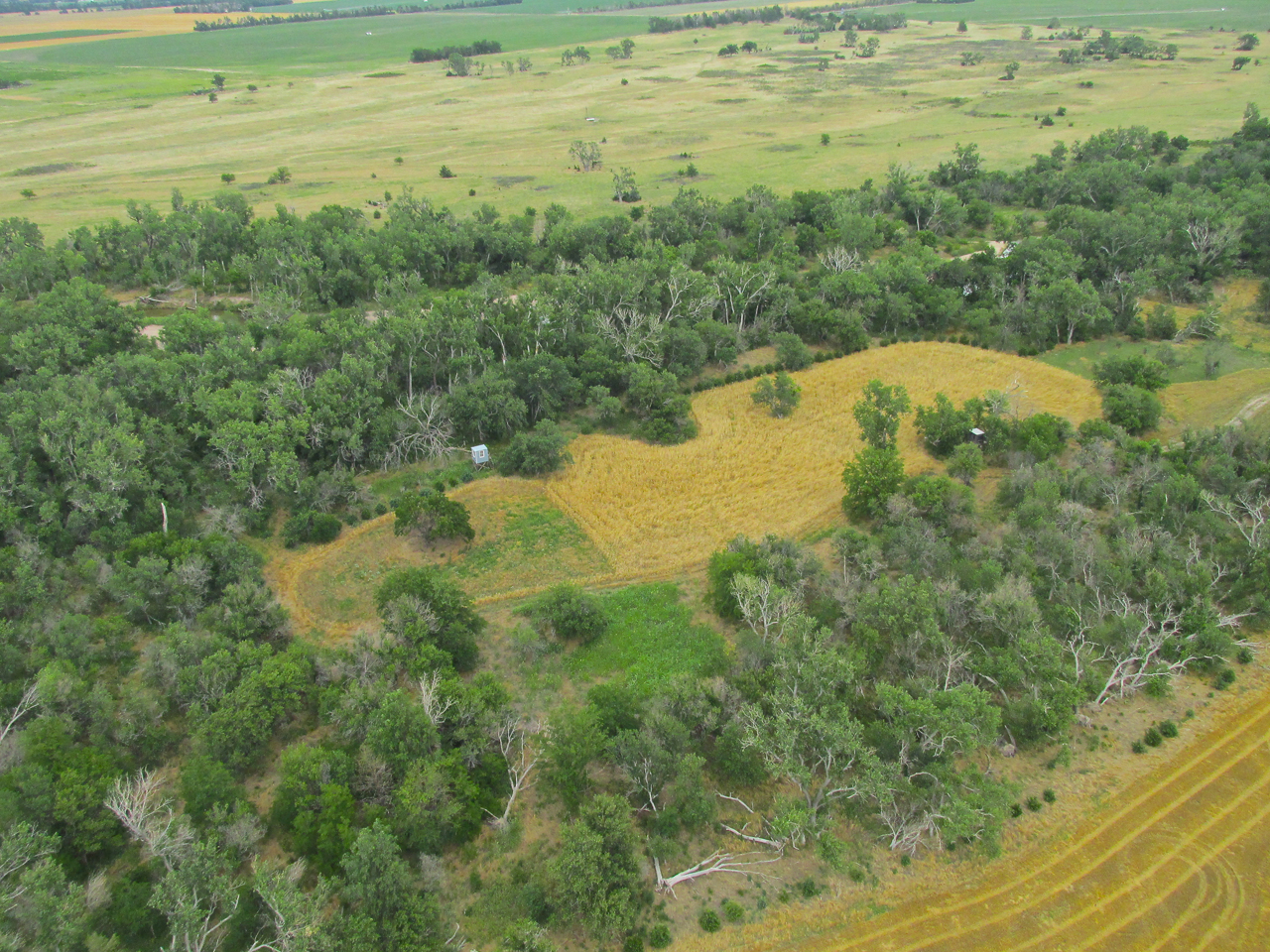
Unique
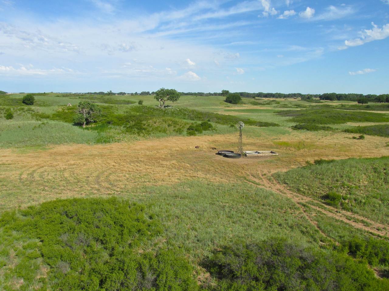
Anyway, the landscape you will see in this next series of photos is about 9 miles Southeast of Ellinwood and like no other area in Kansas I have seen thus far. The dead trees make it quite eerie. That day, other than a few deer, I was the only one there.
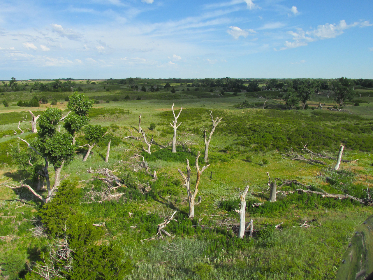
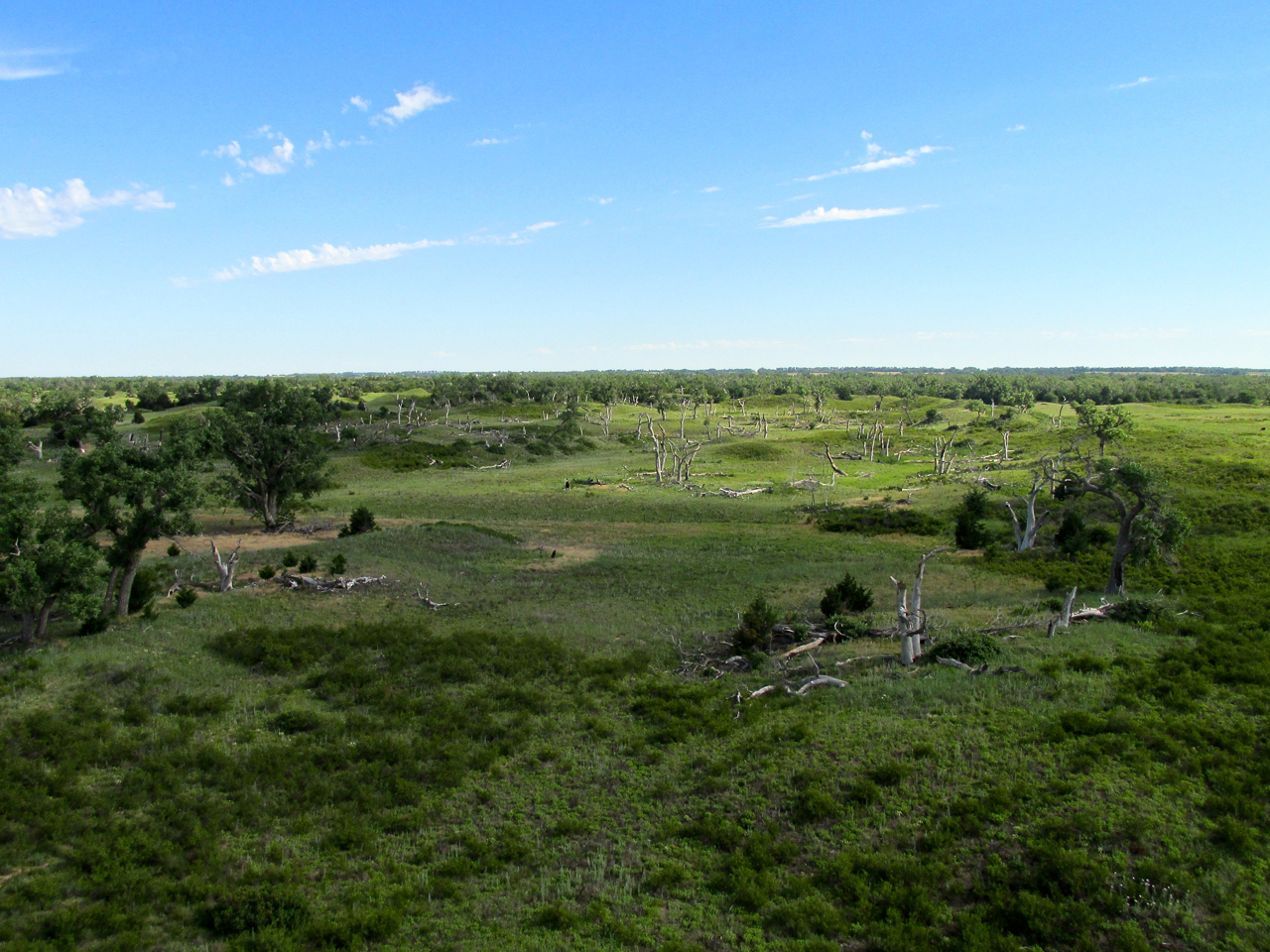
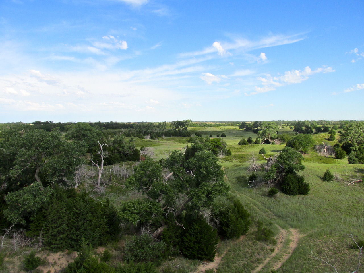
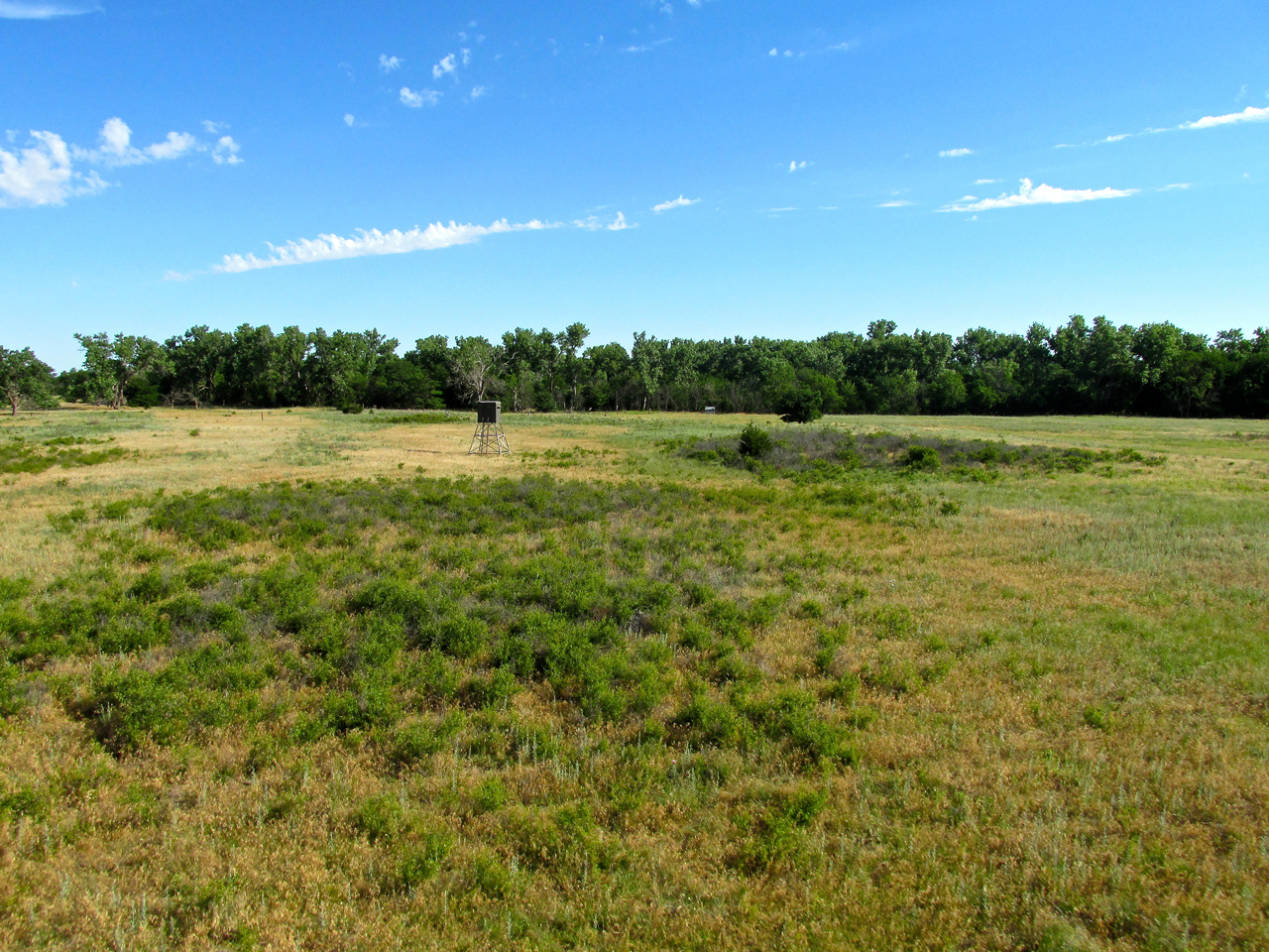
The dense bush-like vegetation in the foreground reminded me of something called “gorse“ that grows wild on the coast of Oregon. Out there it would scratch your car really bad if you drove too close to it.
Ellinwood’s Suburbs
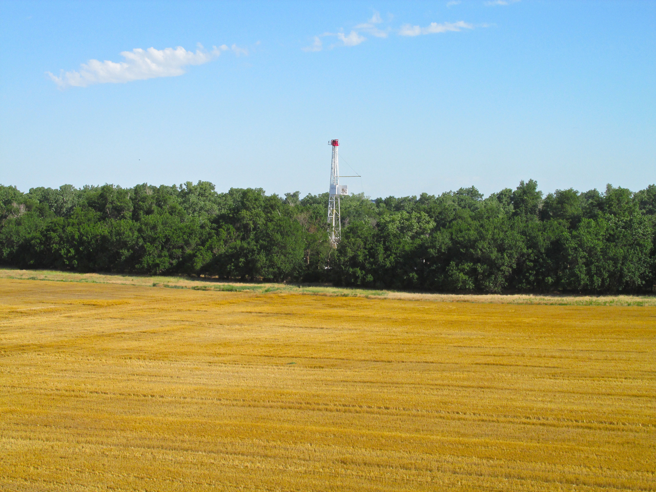
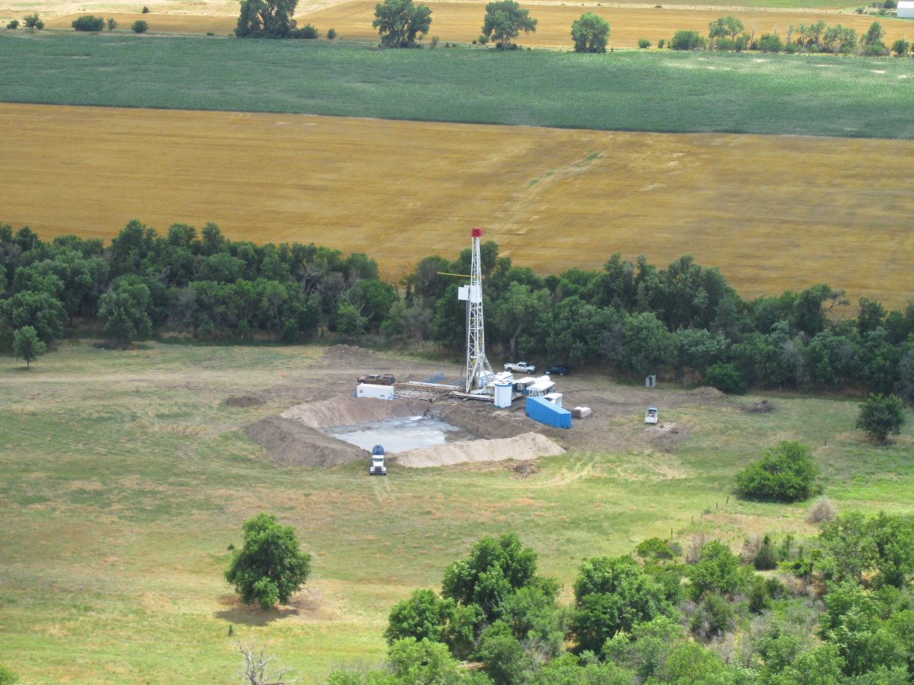
Even though I couldn’t see it yet I knew I was close to Ellinwood. The tree line with the drilling rig in my path required me to gain altitude and that’s when I saw it.
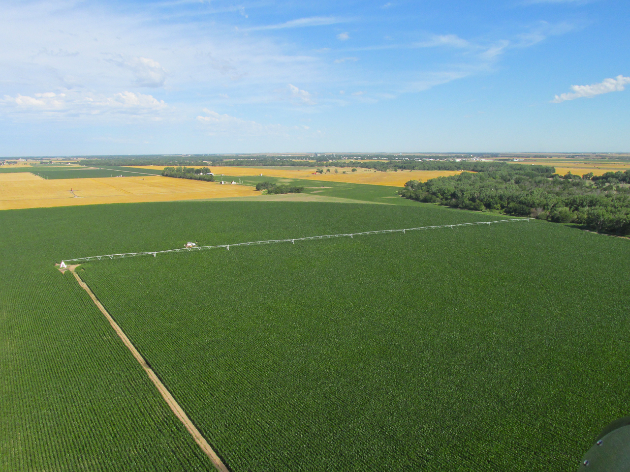
Two miles Southeast of Ellinwood at 500′ AGL. An eight section center pivot irrigation unit in the foreground.
Rising Headwind
Having climbed to the altitude you see in this series of photos, put me in the slowly building 20 mph Northwest Headwind. This slowed my progress dramatically. The timing was perfect, though, as I would have an excellent tailwind for the ride home.
South of town is this sand pit I had expected from the satellite view of Ellinwood I had studied previously. Looking Southwest from 700′ AGL.

Ellinwood, Kansas from 800′ AGL looking Northwest.
Ellinwood’s downtown area from 800′ AGL looking Northeast.
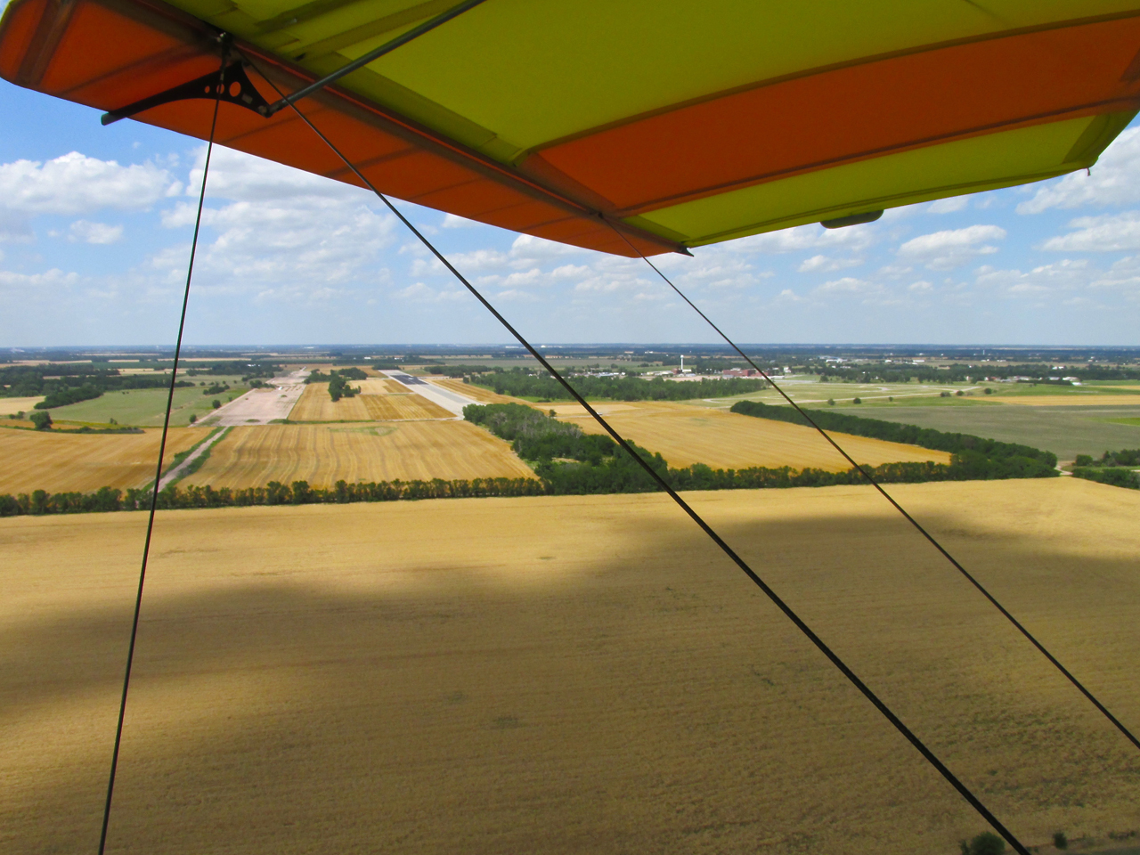
Ellinwood Municipal Airport – a mile from the Northwest edge of town.

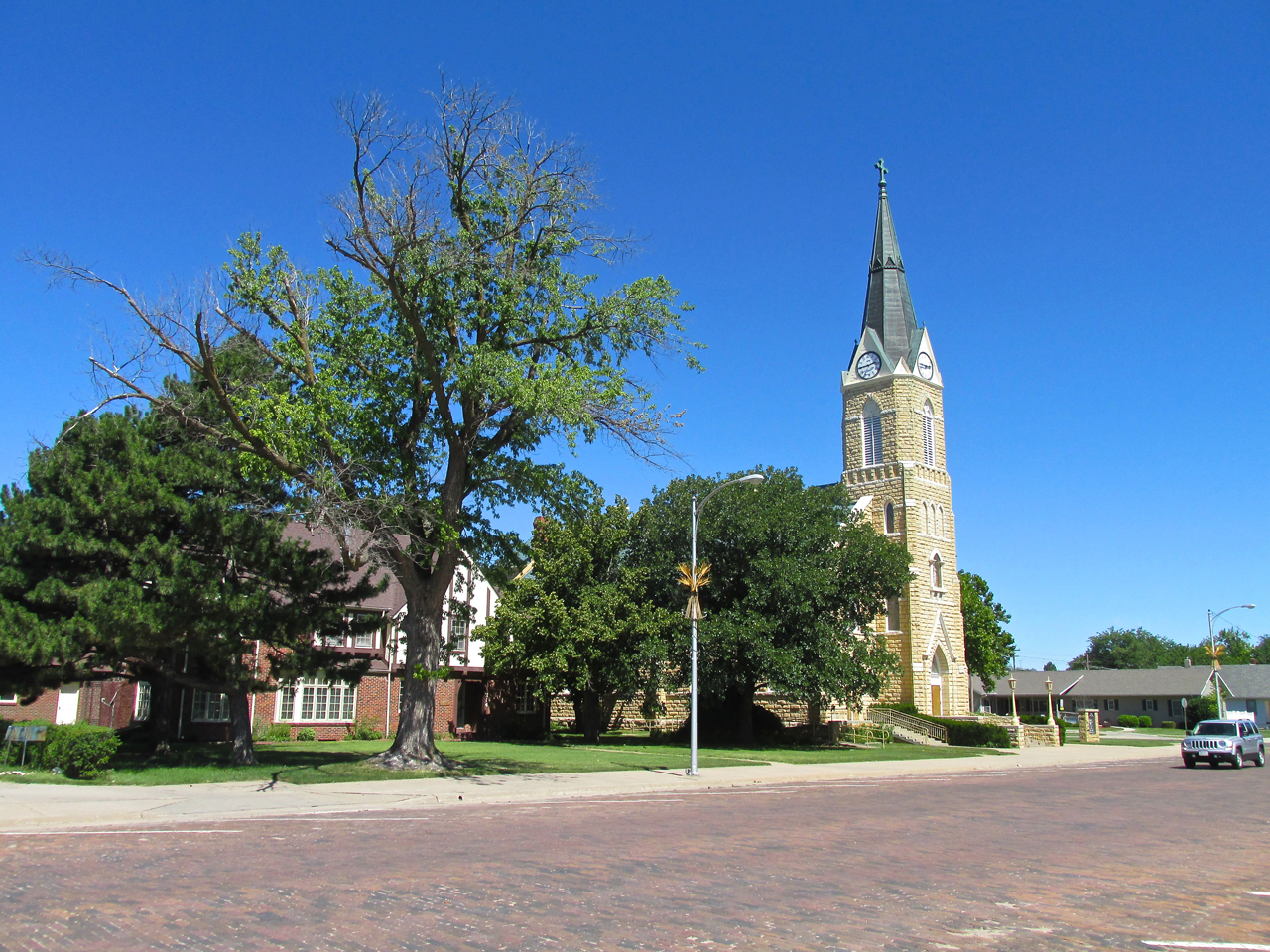
St. John’s Lutheran Church – Ellinwood, Kansas
Great Bend, Kansas can be seen 11 miles West as I enter the pattern of Ellinwood Municipal.
Just after rollout at Ellinwood Airport.
One Sheet To The Wind (Conclusion)
Earlier I alluded to a sheet over my knees in a photo. In the picture below you see said sheet. Here is the back story:
While we had been having unseasonably cool and rainy weather from May through June in Kansas, temperatures had inched up to the 80’s by the Ellinwood Flight. I do my best to plan these missions but in readying for the Ellinwood Flight I had forgotten one of my Cardinal Rules – The Attire Rule: Always “over-dress” when flying an open cockpit Ultralight. Arriving at the hangar early that morning I was dressed in shorts and a t-shirt. This would be excellent for the return journey in the heat of the afternoon but deadly at sunrise. Even though it was about 68 degrees on the ground I knew from experience it could (would?) be chilly in the air. The 20 minute drive back to my house was out of the question. It was either freeze or find a solution. I trolled around the hangar looking for something to cover myself from the inevitable, early morning 40 mph wind (chill) blast. All I could find was a bed sheet that had been used as a painting drop cloth. Shaking it to dislodge any spiders, I took it out. Once the engine was running, I draped the sheet over my knees and upper torso and then buckled my seat and knee belts over it. I’m really glad I did this because it cut the chill just enough to make the flight very pleasant.
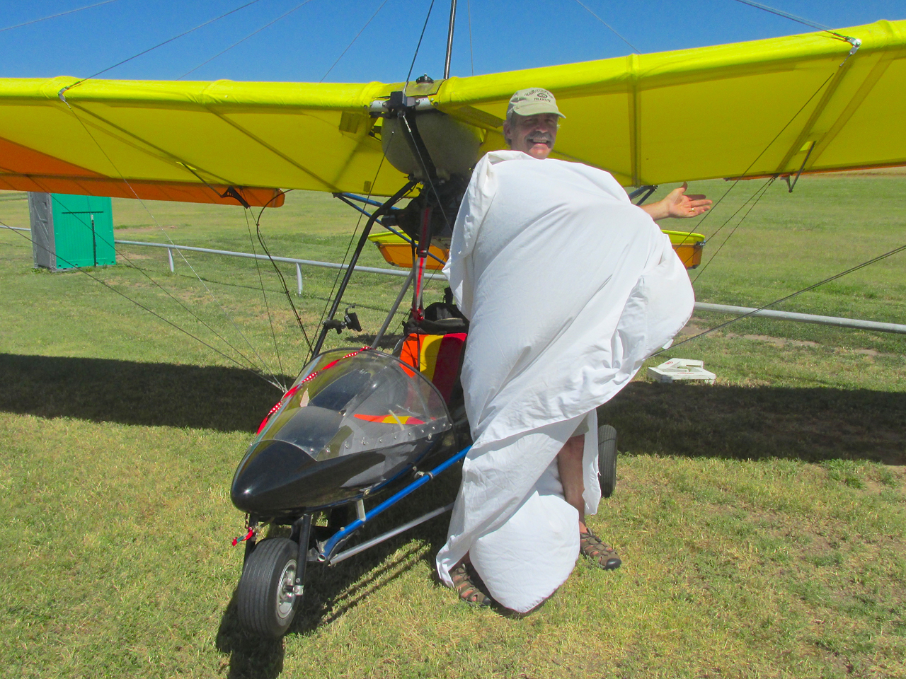
The Prairie Sheik (Sheet?)
Time To Explore
My plan for Ellinwood, was to secure my MXL to what tie downs I could find, grab the two empty fuel tanks I keep behind my seat and head into town with camera “at the ready”. As shown previously, there were three vehicles at the field. I went to the yellow building to see if anyone was there to show me any permanent tie downs they might have ’cause I didn’t see any. No one was there. Because the wind was gaining velocity by the minute, I tied my Quicksilver’s tail to a steel pole fence – tail into the wind. Then I broke out the tie down stakes I carry behind the seat and pounded them into the ground – to affix the tie downs I also carry with me – to the wings. Everything was now secure. Since it was in the direction of my intended travel, I walked to the hangar with two trucks parked next to it. The door was open so I knocked and stepped in to a wonderland of Phillips 66 memorabilia and the company of Ken Lebbin and Robert Yarmer.
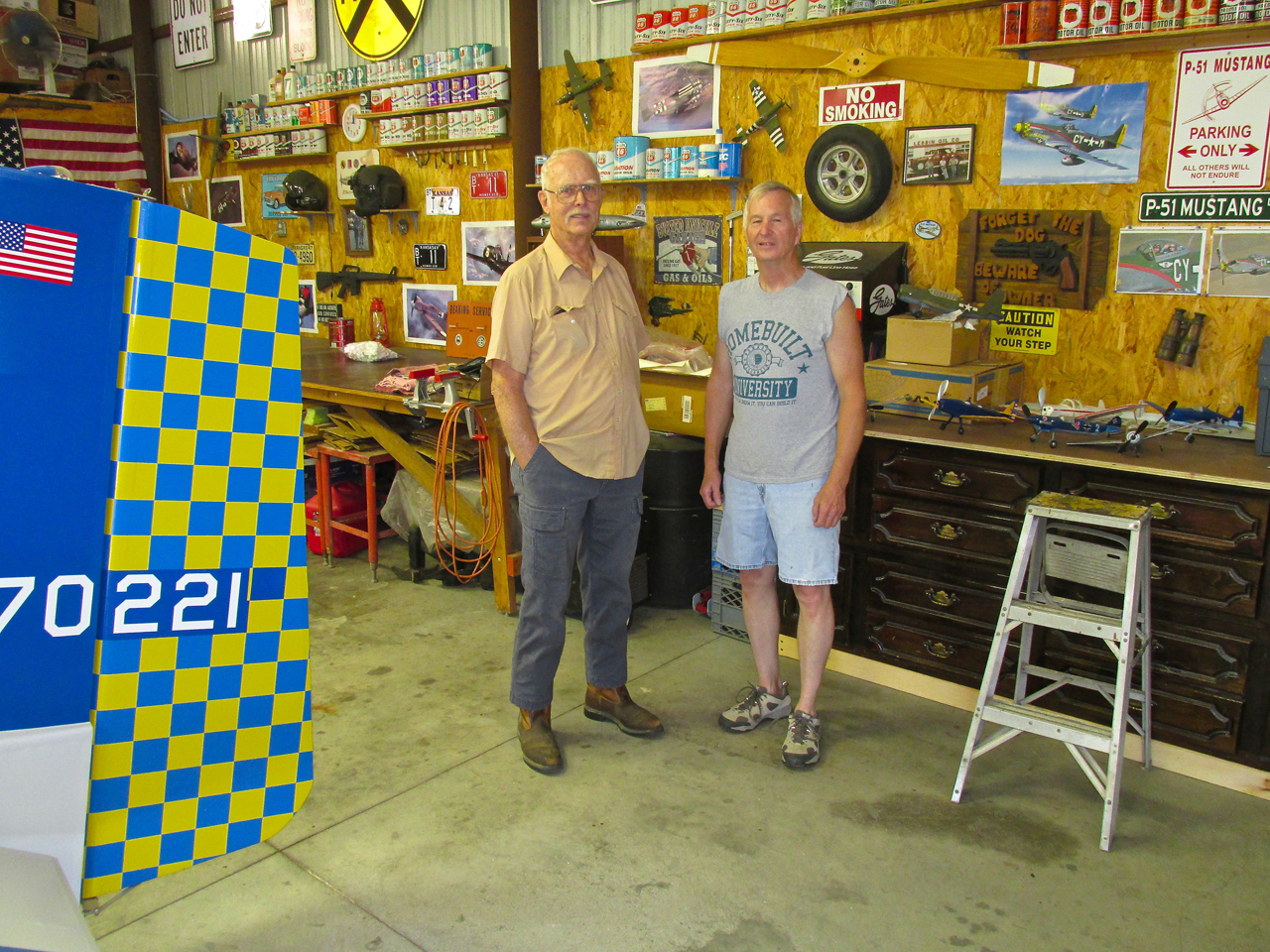
Robert Yarmer and Ken Lebbin
An Interesting Find
I introduced myself and realized they had not heard my arrival due to the noise of a powerful fan that was running. This is Ken’s hangar. Ken and his Father before him had been Phillips Service Station Owners. He was showing Robert some of his memorabilia that morning. As we would discover soon thereafter Ken’s collection would soon be increased. “Photo Op” signals went off in my mind so I asked Ken if I could take some pictures. He said “Fine”.
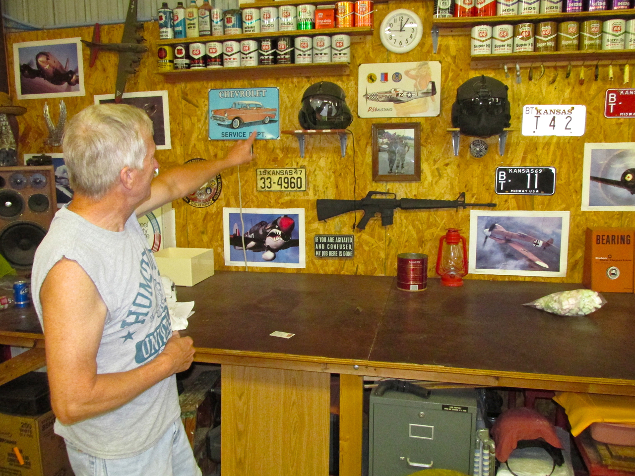
Here Ken shows some of the neat artifacts he has including two examples of the helmets worn by Army Helicopter Pilots. The one on the left is VietNam era and was worn by Ken during his tour of VietNam. The one on the right – an Iraq era helmet was worn by his son David during his tour there – Quite a Legacy!
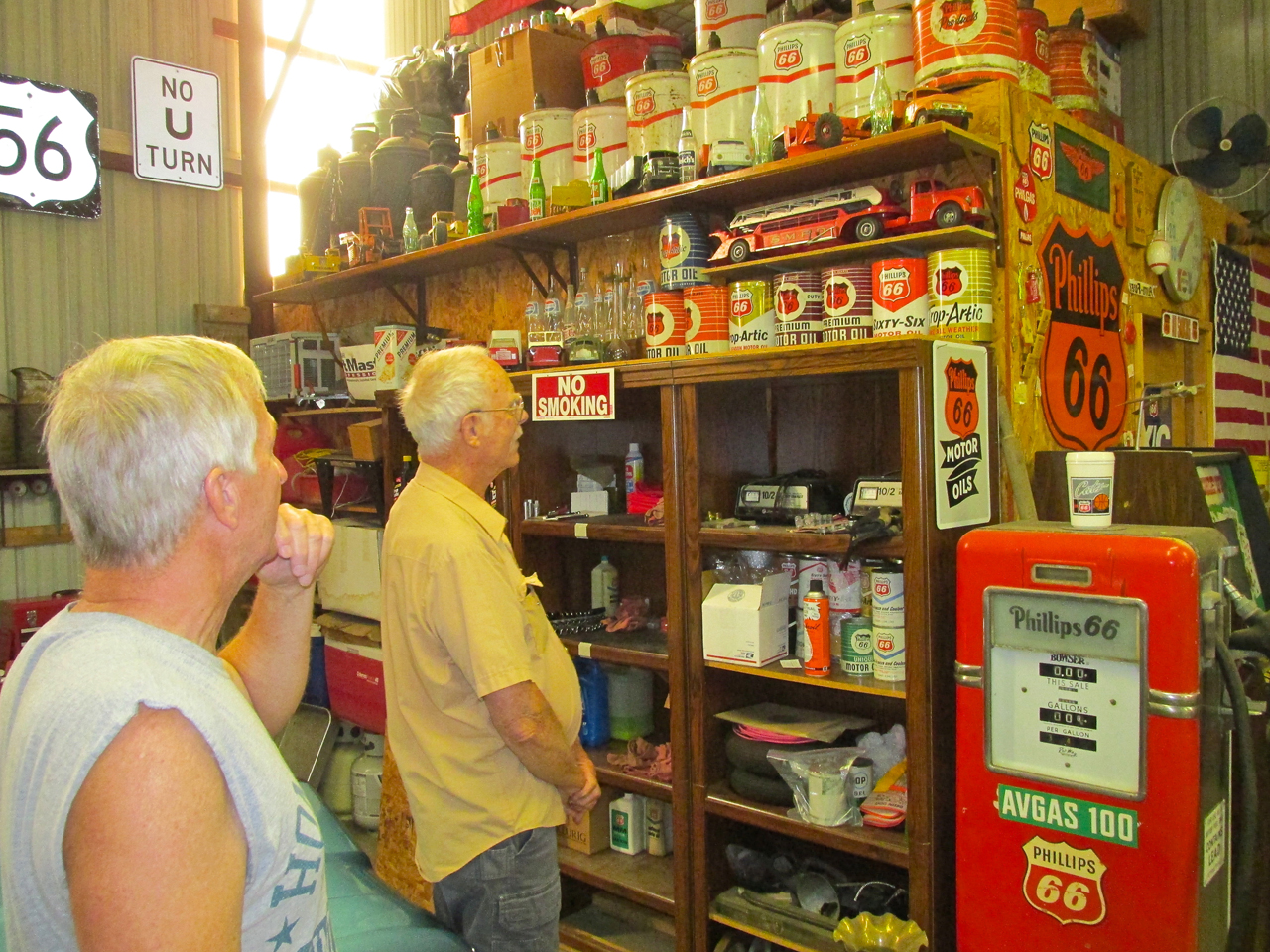
Phillips 66 had cans of oil big enough so that one would suffice for an entire oil change.
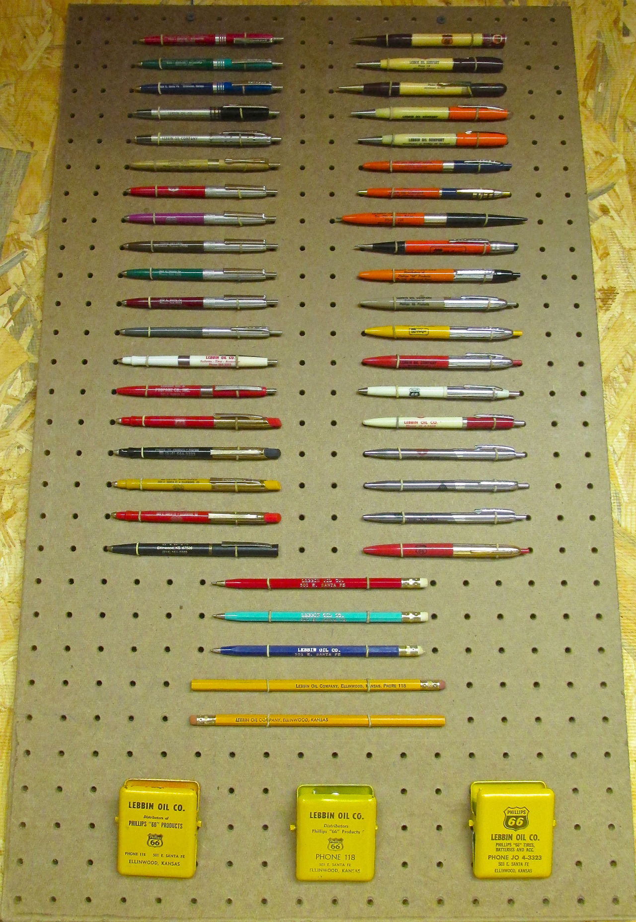
Phillips 66 Promotional Items
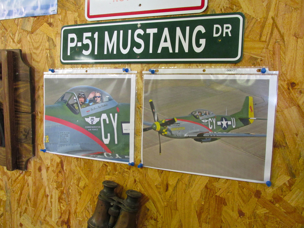
Excellent “Air to Air” photos commemorating a flight Ken took in the back seat of the famous “Gunfighter” P-51.
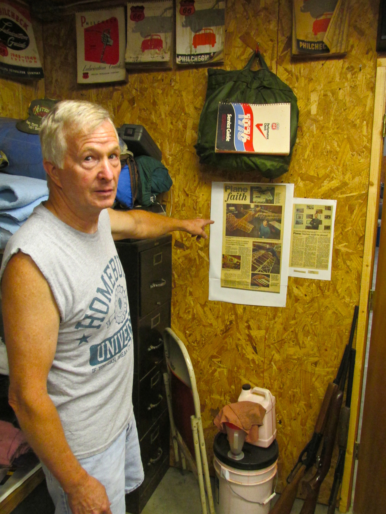
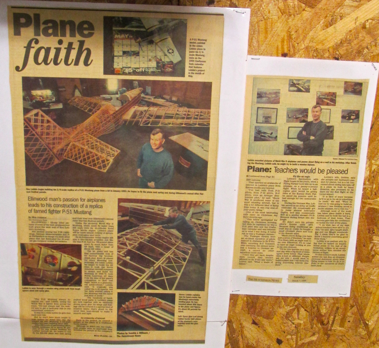
Ken points to a newspaper article featuring a “home built” airplane project he built and now flies.
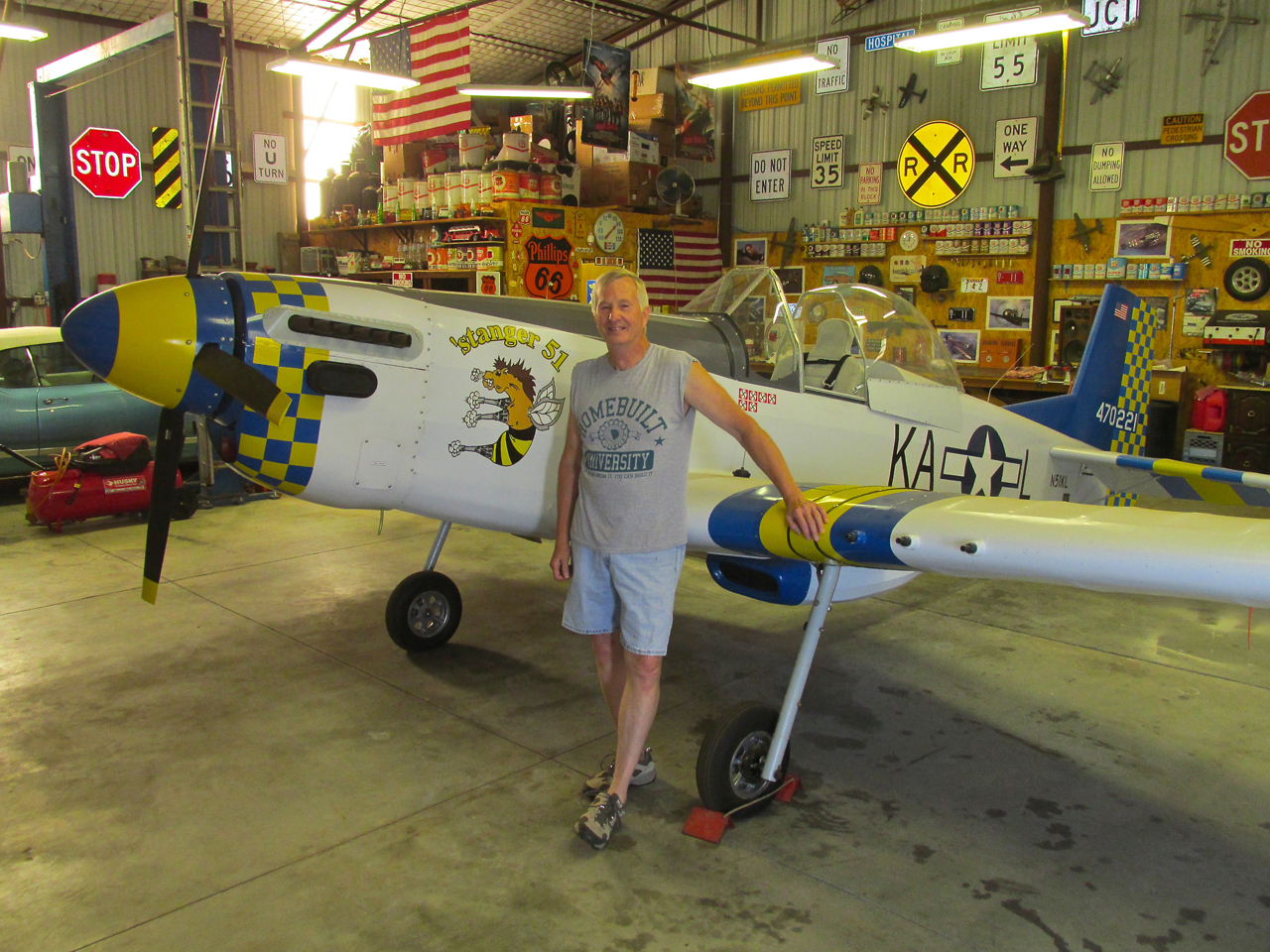
Ken with the aforementioned homebuilt – his Loehle (P)5151 Mustang.
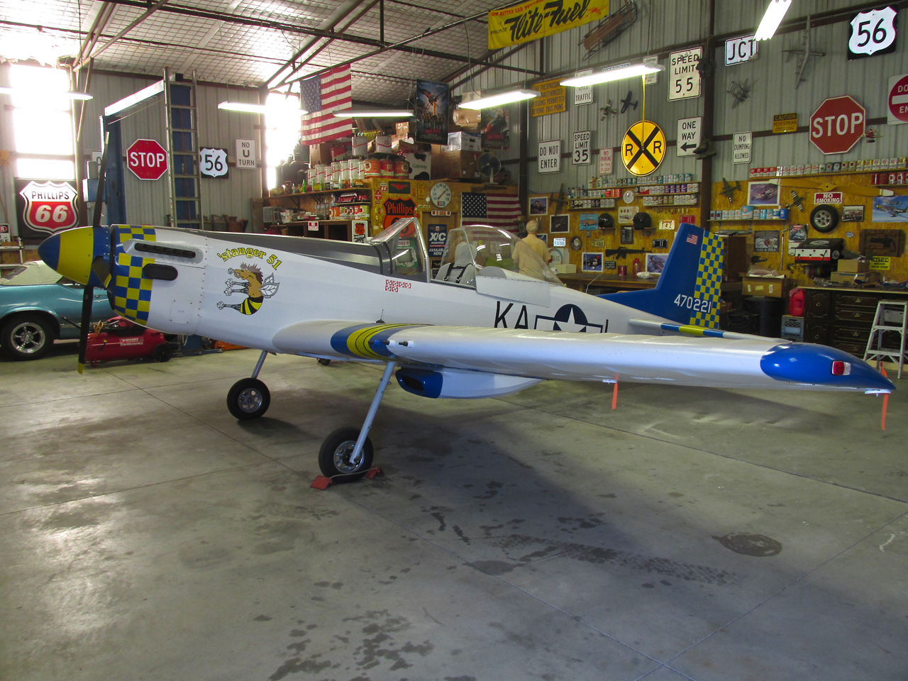
A Solo Shot Of The Mustang
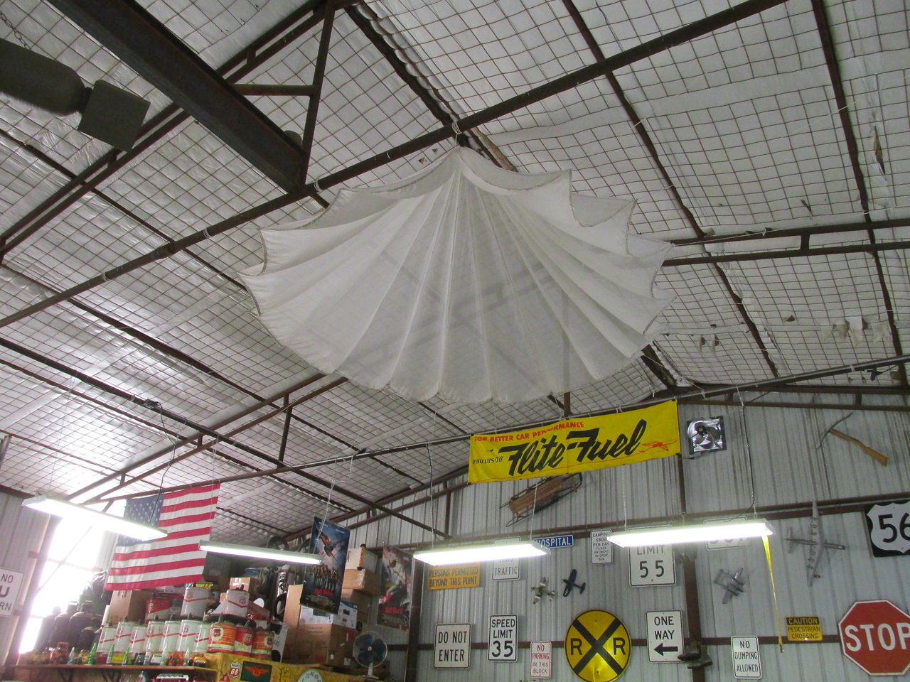
At the top of the hangar is a flare parachute.
The Collection Increases!
When Ken had invited Robert over to his hangar to show him his artifacts that Saturday, Robert was looking forward to the opportunity but also had a secret agenda in mind. While I was standing there he asked if Ken would be interested in a couple more Items of Aviation Interest for his collection. After hearing what they were, Ken happily agreed to take them off Robert’s hands.
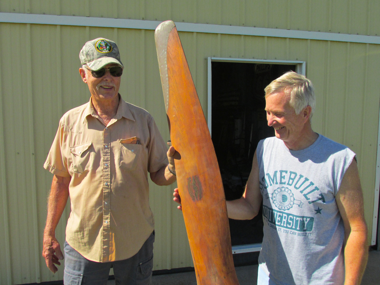
Robert Yarmer hands Ken Lebbin a famous propeller. The person Robert got it from told him it came off a Curtis Jenny! No doubt from back in the barnstorming era.
A Relic From World War II
The other item Robert was to give Ken that morning was stored in a container in town. They asked if I would like to go with them to get it. Ken said he could take me by the gas station, too.
A retired builder of homes, Robert still has things from his former construction business (Strobel/Yarmer) stored in some metal buildings and a shipping container. The artifact was in the container.
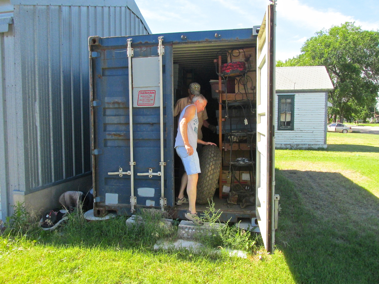
They proceded to roll out…
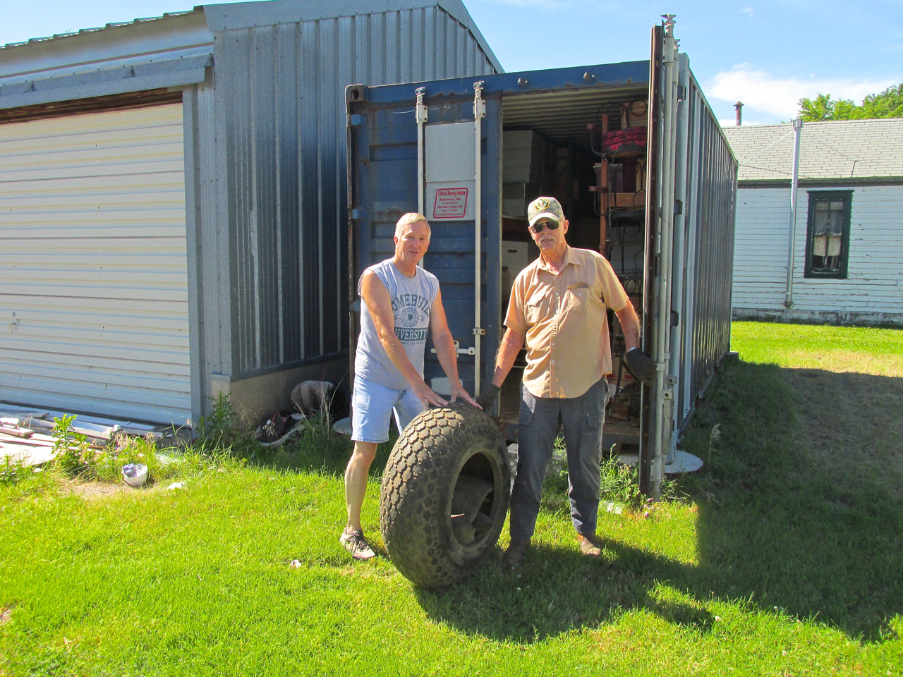
A Nose Wheel Tire to a B-29 Bomber!
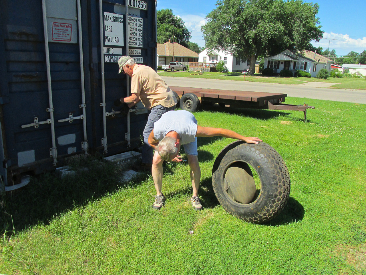
It still has yellow military markings on it and an inner tube. It looks brand new.
Here Ken and Robert unload the tire. I shot this also to show you the two hangars Ken owns.
Ken rents the smaller hangar to a guy who owns this sweet 1946 Luscombe 8A.
Time To Tour The Town
Ken was liking the idea of my Flight Blog Story and wanted to help. He said he would take me around town to see points of interest. What a deal! It sure beat walking and included a Native Ellinwood Tour Guide.
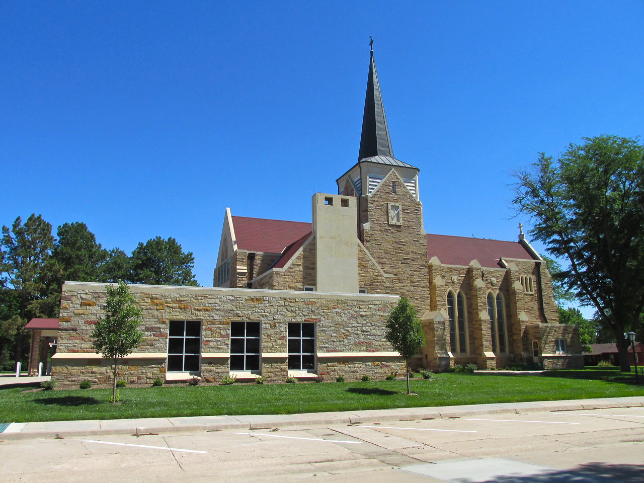
St. Joseph’s Catholic Church
The Lutheran Church I showed earlier from the air (St. John’s). Another great example of the Stone Buildings found in many small Kansas towns.
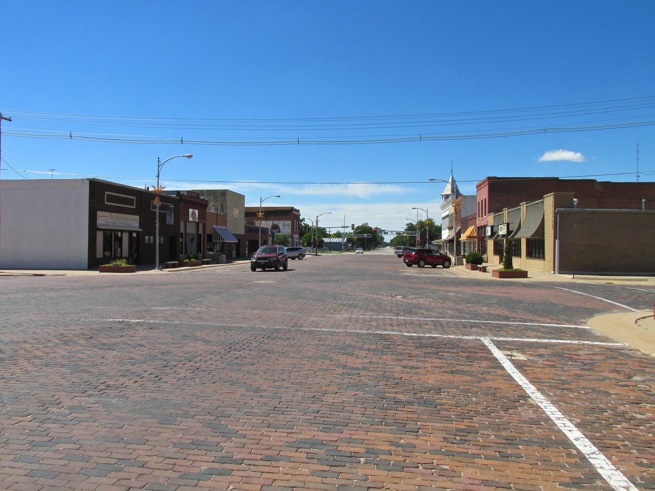
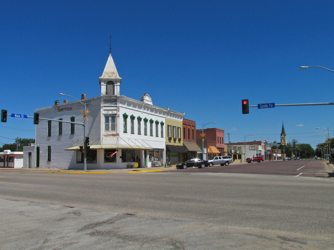
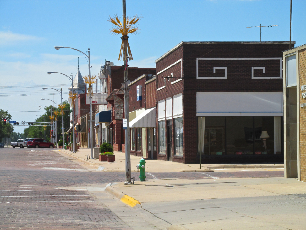
Looking South down Main Street featuring the brick surface I favor.

Also on Main Street is the Heritage Senior Center flanked by an old brick building with a facade.

The West Side of Main Street looking South just before its intersection with Highway 96.
Prairie Tunnels
As with a number of Prairie Towns, there are tunnels under the surface of Ellinwood. Because of time limitation, I was not able to take the tour – but you can. To learn more or to reserve a tour go HERE.
This is the same block as featured above but as seen from the South. The building on corner in the foreground, called The Dick Building, is where the Underground Tours begin.
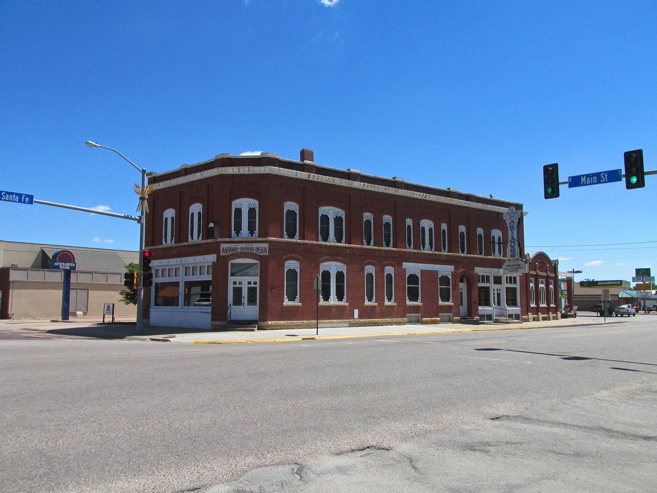
Across from the Dick Building is this fine example in brick. It is to be “returned” into being a hotel. Originally it was The Wolf Hotel. Over time it became a bank, then City Hall, then an Antique Store. The owner’s desire now is for it to once again be a Hotel.
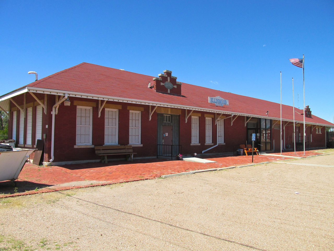
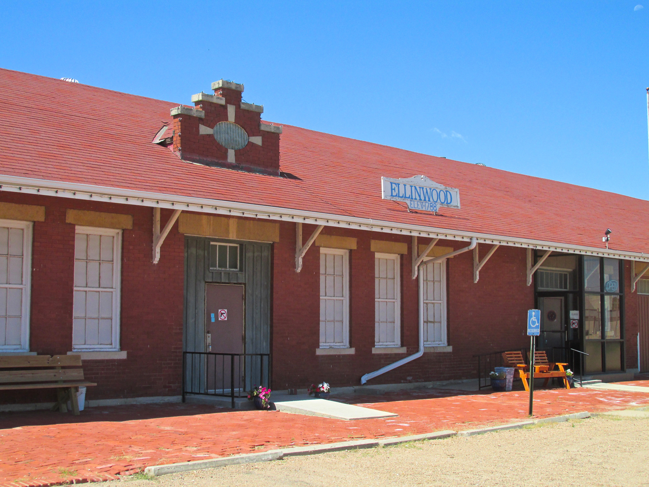
Legion In Action
Ken served in the U.S. Army as an Air Traffic Controller and is a member of The American Legion. His Post refurbished the historic Santa Fe Ellinwood Train Station you see below. They use it for meetings.
Limestone Fence Posts
Wood was scarce in Kansas during the settlement era. Creative people used the area’s abundant limestone to make fence posts.
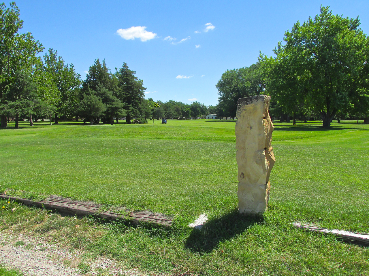
Limestone Post On The Golf Course
Wheat Shocks
Local artist Ray Nienke welded all the Wheat Shocks you see in the photo below decorating the light poles. A nice touch. There are also very large ones at the Highway 96 entrance to town on the East and West sides. Unfortunately at the time of this visit both of them were down for refurbishment so I could not show them to you but you can see a photo of one on their website HERE.
Choppy Air
After the tour of the town, Ken and I had a burger at John Henry’s on Santa Fe Boulevard. By the way, it was the best burger I have had since I can remember – a benefit to dining in Cattle Country. That was the good thing. The “bad thing” (and it wasn’t that bad…) is that we were having such a good time talking about airplanes and such that time slipped away. Typically I would have egressed by 11:30 am or Noon. By the time we returned to the airport at 2 pm, the conditions were very gusty. When I took to the air, wind was from the North at 10 mph gusting to 27 mph. This is what I call “Choppy Air”. It is not the speed (27 mph) but the disparity between the constant air and the gusts. In this case that disparity was 17 mph. That makes for a “bucking bronco” ride. But, hey, if you can direct the bronco, he will get you there sooner. With this strong tailwind I was able to fly non-stop back to Selby Aerodrome arriving with lots of gas left in the tank.
After takeoff I leaned out and took this picture of Ellinwood Muni. You can see Ken Lebbin standing near his pickup. This is from 200′ AGL looking Southwest.
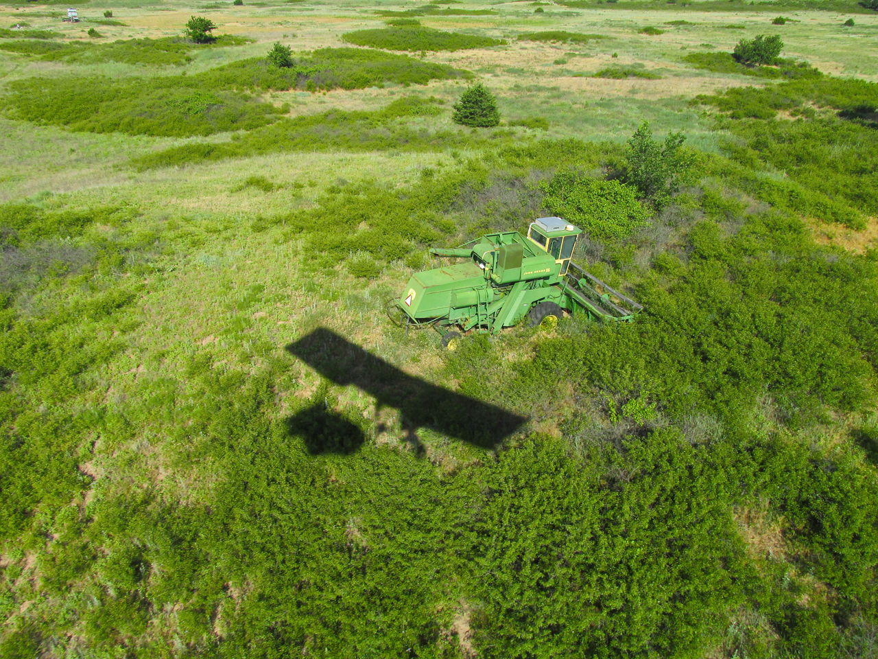
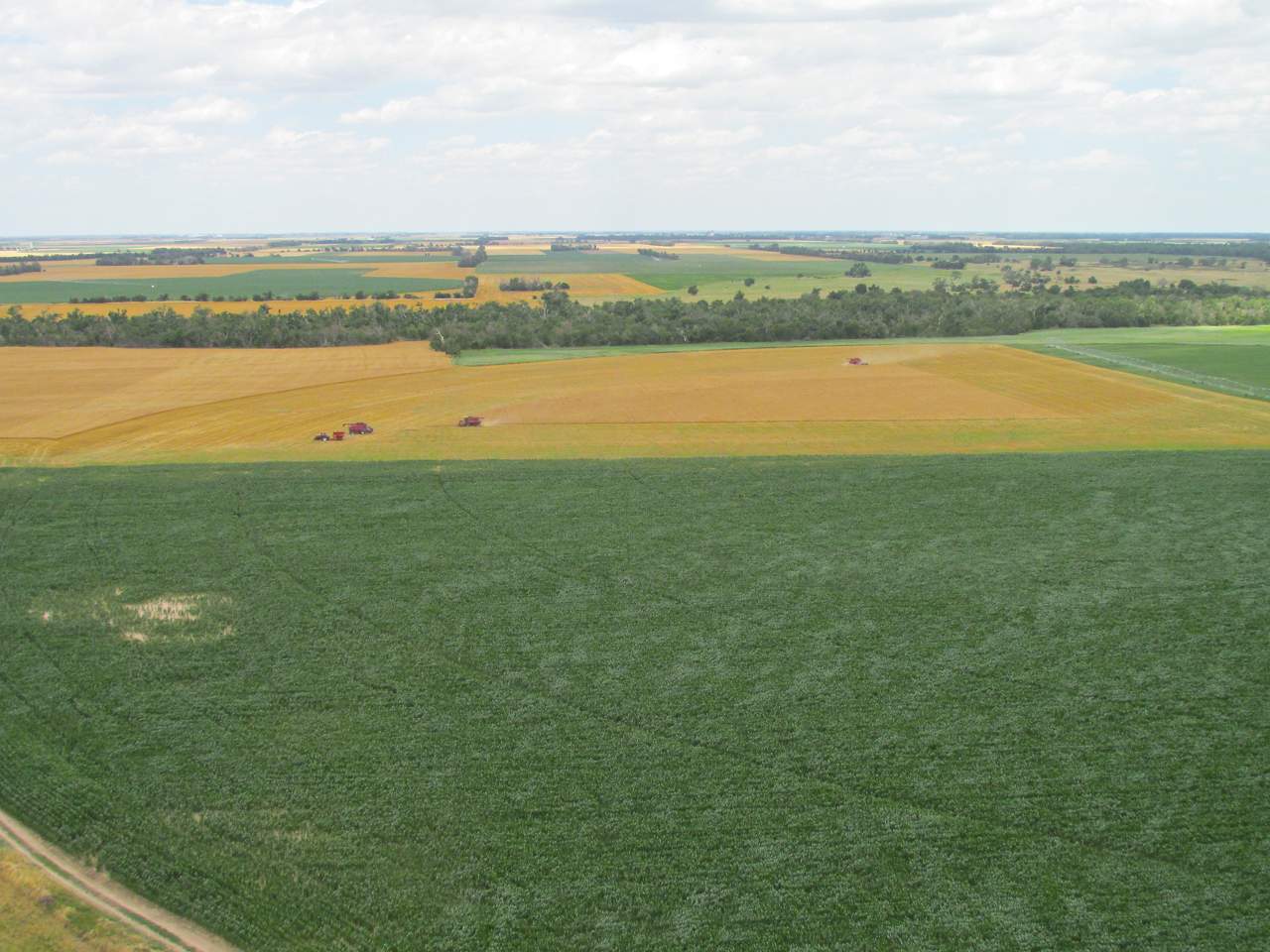
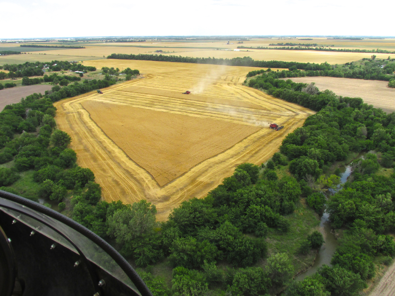
The Dust Of A Thousand Combines
On the flight up I suggested that you take note of the many fields I flew over that had already been gleaned of their wheat. Now on the return flight I will show you that was just a start. I estimate to have seen 100 combines busy cutting wheat as I returned from Ellinwood that day.
Because of the extensive cloud cover, the conditions for cutting wheat were favorable because the shadowing of the clouds lowered the temperature. I was happy for them in this regard but unfortunately that lighting condition is not auspicious for aerial photography. It produces a “flat” look, lacking contrast. Nonetheless, I took a number of pictures so you could see what Kansas Wheat Harvest 2013 looked like from the air. It was very impressive.
First Things First
Before getting to The Harvest, there were some interesting “reverse views” of things I photographed on the trip up. Here’s another look from a different angle.
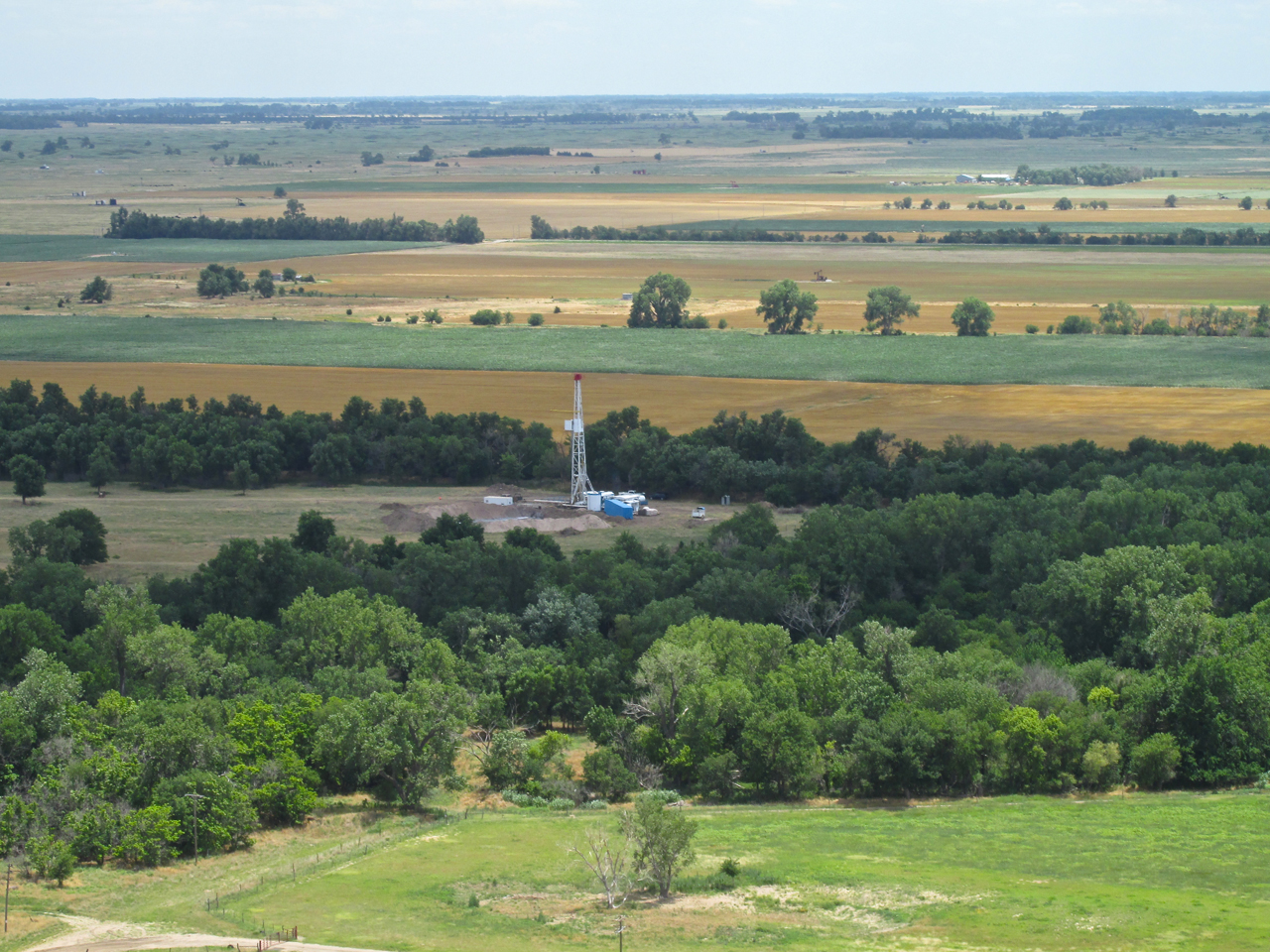
These are better pictures of the drilling site I saw Southeast of Ellinwood.
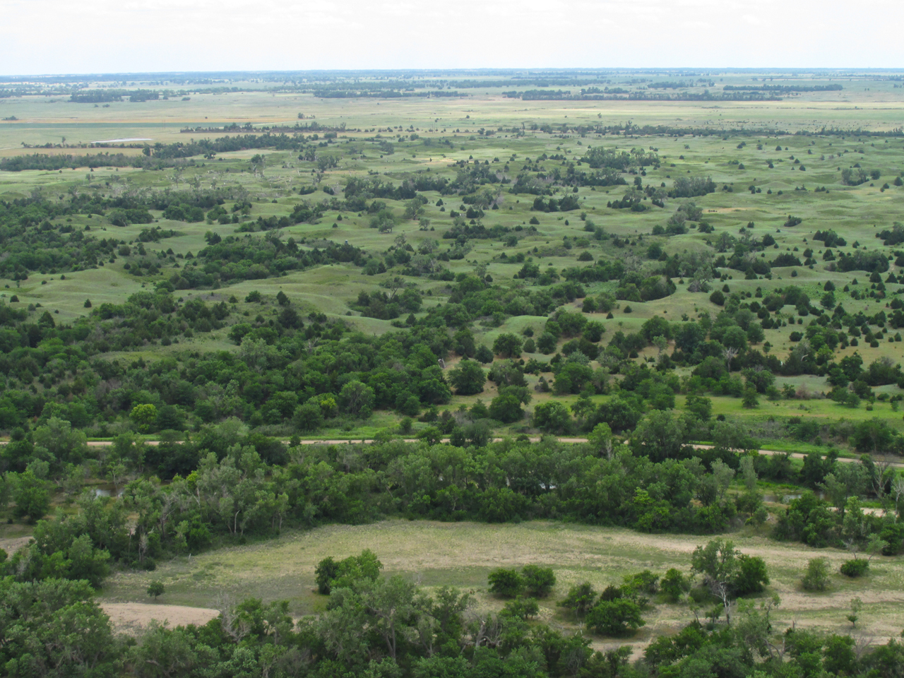
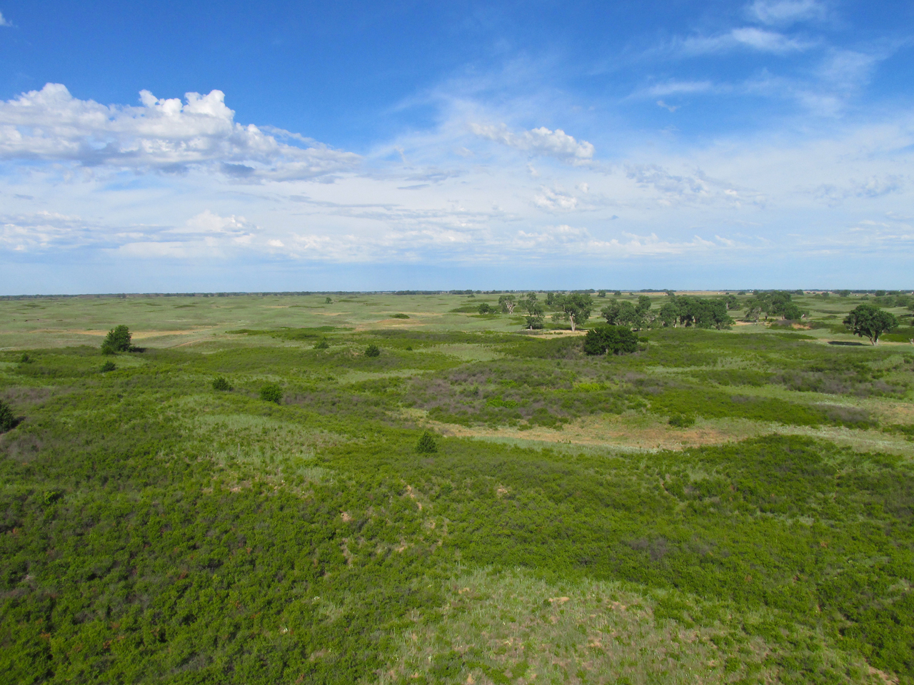
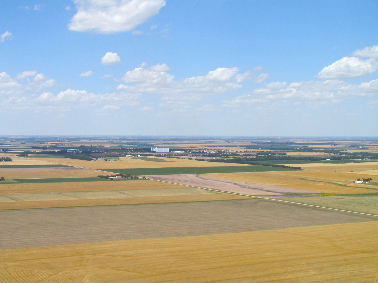
A panoramic view of the “Rolling Mound” territory Northeast of Quivira Wildlife Refuge. From 600′ looking Southwest.
“Wheat State” Wheat Harvest 2013
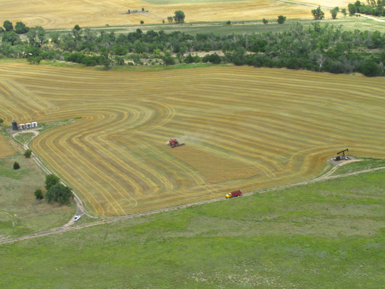
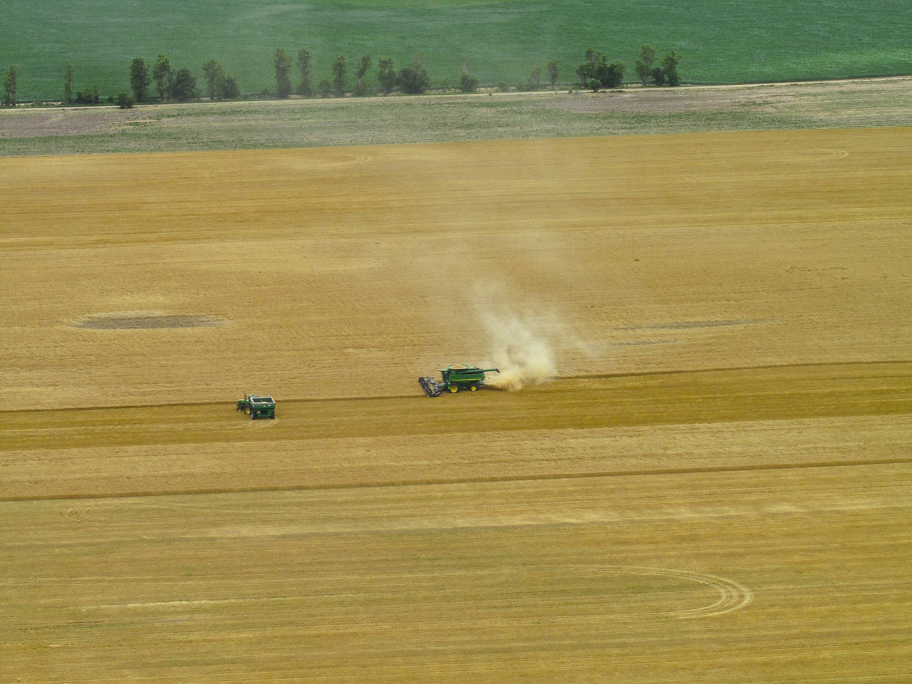
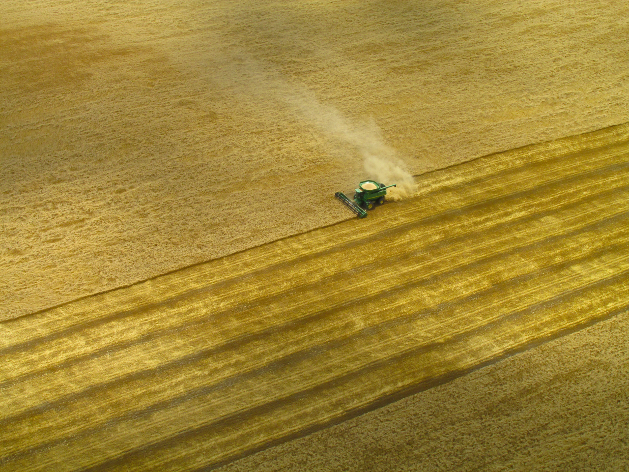
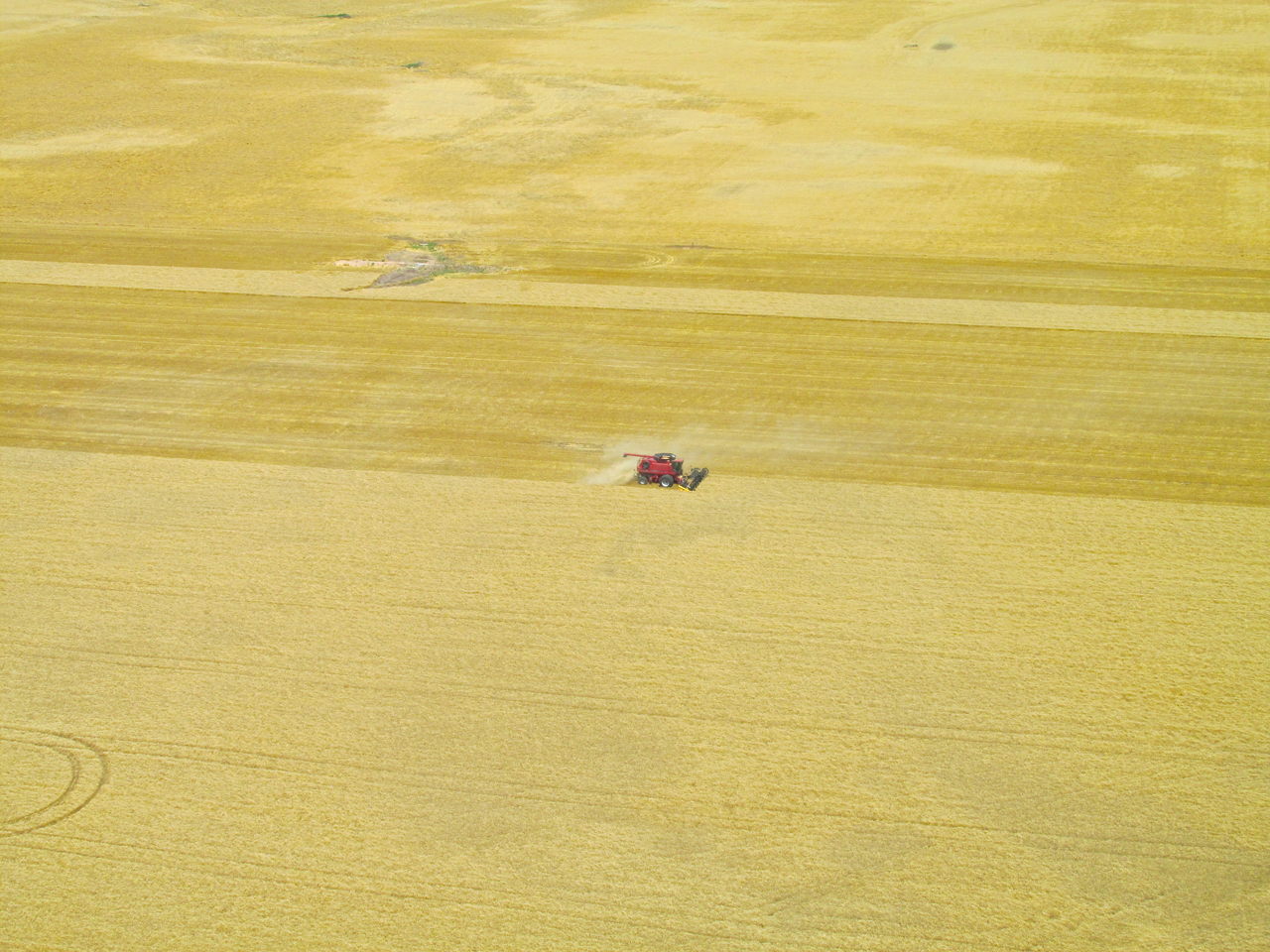
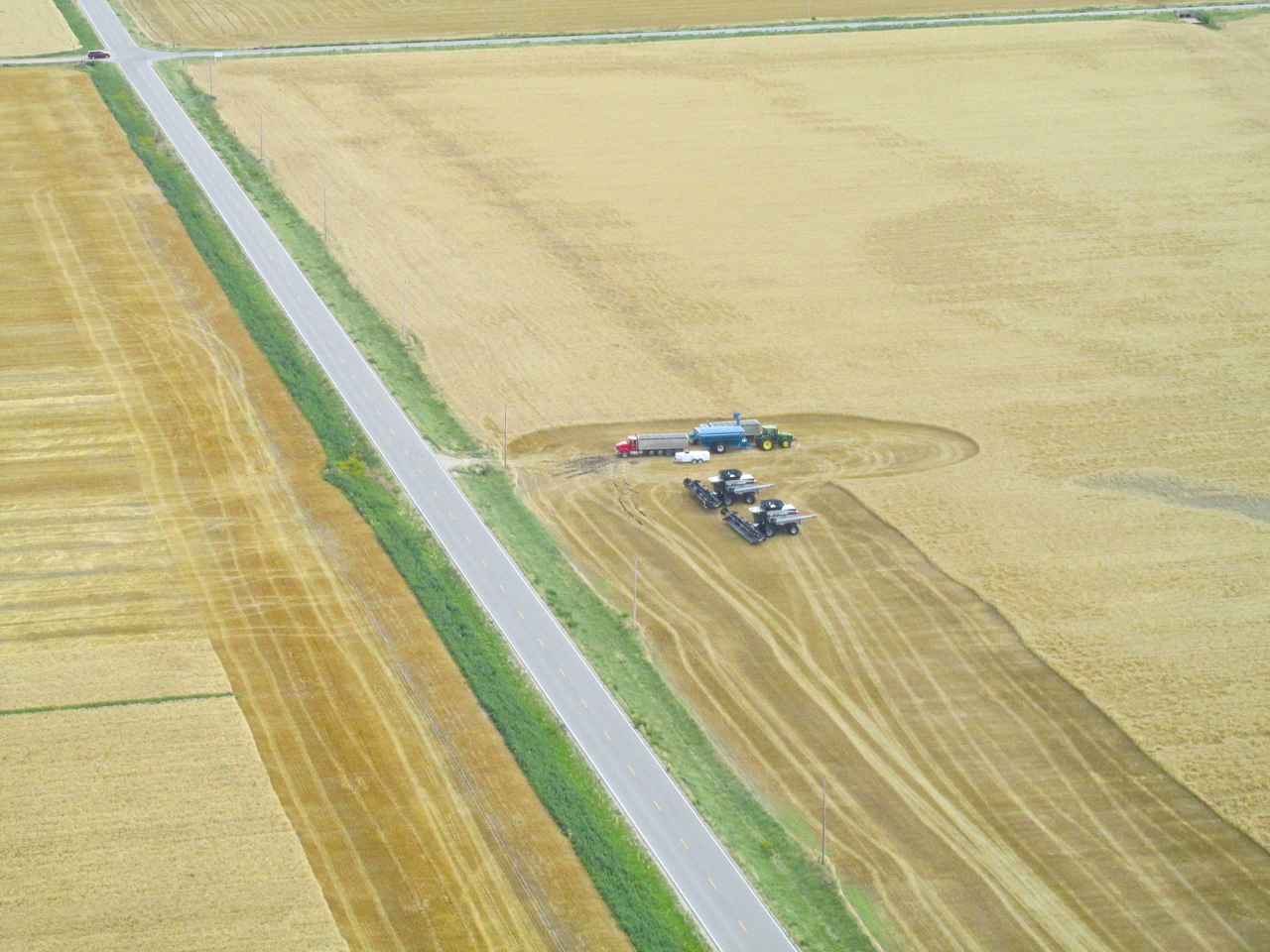
A combine with a waiting wheat truck. The trick in this business is to keep the combine moving while cutting. Wheat trucks need to be ready when the combine’s hopper is full. They then pull up next to the combine and offload on the run.
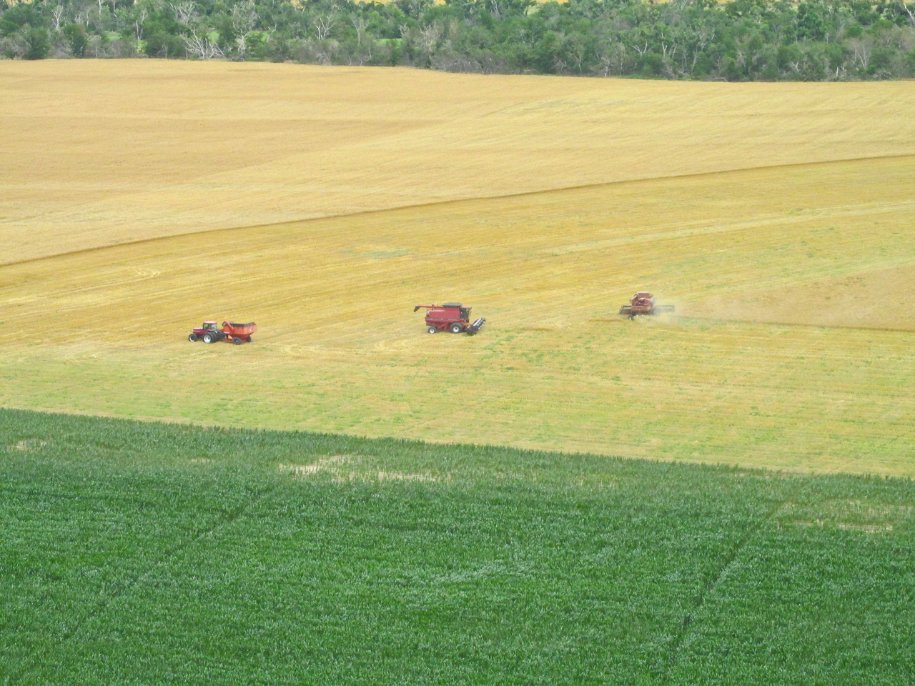
A Combine gets its name from the way it “combines” three processes at once: Reaping, Threshing and Winnowing. The dust seen to the right of the machine is that cast off in the Winnowing.
This meadow is being put to productive use for growing wheat and hunting deer.
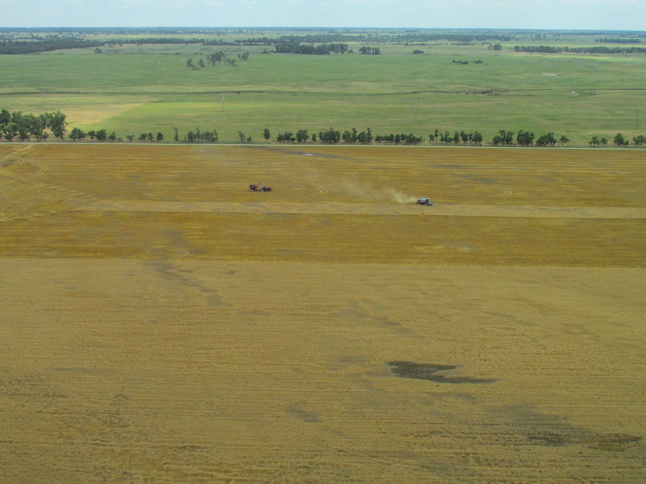
Rays of sunshine began to break through. A couple of miles ahead you can spot the combine in the center of the photo.
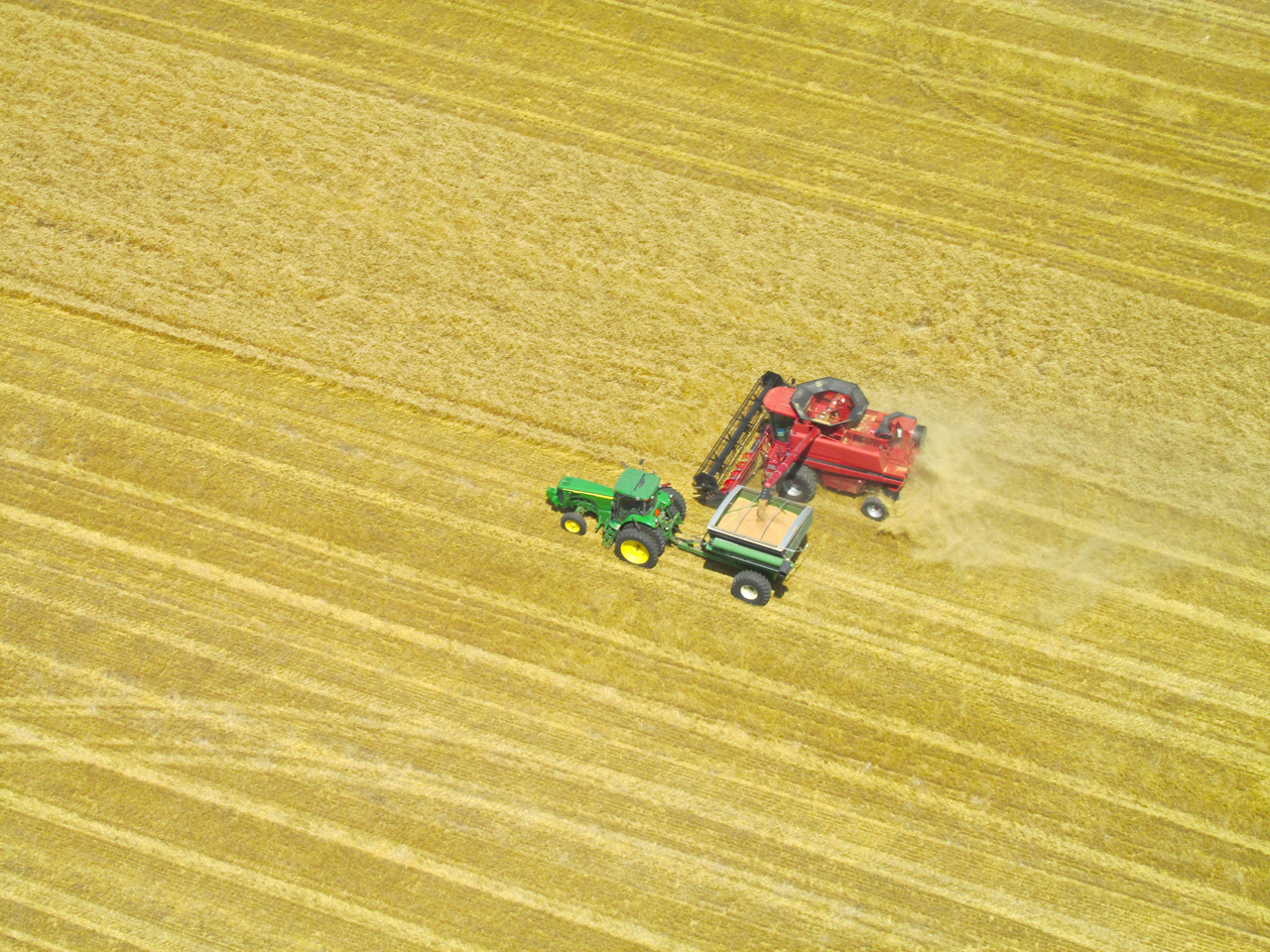
These guys are getting ready to perform a rolling transfer. The combine will not stop reaping while it unloads its wheat to the transport. Once the transfer is completed, the transport vehicle will speed away to unload the wheat and return.

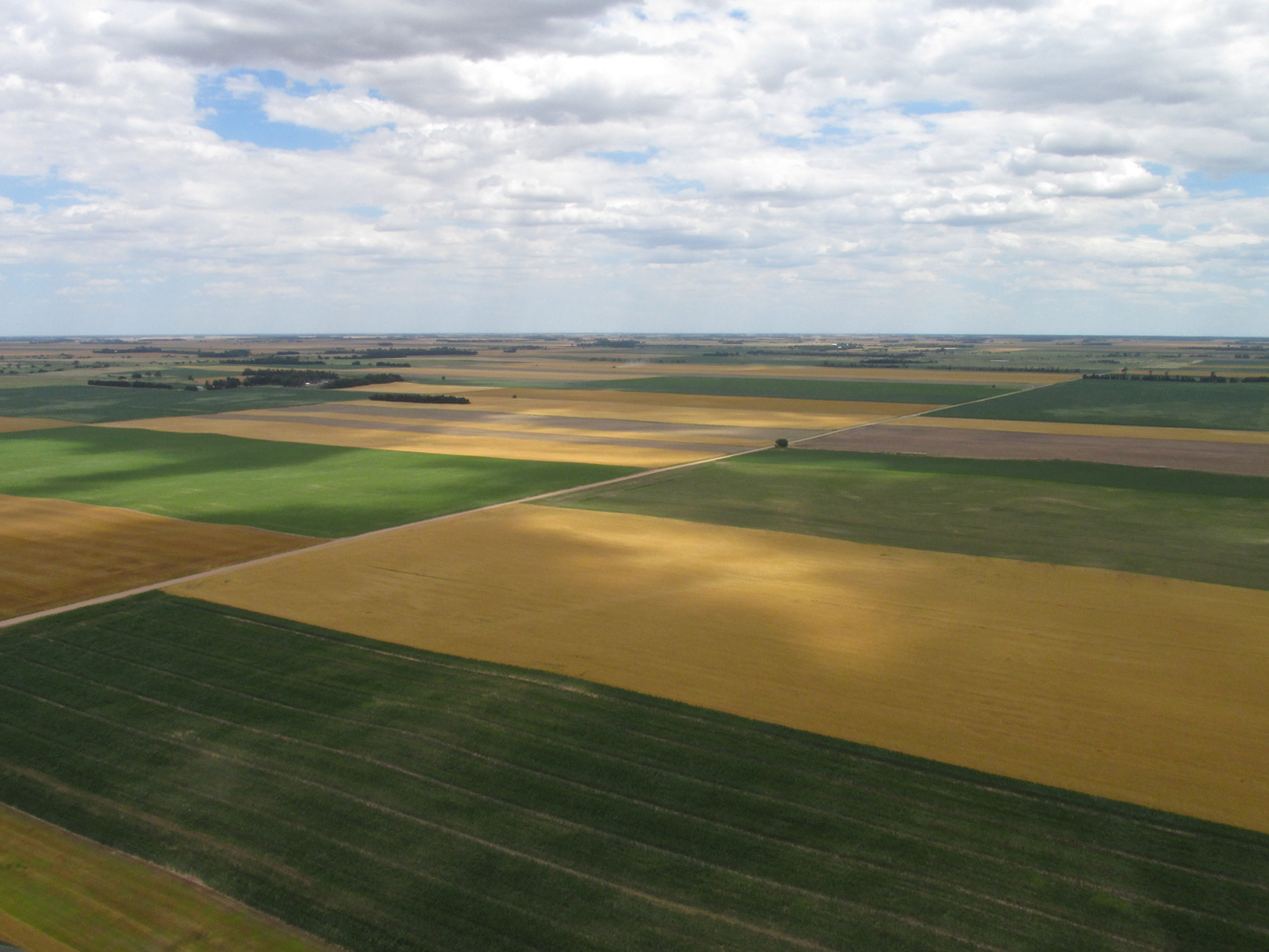
Fields – Some Harvested – Some Yet To Be
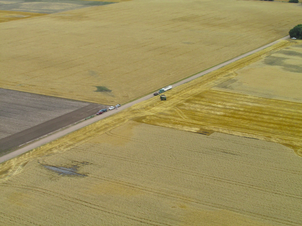
Here a transport vehicle offloads to a Semi-Truck Trailer. The folks near the pickups waved enthusiastically as I passed over.
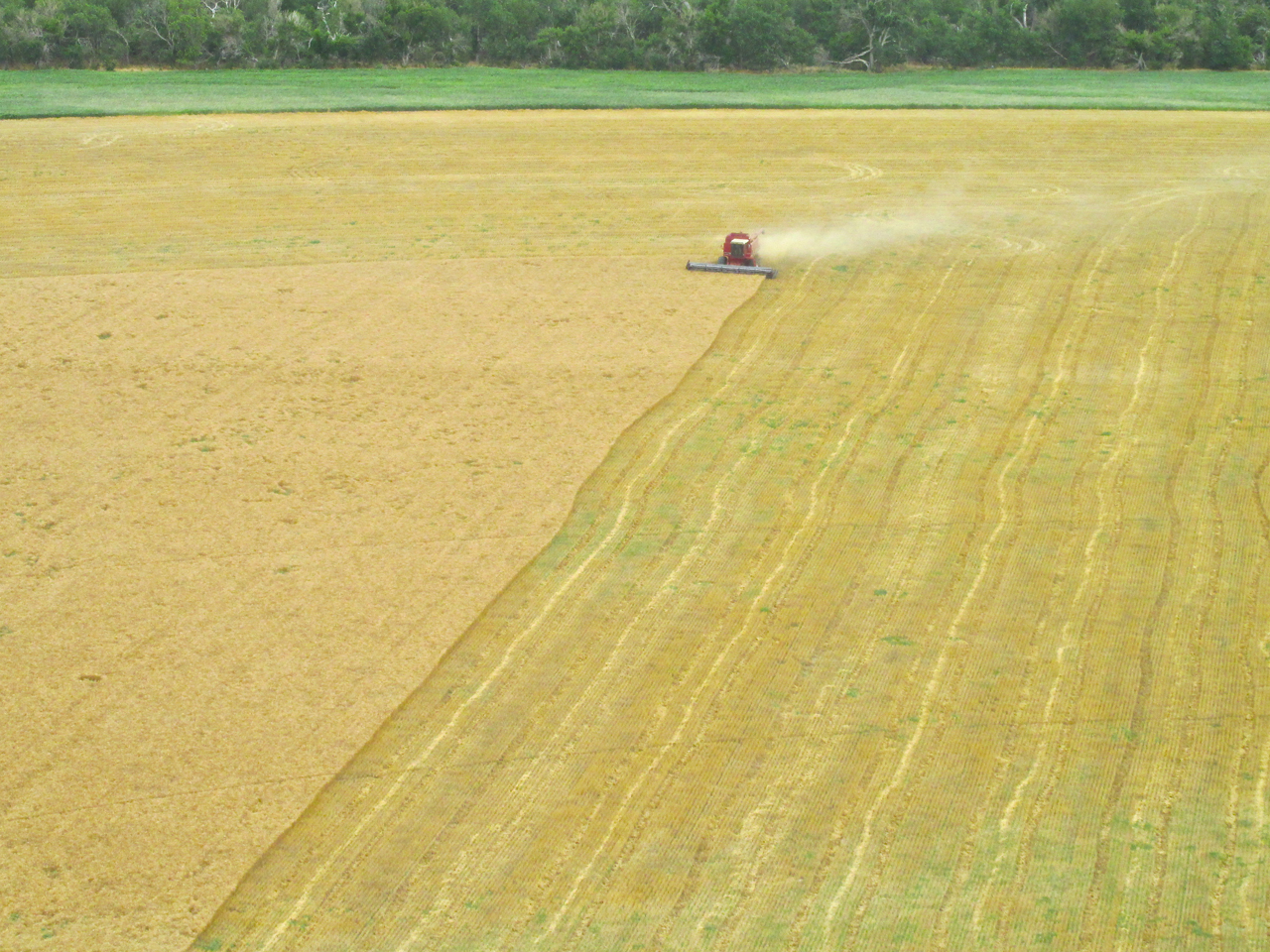
Something has negatively affected the wheat in two spots of this large field. The combine leaves it be.
Until the first time I flew over a combine in action I did not realize this. From here you can see the open hopper on top where the grain is held before transfer. The grain hopper is not evident when a combine is viewed from ground level.
No Coincidence
The rich bounty continuously flowing from what is called The American Breadbasket is no accident. I personally know people who live and raise crops and cattle in the area you have just “flown” over by viewing these photos. They are members of my Church. I have visited their farm on many occasions. They represent a significant majority in this region all having one unifying and defining characteristic – they are Followers of Jesus. Without going into a long dissertation let it be understood that Jesus came to help us have an abundant life (John 10:10). Sure, there will be problems and trials but overall the Christian Life is one of Abundance – Spiritual, Familial, Social, and Economic. In a nutshell, this is the secret of America’s success over the past 200+ years. To the extent a remnant (the size of which is known only to God) has followed and continues to follow Jesus our fortunes rise and fall as a nation.
Quartering Tailwind
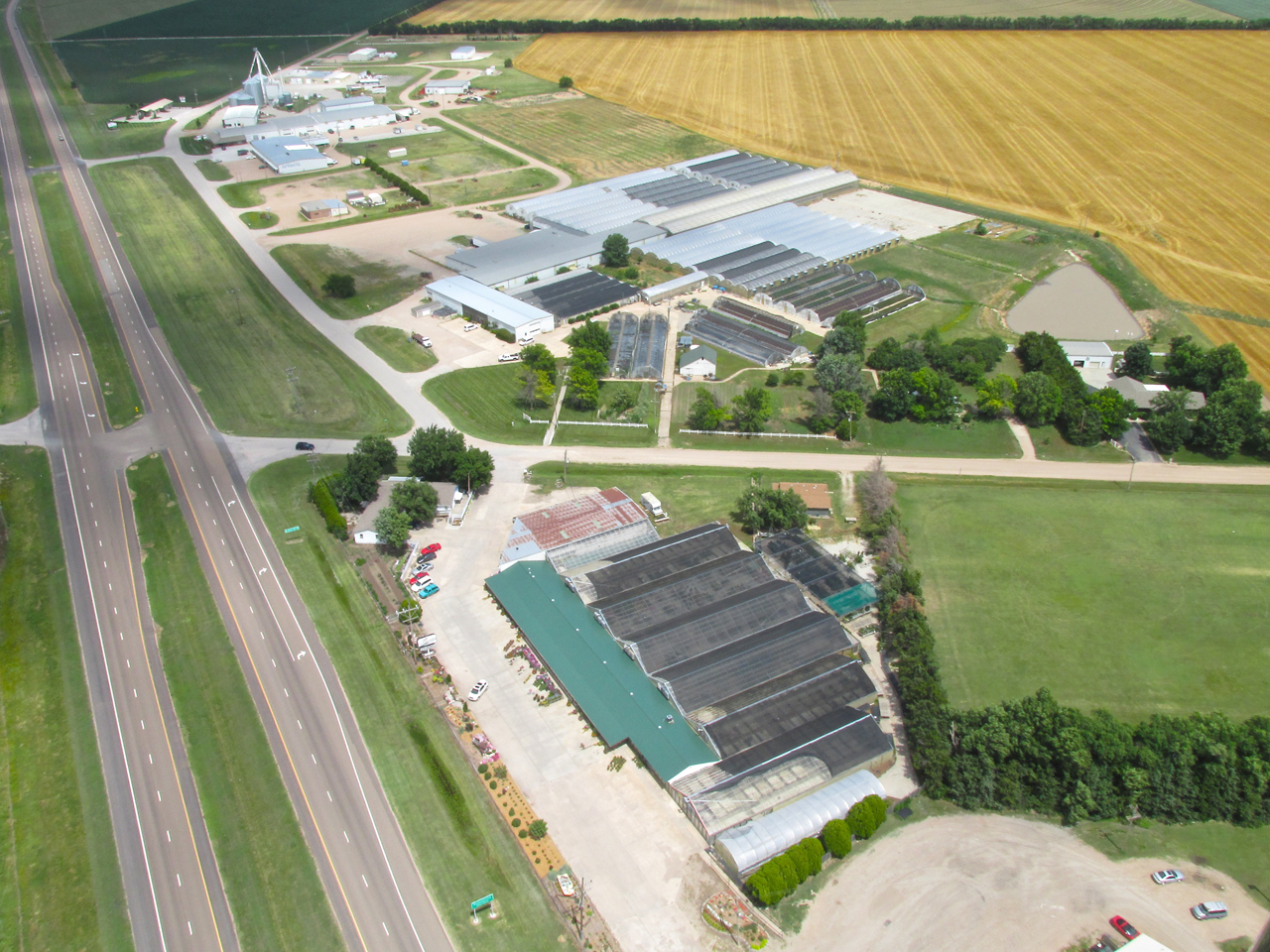
Even though a tailwind is always a help, if it is not directly from behind the aircraft you have to continually make adjustments to “cut across it”. Since my general heading was Southeast, the North Wind was constantly pushing me off course. Regardless of my efforts I would drift from time to time so my path home was not over the same track. This time when crossing Highway 96 I saw this large greenhouse operation I had not seen before.
Hutchinson, Kansas in the distance. 800′ AGL looking Northeast.
Crossing the South end of Sunflower Aerodrome looking North.
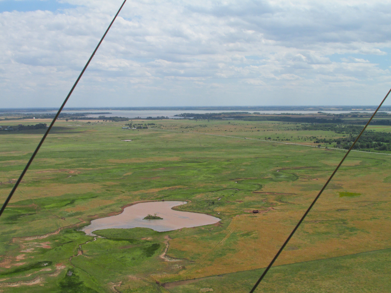
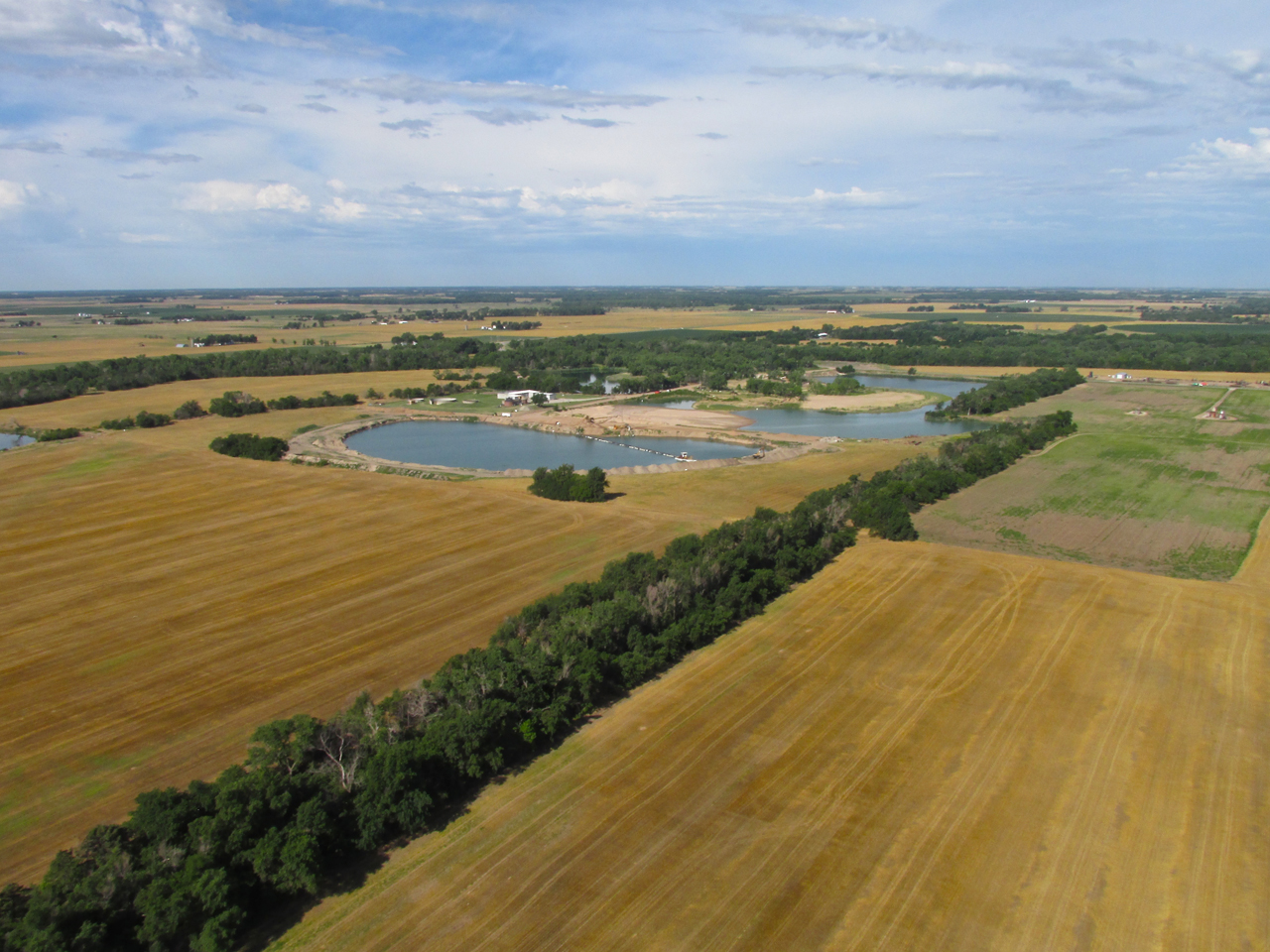
Just past Sunflower Aerodrome a look to the Southeast shows Cheney Lake framed between my flying wires. From this vantage point I could see the recent rains had replenished it to a great degree. 600′ AGL.
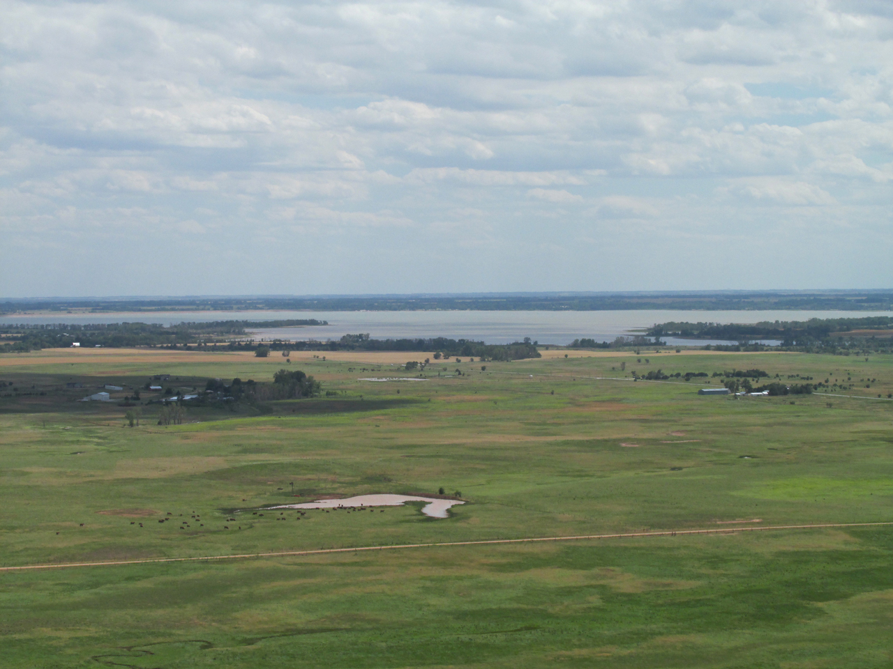
Same as above with the telephoto.
Now The Sun Is Out!
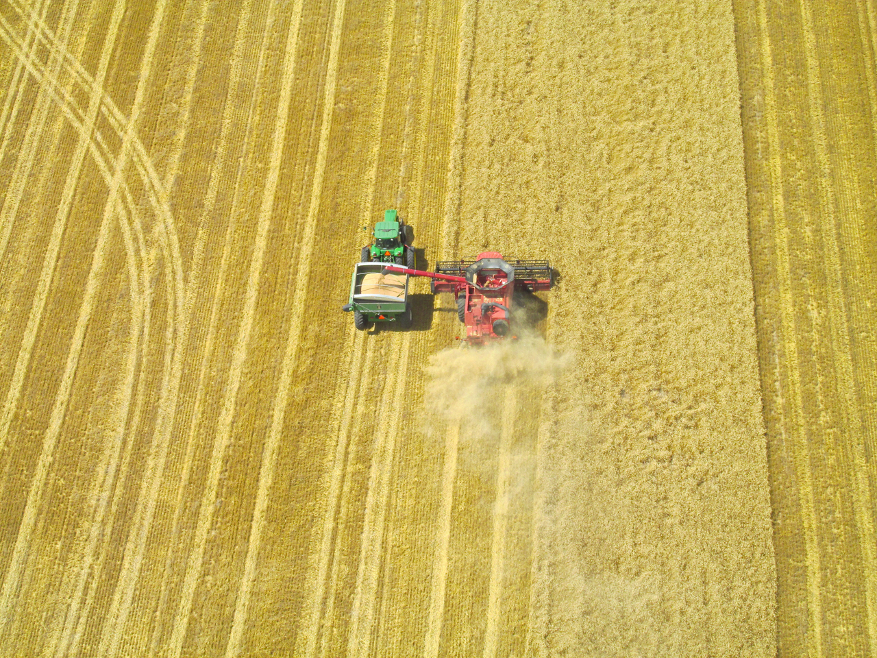
A perfect example of a “running transfer” as both machines “fly in formation”.
Same as above – different angle.
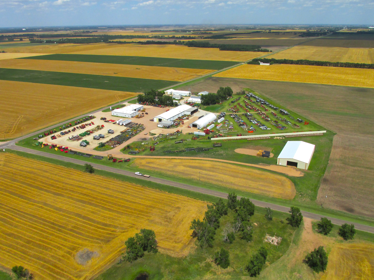
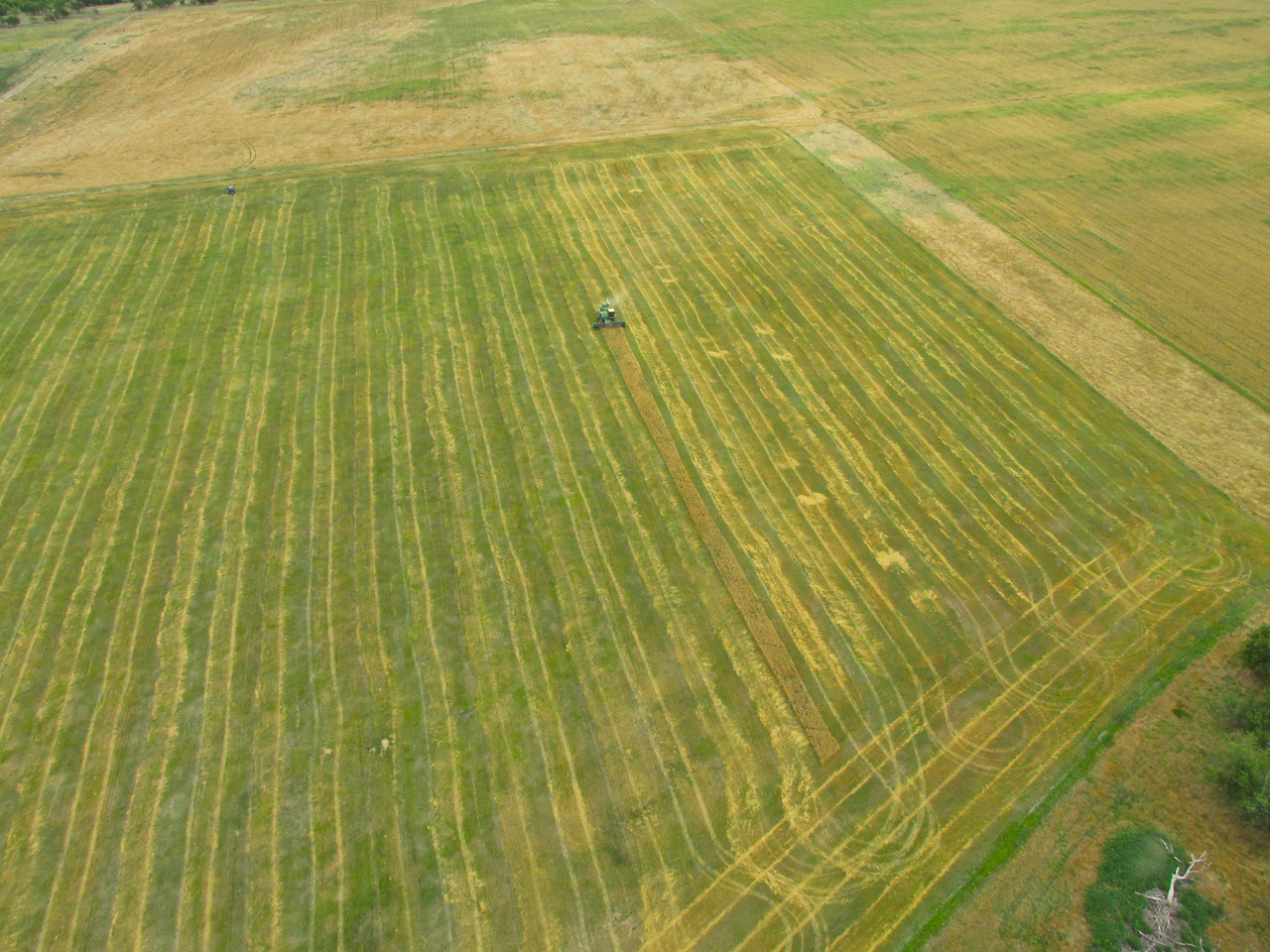
Isolated from any town, I came across this “Used Tractor Dealership”.
I liked the way these farmers “pre-cut” their loading area.
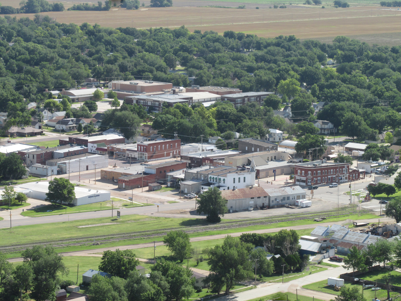
Andale, Kansas from 1,000′ AGL looking Northeast.
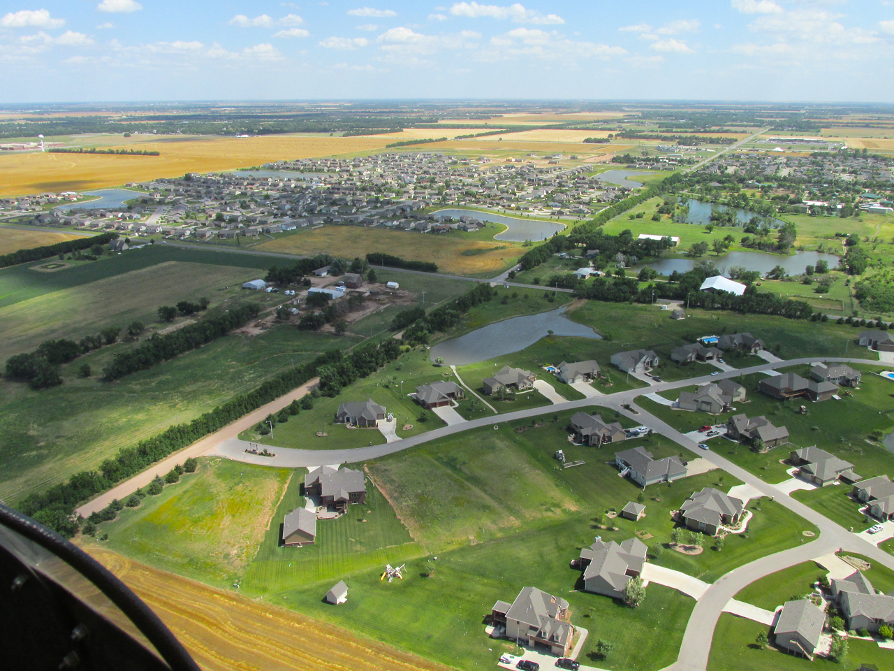
The Northeast Suburbs of Goddard, Kansas.
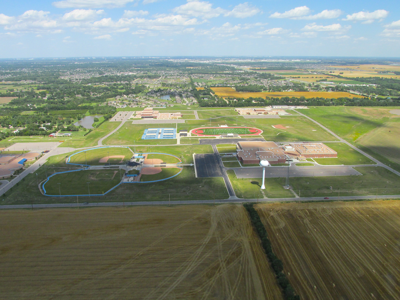
The campus of Goddard’s Eisenhower Middle and High Schools in the foreground.
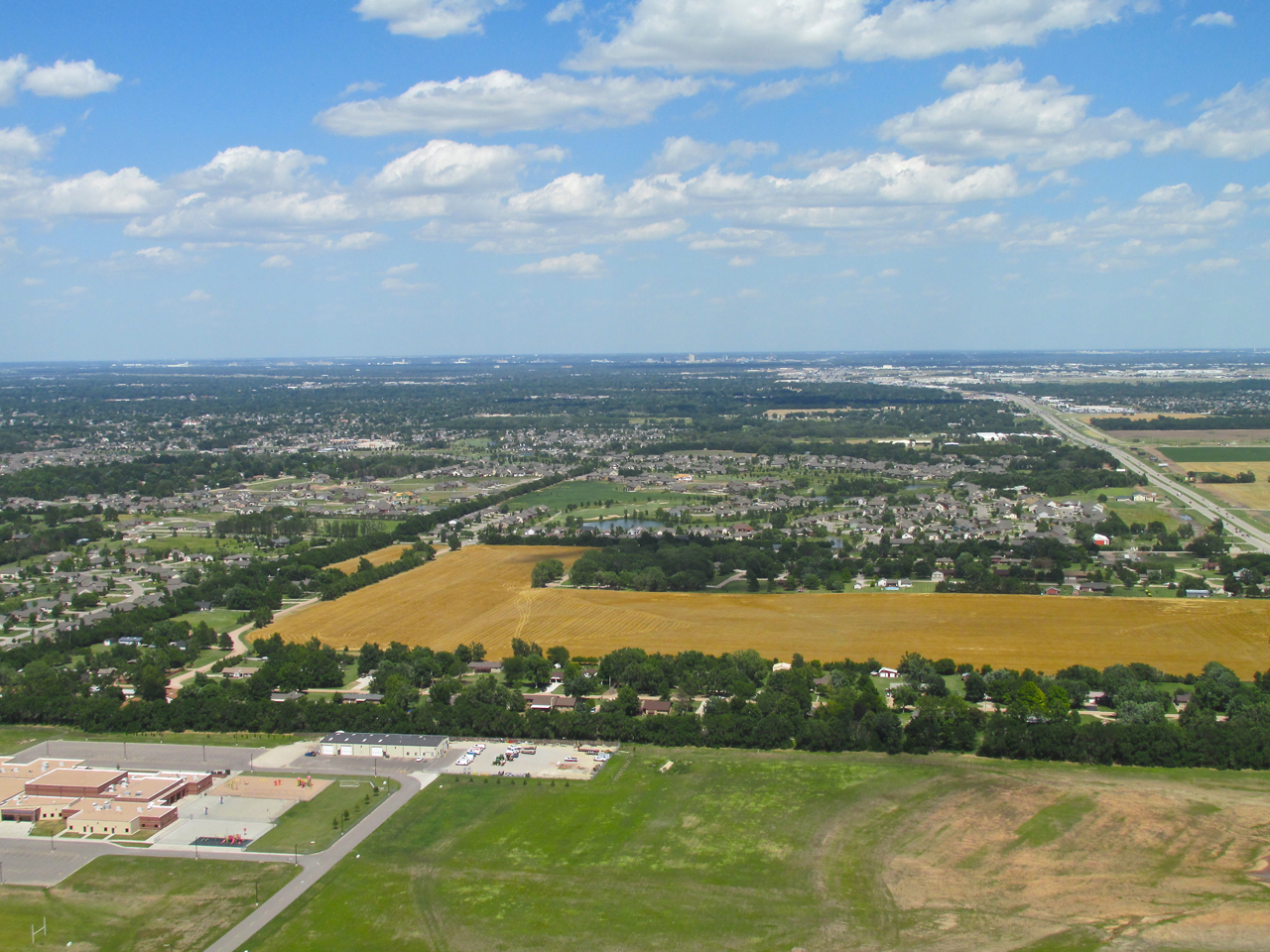
Goddard is 14 miles West of Downtown Wichita which you can see in the distance. This is from 1,100′ AGL looking East.
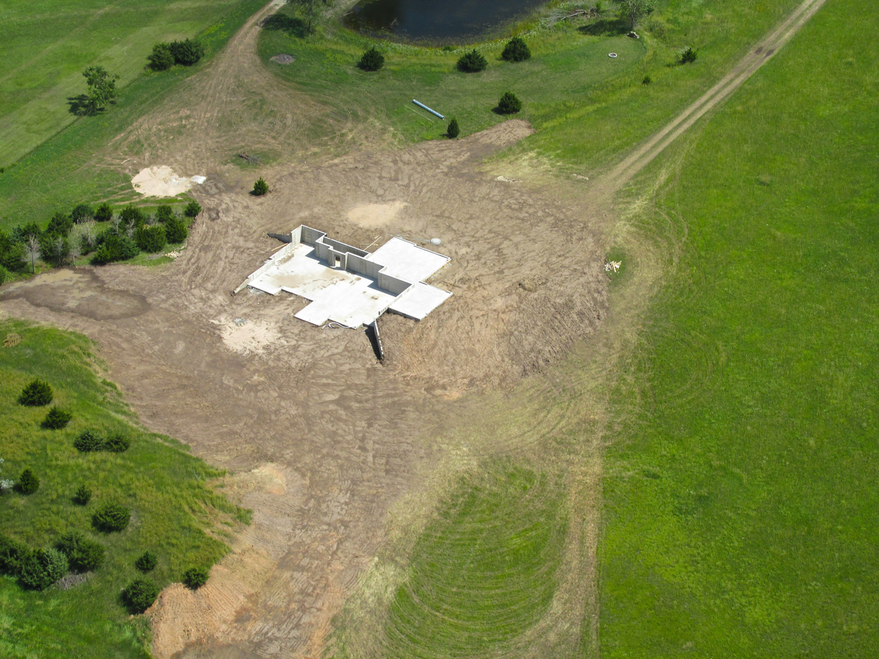
Someone is building a new home with a walk-out basement.
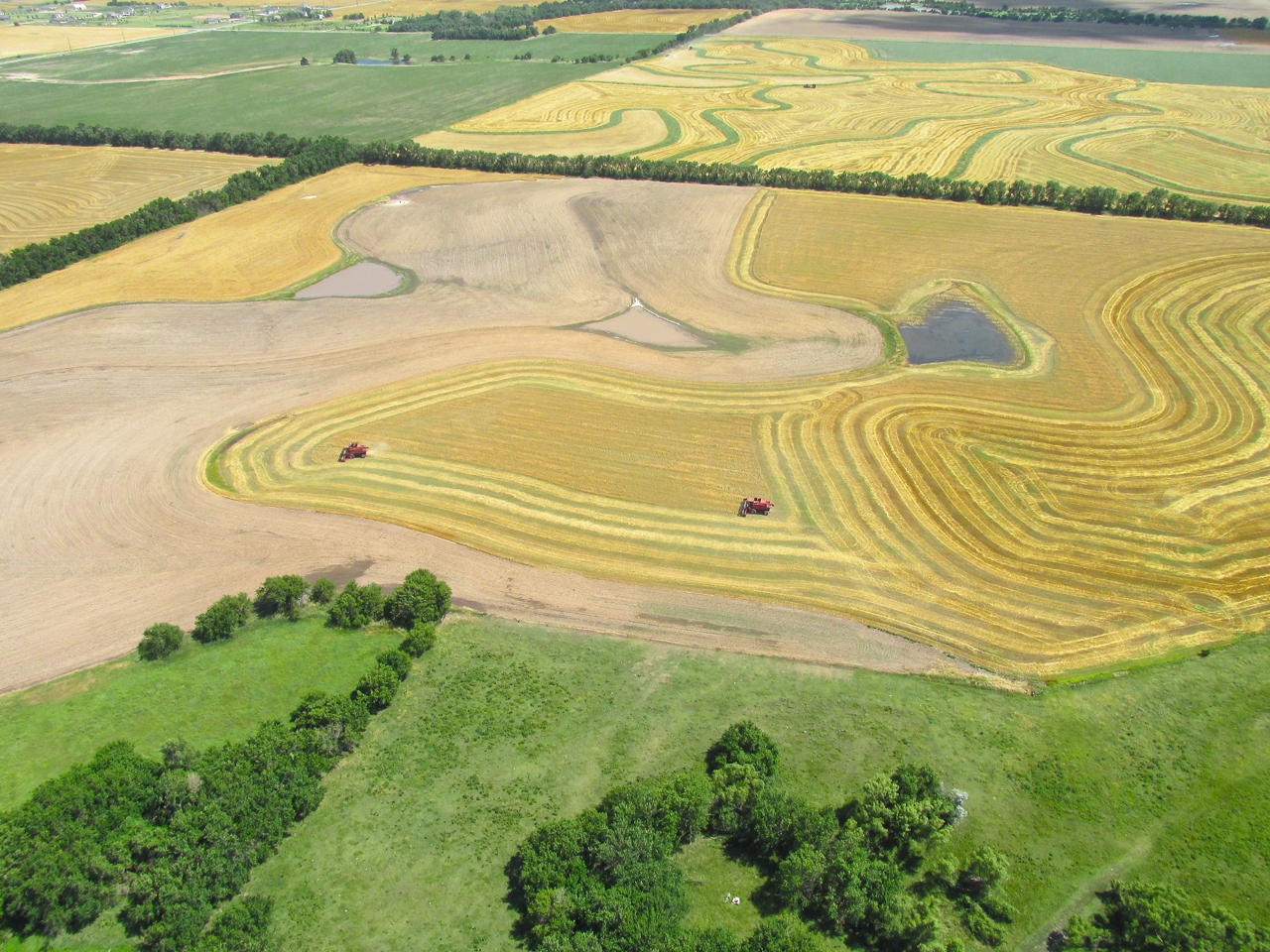
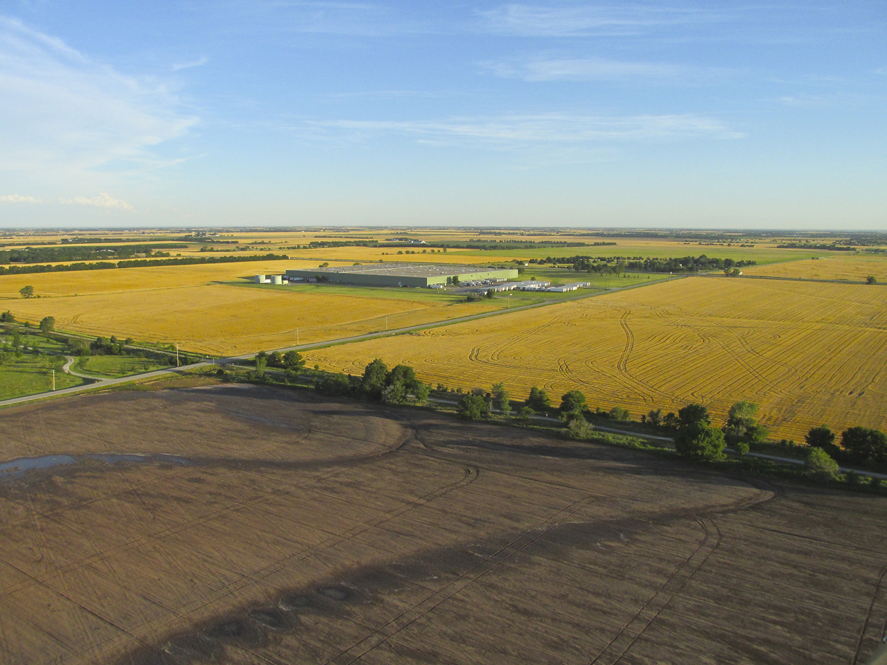
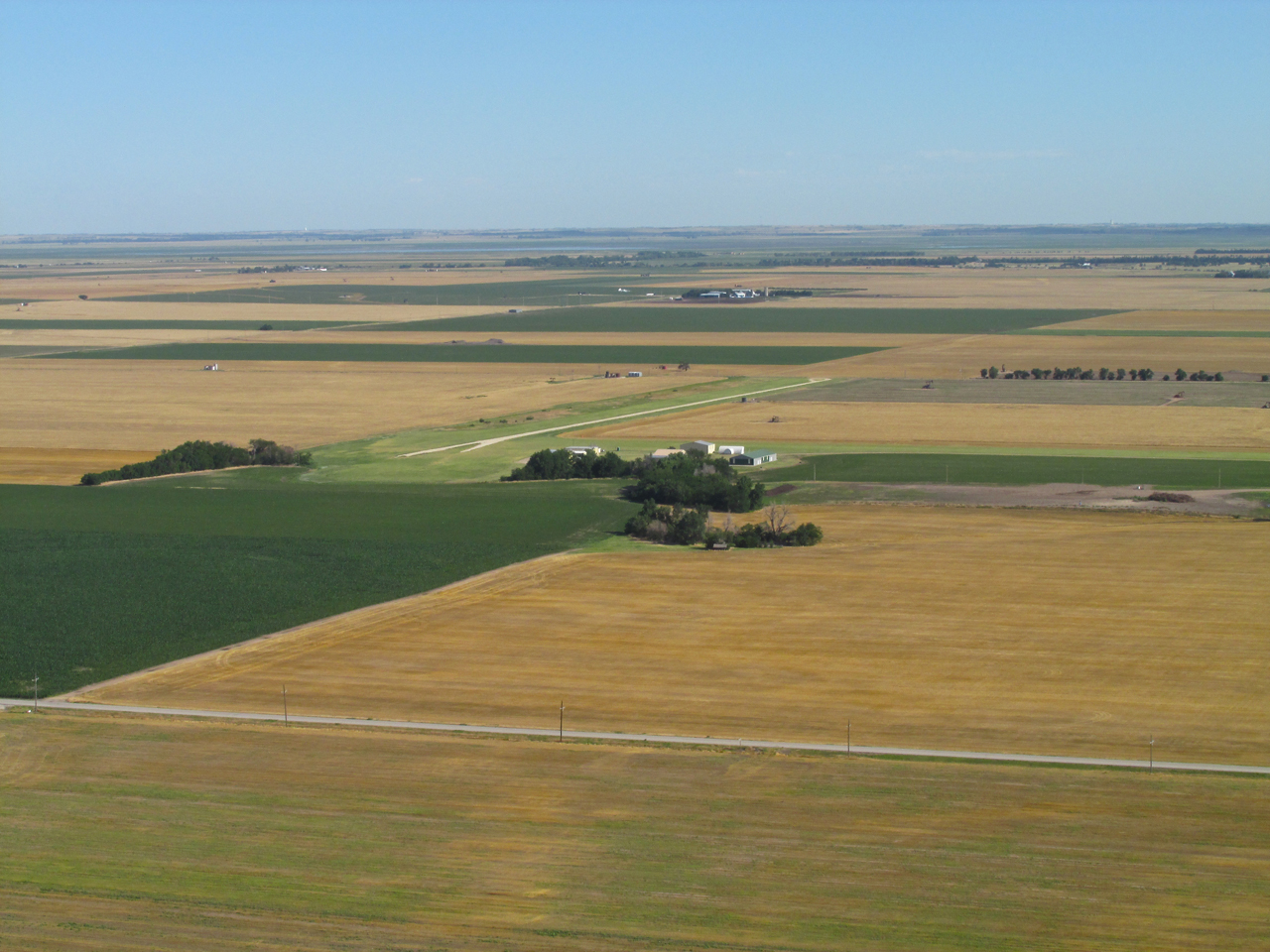
More Wheat Harvest – These Fields Feature Attractive Contour Lines
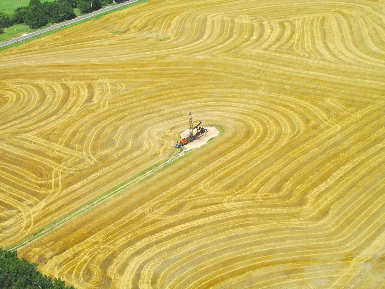
The higher price of oil has brought a lot of inactive oil wells back on line. Here a “workover unit” begins the process to start one back up.
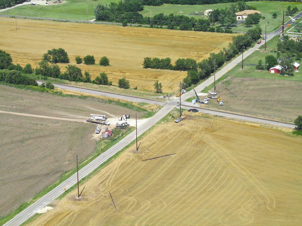
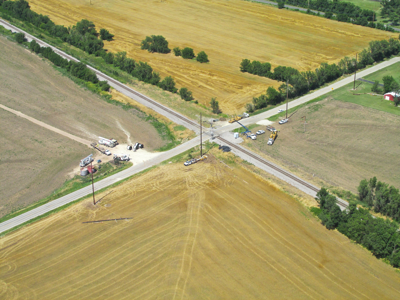
Wichita Linemen
I am always intrigued by the work linemen do to bring electricity to our communities. Much of the type of line work shown below is done out in the country where most of us never see it. In this next series you will see a “pole upgrade change over” taking place to the West of Haysville, Kansas.
Spirit Aerospace, McConnell AFB and Beechcraft
The next two shots were taken at 1,200′ AGL. Because the atmosphere was so clear the visibility was excellent. Spirit Aero and McConnell are the major looking facilities in the foreground and then farther off is the Beechcraft factory and airfield.
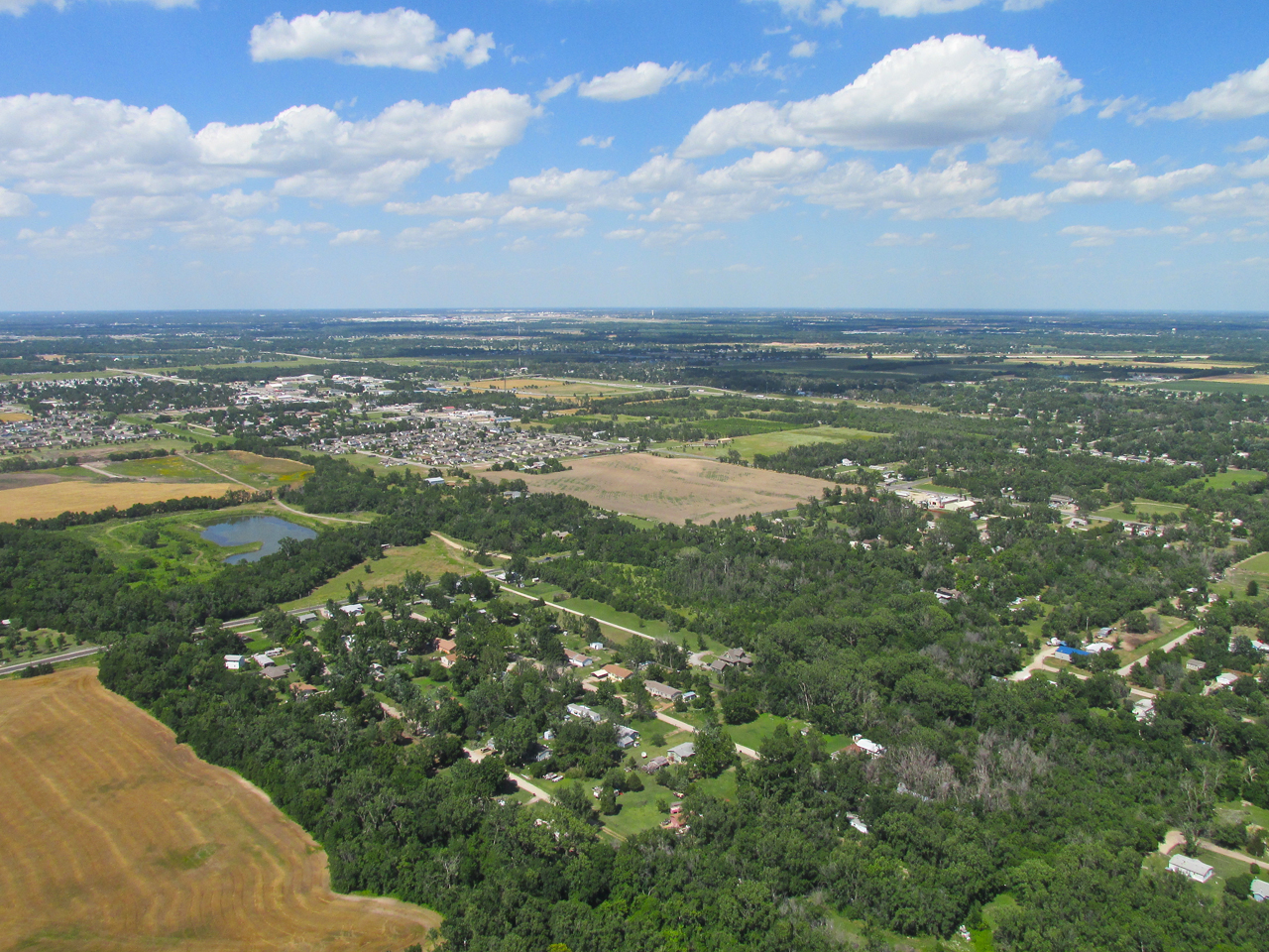
A Wide Shot…
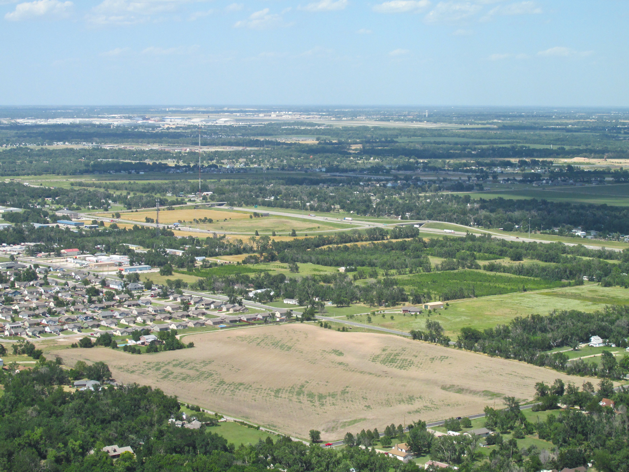
…a medium one…
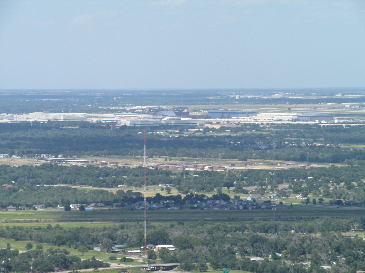
…and the longest telephoto my little camera can muster.
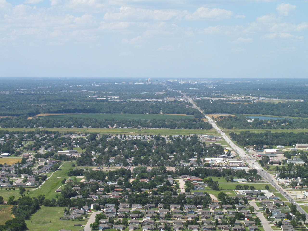
While I was at it I tried a telephoto of Downtown Wichita. I am at 1,200′ AGL looking North.
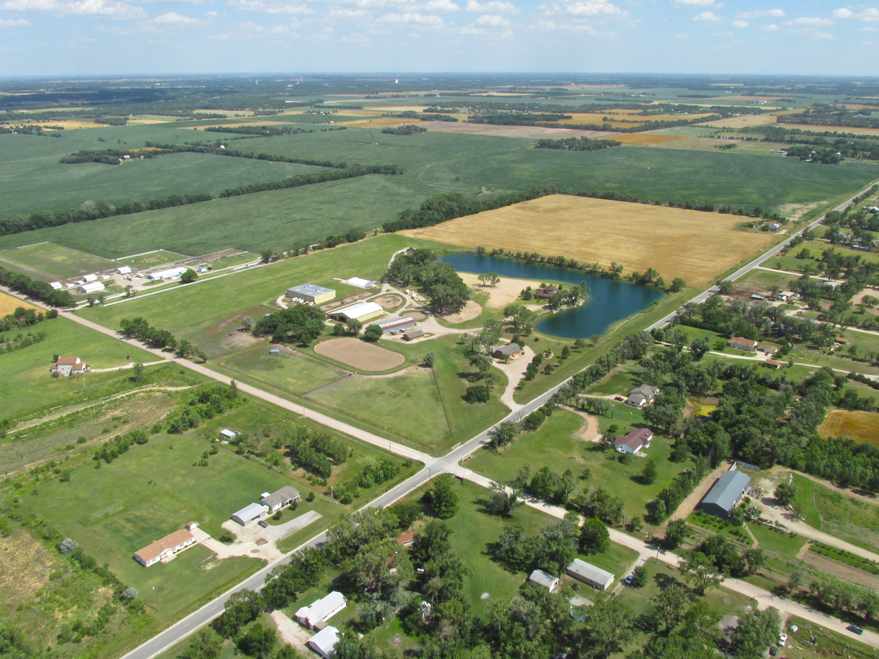
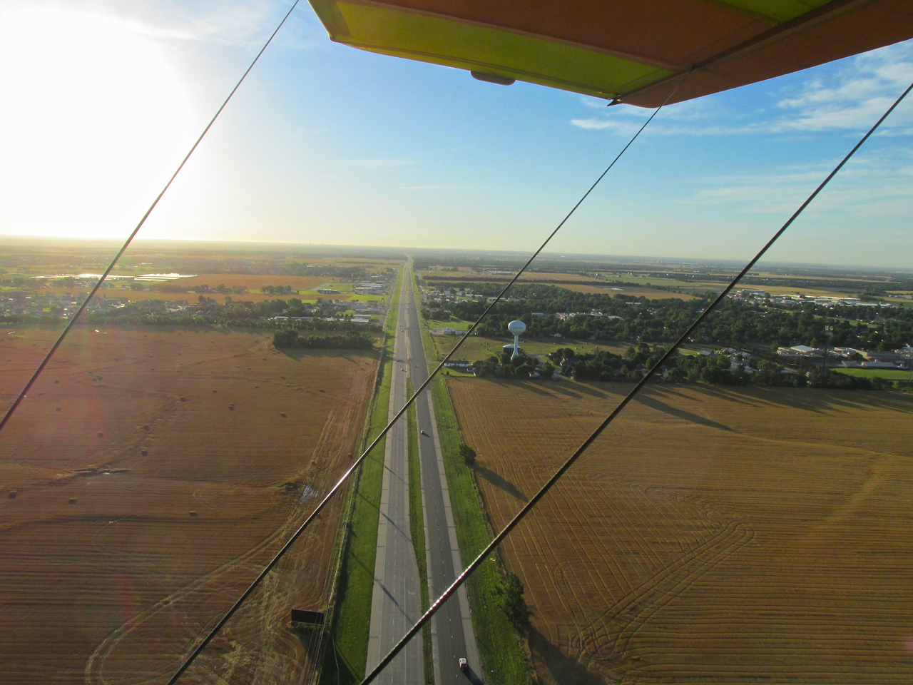
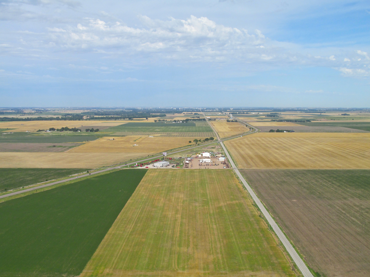
Having shown all the previous, it would be wrong if I didn’t grab a shot of Selby Aerodrome and Horse Stables as I enter the pattern. I am at 1,000′ AGL looking Southeast.
Pulling Off “The High Way”
After a two hour journey down “the high way” in temperatures that had finally reached the high of 90 degrees for the day, I did what I always do at the end of a “hot flight”…
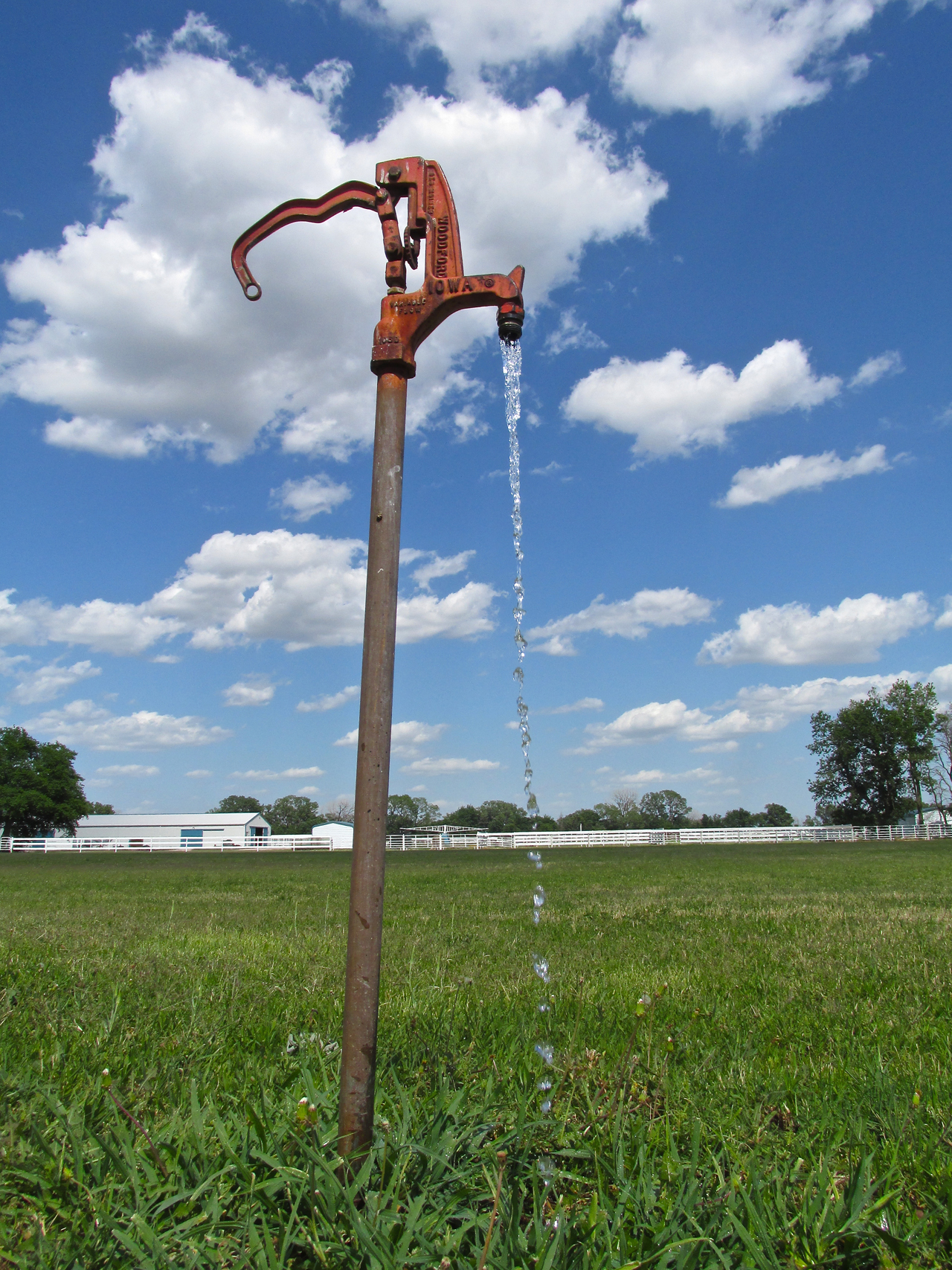
The Faucet Near The Hangar Door
I stuck my head under some nice, cool water!
So ends the latest report from The Sky Surfer. I hope you enjoyed it.
Blue Skies & Tailwinds!™
Brian FitzGerald – Wichita