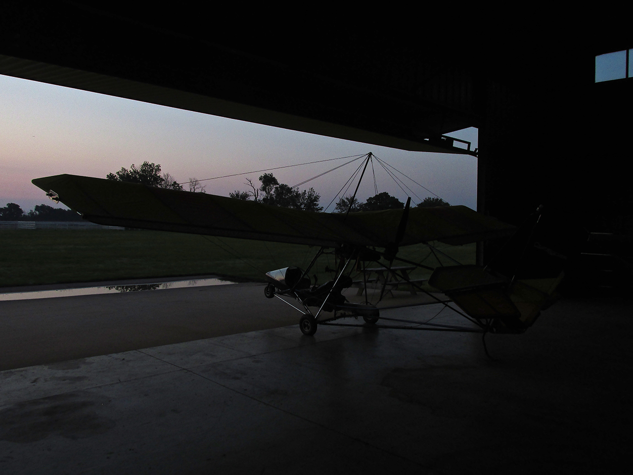
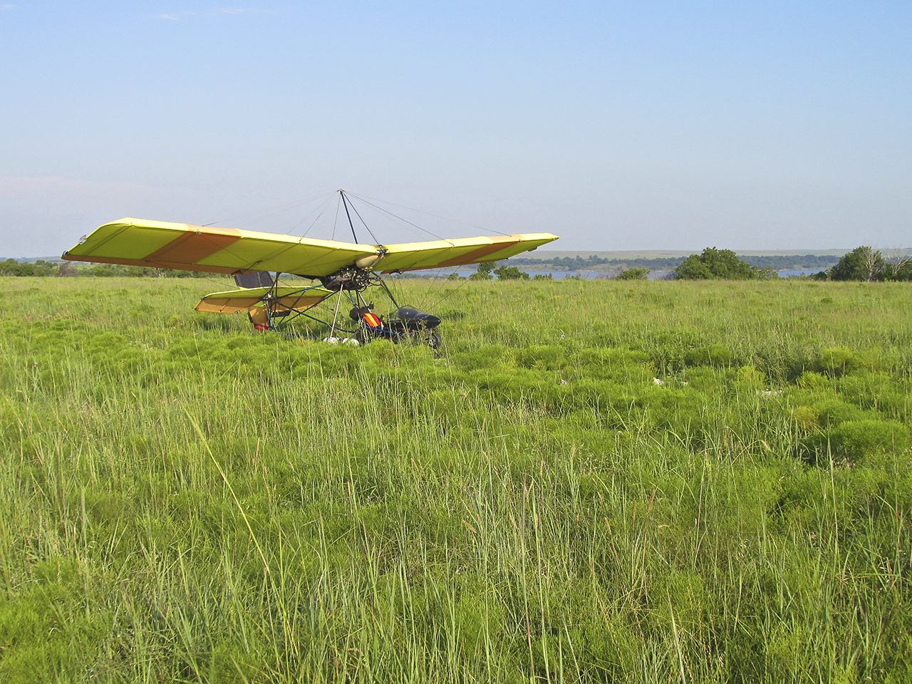
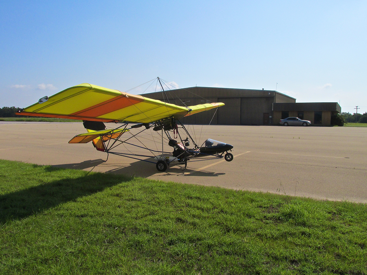
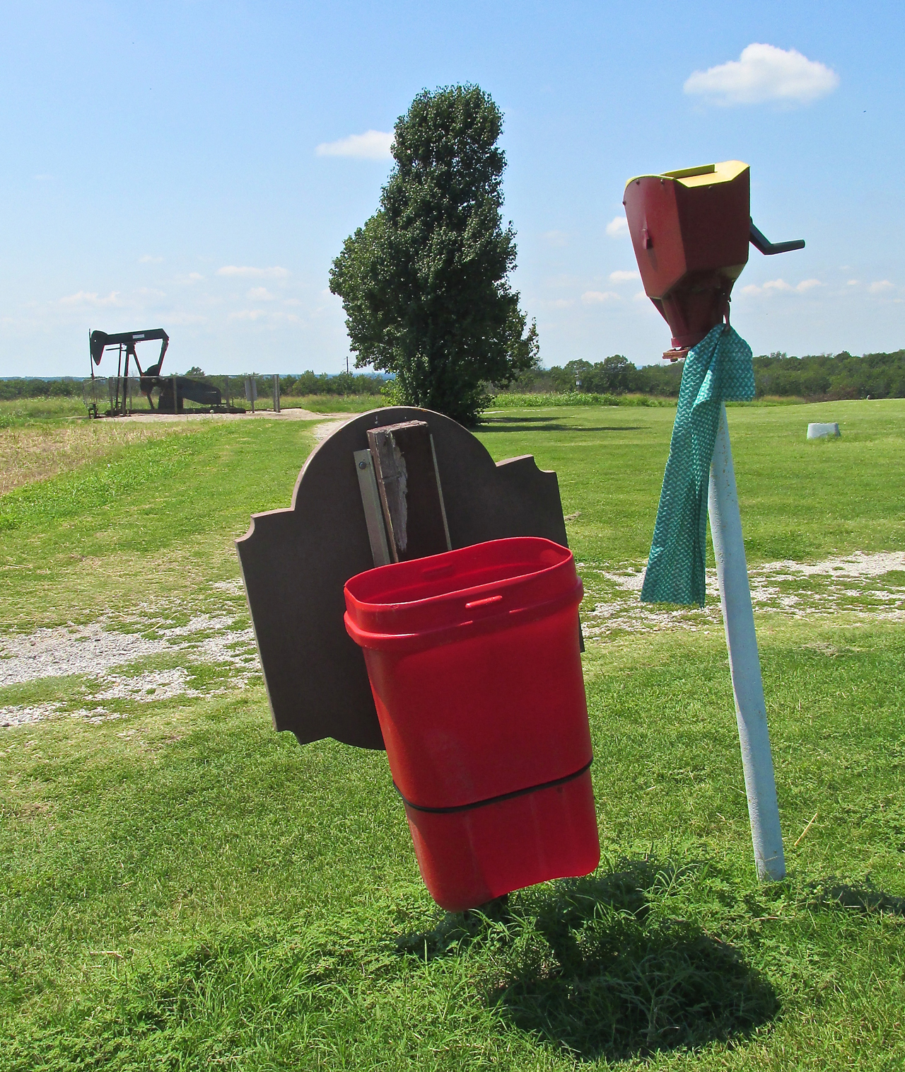
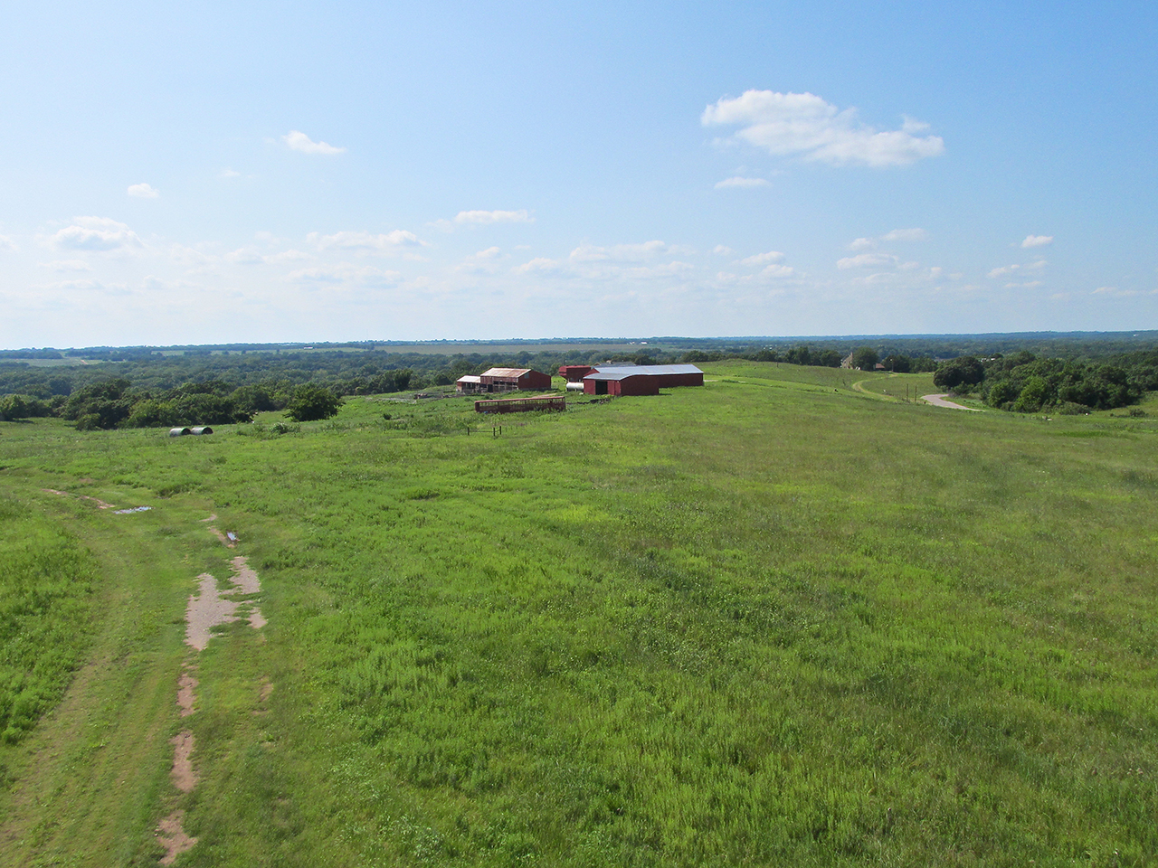
Pre-dawn at The Selby Aerodrome. The Sky Surfer had checked it over the previous evening – the Quicksilver is ready to take wing.
On Route To Tiger Town
The night before making this flight I consulted my primary weather prognosticators (wunderground.com & weather.com) and the consensus was the wind was to be from the Southeast at 9 mph, the temperature fair. I looked on my “Points of Interest” map and zeroed in on an interesting town in Oklahoma to the Southeast that had been brought to my attention on a previous flight to Pawnee, Oklahoma.
On arrival in Pawnee that Friday the 5th of July, I had the good Providence to meet Tom Tisher who was working on the rodeo grounds adjacent to the air field. While giving me a ride into town he suggested I try Cleveland, Oklahoma for one of my next flights. He had been born there and said it featured a good air field on the edge of town. It went on my list, waiting the right wind conditions. Propitious weather conditions occurred 17 Aug 2013 – The Sky Surfer had a mission.
Some Easy – Some Hard
Not to paint this darkly but some Fun Flights require much more physical effort than others. They are all great adventures and inherently fun but some require far more exertion than others. Perhaps God arbitrarily chooses to test one’s mettle on occasion. Maybe He wants us to prove ourselves at times. Also, I suppose one should expect “Mountain Top Experiences” to necessitate more than a passive involvement to achieve. For any or all of those reasons, the Flight to Cleveland was one such test of endurance.
(OK. Let’s stop right here. I have already read through this artful co-mingling of fiction and fact and I’m here to tell you any real or perceived “exertions” The Surfer had on the Cleveland, Oklahoma Fun Flight were all of his own making. As usual the whiner tries to make it sound like he is some Old Testament Mighty Man, striving with God, conquering great forces of nature, performing heroic deeds but, as we shall see, The Flight Was Easy – The Surfer Made It Hard. Hang in there. Let’s just let it unfold. You’ll soon see what I mean. – The Editor)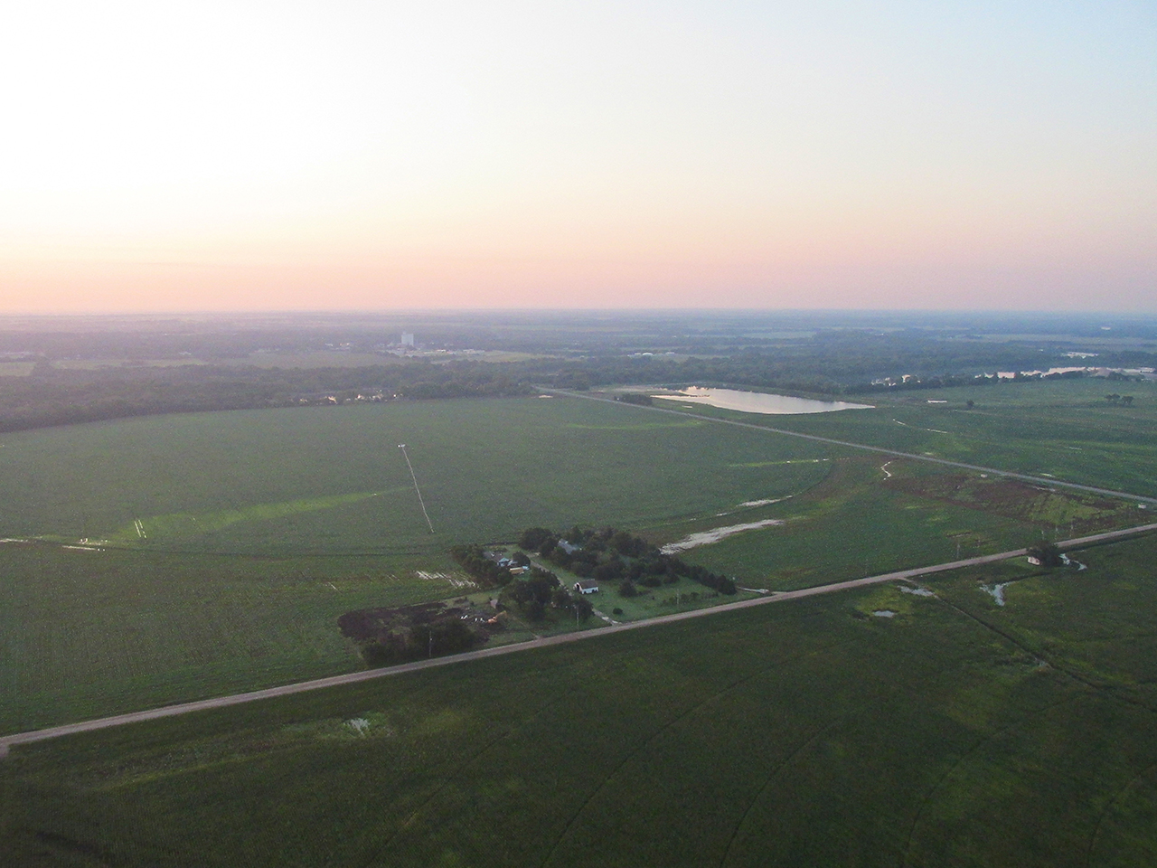
Just after takeoff, the sun has yet to clear the horizon. Looking Southeast from 600′ AGL.
The flatness of the water surfaces below betray the stillness of the air.
Still in a monumental “Summer of Rain”, consistent, daily precipitation has kept the ground wet most everywhere in the region. Oxford, Kansas in the distance.
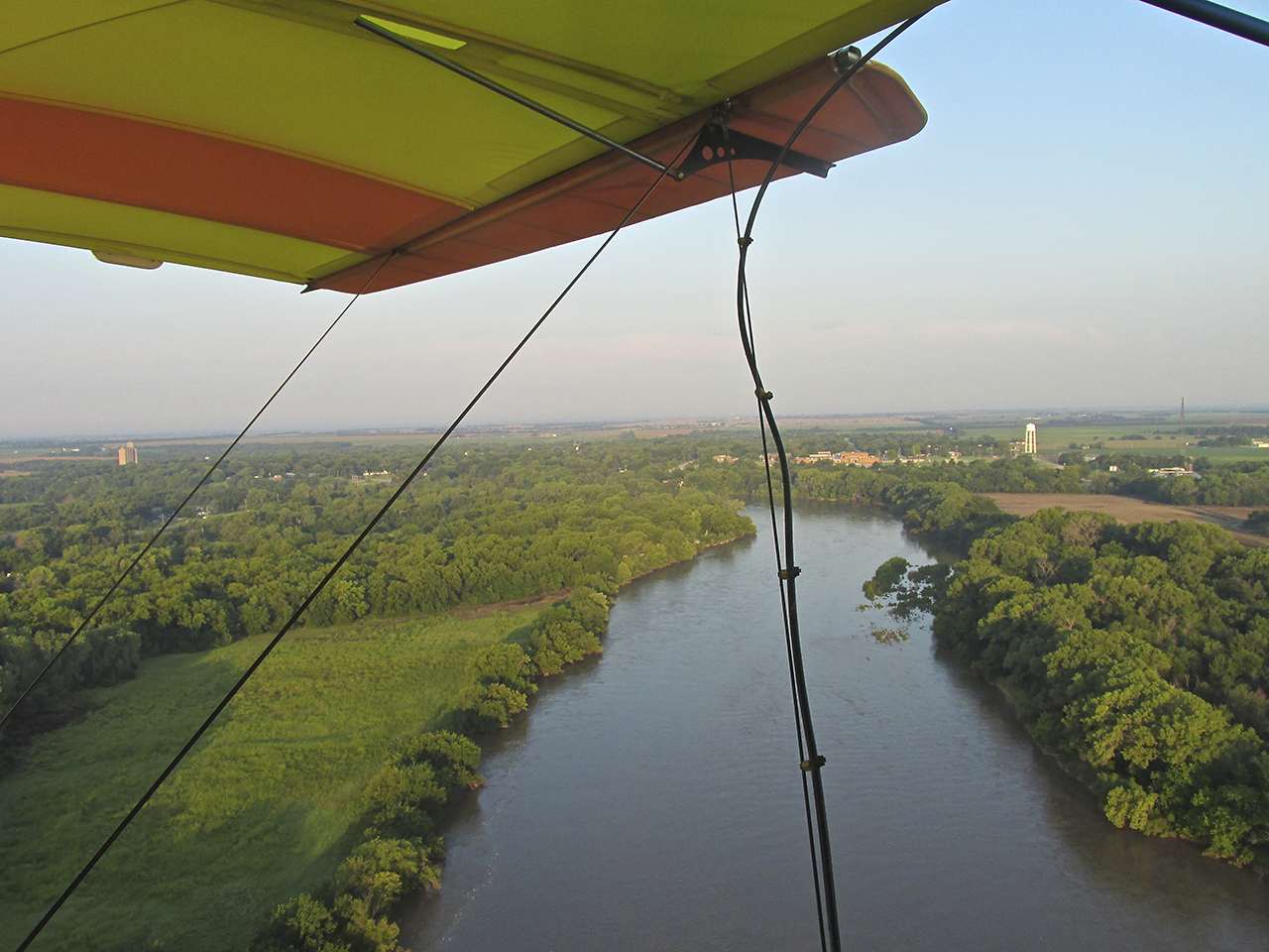
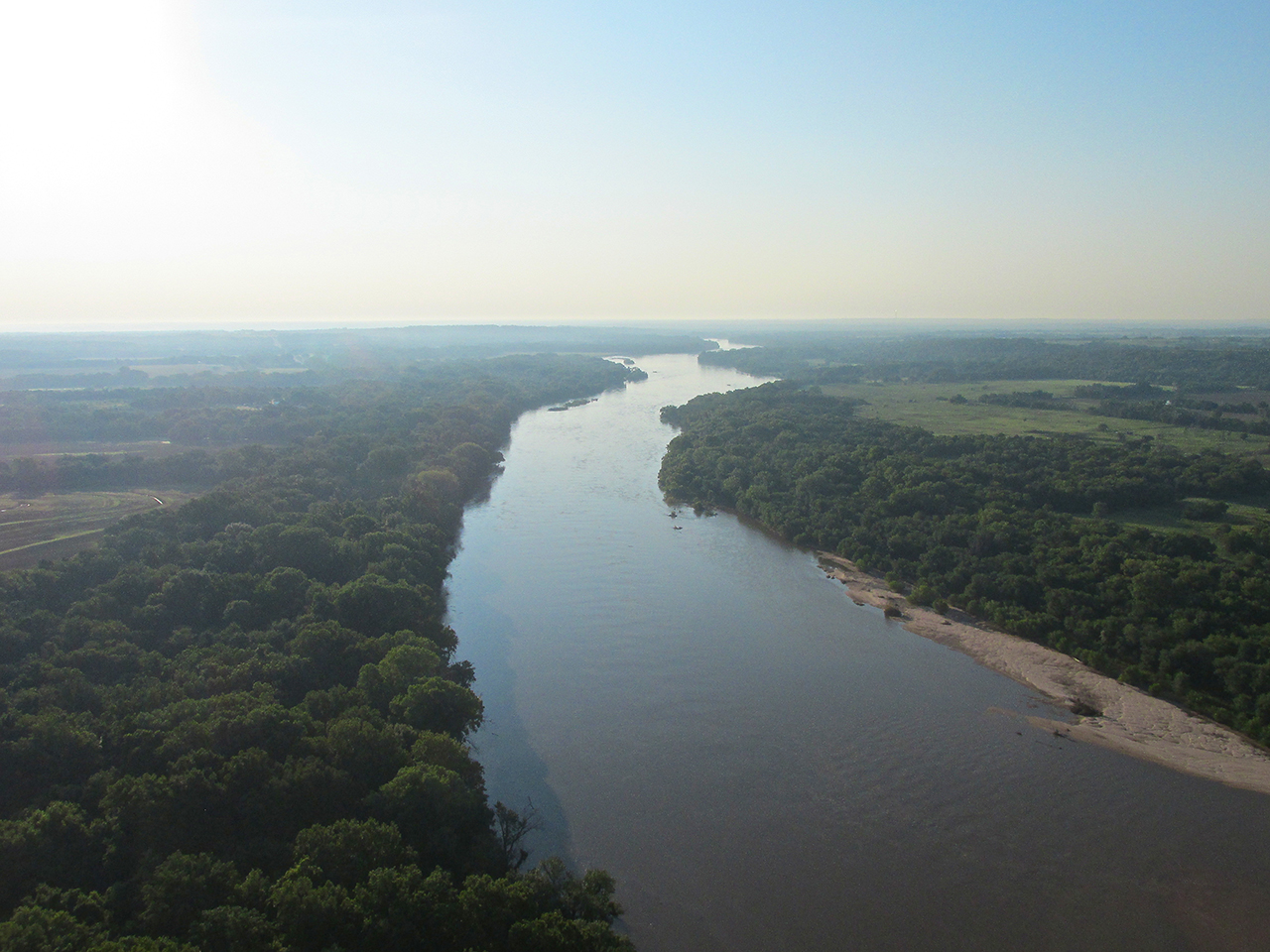
Passing Oxford to the Southeast with the Arkansas River beneath at 300′ AGL looking Northwest.
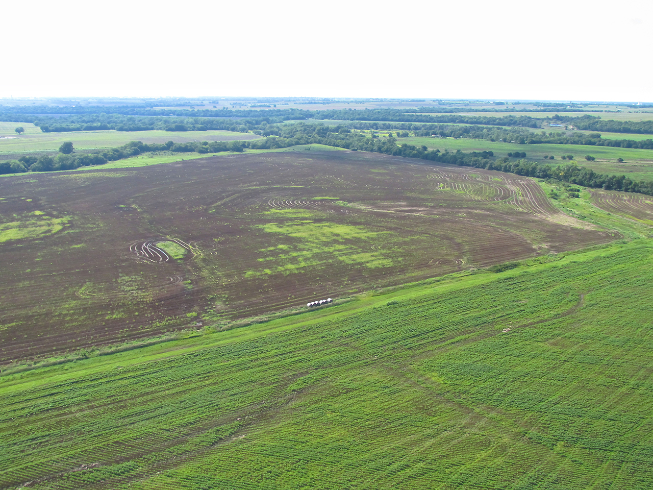
No Till Farming
I tried to photograph this better but, as the best shot of the three, it will have to do. The point of the exercise was to show a good example of “no till” farming. What the photo does not show between the rows as well as I would have liked is the “flat”, cut wheat field underneath the crop. Whereas most of the time, a crop such as this will be planted in furrows dug by a plow, this one was planted by “drilling” the seeds into the ground leaving the previous wheat field fairly intact. There are lots of reasons to take this approach and I have inserted a number of links in this paragraph you can follow if you wish to find more about this method of farming.
(OK. Good call. Rather than guessing wrong again about the type of crop photographed, (as he has done in the past) The Surfer played it safe, went “generic” and thus spared himself the type of agonizing embarrassment his fragile ego cannot bear. – The Editor)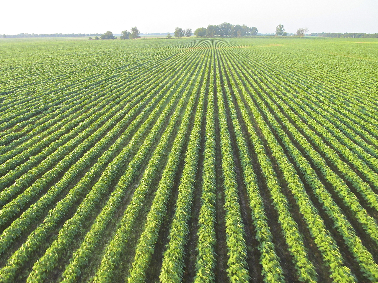
A “No Till” Field Looking Good
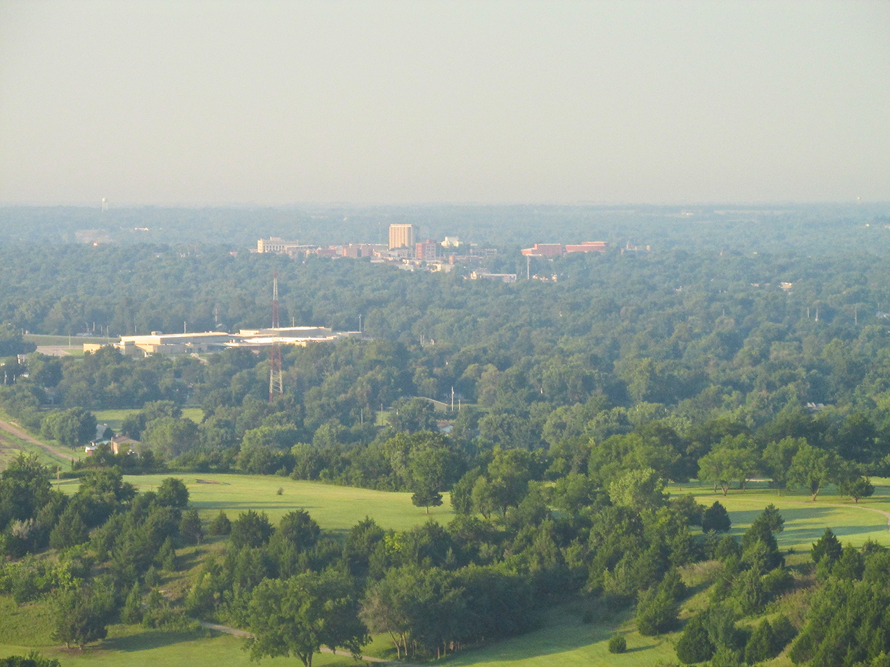
Through the high humidity I use the telephoto to take this picture of Arkansas City, Kansas, South about 5 miles from my position. I am at 600′ AGL.
The same position but wide angle.
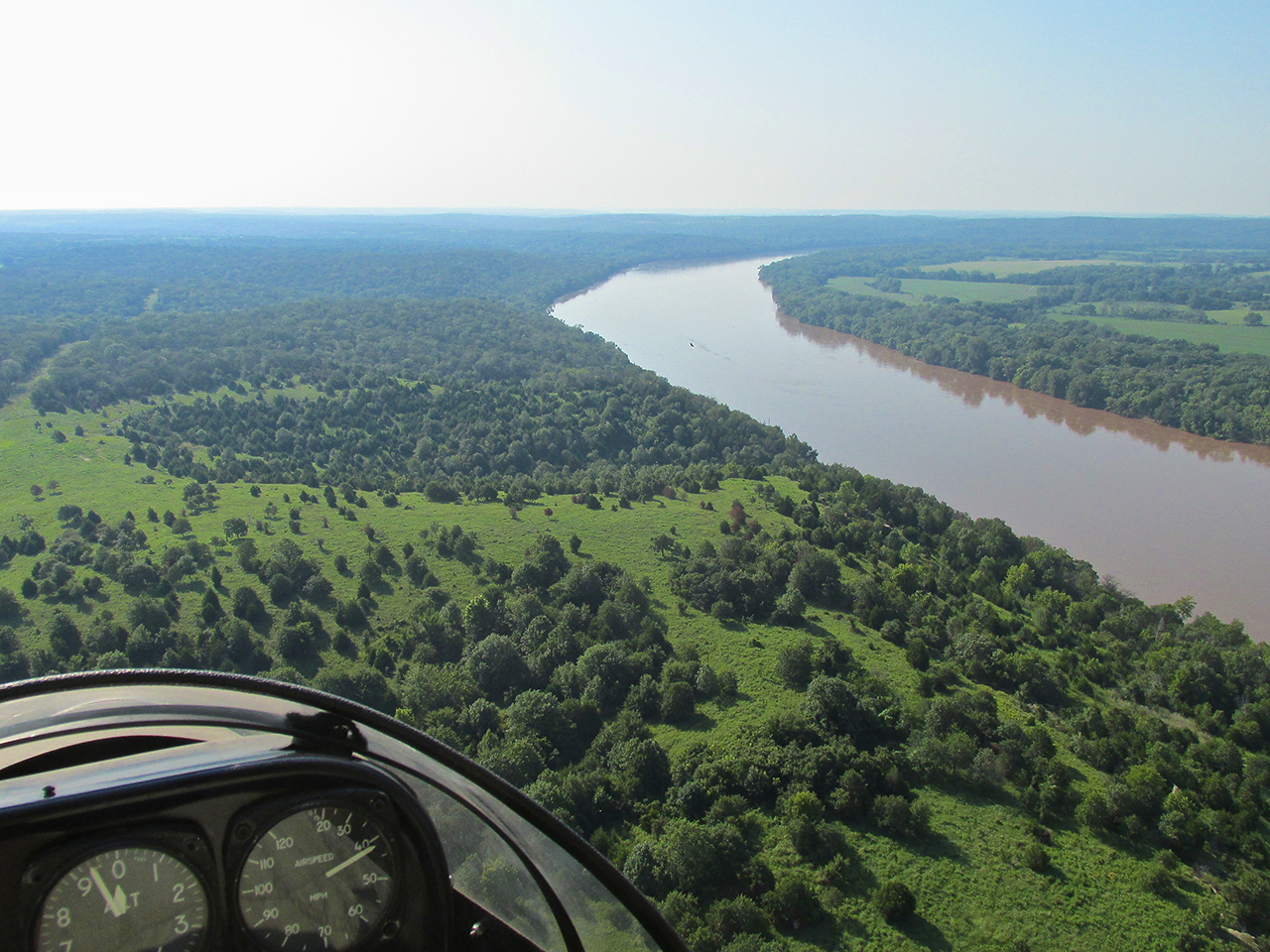
The Arkansas River looking East from the South end of Ark City from 500′ AGL.
Same position but looking West.

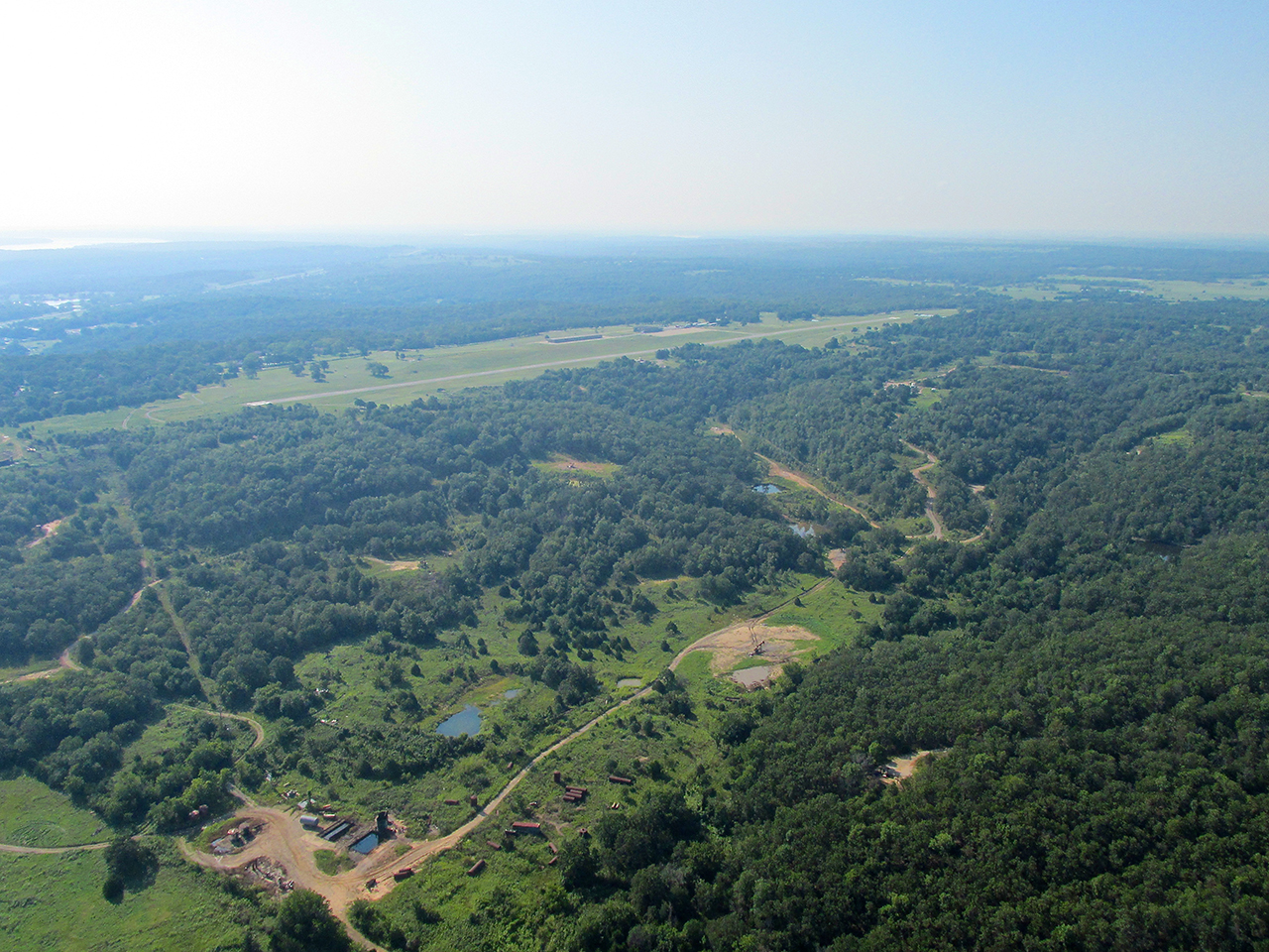
After crossing the Ark River again the topography changes dramatically. A “GlennView” looking Southeast from 100′ AGL.
Now flying at 20′ AGL to stay under the headwind.
In the distance just left of my heading I saw this big rig and took this shot with the telephoto.
Closer, now using the wide angle.
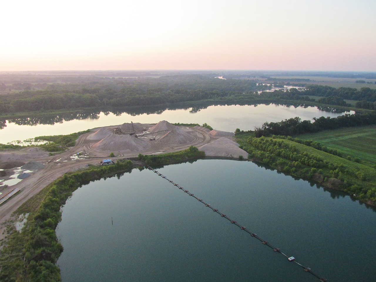
Crossing Big Waters
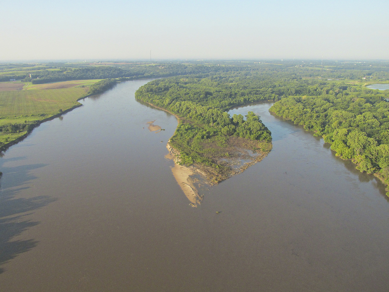
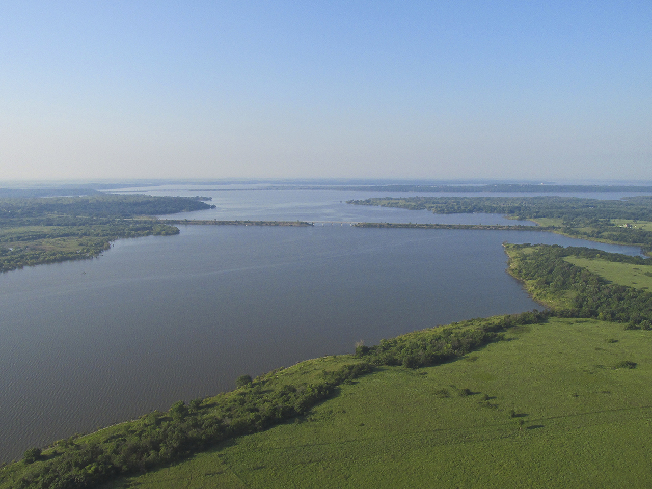
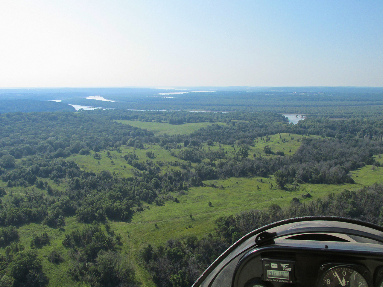
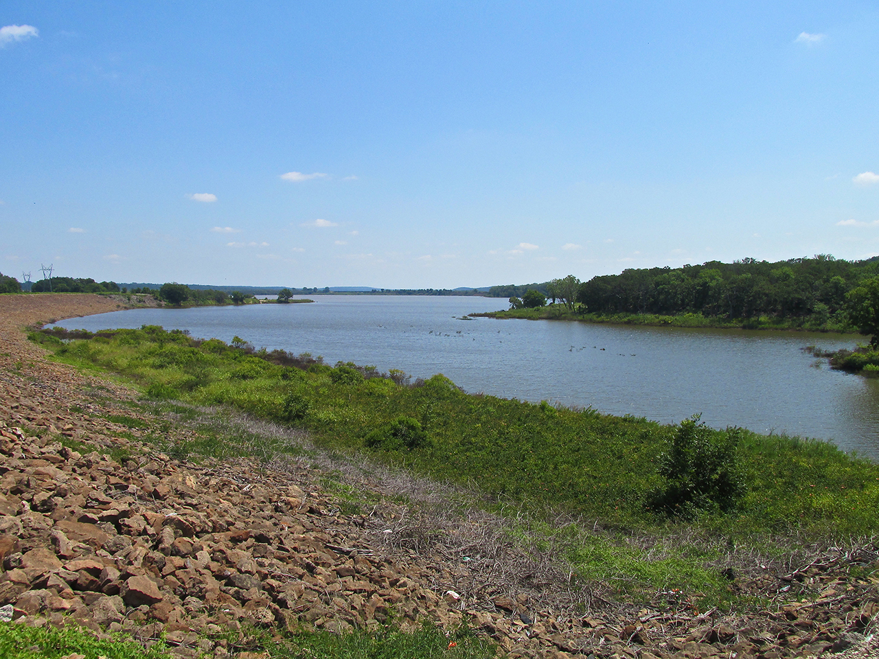
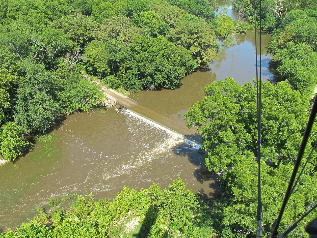
Right on schedule I saw Kaw Lake and began to climb to a higher altitude. When flying any plane, and more so when flying a 2 cycle motor powered one, you endeavor to allow yourself a place to land in case the motor quits. The higher the altitude you maintain, the more choices you give yourself if your engine were to quit. In the photo below, my actual charted path would have started at the closest water in the foreground, continuing over water to the other side. Being not a slave to the GPS, I maneuvered to the right in order to stay over land longer and to cross at the lake’s narrow point East of the Furguson Road Bridge.
Looking Southeast at Kaw Lake from 300′ AGL.
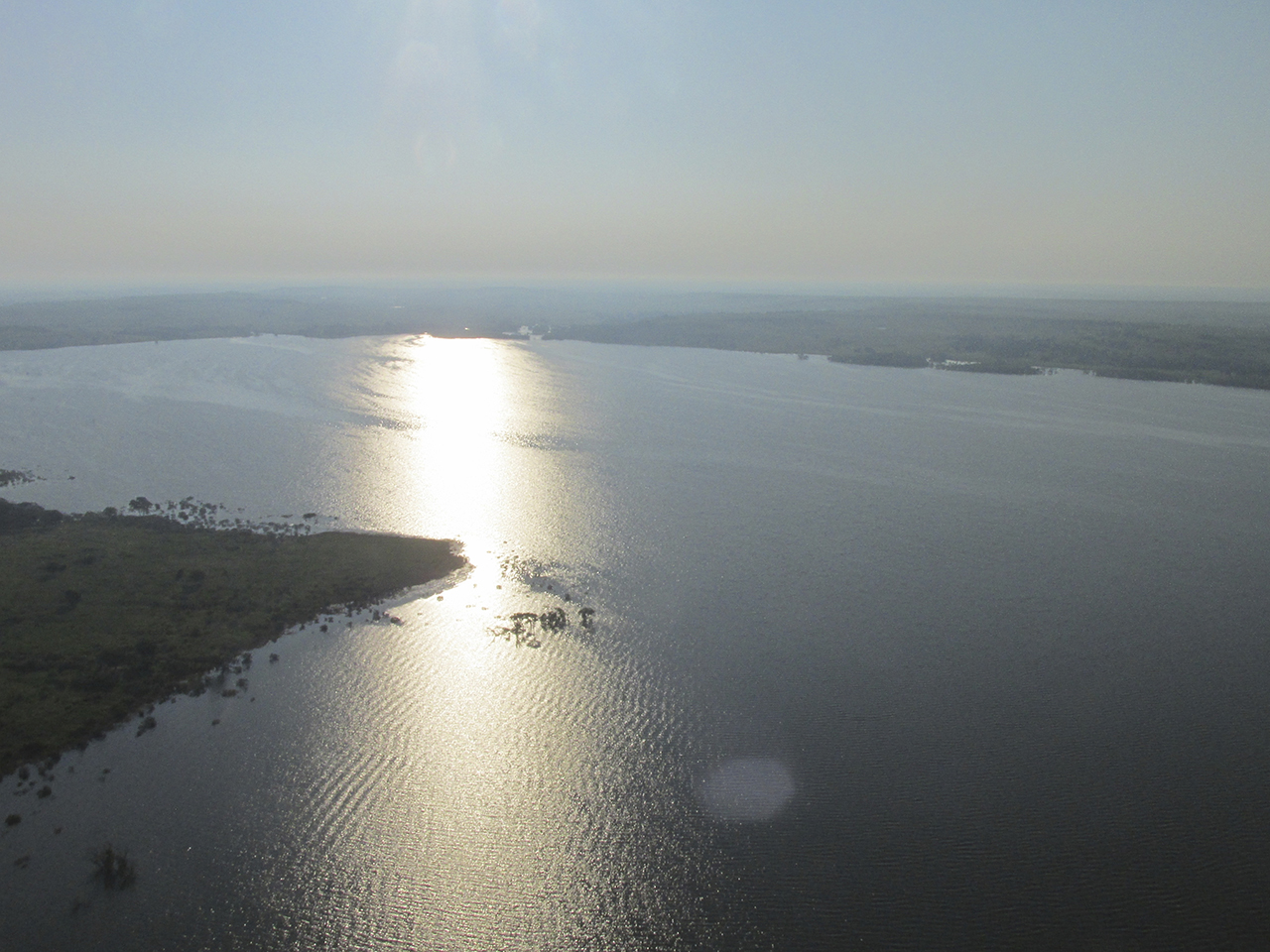
Still climbing I took this picture to the East so you could see how wide the lake gets here.
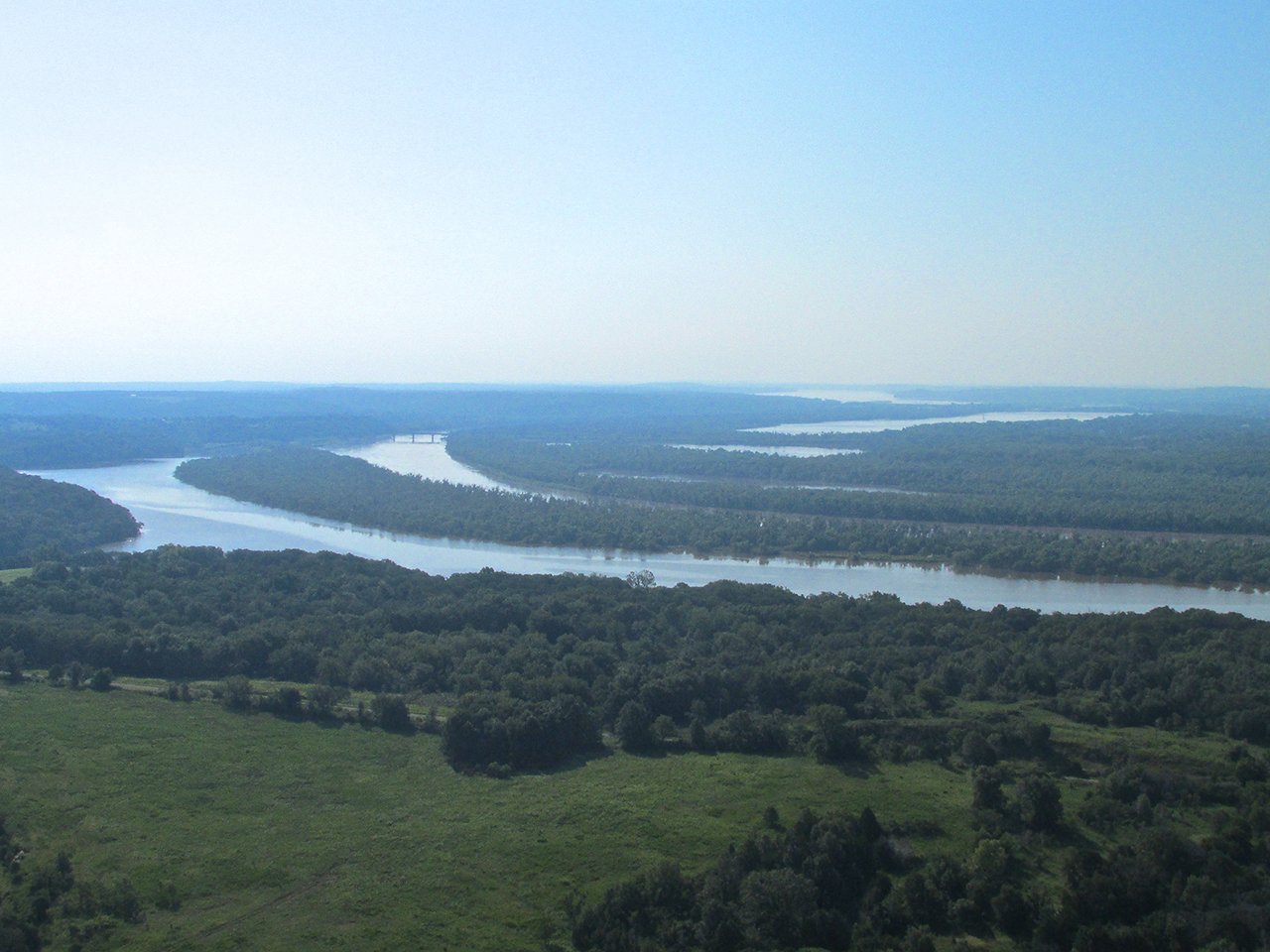
Just before going, as Navy carrier pilots say, “Feet Wet”, I took this shot of the Furguson Road Bridge and the Kaw Lake region to the Southwest. I am now at 1,300′ AGL.
After crossing Kaw Lake I landed on a country road to get out, stretch my legs and check the map.
The road was smooth and just wide enough, although the landing was cross wind.
Burbank, Oklahoma
I had noticed it on the map when studying the route the day before but, flying low that Saturday, it appeared suddenly. I climbed quickly to get a shot of this little village but did not want to expend much fuel on the effort.
After the trip and upon writing this story, though, I learn now that Burbank was once an Oil Field Boom Town. Situated on Osage Indian Tribal Land, during the Oil Boom of the 1920’s, so much money was paid to the tribe in royalties, they were called “The World’s Richest People” by The New York Times. I have added Burbank to my “Future Exploration List”.
Burbank, Oklahoma From 75′ AGL Looking East
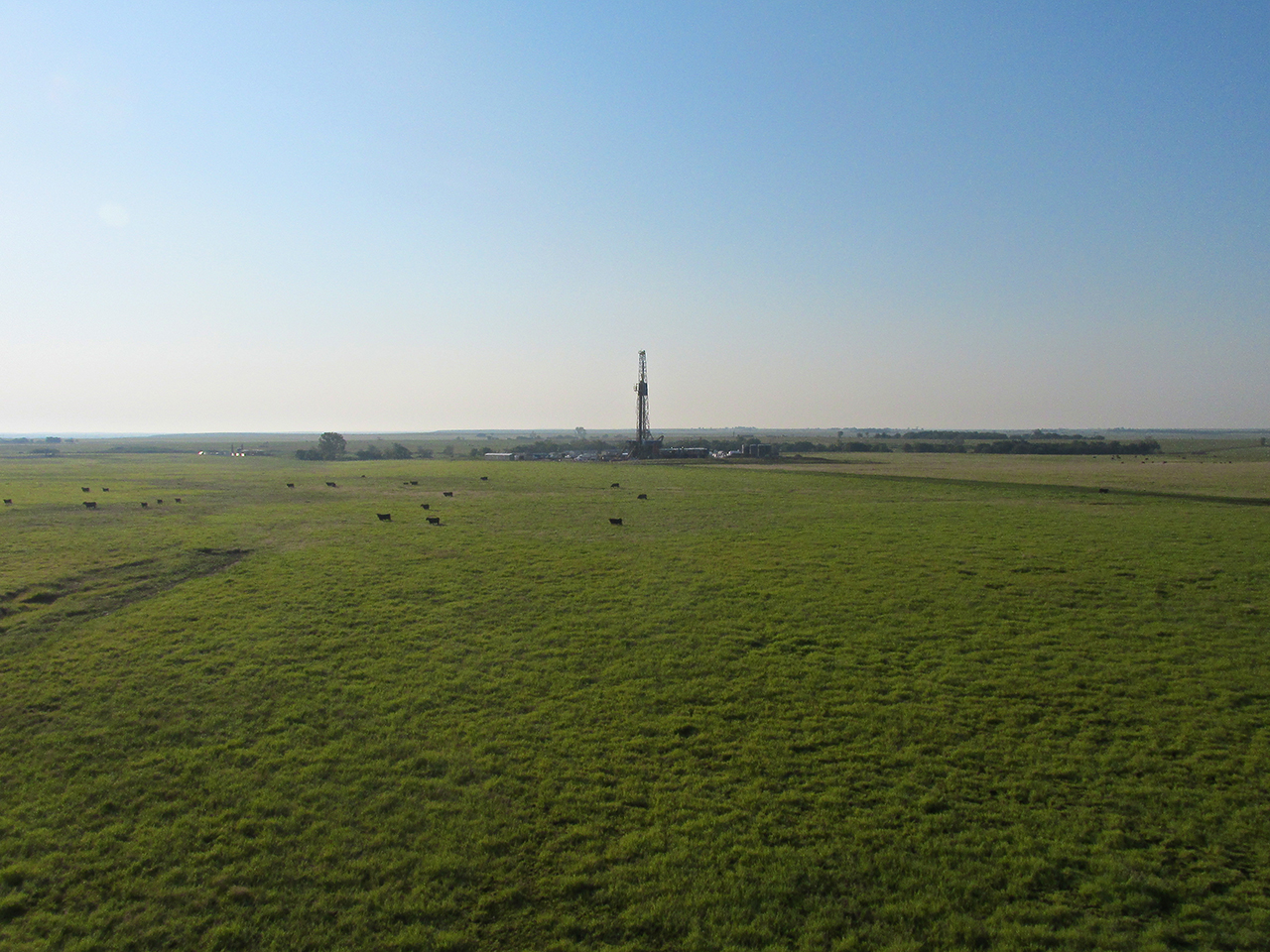
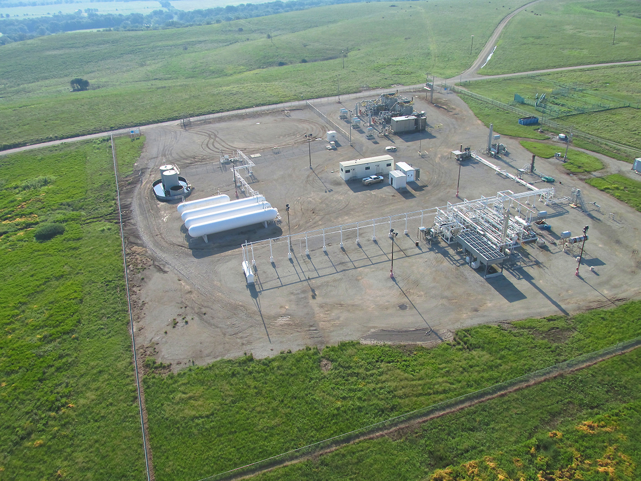
My course takes me over this huge gas well 1 mile South of Burbank.
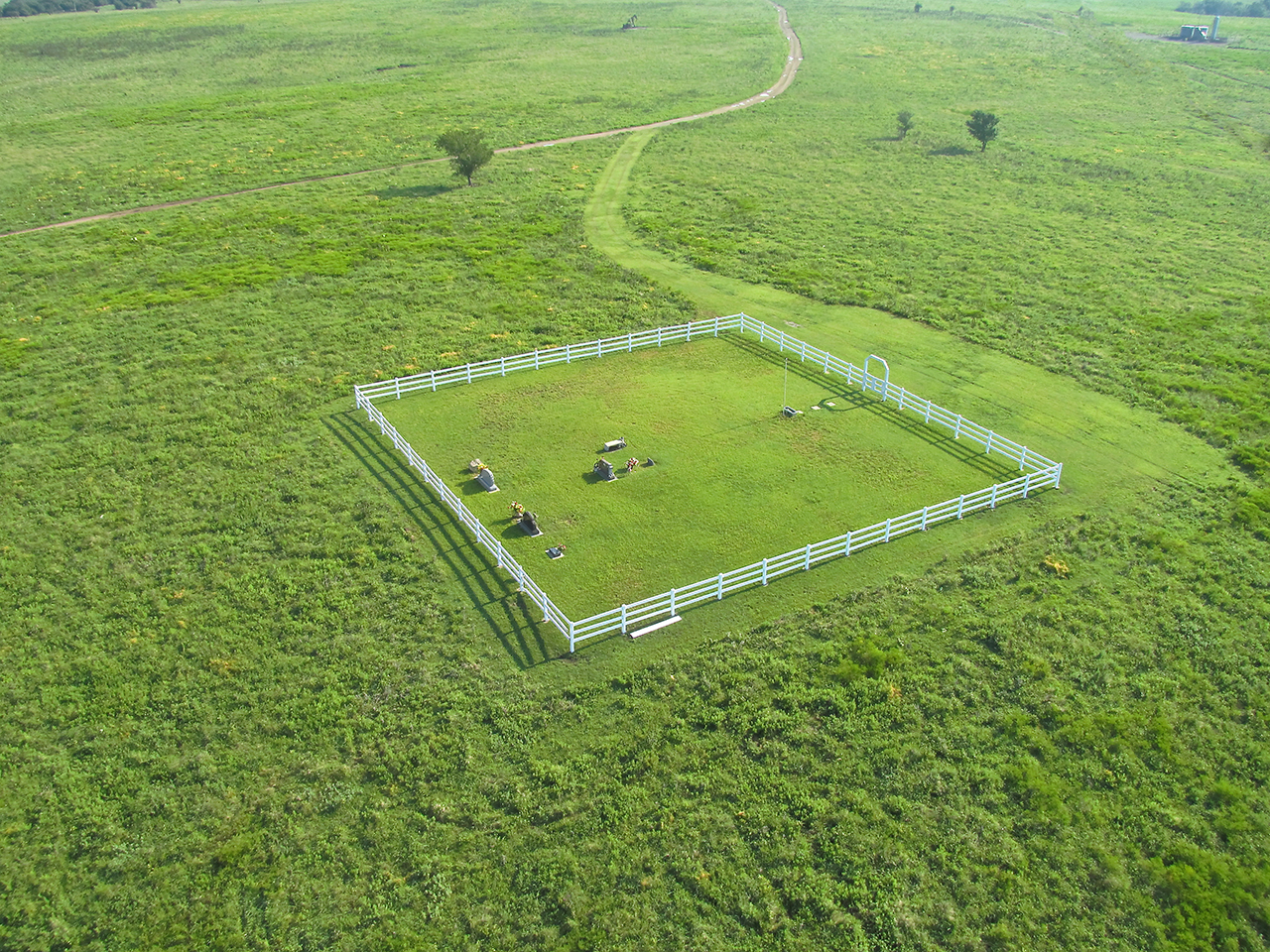
A little further along I saw this well-kept and apparently new cemetery off by itself in the country.
Prairie Golf Course
I’m cruising along in ground effect to extend range. This means I am flying at about 10′ AGL (Above Ground Level). At that altitude one cannot see very far in the distance. Suddenly, out in this vast expanse a Golf Course appears. After taking the shot below I banked hard left so as not to buzz any players that might be out that morning. Nobody was playing yet. Later on Google Earth I discovered it is the Kaw Wah C Golf Course East of Fairfax, Oklahoma.
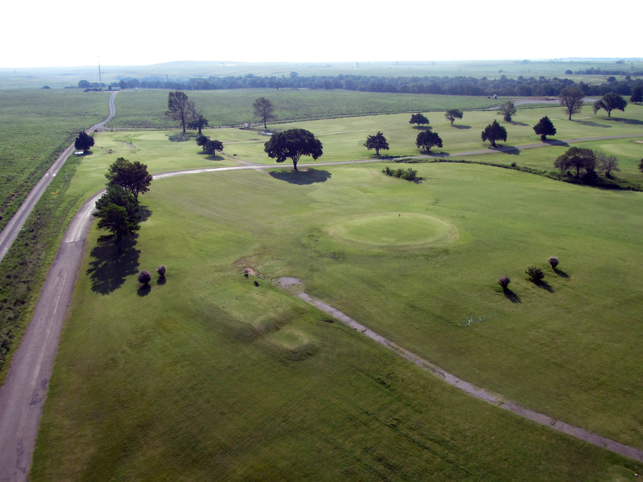
Kaw Wah C Golf Course
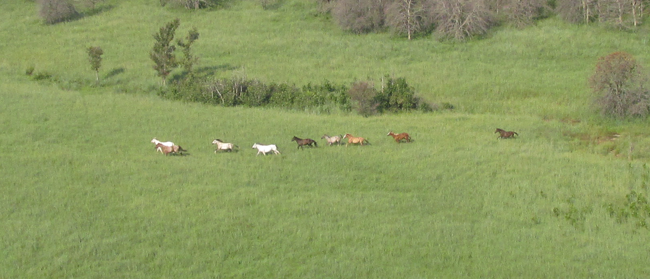
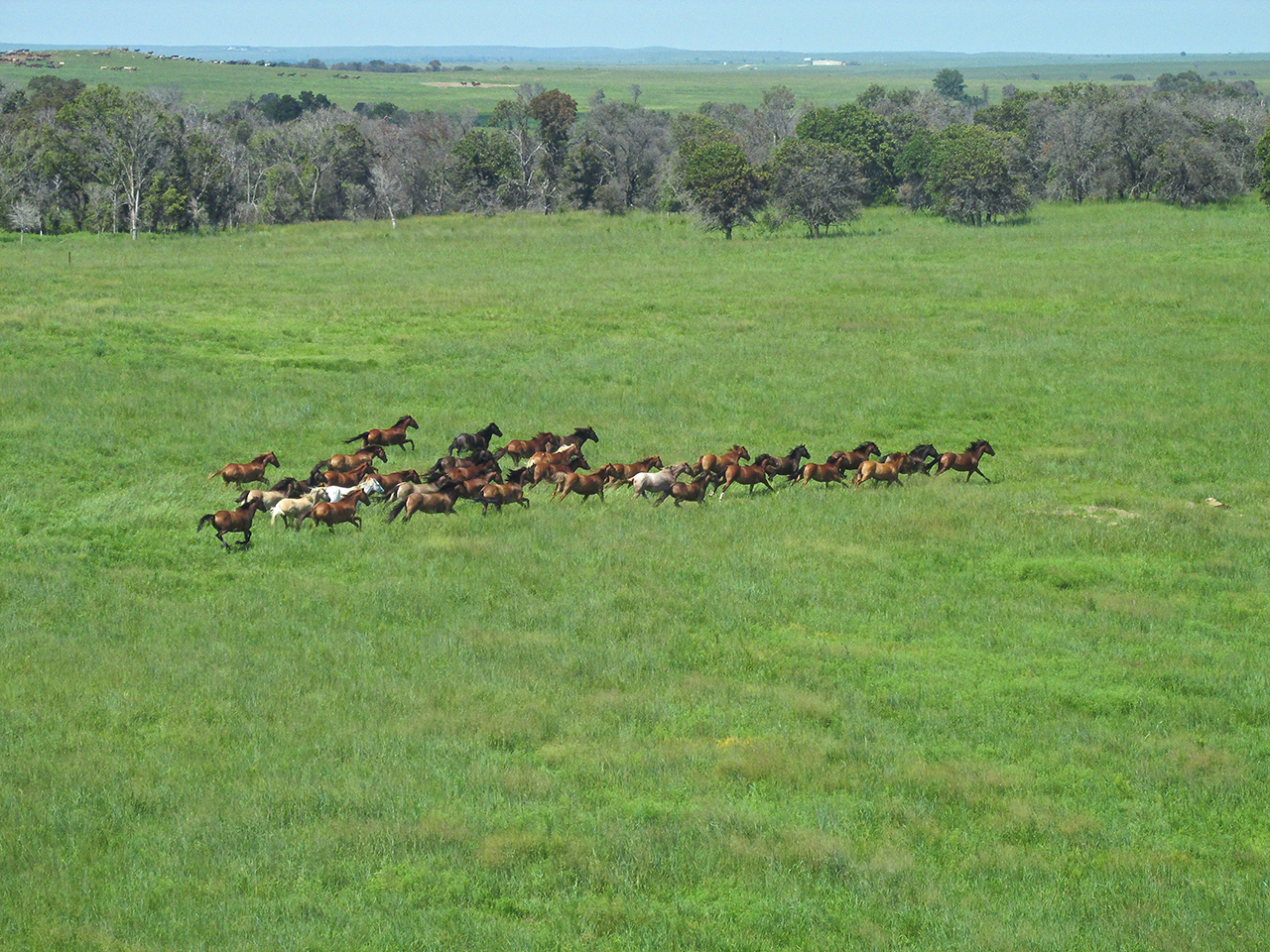
Shortly thereafter I saw this little herd of Mustangs.
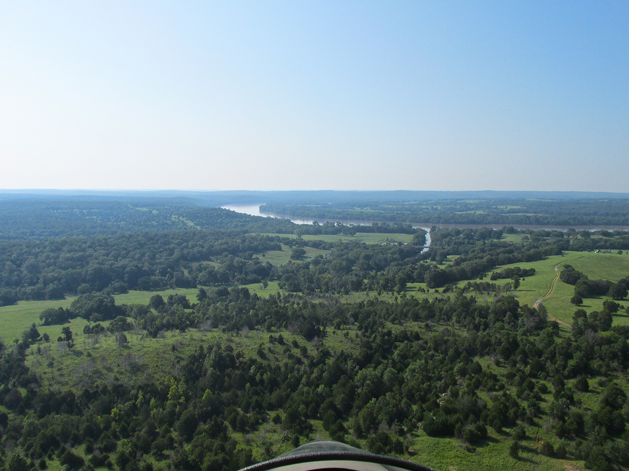
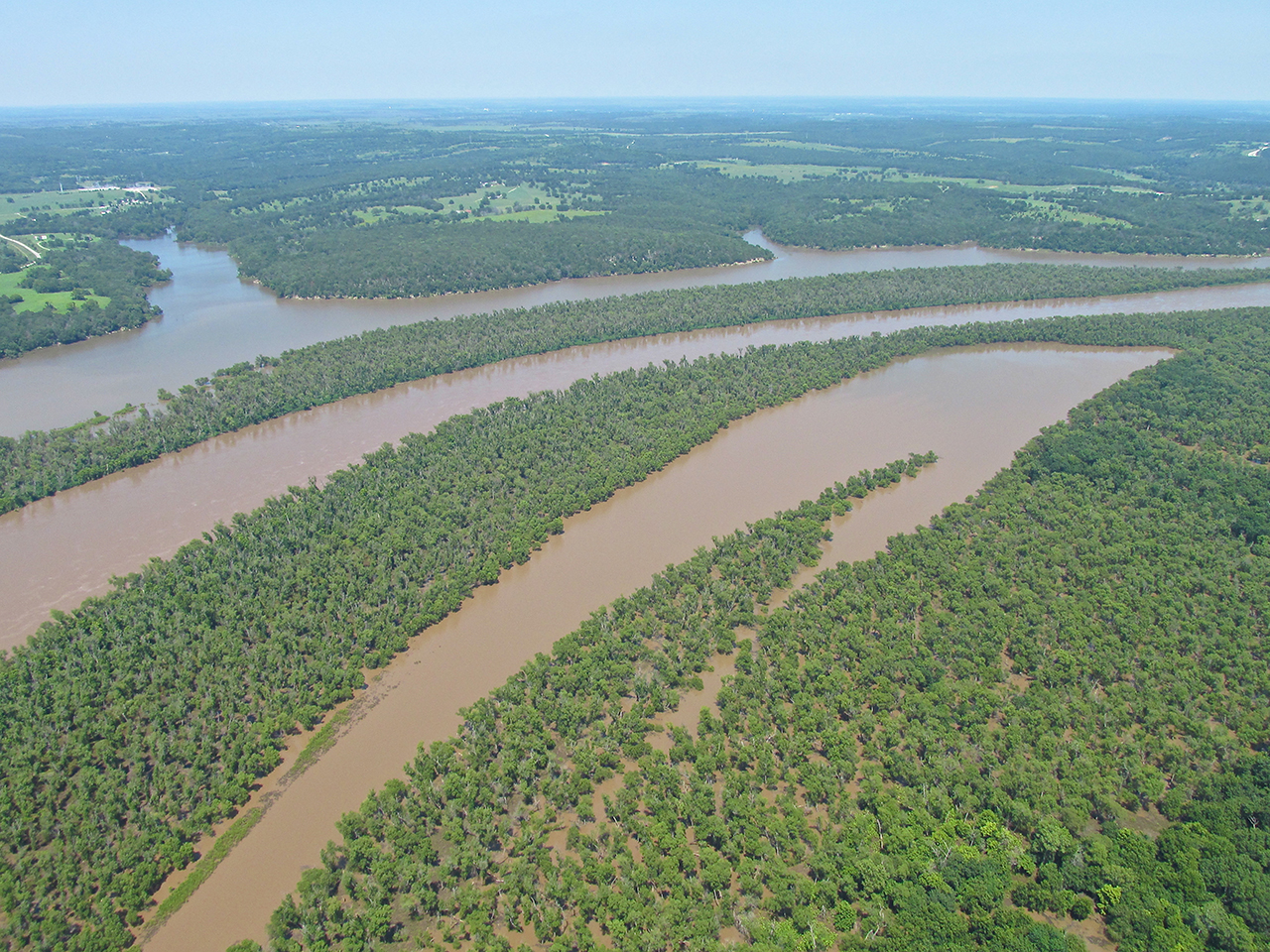
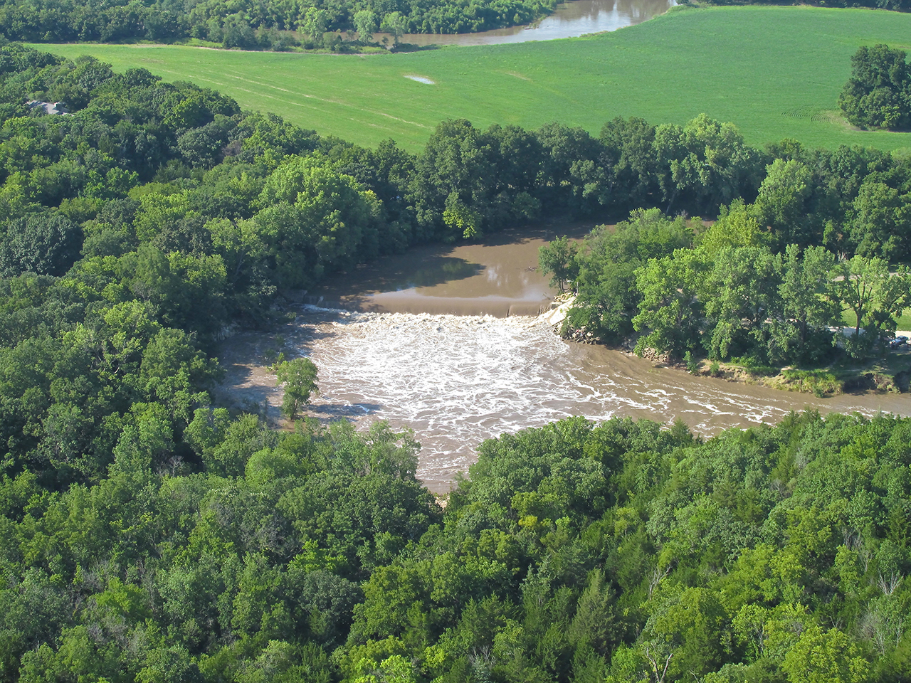
Winding River
Continuing a direct path to Cleveland, Oklahoma would require me to cross the winding Arkansas River three more times in the final stretch. As discussed earlier, crossing wide bodies of water at low altitude is not to be done. Fortunately, where the river bends East at Blackburn, Oklahoma, a detour tracking the Eastward bend of the river would not be very far out of the way. Also, I saw a nice path cut through the woods paralleling the river in the direction I would be traveling. This would provide plenty of landing area should “the fan stop turning”.
A “GlennView“ looking Southeast toward Cleveland. Look for the very small “up tick” on the horizon where the town is. That is probably a water tower.

A bridge crossing a creek tributary of the Arkansas River.
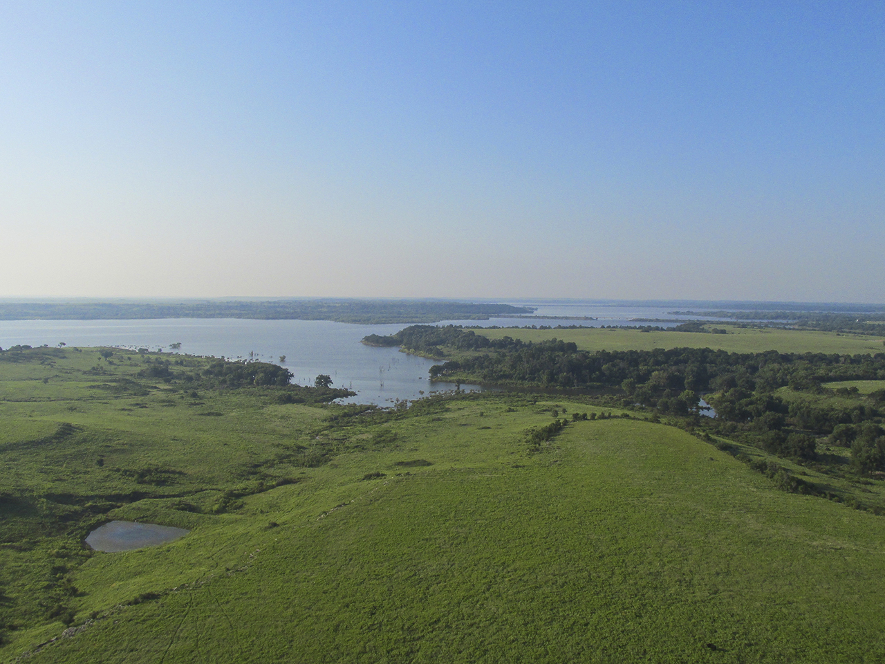
Here you can see the “trail” I am following around the river bend. I am at 600′ AGL looking Southeast.
Another view of The River and the scene to the South.
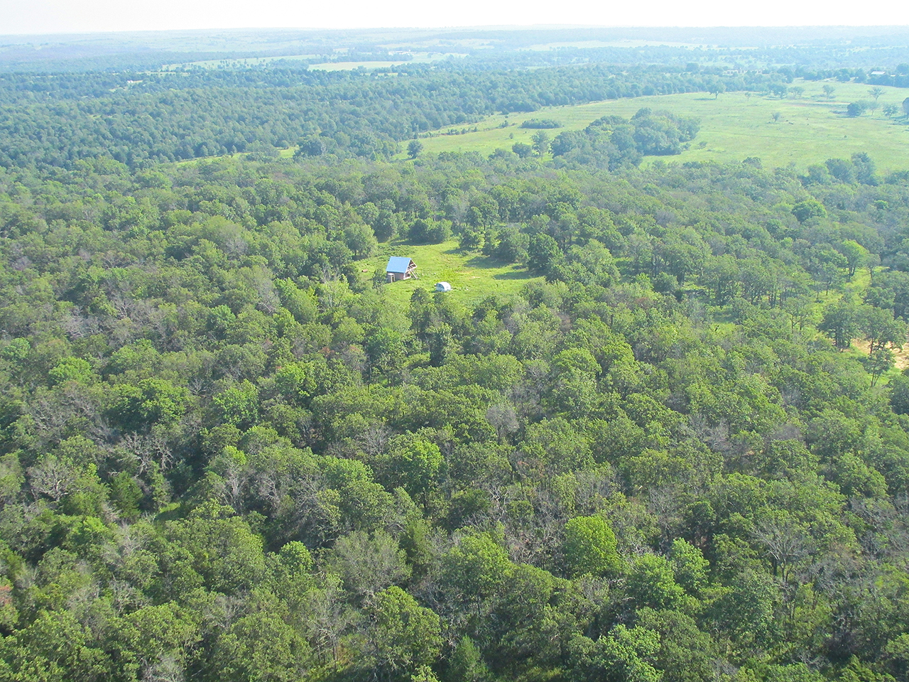
At the farthest point of The River’s swing East I saw this interesting remote cabin.
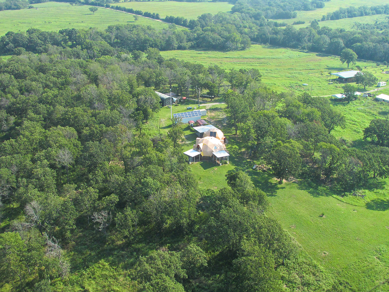
Then, in a half mile I saw these Geodesic Domes complete with Solar Power Panes.
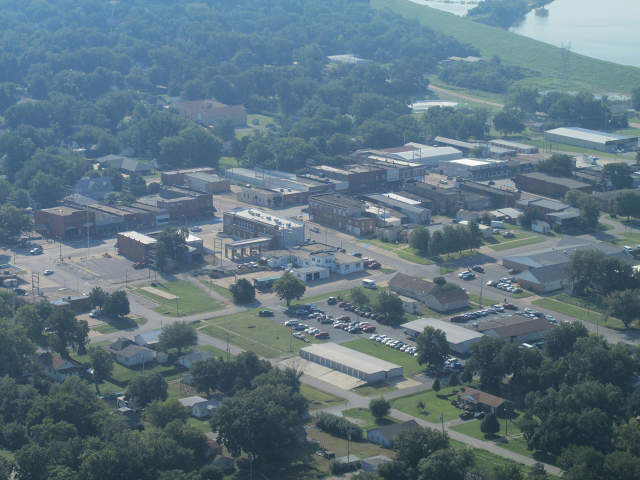
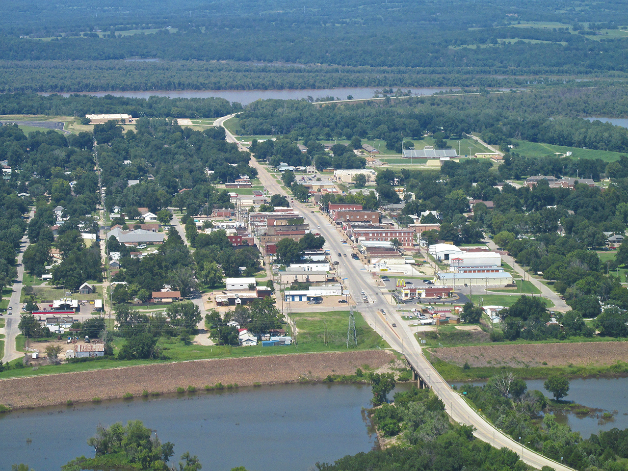
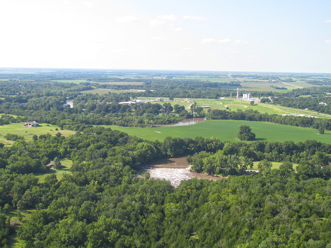
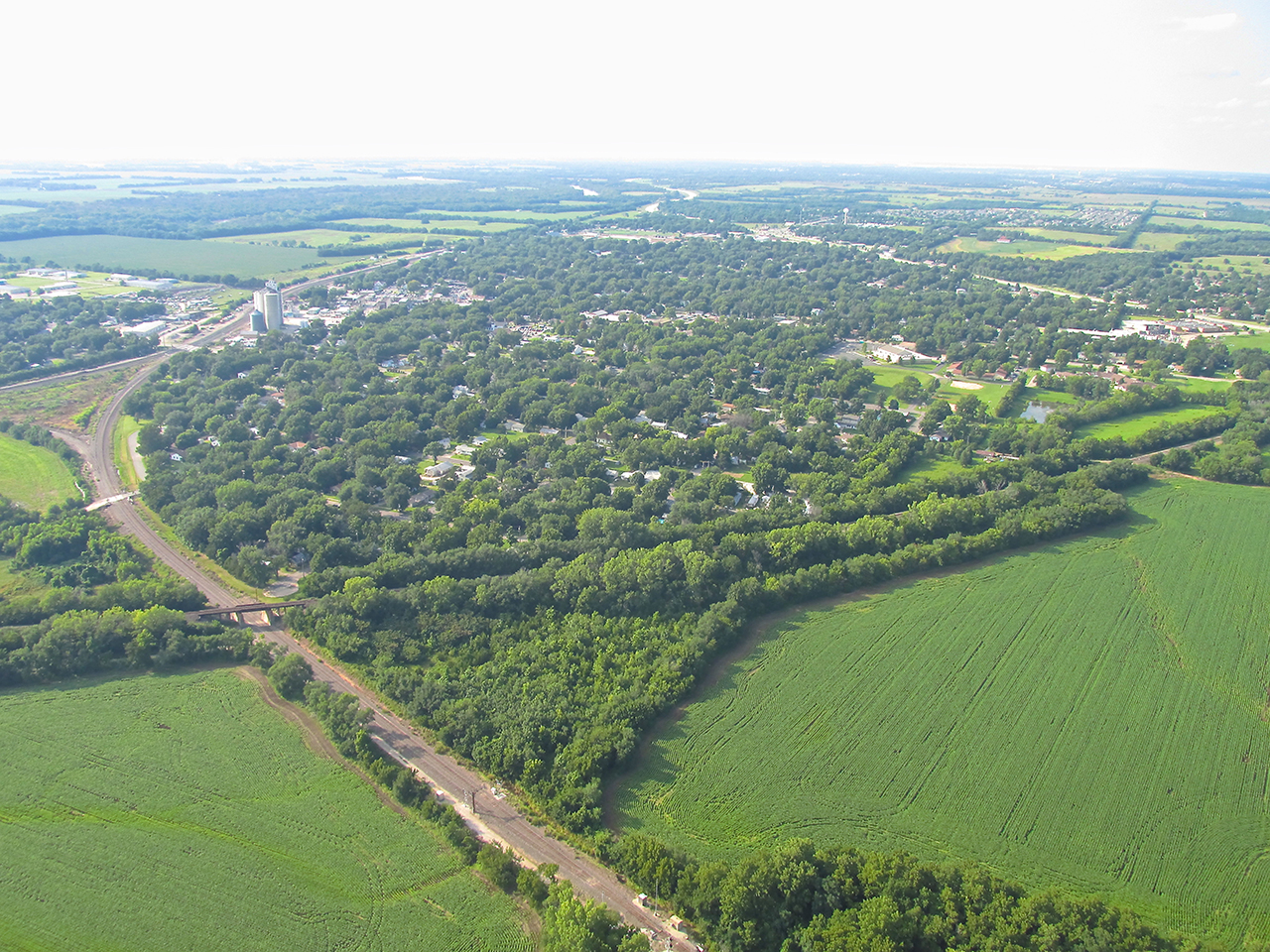
Cleveland On The River
Cleveland is bounded by the Arkansas River on three sides and sits on high ground. Since there had been so much rain, the river had overflowed much of the area beneath the town to the North. The next few shots give you an idea of what that looks like.
Cleveland, Oklahoma surrounded by River Water
A telephoto shot of The River bending on the East Side of town.

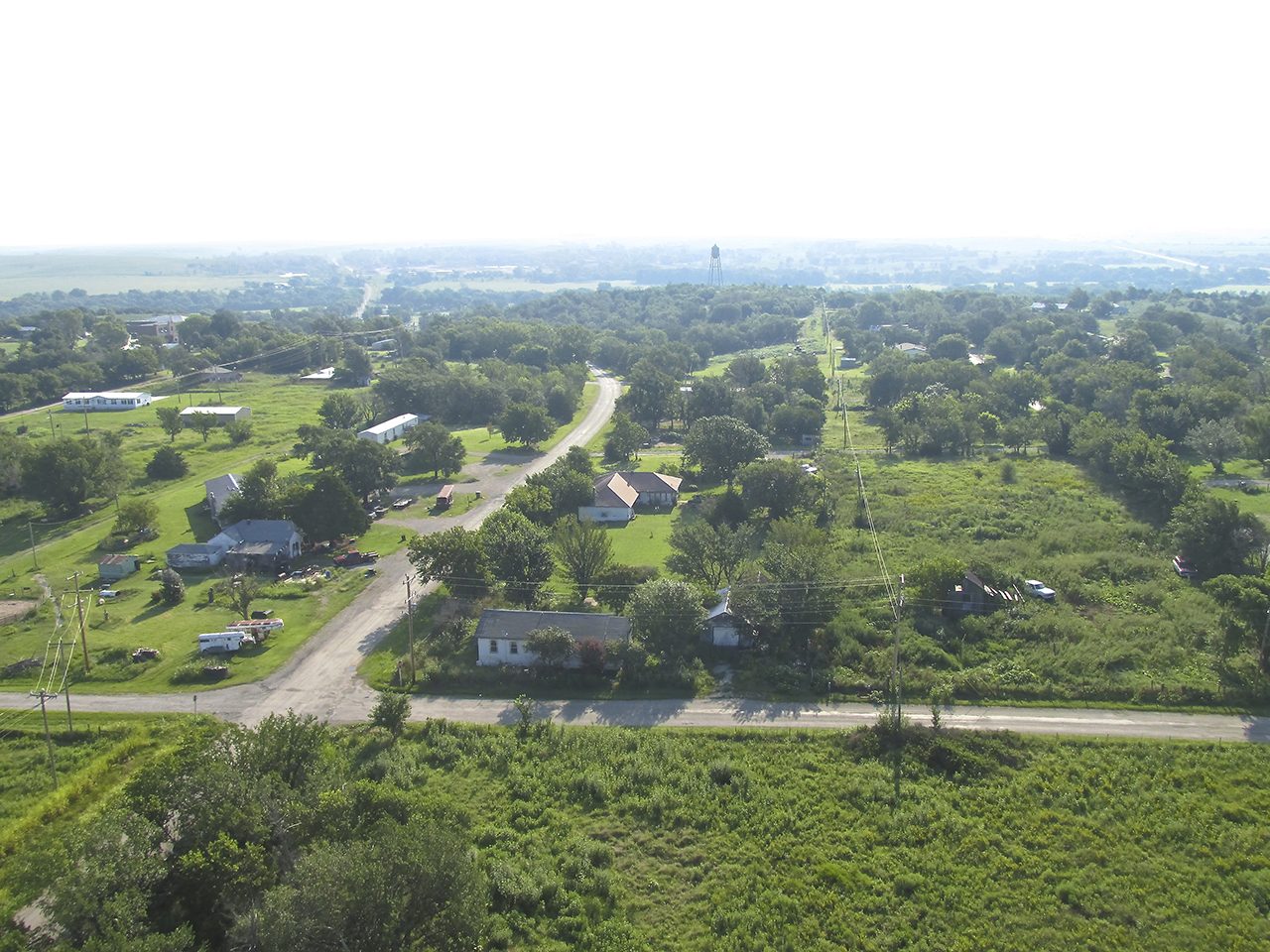
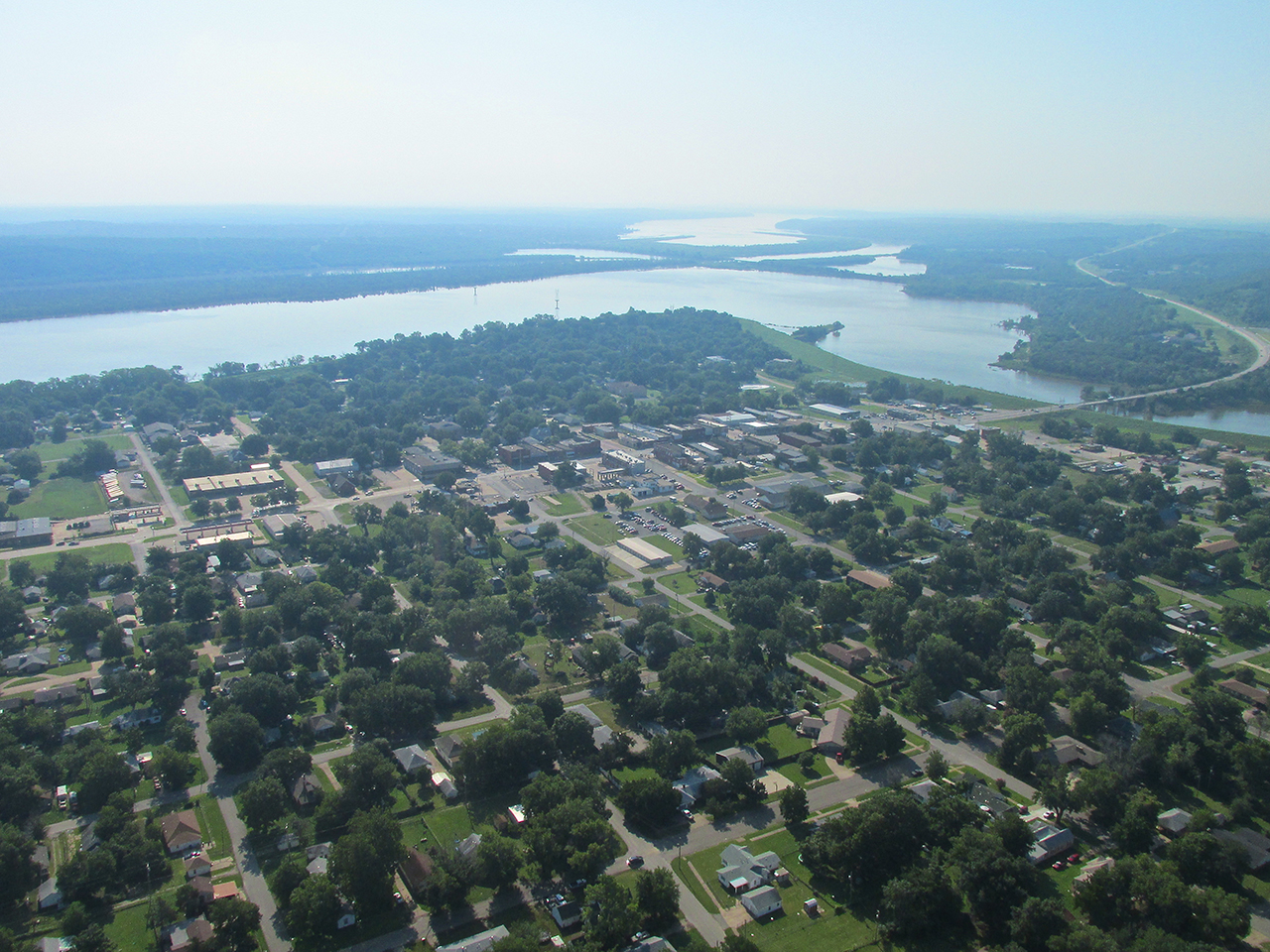
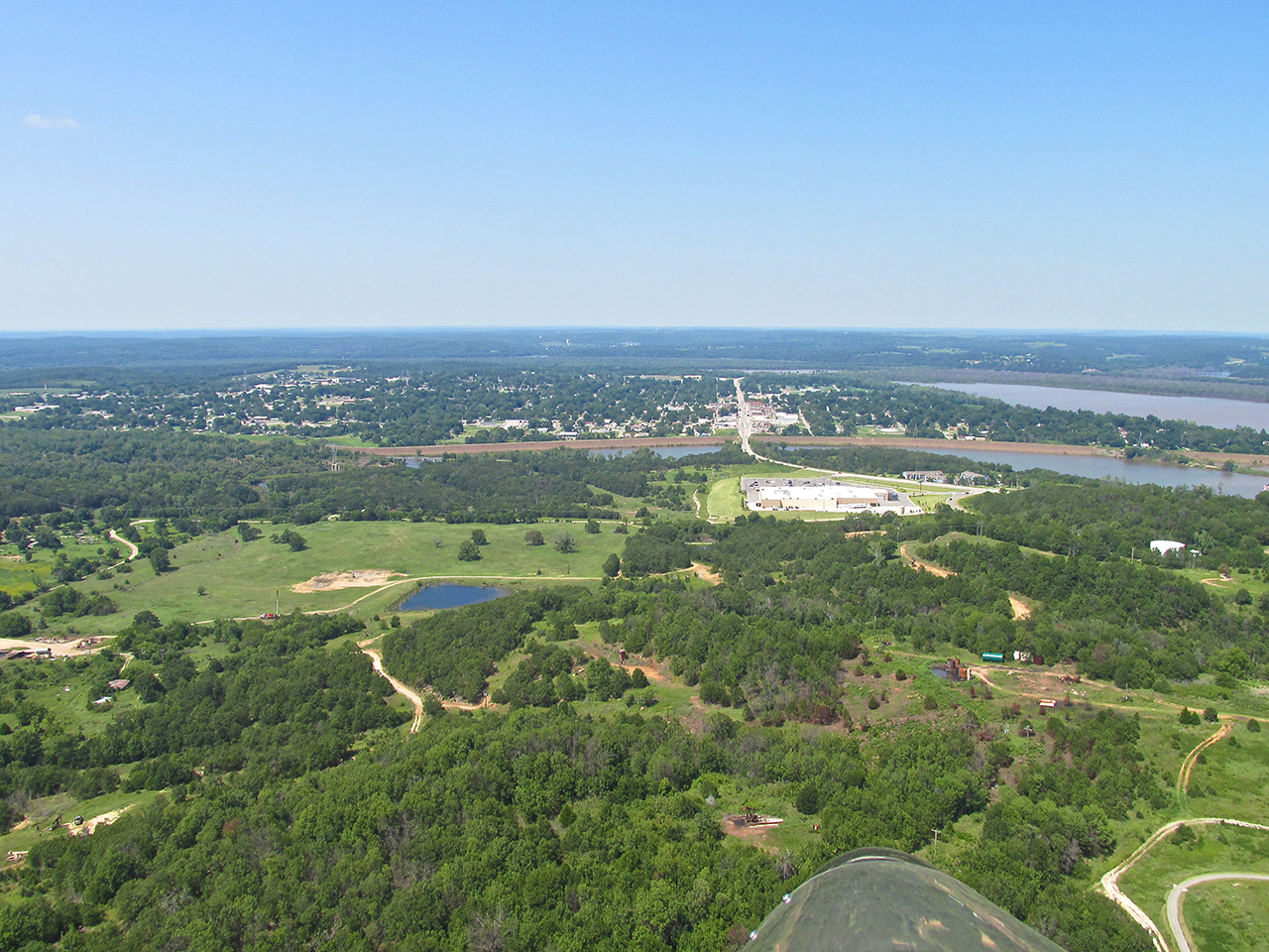
North of town looking Southeast
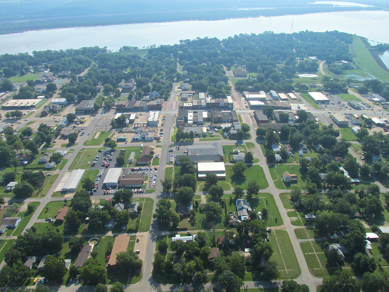
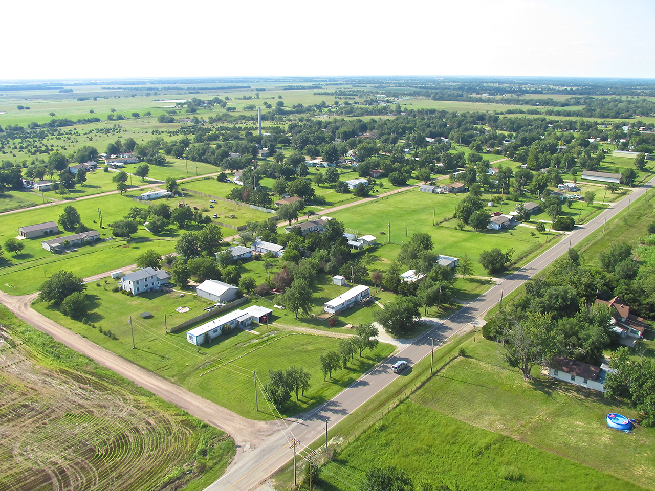
Cleveland as seen from the North. The airfield is on the ridge you can see overlooking the town almost 2 miles directly South.
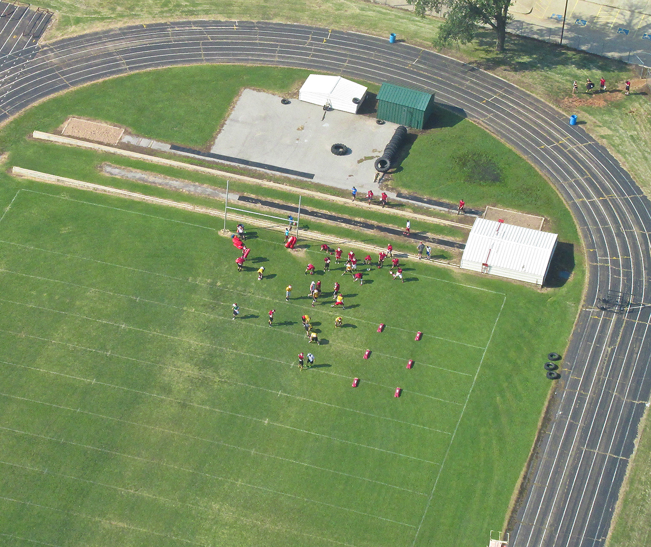
Desire
When I was in High School, you had to have desire to be on the Football Team. One way of demonstrating that was participating in “Summer Two-A-Days”. These sessions were part “fundamentals review”, part “weed out”. They were very hard. You had to really want to be there and show up twice a day in Summer Vacation. Some Coaches would continue this endurance test even after school started. As I pulled into the Cleveland airspace I saw a team working out below me. For a town this size this indicated to me a high level of intensity on the part of their sports program. Checking later I found these to be the Cleveland Tigers.

Cleveland High School
As I traced the West side of town I took the following series of shots from 1,200′ AGL looking Westerly.
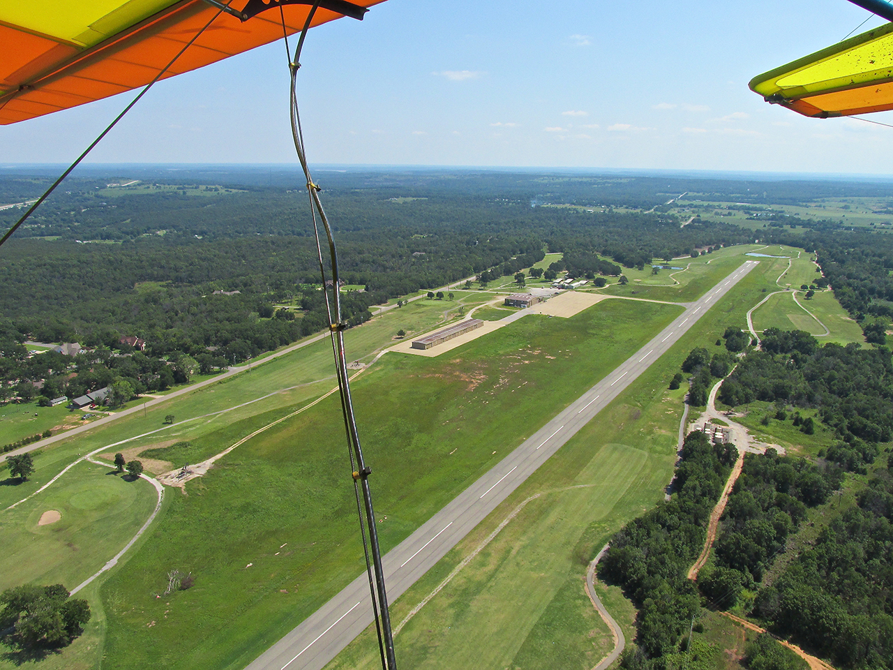
Before entering the pattern I took this picture of the Cleveland Airport which sits on a high spot 2 miles South of town.
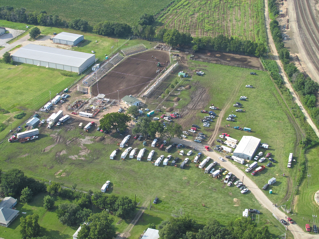
Golf Course Embedment
Cleveland’s Airport is surrounded by The Keystone Golf and Country Club. After landing I could hear the sound of golf carts all around me. It was a beautiful morning, perfect for a round or two. Before tying down my plane I took the picture below. For a moment I amused myself with the thought of how cool it would be to have a Mercedes for a loaner car but, Cleveland Field being an unstaffed airfield, I knew that would not be possible. What the car did tell me was that somebody was working that Saturday and should be around the hangar.
On the ground at 95F (Cleveland’s FAA Field Designation)
After entering the offices I met Gordon Jost, owner of Renue Aircraft. Gordon is in the business of painting airplanes. He also buys and sells them. During the week he employs 4 men in the paint shop. This Saturday, he just had his skeleton crew with him.
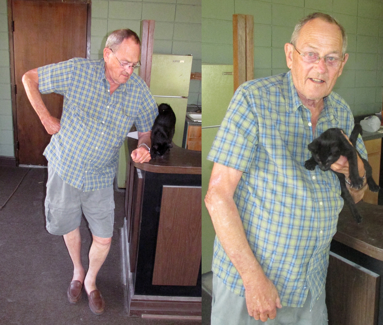
We tried to get this cat to pose for the camera but gave up after some effort.

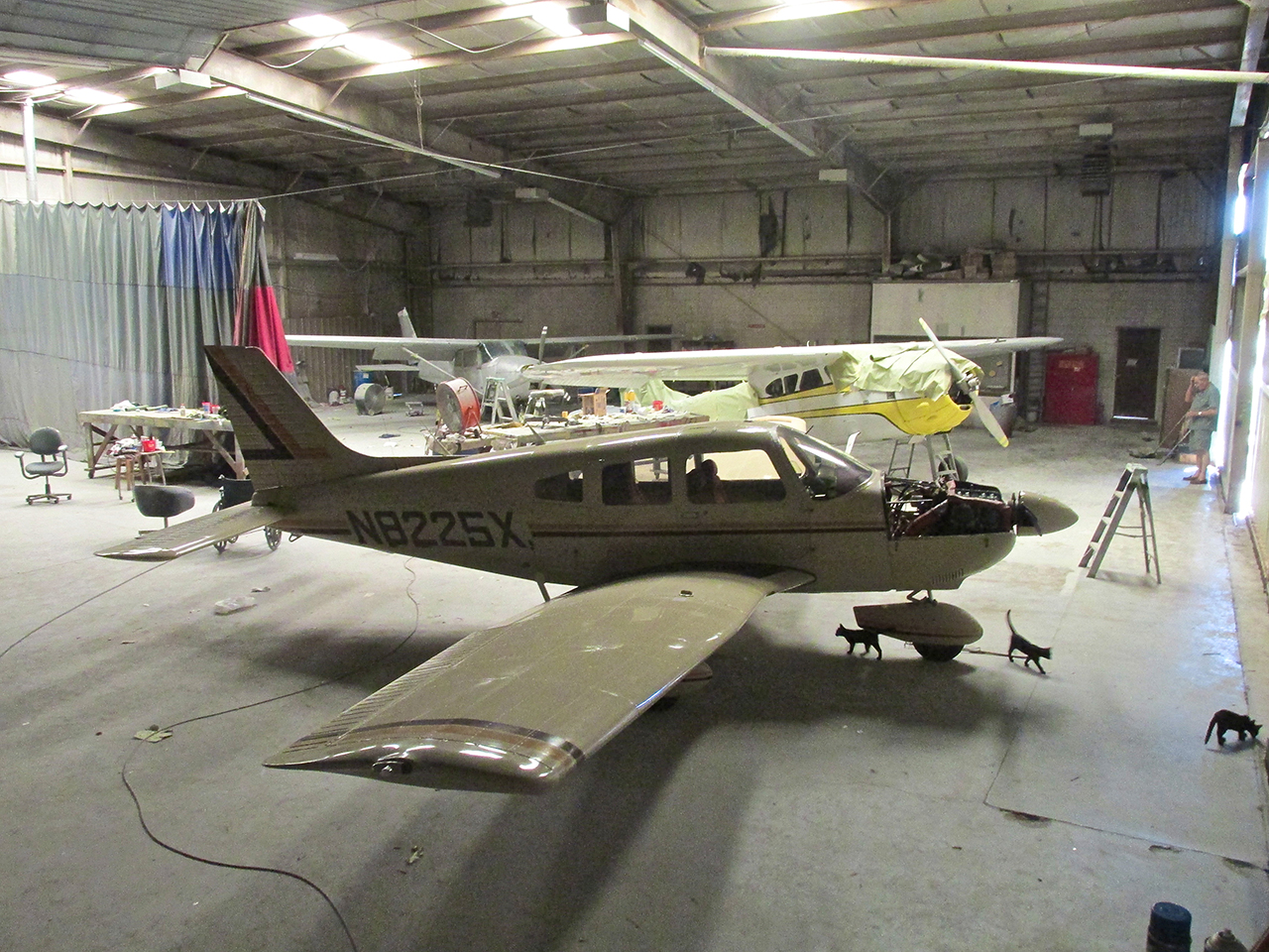
A tour of the hangar/paint shop revealed one of my favorites: a Cessna 195! Gordon says it is for sale.
Other members of the Saturday Staff mill about.
Centrally Located
Gordon and I talked for a while about what I do and what he does and airplanes and such. He lives in Tulsa and drives to the Cleveland shop each day for work. It is a 45 minute drive each way. Renue paints 3 to 5 planes a month and derives the majority of his business from the East and West Coasts and lately from Michigan. After painting a plane from Michigan, all the guys up there liked the job so well they have been bringing theirs to Renue, too.
After about a half hour I thanked Gordon for the tour and said I was walking into town to get some gas. Completely unexpected by me, he volunteered the use of his car. I thanked him for this generous offer and said I would get the gas and bring it back and then walk back into town. I figured this would be better because I like to wander around the towns I visit and I didn’t want to tie up his vehicle too long. Gordon said, “That’s fine”.

Mercedes Loaner
The Trek
As I have noted in other Sky Surfing posts, one thing I like about my journeys is the walk into town from the airport. When talking to City Hall Friday prior to the flight, I was forewarned the airfield was on a significant height above town. My mind reacted “Hey, Oklahoma isn’t Colorado. It can’t be that tough.”
After getting the gas and returning to the airport, I gave the keys to Gordon and headed back down Airport Road into town.
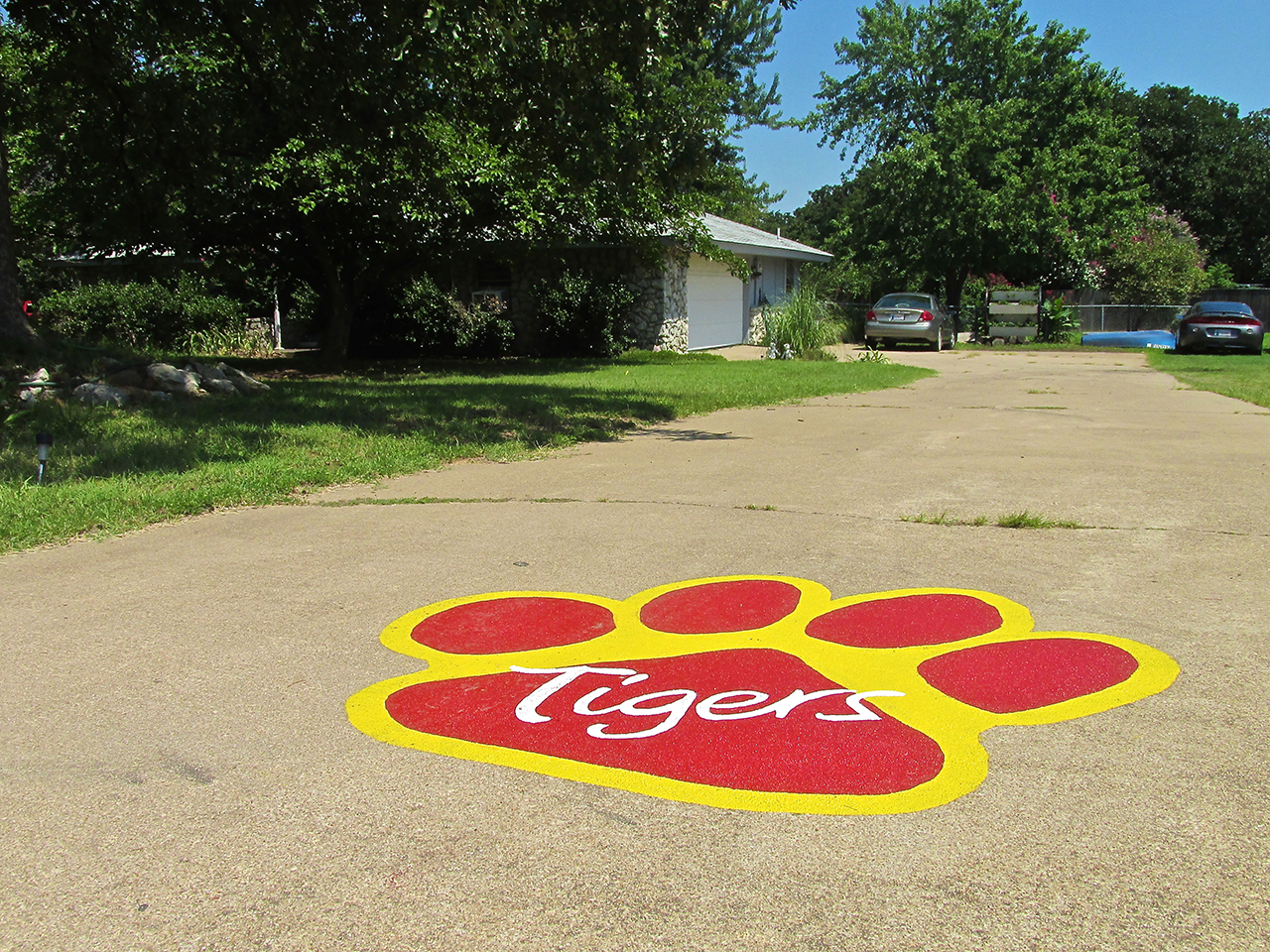
Tiger Town
About a half mile down Airport Road I saw this house sporting The Paw – a confirmation of my earlier suspicion. I think this is a Sports Town.
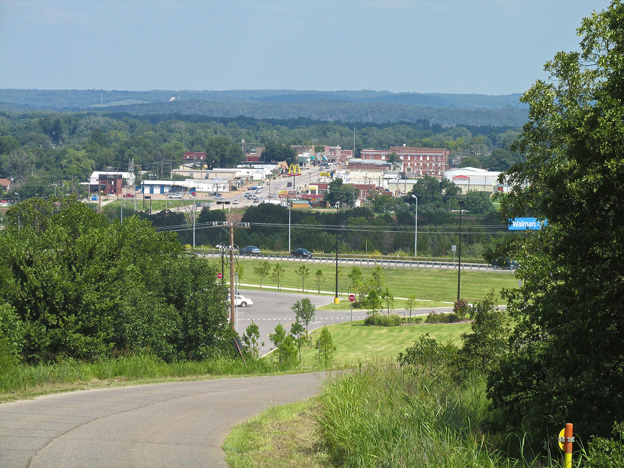
I snapped this telephoto of the downtown area when I was about half way down the hill. The parking lot to the new WalMart is in the foreground.
2nd Thoughts
By the time I reached the WalMart I am having second thoughts as to the wisdom of my walking tour. This was the downhill leg of the journey and I was already tired and hungry. I stepped into the “food side” of the store – always a bad idea when I am hungry. I emerged with a half quart Dr. Pepper, two candy bars, a pack of gum and a huge plastic bag of green grapes. I told you I have no business in a grocery store when I’m hungry. It took me an hour to eat all those grapes…

Total Confirmation
Crossroads
Highways 64 and 99 connect in Cleveland. The traffic was consistent the whole time I was there. Mostly I walked along Broadway Street/Hwy 64 and took this series.
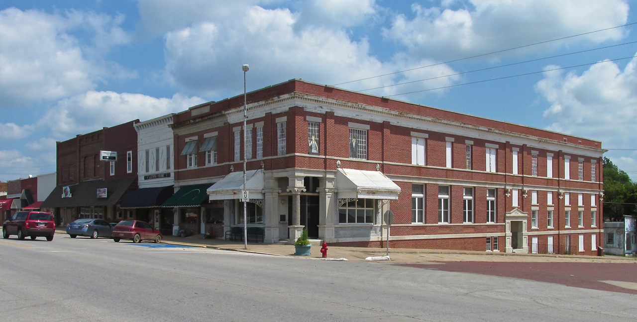
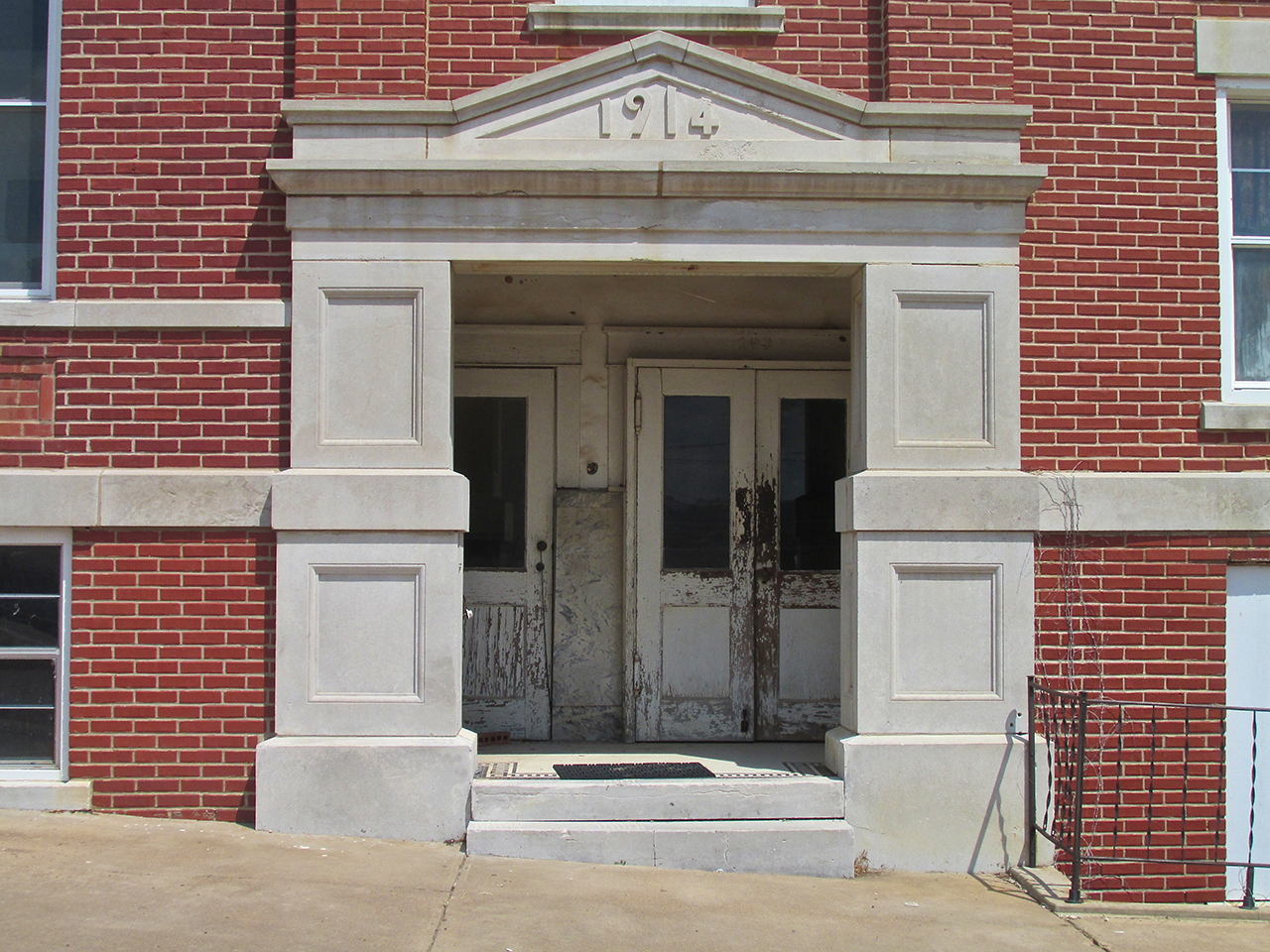
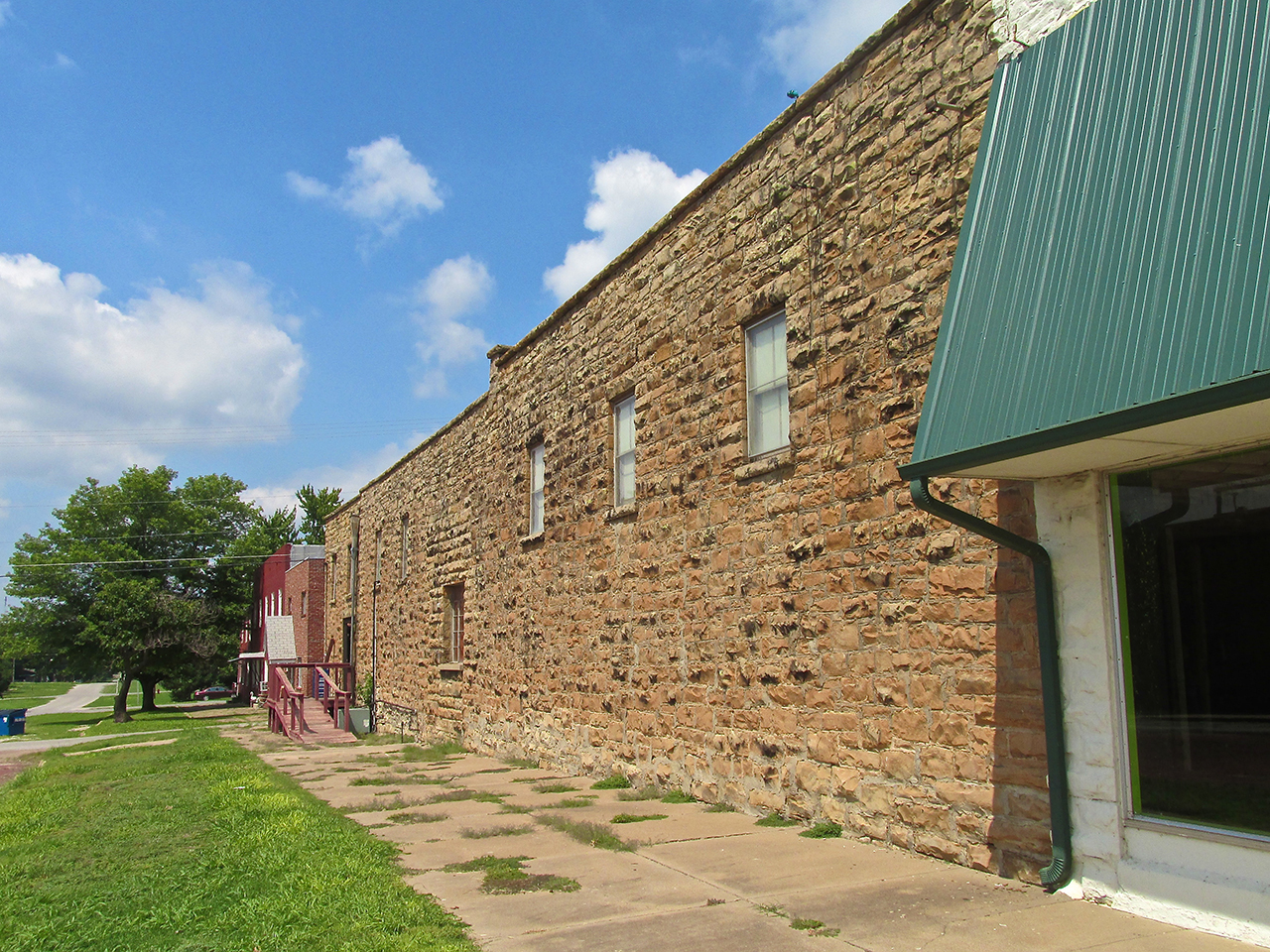
This brick office building is 99 years old.
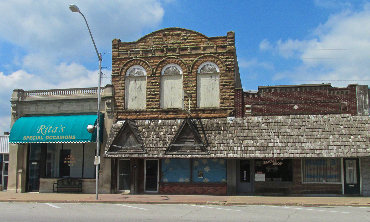
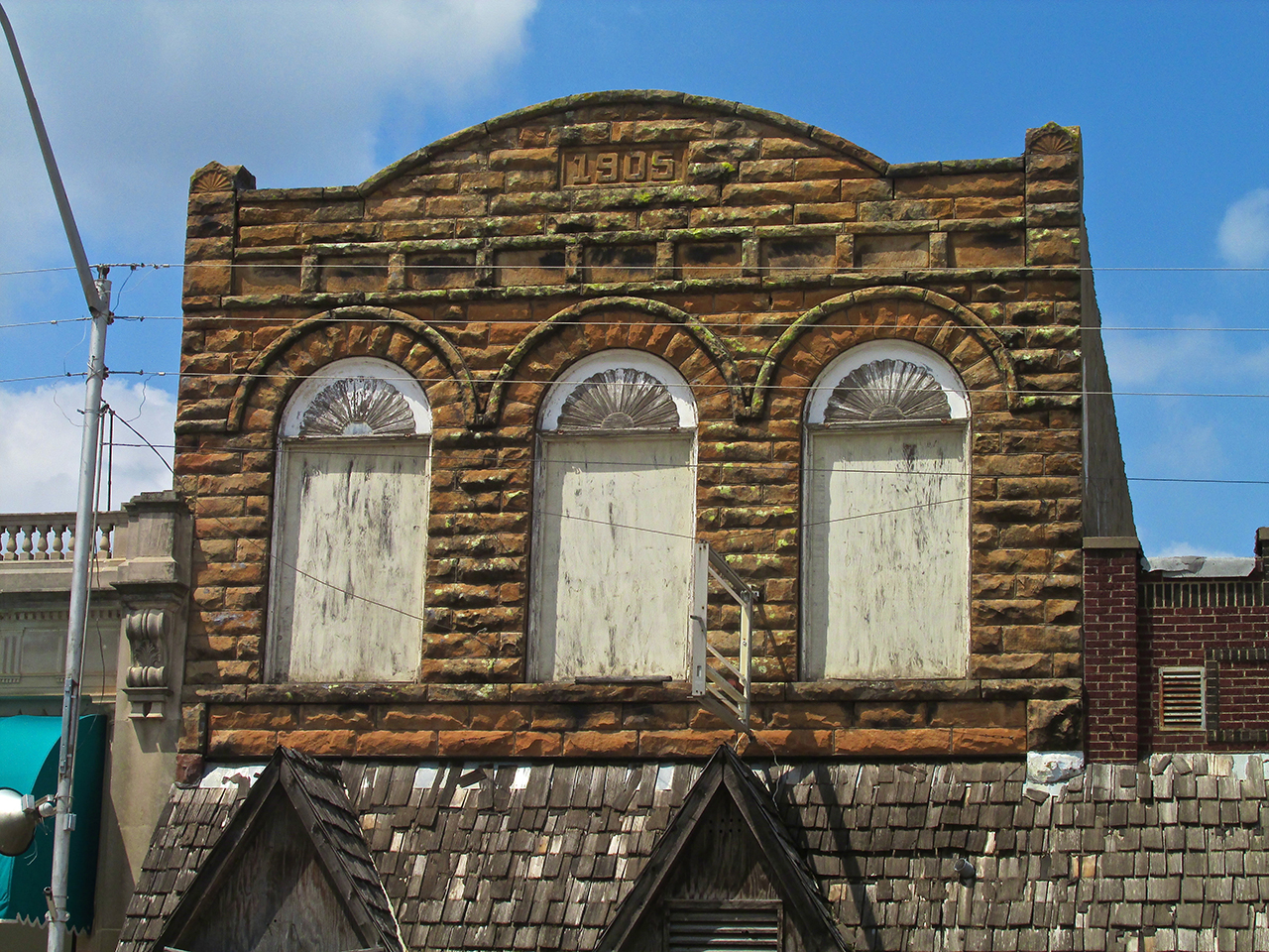
A Stone Building From 1905
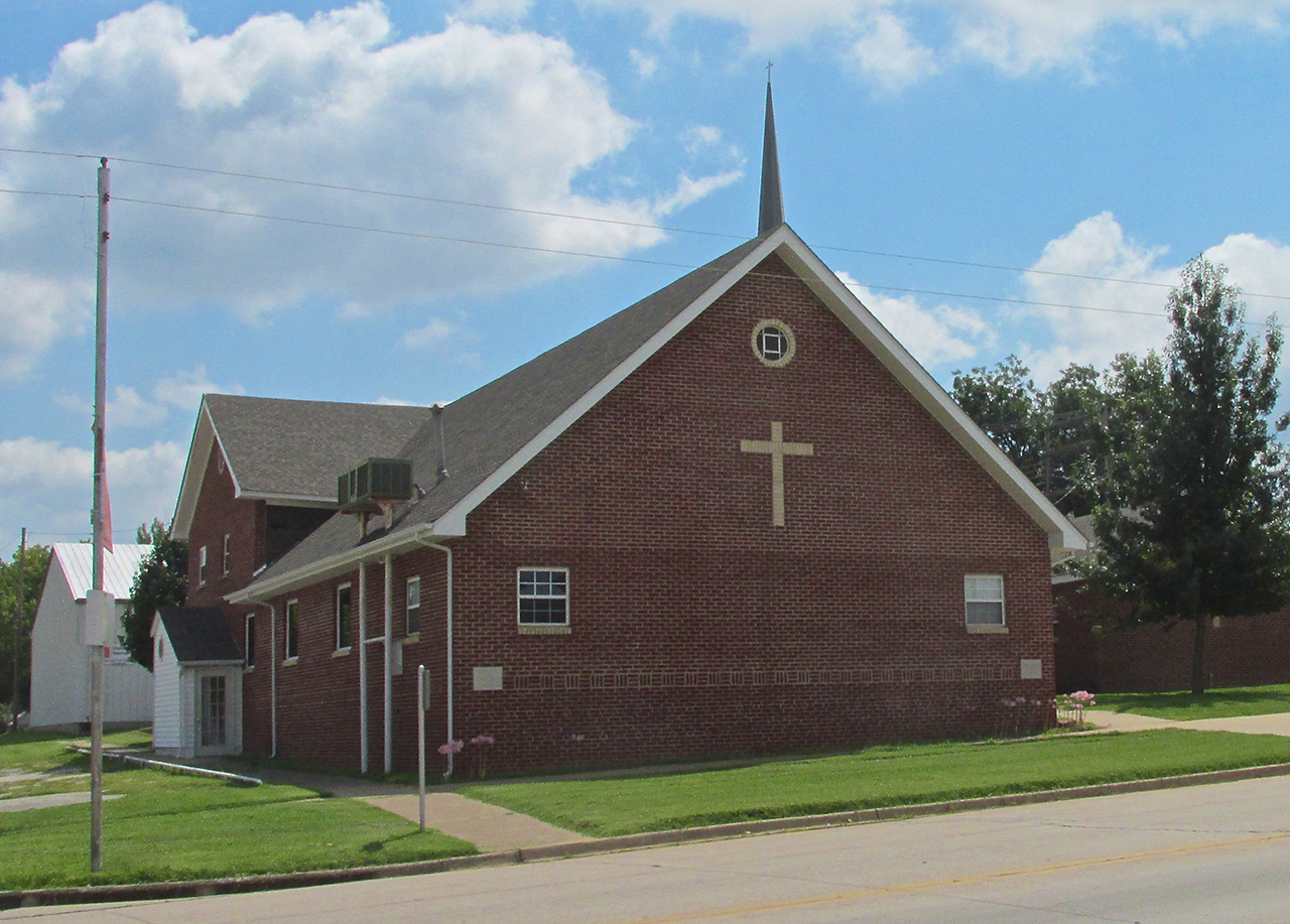
A little farther North I saw this brick Church. It’s not that old but I liked the way it looks.
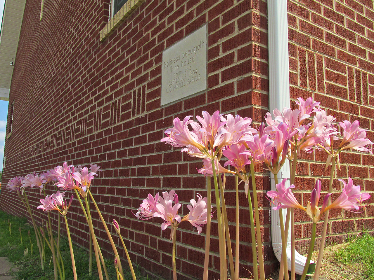
The growth of these flowers in the narro strip of soil between the wall and the sidewalk impressed me.

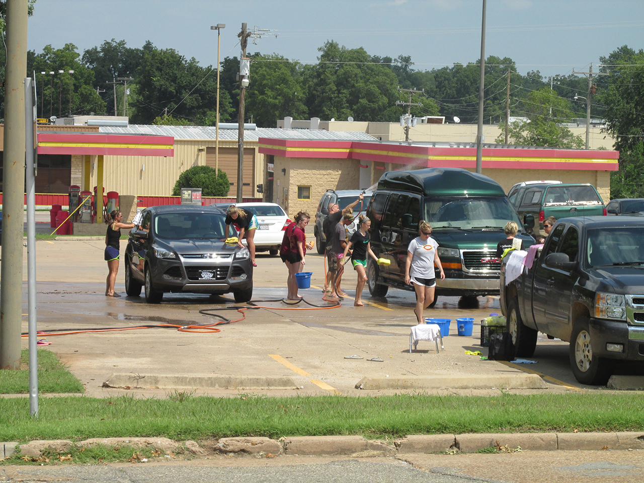
Next to the Church in this parking lot the “CMS Cheerleaders” were raising money with a car wash.
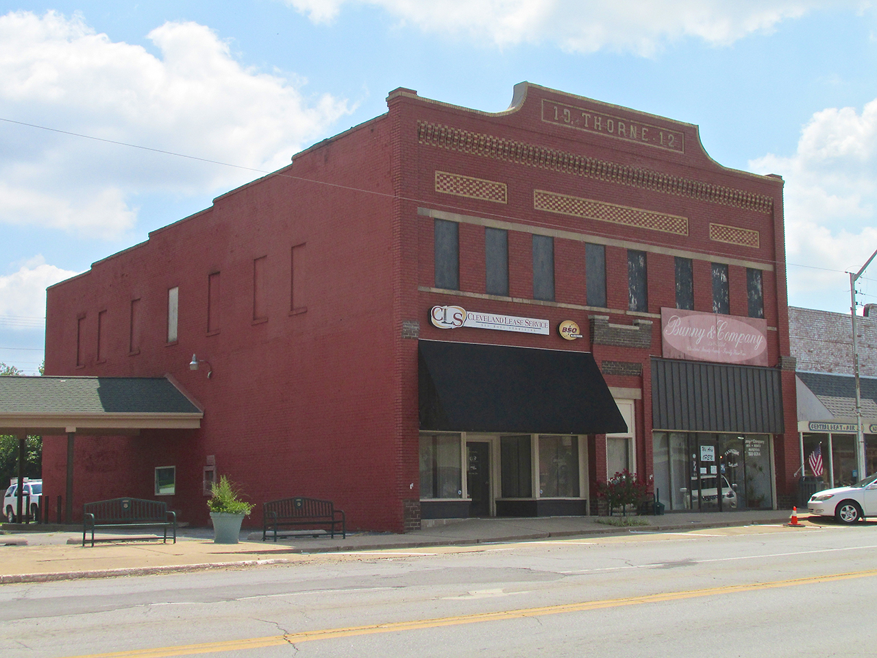
Nice brickwork in the facade of the 101 year old Thorne Building.
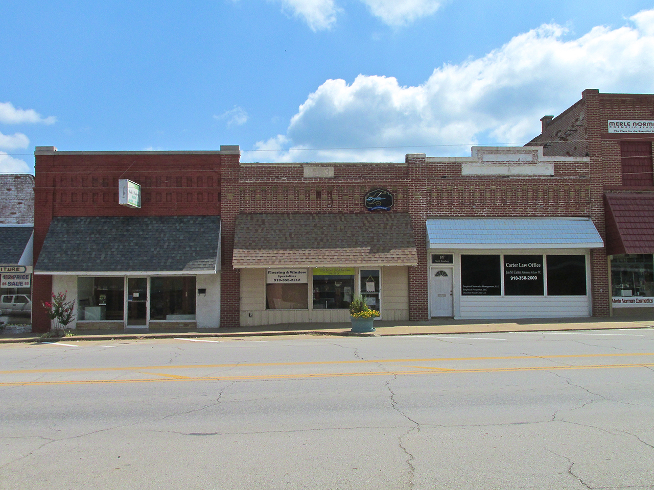
These buildings were all about 100 years old.
Same here.

The J. Sigan Building – 99 Years Old
Although the facade had been updated, the stone wall of this old building remains.

Another Oil Company in Eureka, Kansas used a stripper pump in front of their building, too. I think it is a great touch.
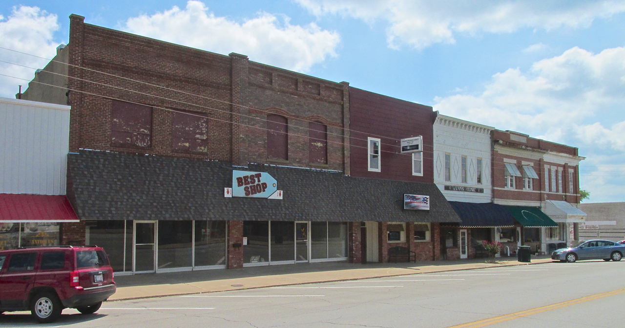
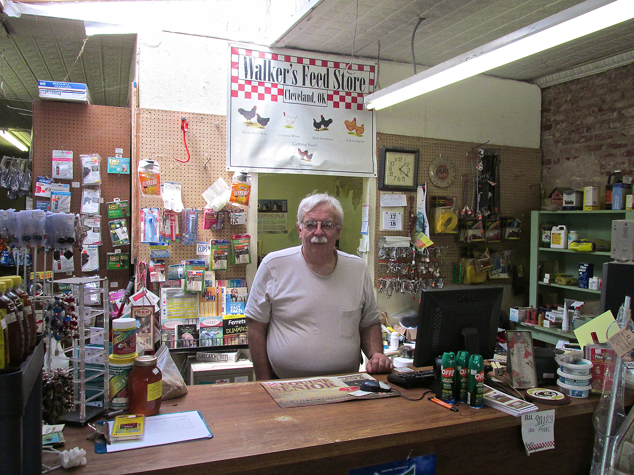
Walker’s Feed, Pet & Garden Center
I was getting pretty tired but wanted to make sure I hadn’t missed any historical items or other items of interest before walking back to the airport. A lot of the businesses were closed that morning but I noticed Walker’s was open. I entered to see what I could discover.
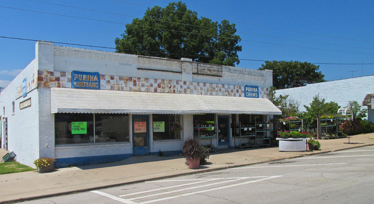
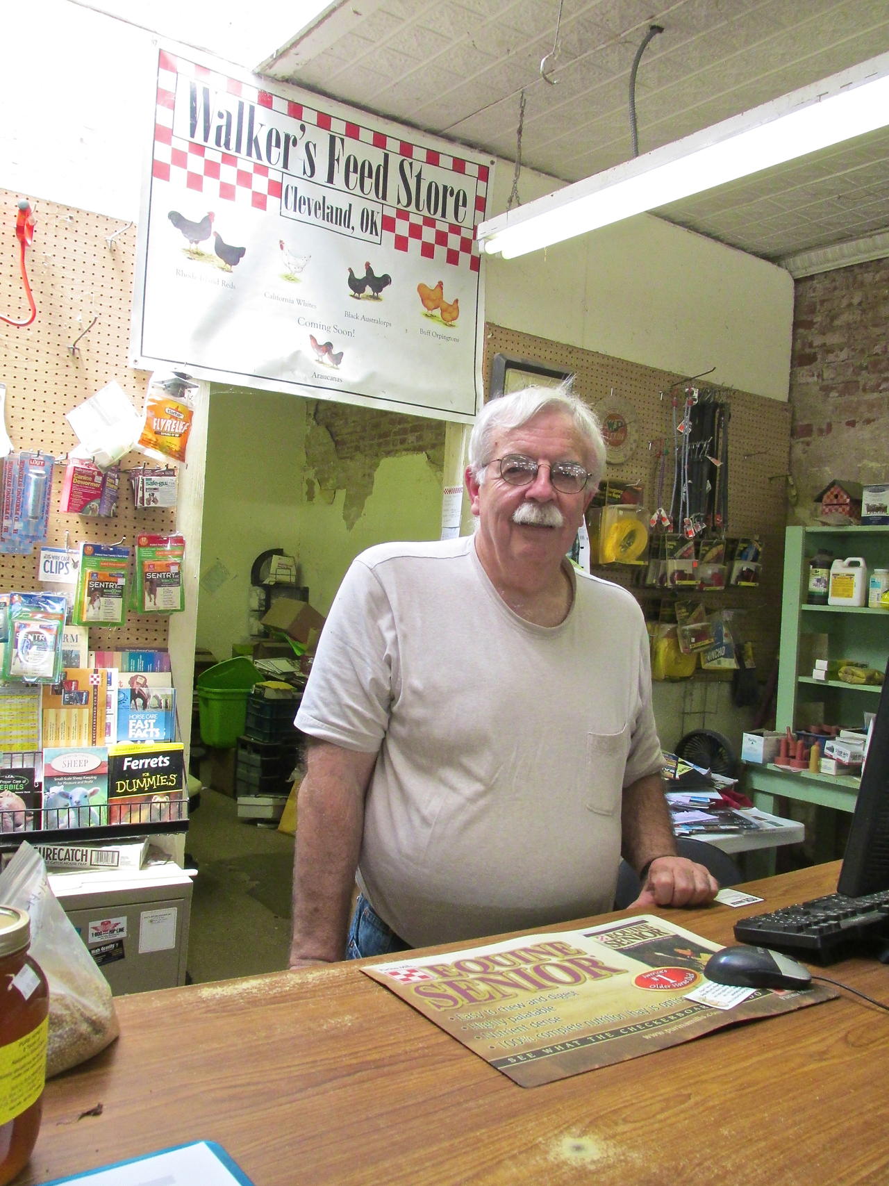
Inside I met Daniel Henning. Dan and his wife own this store. It has been in her family for three generations. The website I linked to the store name features some good pictures from earlier times. Until 1978, Dan hailed from Wichita. He attended Kapaun Mt. Carmel and Wichita State University and worked for a while at Cessna Aircraft. Then they moved to Cleveland.
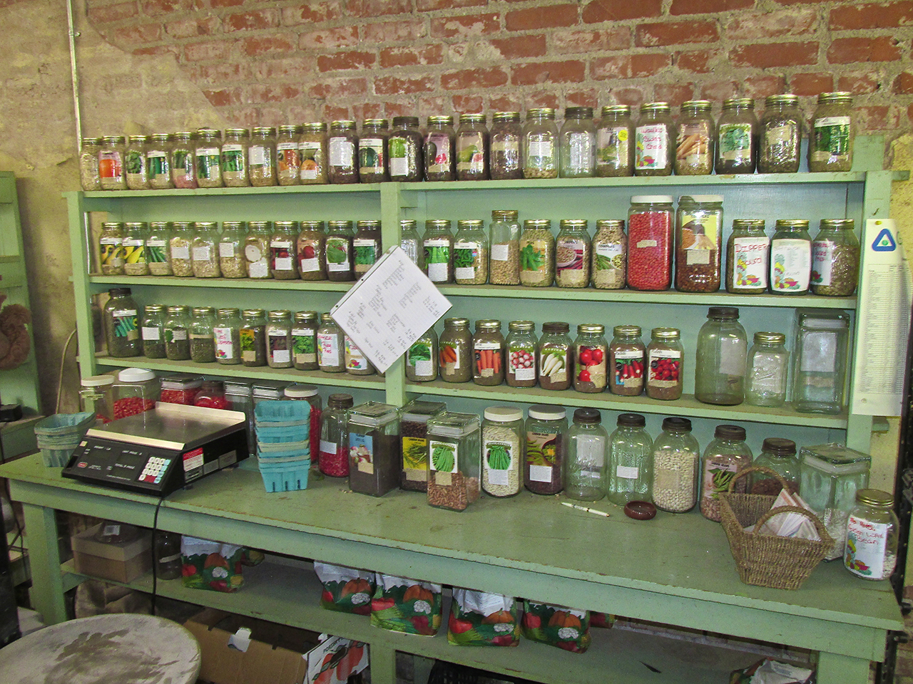
This marvelous seed selection caught my attention. Last year I have became an urban gardner.
Dan told me there had been two historic buildings across the street but they had recently been torn down. He said people would actually travel to Cleveland to photograph them. Bummer… He also told me Getty drilled some of his first wells in the creek bed area I would be crossing again.
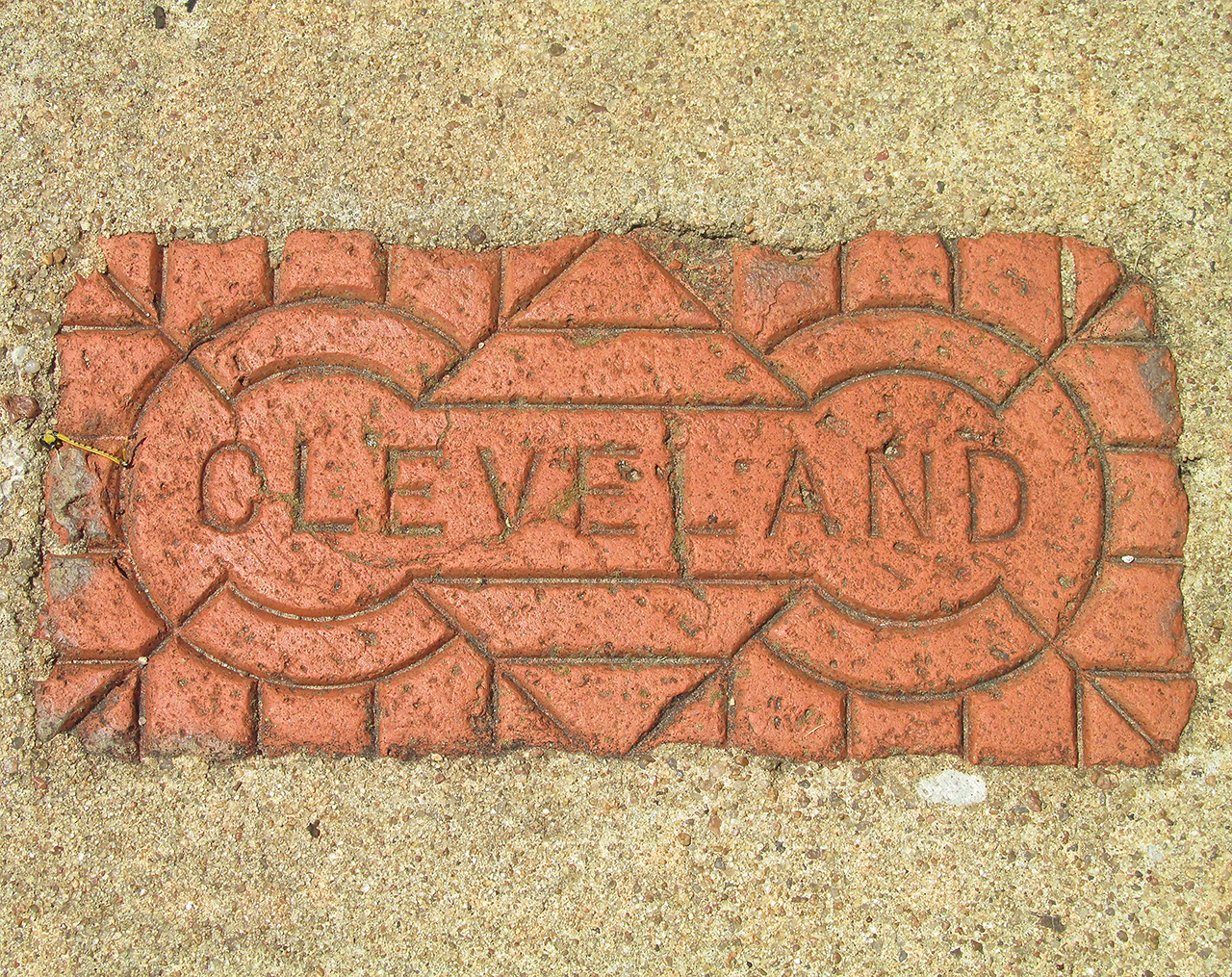
On the way to the Broadway Street Bridge I saw this brick embedded in the sidewalk. I had seen some other “Cleveland” bricks around town and surmised that there might be a Cleveland Brick Company in town. Searching the Internet did not yield that result. Maybe ACME Brick made bricks with the town’s name on them.
This is the view East from next to the Broadway Bridge of the Ark River overflow area.
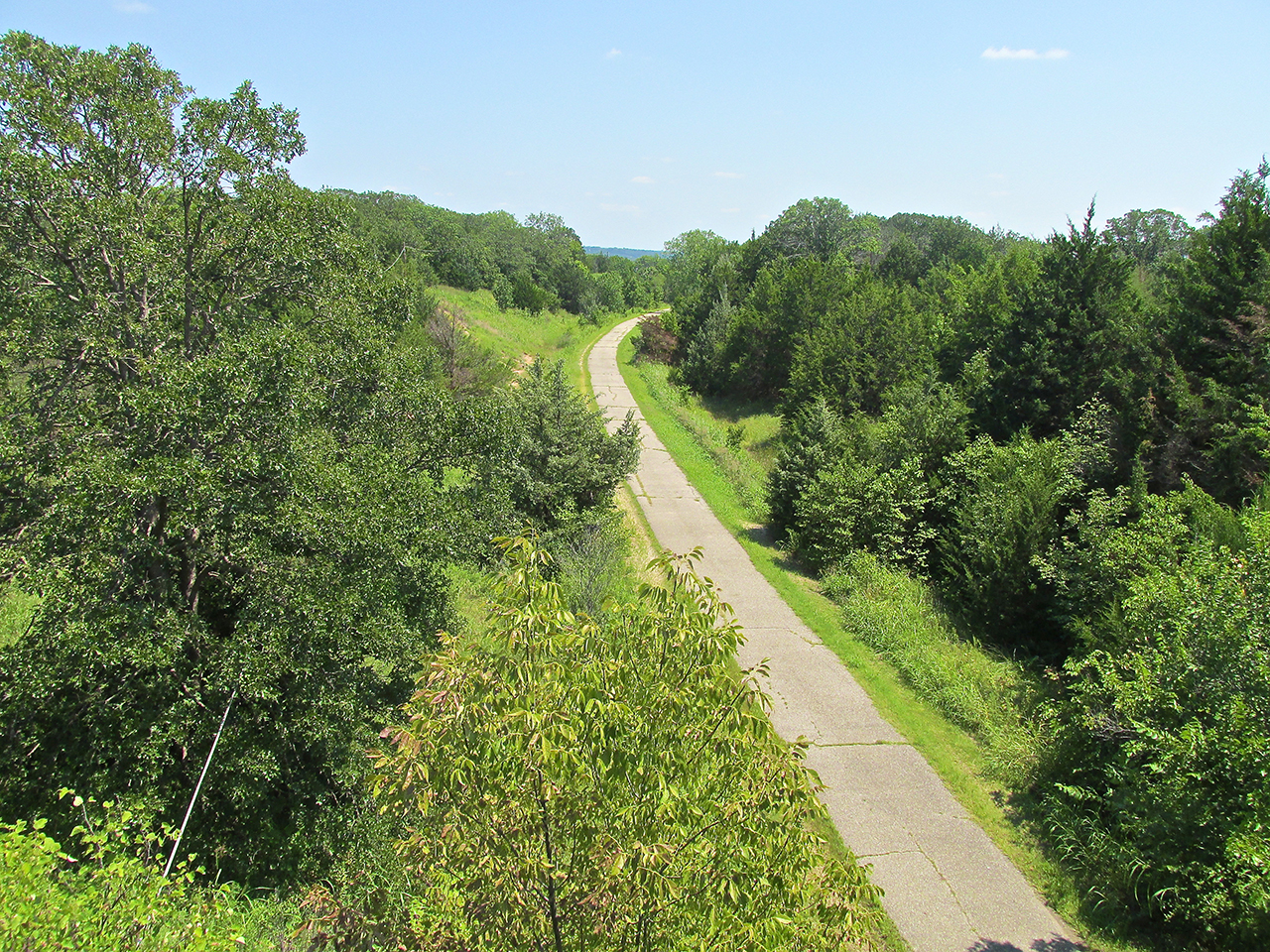
This is where The Cleveland Trail crosses under the Broadway Bridge. The Cleveland Trail is asphalt and covers the old Missouri–Kansas–Texas Railroad (MKT). It is part of that “Rails to Trails“ project.
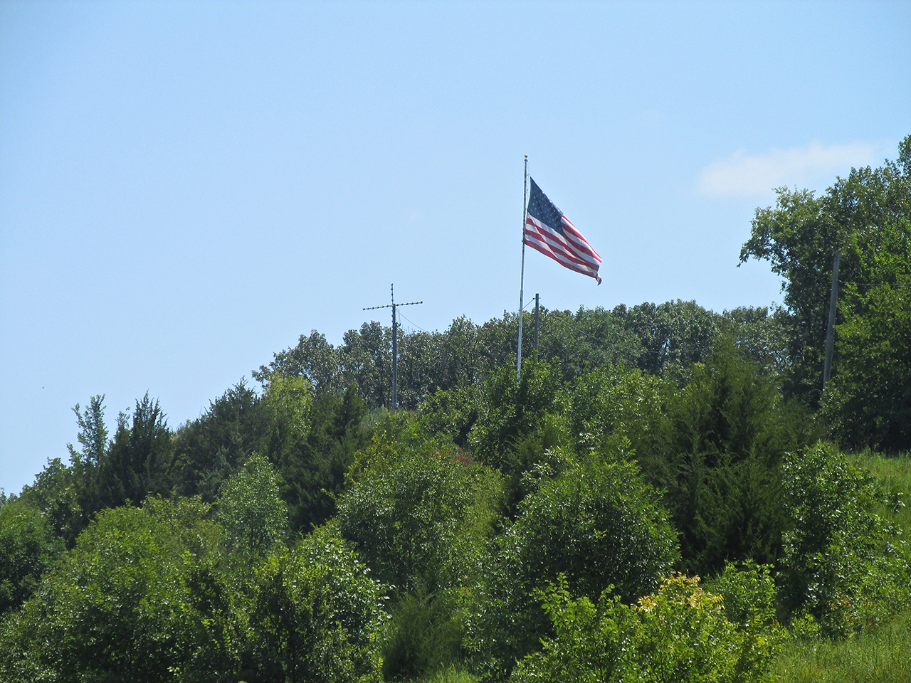
After crossing the bridge and before starting my mile long ascent to the airport, I saw this Cross and Flag combination. I believe you cannot have the one on the right without the one on the left – at least not the one our Nation’s Founders and Our Forebears gave us. God Blesses America When America Blesses God – 2 Chron 7:14
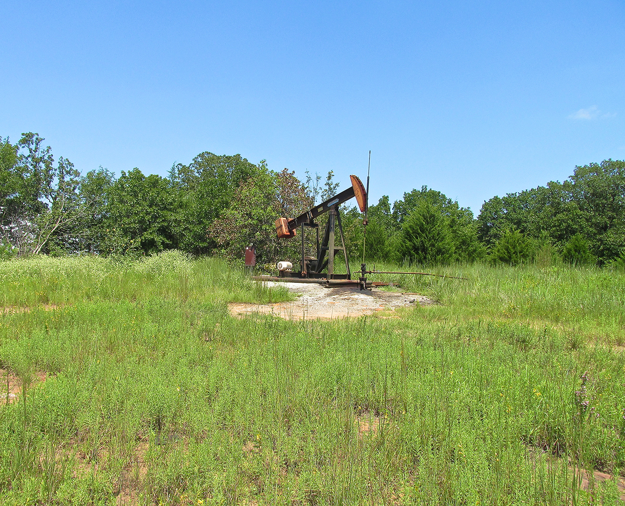
With Daniel Hennings’ words in mind, I looked for Oil Wells that might be from the early Getty discovery. This one looked like it had been pumping for years.
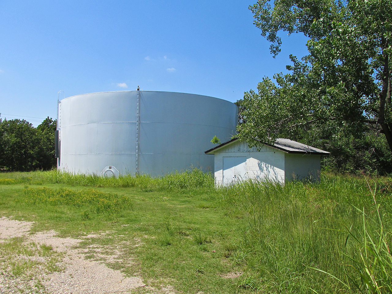
30 yards from the previous pumpjack was this scene. I can’t remember seeing a holding tank this big in Kansas. A number of pumpjacks are feeding this monster.
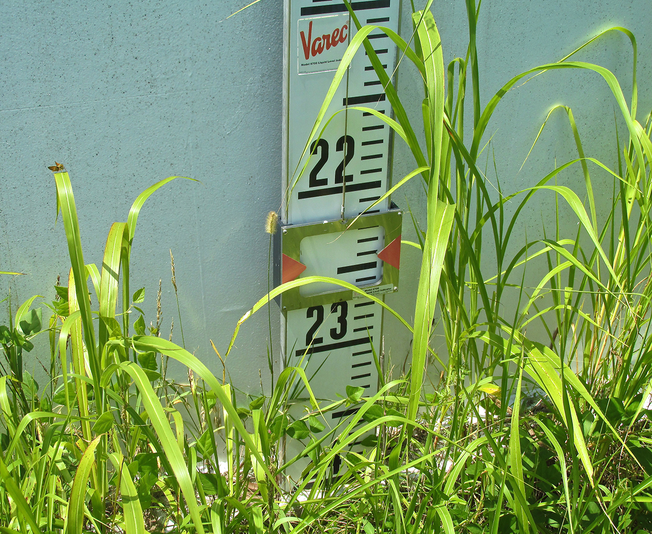
The measuring gauge on the side is a simple float system. As the float goes higher the measuring pointer goes lower. This tank is almost full. That’s a lot of oil.
Pumpjacks are everywhere. As I walked through The Keystone Golf and Country Club surrounding the airport I saw one next to a tee.
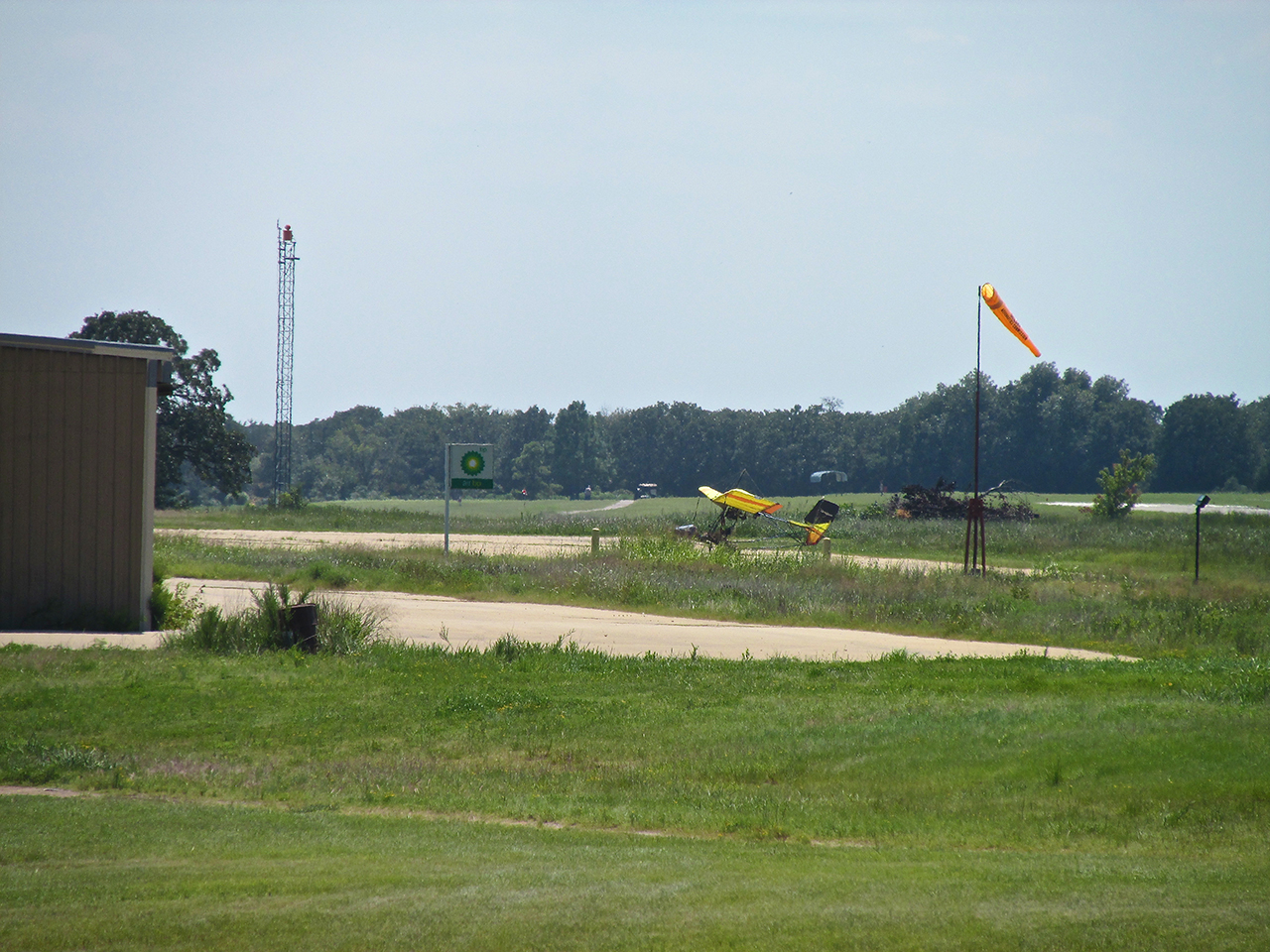
From the tee shown earlier I used the telephoto to show my airplane with more of the surrounding Golf Course behind it, bordered by a Light Tower and Wind Sock. BP (British Petroleum) no longer sells fuel at the field.
Running Late
When I finally got back to the airport I ducked into Gordon’s office to tell him I was back. He said, “Did you enjoy your walk?”. I had to admit to him it was quite a test of endurance. I offered that I probably could have been fairly well served if after using his car to get the gas, I would have spun the prop and returned to The Air Capital. But then I wouldn’t have met Dan Henning or really seen much of Cleveland. The walking tour was worth it.
My “mind clock” had the time at about 1:30 or 2 pm. The clock Gordon and everybody else uses said 3 pm. With that surprise I accelerated my egress, said goodbye to Gordon & Company and hit the sky. Gordon had let on that he presumed my Quicksilver could take off in a short distance so I confirmed his suspicion by taking off from the tie down area next to his hangar (with room to spare).
After takeoff I popped the rudder left to move it out of the way and snapped this shot of the Cleveland Airfield from about 500′ AGL.
Then I took this wide shot looking North of Cleveland and environs. In the foreground you can see much evidence of the oil field I had just walked through.
The lighting was much better than when I had arrived in the morning so I had to get this telephoto shot of Broadway /Hwy 64 coursing through town. I walked across the bridge in the foreground to return to the airport.
Again, because of better lighting, I took another shot of the River Overflow area North of town…
About 30 minutes later cruising at 70′ AGL, I stumbled across my best shot of The Great Plains Wild Mustangs to date. On the hill at the upper left of the shot you can see a couple hundred more of them lounging about.
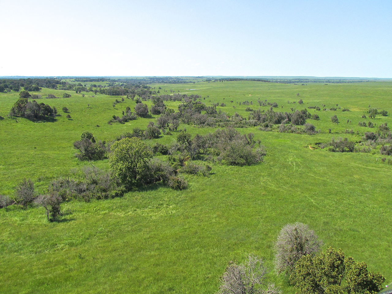
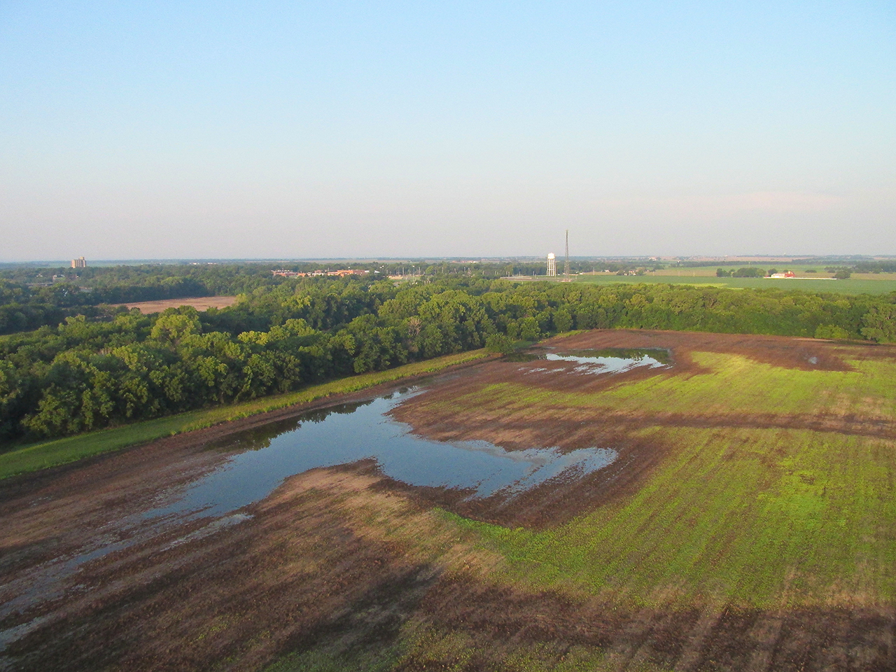
Lots of rain does marvelous things for The Prairie in The Summer.

Another Oil Field with no one around, pumpjacks slowly, continually bobbing up and down.
I didn’t realize this was here until I had almost passed it by.
From my recent trip to Burlington, Kansas and my conversation there with Gadget the Wizard, I take this to be a weir that can also be used as a river crossing.
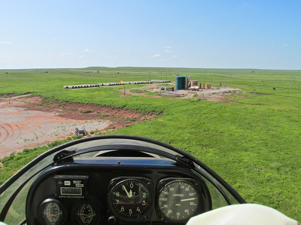
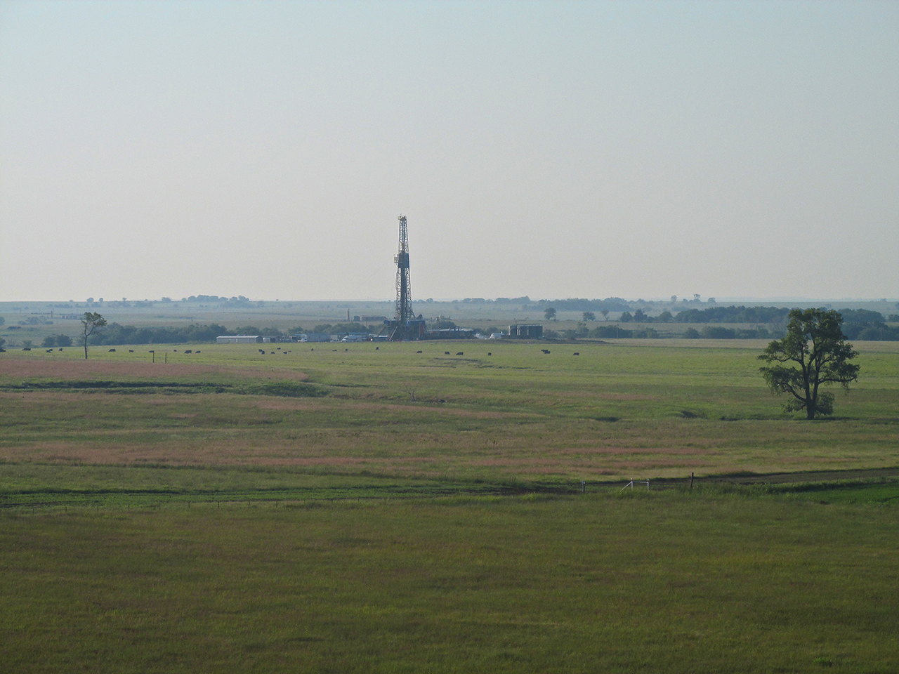
I have yet to see this in Kansas. This well is having to flare off some gas.

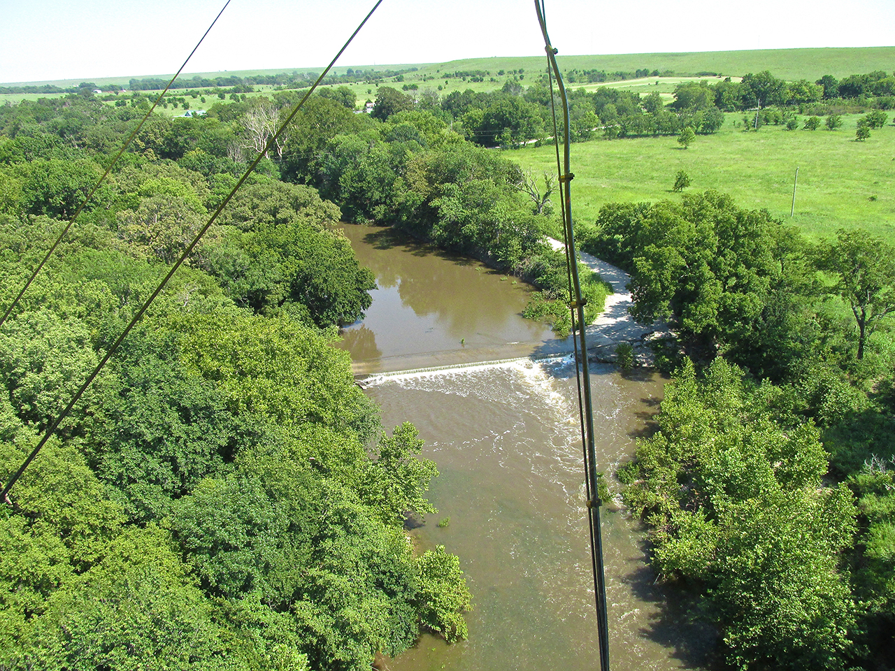
This time I crossed Kaw Lake about a half mile more to the East.

An almost fluorescent algae covered large areas of the lake’s leeward side.
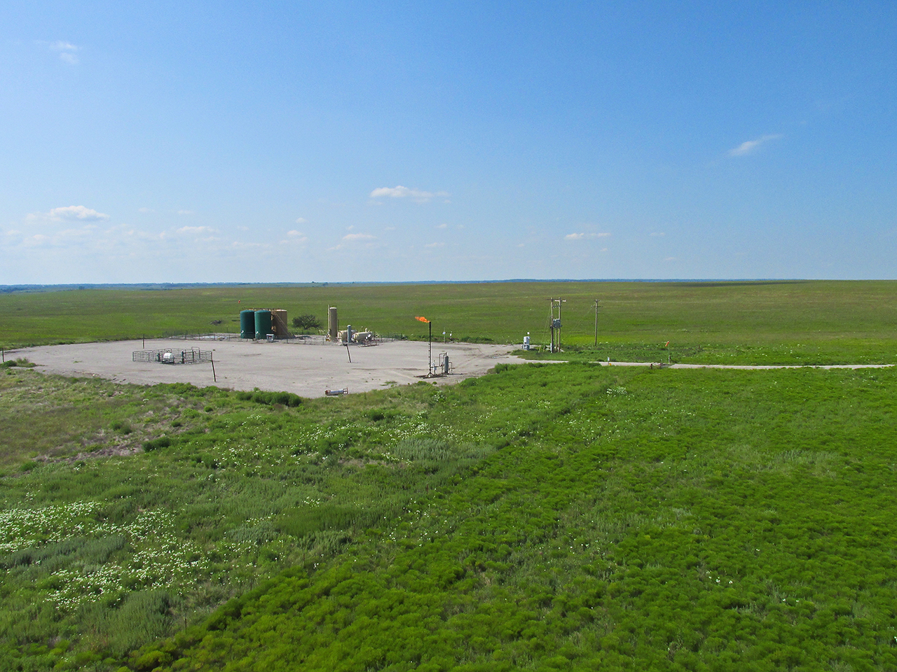
Another small flare
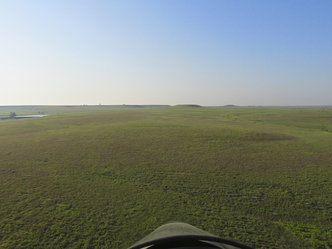
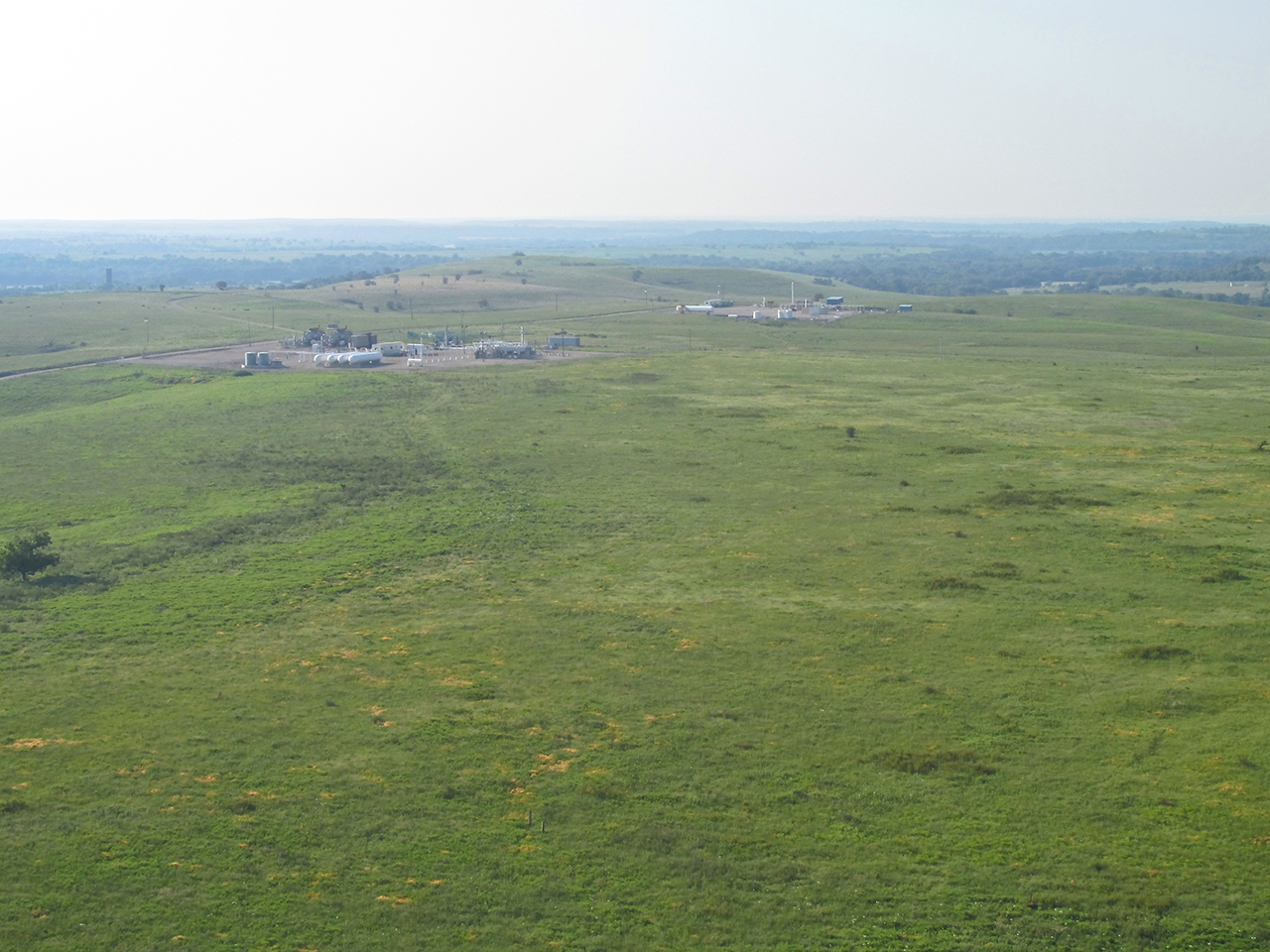
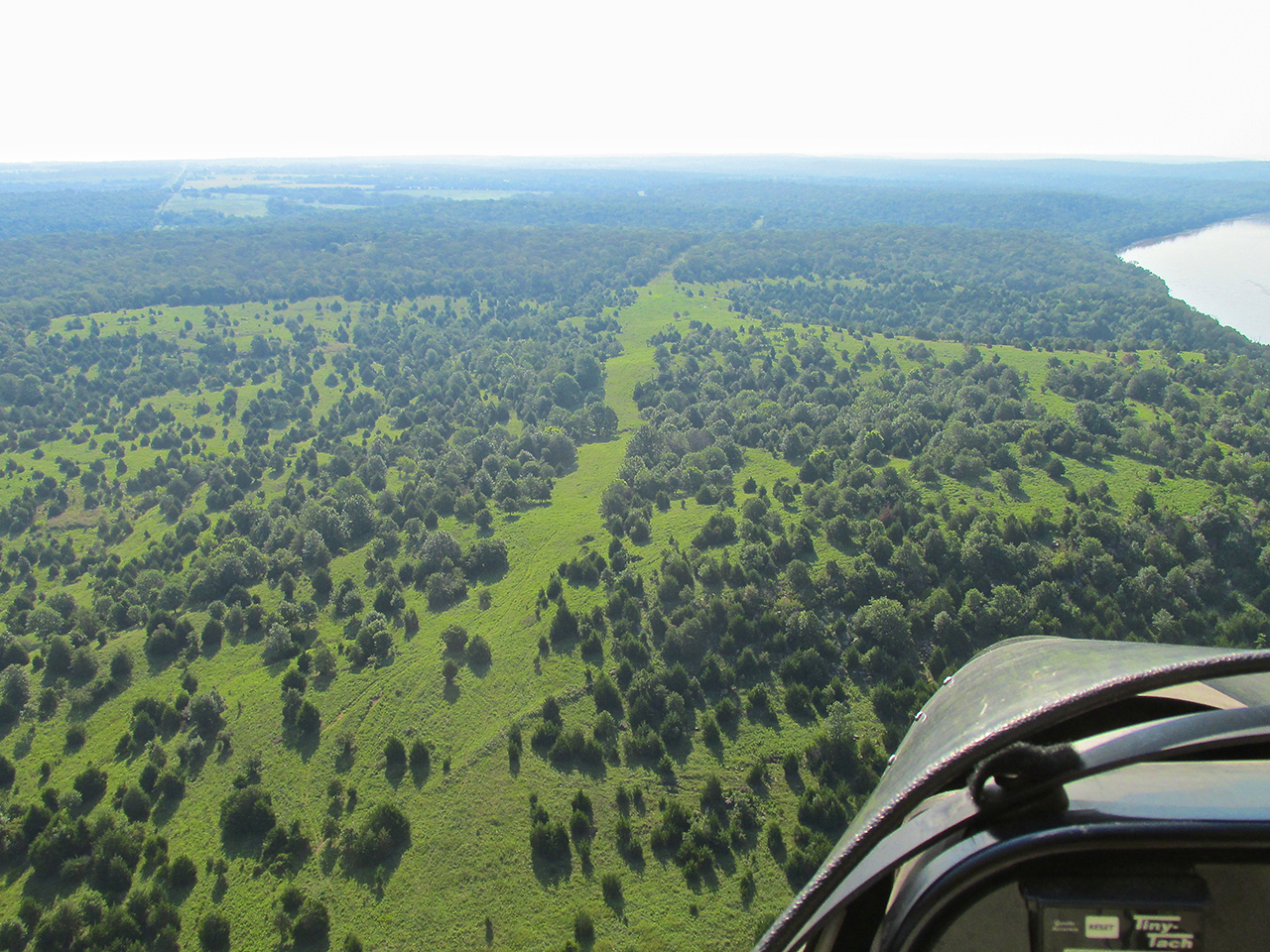
About an hour and a half into the flight the landscape turns to rolling hills.
Break Time
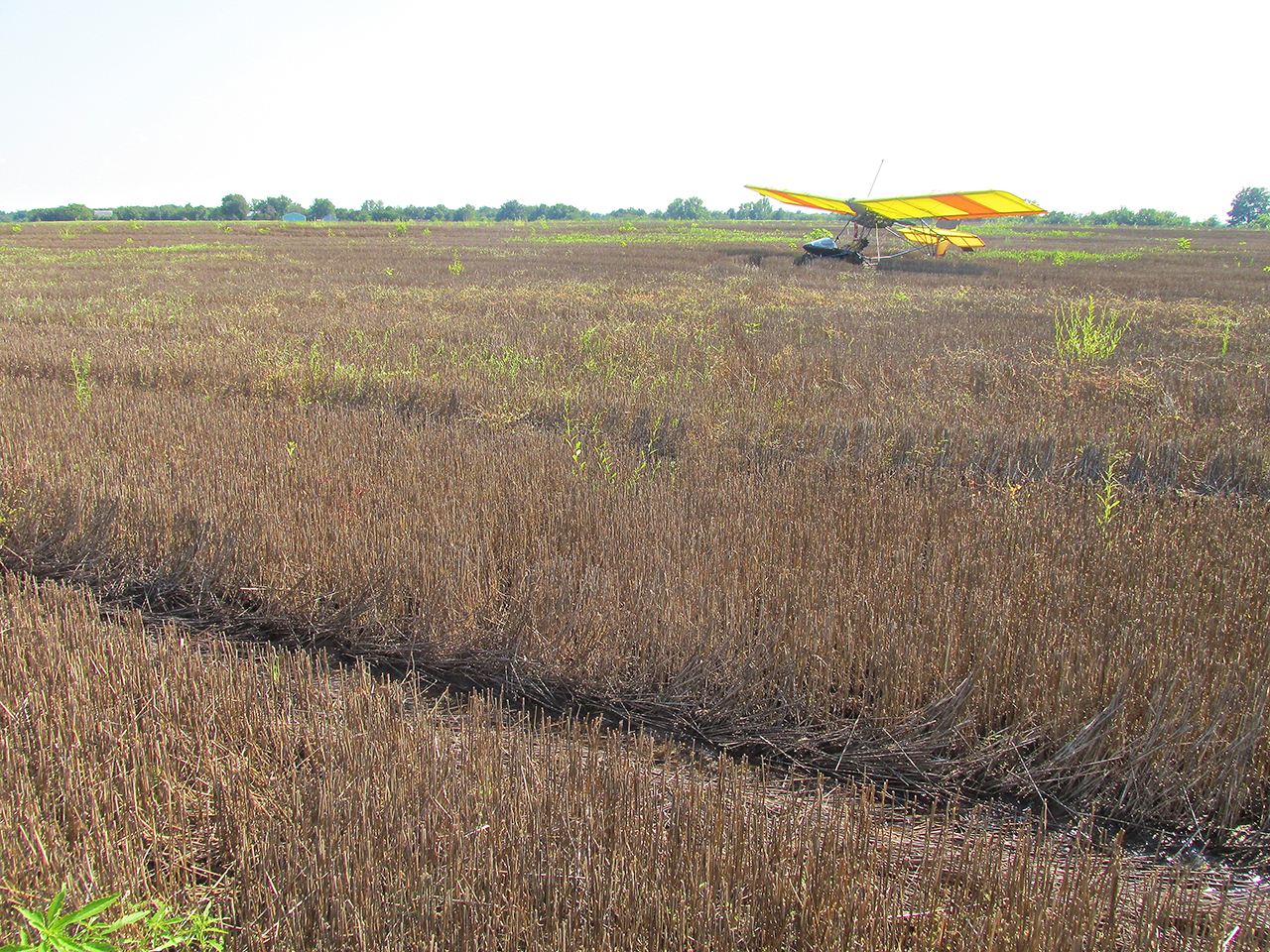
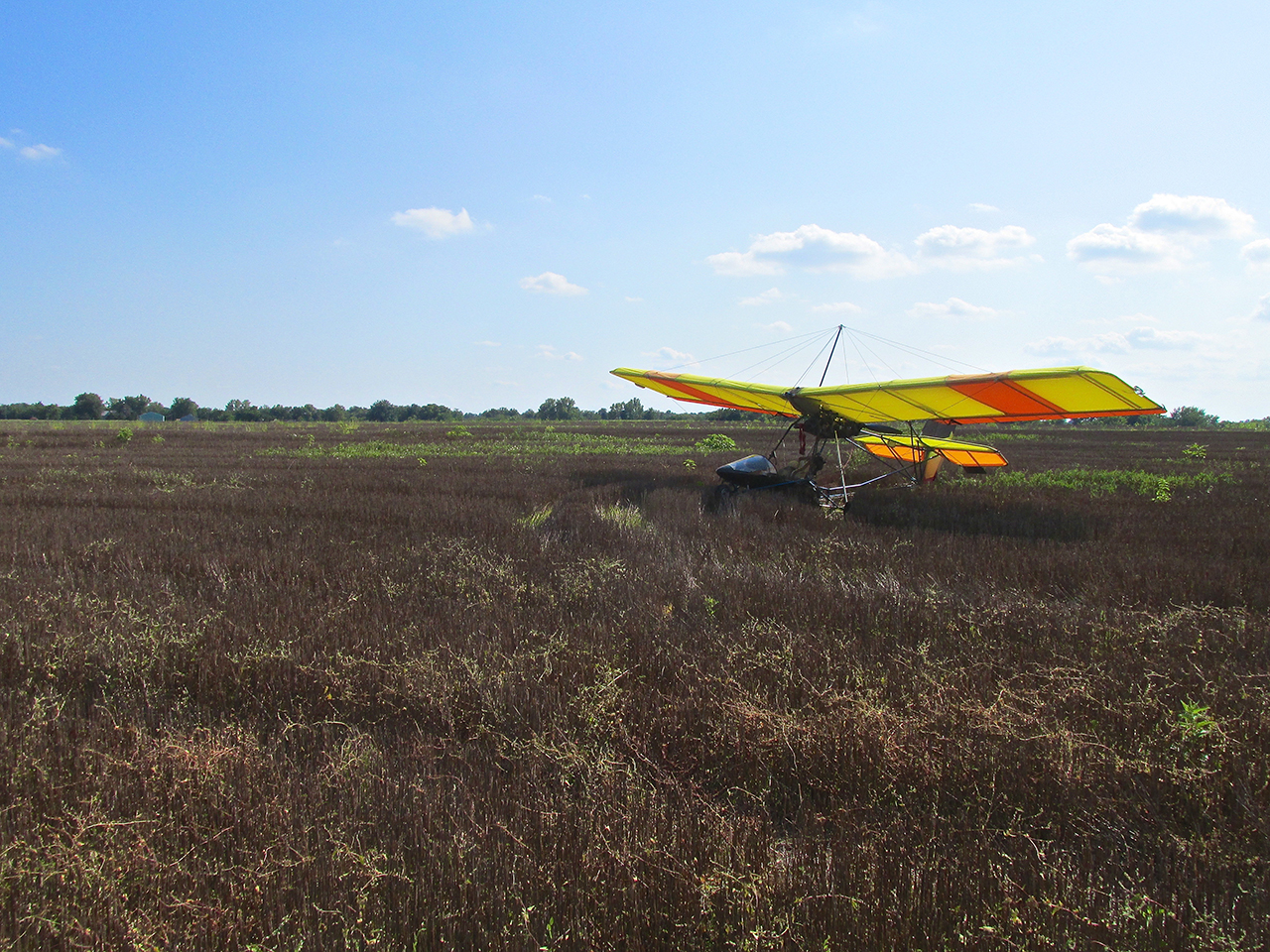
After almost 2 hours in the seat, I decided I needed a break. Just a little to the left of my path I saw the harvested wheat field shown below. Even though there were a couple of wet spots, it looked like a promising candidate for a short layover. I circled once and settled on to the field. Usually about 4 inches, the wheat stubble on this field was quite a bit higher than I am accustomed to – probably 18 inches. Its resistance to my landing gear and nose pod rapidly drew me to a stop. I got out, took a few pictures and after admiring the scenery took off again.
Winfield, Kansas
After taking the short break in the wheat field I made a slight detour. My Good Buddy Captain Doug Moler told me he would be attending the K & O Steam and Gas Engine Show at the Winfield Fair Grounds. If I hadn’t already committed to the Cleveland Flight, I would have gone there, too. It is a big, regional event for the showing of Antique Steam and Gas Powered Farm Equipment. There is always a good turnout and the opportunity to watch these venerable old machines in action.
Directly South of Winfield is this unincorporated village with Crossroads Community Church at its North end.
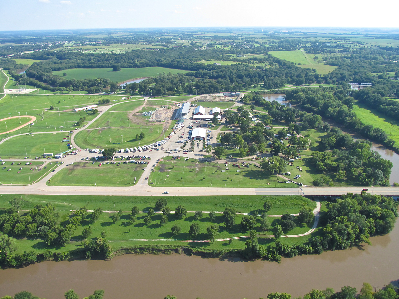
The Fairgrounds are seen directly ahead. I decided I would swing East of them (to the right) along the railroad track and then cut back Southeast for home.
Now I see weirs all the time.
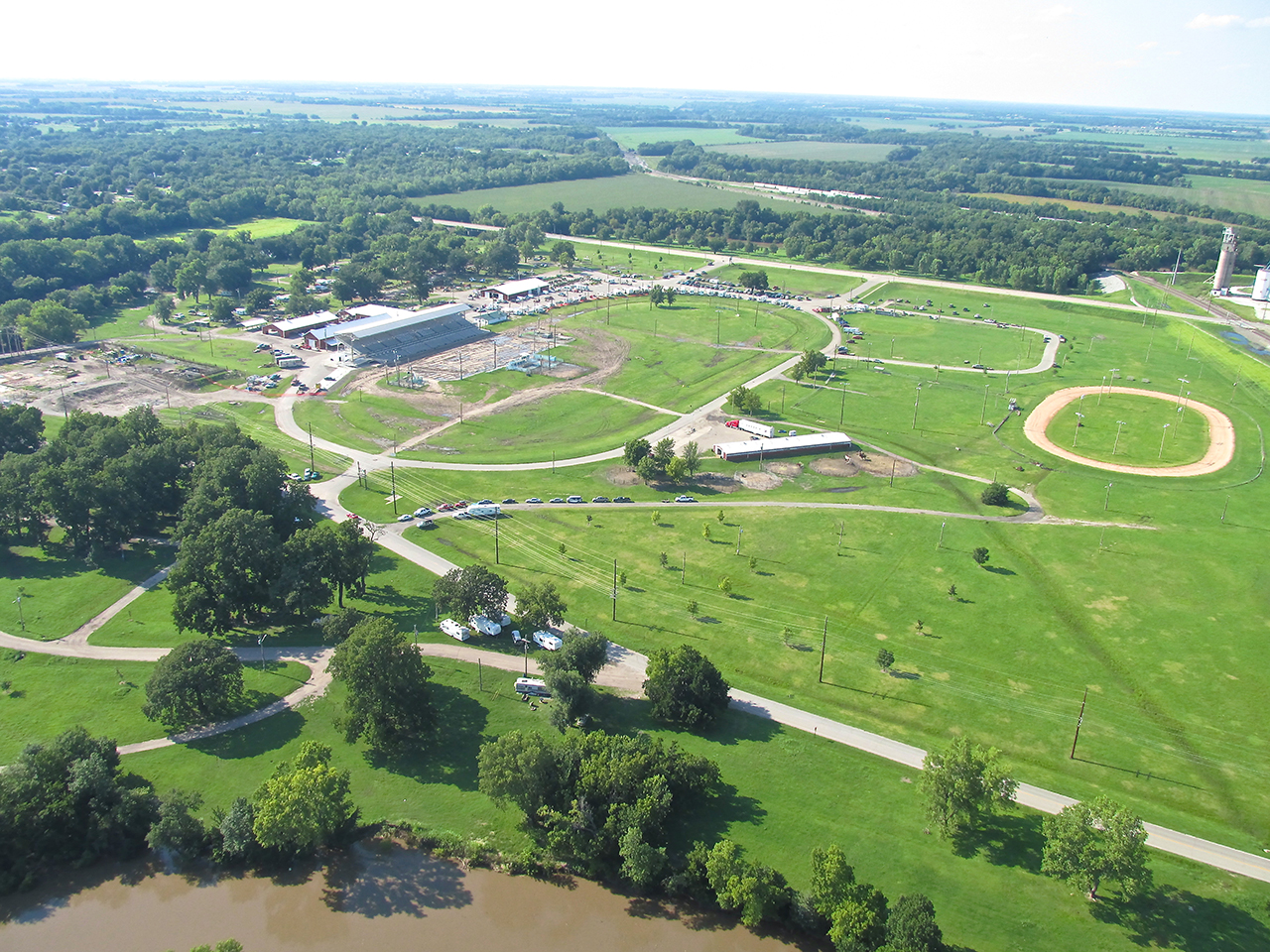
The Winfield Fair Grounds is home to the World Famous Walnut Valley Bluegrass Festival. It occurs in September. This is from 1,000′ AGL looking Northwest.
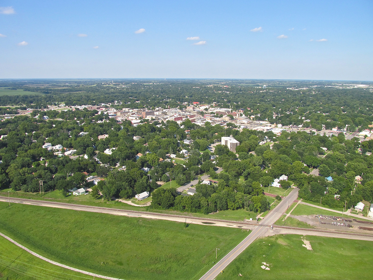
Winfield, Kansas looking Northeast from 1,000′ AGL
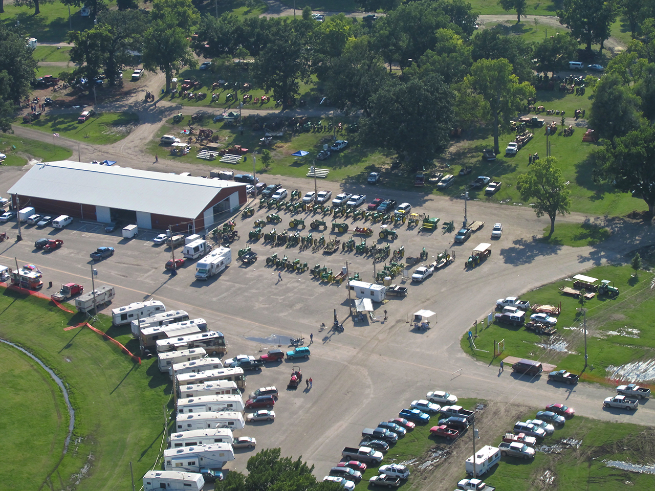
The A & O Show from 1,000′ AGL looking Southwest.
One more again from 1,000′ AGL looking South.

The Sky Surfer’s favorite sky – Blue With Cumulus Clouds. Looking Northwest from 1,500′ AGL.
In the foreground is “Cherokee Strip Residential Airpark“ with Udall, Kansas just beyond. From 1,200′ AGL looking North.
Back in “the neighborhood”, here is Mulvane, Kansas from 1,200′ AGL looking Northwest. When looking at this, I am struck by how the trees, so lush after the exceptional rains of late, are obscuring most of the town.
At The Mulvane Rodeo Arena on Mulvane’s West side I saw preparation for a Rodeo. From 1,100′ AGL looking North Northwest.
The East Wind blows smoke from an open fire 2 miles Southeast of Selby Aerodrome.
Trip Complete
The photo above is no Objet d’Art but was taken to show the wind direction. Hoping to get a full tailwind push all the way home, for most of the trip there was no help at all. The weathermen missed this one for me but at least it did not turn into a headwind. I’m glad I had the opportunity to visit Tiger Town and walk around a bit. I hope you enjoyed the journey, too.
See you next time!
Blue Skies & Tailwinds!™
The Sky Surfer
(Amazing… So typical The Sky Surfer would lay his tailwind deficit at the feet of the weathermen. He knew the wind direction could change. After all, he is constantly harping about this area being The Great Plains. Overall, though, I am glad I gave Surfer Boy this opportunity for growth. As you can see he has far to go before possibly reaching his goal to be a photo-journalist. It might happen over time – stranger things have. Folks, handling “A Star” – at least in his own mind – is an art occasionally requiring the implementation of extraordinary means. If anything, I hope this exercise has given you an insider’s look at The Flite Blog™ process – the “tug and pull” – the stratagems – behind the scenes leading to the output quality you expect. The sly benefit for management (knowing the fragility of The Sky Surfer’s ego) has been that once he sees all these public corrections to his weak report, we know he will sulk for a long, long, long, long time. This will allow us to get back to status quo: The Sky Surfer flitting about the countryside taking random photos – The real writers back at the shop tying it all together and doing the “intellectual heavy lifting”. After all, as long as “Sky Surfing – The Flite Blog” remains a visually interesting, somewhat informative web log, the “background process” is not that important to be known. Thanks again for being part of this experiment/management tactic. – The Editor)